Niemur River | |
Perennial stream [1] | |
Country | Australia |
---|---|
State | New South Wales |
Region | IBRA: Riverina |
District | Riverina |
Municipalities | Murray, Deniliquin, Wakool |
Part of | Murray River, Murray–Darling basin |
Source | Edward River |
- location | near Moonahcullah |
- elevation | 92 m (302 ft) |
Mouth | confluence with the Wakool River |
- location | north of Swan Hill |
- elevation | 63 m (207 ft) |
Length | 155 km (96 mi) |
[2] | |
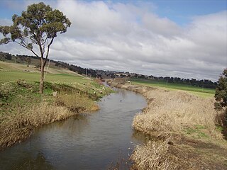
Niemur River, a perennial stream of the Murray catchment and part of the Murray-Darling basin, is located in the western Riverina region of south western New South Wales, Australia.
The Murray River is Australia's longest river, at 2,508 kilometres (1,558 mi) in length. The Murray rises in the Australian Alps, draining the western side of Australia's highest mountains, and then meanders across Australia's inland plains, forming the border between the states of New South Wales and Victoria as it flows to the northwest into South Australia. It turns south at Morgan for its final 315 kilometres (196 mi), reaching the ocean at Lake Alexandrina.
The Riverina is an agricultural region of South-Western New South Wales (NSW), Australia. The Riverina is distinguished from other Australian regions by the combination of flat plains, warm to hot climate and an ample supply of water for irrigation. This combination has allowed the Riverina to develop into one of the most productive and agriculturally diverse areas of Australia. Bordered on the south by the state of Victoria and on the east by the Great Dividing Range, the Riverina covers those areas of New South Wales in the Murray and Murrumbidgee drainage zones to their confluence in the west.
New South Wales is a state on the east coast of Australia. It borders Queensland to the north, Victoria to the south, and South Australia to the west. Its coast borders the Tasman Sea to the east. The Australian Capital Territory is an enclave within the state. New South Wales' state capital is Sydney, which is also Australia's most populous city. In September 2018, the population of New South Wales was over 8 million, making it Australia's most populous state. Just under two-thirds of the state's population, 5.1 million, live in the Greater Sydney area. Inhabitants of New South Wales are referred to as New South Welshmen.
The river leaves Edward River, near Moonahcullah, flowing generally west north-west, joined by five minor tributaries, before reaching its confluence with the Wakool River, north of Swan Hill; descending 29 metres (95 ft) over its 155 kilometres (96 mi) course. [2]
Edward River, or Kyalite River, an anabranch of the Murray River and part of the Murray-Darling basin, is located in the western Riverina region of south western New South Wales, Australia.
A tributary or affluent is a stream or river that flows into a larger stream or main stem river or a lake. A tributary does not flow directly into a sea or ocean. Tributaries and the main stem river drain the surrounding drainage basin of its surface water and groundwater, leading the water out into an ocean.
In geography, a confluence occurs where two or more flowing bodies of water join together to form a single channel. A confluence can occur in several configurations: at the point where a tributary joins a larger river ; or where two streams meet to become the source of a river of a new name ; or where two separated channels of a river rejoin at the downstream end.
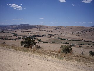
Little River (Dubbo), a watercourse of the Macquarie catchment within the Murray-Darling basin, is located in the central western and Orana districts of New South Wales, Australia.
Tooma River, a perennial stream that has had its flow diverted as a result of the Snowy Mountains Scheme, is part of the Murray catchment within the Murray–Darling basin and is located in the Australian Alpine region of New South Wales and Victoria, Australia.
Cockburn River, a perennial river that is part of the Namoi catchment within the Murray–Darling basin, is located in the Northern Tablelands district of New South Wales, Australia.
Bolong River, a watercourse that is part of the Lachlan catchment within the Murray–Darling basin, is located in the central–western region of New South Wales, Australia.
Bredbo River, a perennial stream that is part of the Murrumbidgee catchment within the Murray–Darling basin, is located in the Monaro region of New South Wales, Australia.
Campbells River, a perennial stream that is part of the Upper Macquarie catchment within the Murray–Darling basin, is located in the central–western region of New South Wales, Australia.
Corang River is a perennial river of the Shoalhaven catchment located in the Southern Tablelands region of New South Wales, Australia.
Crudine River, a watercourse that is part of the Macquarie catchment within the Murray–Darling basin, is located in the central western district of New South Wales, Australia.
Deepwater River, a mostly perennial stream of the Dumaresq-Macintyre catchment within the Murray–Darling basin, is located in the Northern Tablelands district of New South Wales, Australia.
Goobarragandra River, a perennial stream that is part of the Murrumbidgee catchment within the Murray–Darling basin, is located in the Snowy Mountains region of New South Wales, Australia.
The Goorudee Rivulet, a perennial river of the Murrumbidgee catchment of the Murray-Darling basin, is located in the Snowy Mountains region of New South Wales, Australia.
Rufus River, a watercourse of the Murray catchment and part of the Murray-Darling basin, is located in the western Riverina region of south western New South Wales, Australia.
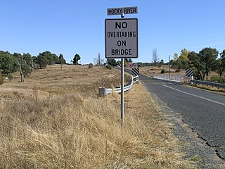
Rocky River, a watercourse of the Gwydir catchment within the Murray–Darling basin, is located in the Northern Tablelands district of New South Wales, Australia.
Wakool River, an anabranch of the Edward River that is part of the Murray River catchment within the Murray-Darling basin, is located in the western Riverina region of south western New South Wales, Australia.
Doubtful Creek, formerly known as Doubtful River, a watercourse that is part of the Murrumbidgee catchment within the Murray–Darling basin, is located in the Snowy Mountains district of New South Wales, Australia.
Isabella River, a perennial stream that is part of the Lachlan catchment within the Murray–Darling basin, is located in the central–western region of New South Wales, Australia.
Tumbarumba Creek, a watercourse of the Murray catchment within the Murray–Darling basin, is located in the region bordering the Riverina and Australian Alps of New South Wales, Australia.
Rouchel Brook, a perennial stream of the Hunter River catchment, is located in the Hunter region of New South Wales, Australia.
The Mirrool Creek, a watercourse that is part of the Lachlan sub-catchment of the Murrumbidgee catchment within the Murray–Darling basin, is located in the Riverina region of New South Wales, Australia. The course of the Mirrool Creek is indefinite at various locations.
The Government of New South Wales, also referred to as the New South Wales Government or NSW Government, is the Australian state democratic administrative authority of New South Wales. It is currently held by a coalition of the Liberal Party and the National Party. The Government of New South Wales, a parliamentary constitutional monarchy, was formed in 1856 as prescribed in its Constitution, as amended from time to time. Since the Federation of Australia in 1901, New South Wales has been a state of the Commonwealth of Australia, and the Constitution of Australia regulates its relationship with the Commonwealth. Under the Australian Constitution, New South Wales ceded legislative and judicial supremacy to the Commonwealth, but retained powers in all matters not in conflict with the Commonwealth.
Coordinates: 35°08′S143°42′E / 35.133°S 143.700°E
A geographic coordinate system is a coordinate system that enables every location on Earth to be specified by a set of numbers, letters or symbols. The coordinates are often chosen such that one of the numbers represents a vertical position and two or three of the numbers represent a horizontal position; alternatively, a geographic position may be expressed in a combined three-dimensional Cartesian vector. A common choice of coordinates is latitude, longitude and elevation. To specify a location on a plane requires a map projection.
This New South Wales river or creek related article is a stub. You can help Wikipedia by expanding it. |