Orara River, a perennial stream of the Clarence River catchment, is located in the Northern Rivers district of New South Wales, Australia.

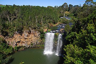
The Dorrigo Plateau is a plateau in the Northern Tablelands and New England regions of New South Wales, Australia. The plateau forms part of the Great Dividing Range and is sometimes referred to as the Dorrigo and Guy Fawkes Plateau.

Dorrigo, a small town on the Waterfall Way, is located on the Northern Tablelands, in northern New South Wales, Australia. The town is part of Bellingen local government area.
Guy Fawkes River, a perennial stream that is part of the Clarence River catchment, is in the New England and Northern Tablelands districts of New South Wales, Australia.

Dangarsleigh is a rural locality and minor trigonometrical station about 11 km south east of Armidale, New South Wales. The locality is at an altitude of about 1,020 metres on the Northern Tablelands in the New England region of New South Wales, Australia. The name Dangarsleigh commemorates the surveyor and pastoralist Henry Dangar’s name. It is within the Armidale Regional Council local government area and Sandon County.
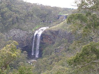
The Dangar Falls is a cascade waterfall located across the Bielsdown River about 1.2 km (0.7 mi) north of Dorrigo in the New England region of New South Wales, Australia. The falls are small, picturesque, and are a popular photographic subject. For a short time after rain, they are quite spectacular. There is an attractive picnic spot which offers excellent views. It is possible to climb down the banks and walk along the river below the water falls.

The Nymboida River, a perennial stream of the Clarence River catchment, is located in the Northern Rivers region of New South Wales, Australia.
Blicks River, a perennial stream that is part of the Clarence River catchment, is located in the Northern Tablelands district of New South Wales, Australia.

Boonoo Boonoo River, a watercourse of the Clarence River catchment, is located in the Northern Tablelands district of New South Wales, Australia.
Boyd River, a perennial stream that is part of the Clarence River catchment, is located in the Northern Tablelands district of New South Wales, Australia.
Glen Fernaigh River, a perennial river of the Clarence River catchment, is located in the Northern Rivers region of New South Wales, Australia.
Never Never River, a perennial stream of the Bellinger River catchment, is located in the Mid North Coast region of New South Wales, Australia.
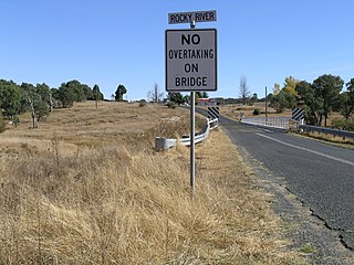
Rocky River, a watercourse of the Gwydir catchment within the Murray–Darling basin, is located in the Northern Tablelands district of New South Wales, Australia.

Forbes River, a perennial river of the Hastings River catchment, is located in the Mid North Coast region of New South Wales, Australia.

Esk River, a perennial stream that is part of the Clarence River catchment, is located in the Northern Rivers region of New South Wales, Australia.
Rosewood River, a perennial river of the Bellinger River catchment, is located in the Mid North Coast region of New South Wales, Australia.
The Clouds Creek, a perennial stream that is part of the Clarence River catchment, is located in the Northern Tablelands region of New South Wales, Australia.
The Georges Creek, a perennial stream that is part of the Macleay River catchment, is located in the Northern Tablelands and Mid North Coast regions of New South Wales, Australia.
The Ralfes Creek, a perennial stream that is part of the Hastings River catchment, is located in the Mid North Coast region of New South Wales, Australia.
Dingo Creek, a perennial stream of the Manning River catchment, is located in the Mid North Coast region of New South Wales, Australia.

