Bellinger River

Last updated

Bellinger River
North Arm Bellingen River, North Arm Bellinger River [1]
Bellinger River NSW 1.jpg
2009
Australia relief map.jpg
Red pog.svg
Location
Country Australia
State New South Wales
IBRA NSW North Coast
District Mid North Coast
Local government area Bellingen
Physical characteristics
Source Great Dividing Range
  locationbelow Point Lookout, near Ebor
  elevation1,150 m (3,770 ft)
Mouth Tasman Sea, South Pacific Ocean
  location
east of Urunga
  elevation
0 m (0 ft)
Length109 km (68 mi)
Basin size1,100 km2 (420 sq mi)
Basin features
Tributaries 
  leftHydes Creek, Woods Creek (New South Wales), Never Never River
  right Boggy Creek
National parks New England NP, Bellinger River NP
[2]

Bellinger River, an open and trained mature wave dominated, barrier estuary, [3] is located in the Mid North Coast region of New South Wales, Australia.

Contents

Course and features

The Bellinger River is home to the rare freshwater snapping turtle the, Bellinger River is the only place they are found on Earth. Bellinger River Valley, as seen from Point Lookout, 1995 View from Point Lookout.jpg
The Bellinger River is home to the rare freshwater snapping turtle the, Bellinger River is the only place they are found on Earth. Bellinger River Valley, as seen from Point Lookout, 1995

Bellinger River rises below Point Lookout within the Great Dividing Range, southeast of Ebor, and flows in a meandering course generally east, joined by four tributaries including Never Never River, before reaching its mouth at the Tasman Sea of the South Pacific Ocean, east of Urunga. The river descends 1,150 metres (3,770 ft) over its 69 kilometres (43 mi) course. [2]

Parts of the Bellinger River are contained within the Bellinger River National Park and the New England National Park. Other land uses in the valley include livestock grazing and forestry.

Waterfall Way is located adjacent to the middle reaches of the Bellinger River; and towards its mouth, the river is transversed by the Pacific Highway, near Raleigh.

A rare Australian turtle, the Emydura macquarii (or the Bellinger River freshwater turtle), has a restricted distribution in the upper Bellinger River above Thora. [4]

History

Clement Hodgkinson was the first European to explore the area in March 1841.[ citation needed ]

See also

Related Research Articles

<span class="mw-page-title-main">Tweed River (New South Wales)</span> River in northern New South Wales, Australia

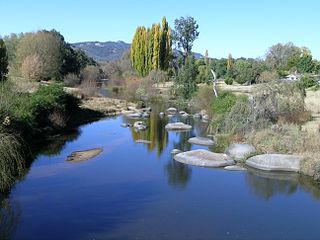
The Tweed River is a river situated in the Northern Rivers district of New South Wales, Australia. From the middle reaches of its course, the state boundary between New South Wales and Queensland is located approximately 10 kilometres (6.2 mi) north.

<span class="mw-page-title-main">Macdonald River (Bendemeer)</span> River in New South Wales, Australia

Macdonald River, a perennial river that is part of the Namoi catchment within the Murray–Darling basin, is located in the Northern Tablelands district of New South Wales, Australia.

<span class="mw-page-title-main">Nambucca River</span> River in Australia

The Nambucca River is a river located in the Mid North Coast region of New South Wales, Australia.

<span class="mw-page-title-main">Hastings River</span> River in New South Wales, Australia

Hastings River, an open and trained intermediate wave dominated barrier estuary, is located in the Northern Tablelands and Mid North Coast districts of New South Wales, Australia.

<span class="mw-page-title-main">Bermagui River</span> River in New South Wales, Australia

Bermagui River is an open and trained semi-mature wave dominated barrier estuary or perennial river located in the South Coast region of New South Wales, Australia.

Corindi River, an open mature wave dominated barrier estuary, is located in the Northern Rivers region of New South Wales, Australia.

The Merrica River is an intermediate intermittently closed saline coastal lagoon or perennial river located in the South Coast region of New South Wales, Australia.

Murrah River is an open mature wave dominated barrier estuary or perennial river located in the South Coast region of New South Wales, Australia.

The Nadgee River is a mature intermittently closed saline coastal lagoon; or perennial river located in the South Coast region of New South Wales, Australia.

Never Never River, a perennial stream of the Bellinger River catchment, is located in the Mid North Coast region of New South Wales, Australia.

The Nullica River is an intermittently closed semi-mature saline coastal lagoon or perennial river, located in the South Coast region of New South Wales, Australia.

Pambula River is an open semi-mature wave dominated barrier estuary or perennial river located in the South Coast region of New South Wales, Australia.

Sandon River, an open mature wave dominated, barrier estuary, is located in the Northern Rivers region of New South Wales, Australia.

The Towamba River is an open mature wave dominated barrier estuary or perennial river, located in the South Coast region of New South Wales, Australia.

<span class="mw-page-title-main">Tuross River</span> River in New South Wales, Australia

The Tuross River, an open semi-mature wave dominated barrier estuary or perennial stream, is located in the South Coast region of New South Wales, Australia.

The Wonboyn River, an open youthful wave dominated barrier estuary or perennial stream, is located in the South Coast region of New South Wales, Australia.

Wooli Wooli River, an open and trained mature wave dominated, barrier estuary, is located in the Northern Rivers region of New South Wales, Australia.

<span class="mw-page-title-main">Bega River (New South Wales)</span> River in New South Wales, Australia

The Bega River is an intermittently open intermediate wave dominated barrier estuary that is located in the South Coast region of New South Wales, Australia.

Evans River, an open and trained youthful wave dominated, interbarrier estuary, is located in the Northern Rivers region of New South Wales, Australia.

Kalang River, a perennial river of the Bellinger River catchment, is located in the Mid North Coast region of New South Wales, Australia.

References

  1. "Bellinger River". Geographical Names Register (GNR) of NSW. Geographical Names Board of New South Wales . Retrieved 10 March 2013. OOjs UI icon edit-ltr-progressive.svg
  2. 1 2 "Map of Bellinger River, NSW". Bonzle Digital Atlas of Australia. Retrieved 10 March 2013.
  3. Roy, P. S; Williams, R. J; Jones, A. R; Yassini, I; et al. (2001). "Structure and Function of South-east Australian Estuaries". Estuarine, Coastal and Shelf Science . 53: 351–384. doi:10.1006/ecss.2001.0796.
  4. "Bellinger River Emydura (Emydura macquarii) Recovery Plan". NSW National Parks and Wildlife Service . Department of Sustainability, Environment, Water, Population and Communities. ISBN   0-731-36367-1 . Retrieved 12 December 2008.

Coordinates: 30°30′S153°02′E / 30.500°S 153.033°E / -30.500; 153.033