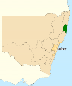
Nambucca Valley Council is a local government area in the Mid North Coast region of New South Wales, Australia.

The Division of Cowper is an Australian electoral division in the state of New South Wales.

The Mid North Coast is a country region in the north-east of the state of New South Wales, Australia. The region covers the mid northern coast of the state, beginning from Port Stephens 160 km (99 mi) north of Sydney, and extending as far north as Woolgoolga, 562 km (349 mi) north of Sydney, a distance of roughly 400 km (250 mi).

The Division of Lyne is an Australian electoral division in the state of New South Wales.

Ballina is an electoral district of the Legislative Assembly in the Australian state of New South Wales.

Bega is an electoral district of the Legislative Assembly in the Australian state of New South Wales. It is represented by Michael Holland of the Labor Party.

Upper Hunter is an electoral district of the Legislative Assembly in the Australian state of New South Wales. The seat is currently held by Dave Layzell for the National Party after he was elected at a by-election to replace Michael Johnsen.
Swansea is an electoral district of the Legislative Assembly in the Hunter Region of the Australian state of New South Wales. It is represented by Yasmin Catley of the Labor Party.

Port Macquarie is an electoral district of the Legislative Assembly in the Australian state of New South Wales. It is represented by Leslie Williams of the Liberal Party.

Northern Tablelands is an electoral district of the Legislative Assembly in the Australian state of New South Wales. It is currently held by Adam Marshall representing the National Party, following a by-election triggered by the resignation of independent member Richard Torbay. The electorate currently includes Uralla Shire, Armidale Regional Council, Glen Innes Severn, Inverell Shire, Gwydir Shire and Moree Plains Shire.

Wollondilly is an electoral district of the Legislative Assembly in the Australian state of New South Wales. It is represented by Nathaniel Smith of the Liberal Party.

Sydney is an electoral district of the Legislative Assembly of the Australian state of New South Wales in Inner Sydney. It includes the Sydney CBD; the suburbs and localities of Barangaroo, Broadway, Chinatown, Darling Harbour, Darlinghurst, Dawes Point, Elizabeth Bay, Haymarket, Millers Point, Paddington, Potts Point, Pyrmont, The Rocks, Woolloomooloo, Wynyard; and parts of Edgecliff, Rushcutters Bay, Surry Hills, Ultimo and Woollahra.

Cootamundra is an electoral district of the Legislative Assembly in the Australian state of New South Wales.
Hastings was an electoral district of the Legislative Assembly in the Australian state of New South Wales from 1859 to 1880. It was abolished in 1880 as part of the first major redistribution since 1858, replaced by Hastings and Manning from 1880 to 1894, which elected two members with voters casting two votes and the two leading candidates being elected. In 1894 it was divided between the single-member electoral district of Hastings and Macleay and Manning. In 1920 proportional representation was introduced and Hastings and Macleay was absorbed into the new four-member district of Oxley. The electorate was named after the Hastings, the alluvial valleys of which contained most of its population.
Condoublin was an electoral district of the Legislative Assembly in the Australian state of New South Wales from 1894 to 1901, in the Condobolin area.
Tumut was an electoral district for the Legislative Assembly in the Australian state of New South Wales in the Tumut area, one of 62 new districts established under the Electoral Act 1858 (NSW), in the 1858 redistribution. It replaced part of the district of Murrumbidgee which was reduced from 2 to 1 member. It was abolished in 1904 and replaced by Wynyard.
Macquarie, until 1910 The Macquarie was an electoral district of the Legislative Assembly in the Australian state of New South Wales, created in 1894 and named after the Macquarie River. It was re-created in 1904, retaining nothing but the name, then abolished in 1920.

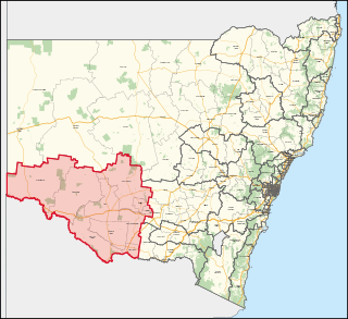
Murray is an electoral district in the Australian state of New South Wales.
The Electoral district of Pastoral Districts of New England and Macleay was an electorate of the New South Wales Legislative Council at a time when some of its members were elected and the balance were appointed by the Governor. It was a new electorate created in 1851 by the expansion of the Legislative Council to 54, 18 to be appointed and 36 elected. The district is located in the north of the state and covered the Northern Tablelands region of New England and part of the Mid North Coast region, including the area to the north of the Macleay River, but excluding the area south of the Macleay River which was included in the Counties of Gloucester and Macquarie. To the north was the Pastoral Districts of Clarence and Darling Downs and to the west the Pastoral Districts of Liverpool Plains and Gwydir. Polling took place in the towns of Wellingrove, Armidale, Tenterfield, Walcha and Kempsey.
Giinagay Way is a road in the Mid North Coast region of New South Wales linking the towns of Warrell Creek, Macksville, Nambucca Heads and Urunga to Pacific Highway. It runs along a former section of the highway between Eungai Creek and Raleigh that was bypassed by a new parallel alignment between 2016 and 2018.


