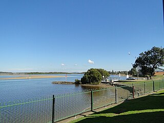
Tea Gardens is a locality in the Mid-Coast Council local government area, in Mid North Coast region of New South Wales, Australia.

Old Bar is a coastal town in New South Wales, Australia in Mid-Coast Council. It lies around 18 kilometres (11 mi) east of Taree on the Mid North Coast, and around 315 kilometres (196 mi) north of Sydney.

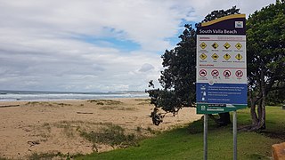
Valla is a suburb in the Nambucca Valley, on the Mid North Coast of New South Wales, Australia. The name was chosen to match that of the British residence of nineteenth century diplomat Andrew Buchanan.

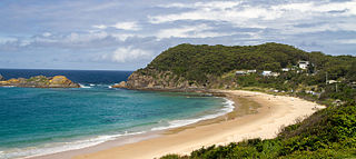
Seal Rocks is a small coastal settlement in the Mid-Coast Council local government area, in the Mid North Coast region of New South Wales, Australia, 275 kilometres (171 mi) north-north-east of Sydney. It is famous for its many premier surfing beaches, and also for being the home of Seal Rocks lighthouse, officially known as Sugarloaf Point Lighthouse. At the 2021 census, the area had a population of 56 persons.

Kendall is a town on the Mid North Coast of New South Wales, Australia.

Eungai is a town on the mid-North Coast of New South Wales, Australia. It is made up of two localities, Eungai Creek and Eungai Rail, although both have the same postcode. The Eungai district is midway between Sydney (500 km) and Brisbane, midway between Port Macquarie (90 km) and Coffs Harbour, and midway between Kempsey (20 km) and Macksville. It is in the Nambucca Valley. It has a population of 605 in the 2021 census.

Nambucca Heads is a town on the Mid North Coast of New South Wales, Australia in the Nambucca Valley. It is located on a ridge, north of the estuary of the Nambucca River near the Pacific Highway. Its 2021 population was 6,675, including 5,226 (78.3%) Australian-born persons and 672 indigenous persons.
Failford is a locality in the Mid-Coast Council local government area on the Mid North Coast of New South Wales, Australia. Located to the east of the Pacific Highway, Failford is about 17 km (11 mi) northwest of Forster. At the 2011 census it had a population of 495.

Karuah is a locality in both the Port Stephens and Mid-Coast Councils, the Port Stephens lga side is part the Hunter Region while the Mid-Coast lga is in the Mid North Coast region of New South Wales, Australia. It is thought that the name means 'native plum tree' in the local Aboriginal dialect.

Nerrigundah is a small village on the Eurobodalla Nature Coast in south eastern New South Wales. Situated at the head of the Tuross River Valley, it is nineteen kilometres inland from Bodalla. At the 2016 census, Nerrigundah had a population of 25.

Harrington is a fishing village located on the northern entrance of the Manning River in New South Wales, Australia. It was established in 1853 and proclaimed a village on 26 September 1896. It is 15 km north-east of Taree on the Mid North Coast, and 335 kilometres (208 mi) north east of the state capital, Sydney. At the 2021 census, Harrington had a population of 3,381. It was named after the Earl of Harrington by the explorer, John Oxley.

Burrill Lake is a small village on the Princes Highway in the South Coast region of New South Wales, Australia. It is a seaside suburb of the Milton-Ulladulla district, a part of the City of Shoalhaven local government area and surrounds the lake of the same name. In 2021, Burrill Lake had a population of 1,782. The name of the town is derived from an Aboriginal word meaning 'wallaby'.

Scotts Head is a coastal village of the Nambucca Valley local government area in the Mid North Coast region of New South Wales, Australia. Located on the coast of the Pacific Ocean, approximately 10 kilometres (6 mi) from the Pacific Highway and 480 kilometres (300 mi) from Sydney, it stretches southwards from just south of the mouth of the Nambucca River to the town of Scotts Head in the south.

Stratford is a rural locality in the Mid-Coast Council local government area in the Hunter Region of New South Wales, Australia. The largest population centre in the area is the town of Stratford, which is approximately 14 kilometres (9 mi) south of Gloucester and 109 km (68 mi) north of Newcastle. Stratford, which is next to the Avon River, is on Bucketts Way, 66 km (41 mi) from the Pacific Highway, the nearest major highway.

Cundletown is a town on the Mid North Coast, New South Wales, Australia. Cundletown and the nearby larger town of Taree were both settled in 1831 by William Wynter. Cundletown had a population of 2,054 as of the 2016 census. and is a significant agricultural district. It is 16 km from the Tasman Sea coast, and 317 km north of Sydney.
Manning Point is a small village located at the mouth of the Manning River in New South Wales, Australia. Lying on Mitchells Island, it lies opposite the town of Harrington. It is 33 kilometres (21 mi) east of Taree on the Mid North Coast. At the 2006 census, Manning Point had a population of 228.

Rollands Plains is a village and bounded rural locality in Mid North Coast of New South Wales, Australia.

MidCoast Council is a local government area that is located in the Mid North Coast region of New South Wales, Australia. The council was formed on 12 May 2016 through a merger of the Gloucester Shire, Great Lakes and City of Greater Taree Councils.
Mount George is a locality in the Mid-Coast Council of New South Wales. It had a population of 288 as of the 2016 census.

Johns River is a locality in the Mid-Coast Council of New South Wales.


