Wallis Lake

Last updated

Wallis Lake
Wallis Lake from Whoota Lookout - panoramio.jpg
Australia New South Wales relief location map.png
Red pog.svg
Wallis Lake
Australia relief map.jpg
Red pog.svg
Wallis Lake
Location Mid North Coast, New South Wales, Australia
Coordinates 32°18′S152°30′E / 32.300°S 152.500°E / -32.300; 152.500 Coordinates: 32°18′S152°30′E / 32.300°S 152.500°E / -32.300; 152.500
Lake type An open and trained wave dominated barrier estuary [1]
Primary inflows Wallamba River, Coolongolook River, Pipers Creek
Primary outflows Coolongolook River to the Tasman Sea
Catchment area 1,196.9 square kilometres (462.1 sq mi) [2]
Basin  countriesAustralia
Managing agency Mid-Coast Council
Max. length25 kilometres (16 mi) [3]
Max. width9 kilometres (5.6 mi) [4]
Surface area 98.7 square kilometres (38.1 sq mi) [2]
Average depth2.3 metres (7 ft 7 in) [2]
Water volume 217,951.5 megalitres (7,696.88×10^6 cu ft) [2]
Surface elevation0 m (0 ft)
Islands Hadleys Island, Wallis Island
Settlements Coomba Park, Forster, Green Point, Pacific Palms, Tuncurry
Website NSW Environment & Heritage webpage
References [5]

Wallis Lake, an open and trained wave dominated barrier estuary, [1] is located within the Mid-Coast Council local government area in the Mid North Coast region of New South Wales, Australia. Wallis Lake is located adjacent to the towns of Forster and Tuncurry, and adjacent to the east coast, about 308 kilometres (191 mi) north of Sydney.

Contents

Features and location

Drawing its catchment from within Wallingat National Park and the Wallamba River, Coolongolook River, and Pipers Creek, Wallis Lake has a catchment area of 1,197 square kilometres (462 sq mi) and a surface area of 99 square kilometres (38 sq mi). [2] When full, Wallis Lake covers an area of around 10,000 hectares (25,000 acres), [5] is approximately 25 kilometres (16 mi) long, [3] with a width of 9 kilometres (5.6 mi). [4]

Hadleys Island lies within Wallis Lake, near the confluence of the Wallamba and Coolongolook rivers.

The waterways surrounding Wallis Lake are well known for oyster production. [6]

Lake Wallis was named in honour of James Wallis, an officer of the 46th Regiment. [4]

See also

Related Research Articles

<span class="mw-page-title-main">Myall Lakes</span> Lakes in New South Wales, Australia

Myall Lakes, a series of fresh water lakes protected under the Ramsar Convention, are located within the Mid-Coast Council local government area in the Mid North Coast region of New South Wales, Australia.

<span class="mw-page-title-main">Port Stephens (New South Wales)</span> Estuarine lake in New South Wales, Australia

Port Stephens, an open youthful tide-dominated drowned-valley estuary, is a large natural harbour of approximately 134 square kilometres (52 sq mi) located in the Hunter Region of New South Wales, Australia.

<span class="mw-page-title-main">Pittwater</span> Estuary in Sydney, Australia

Pittwater is a semi-mature tide dominated drowned valley estuary, located about 40 kilometres (25 mi) north of the Sydney central business district, New South Wales, Australia; being one of the bodies of water that separate greater Metropolitan Sydney from the Central Coast.

<span class="mw-page-title-main">Myall River</span> River in New South Wales, Australia

Myall River, an open semi-mature brackish freshwater barrier estuary of the Mid-Coast Council system, is located in the Mid North Coast region of New South Wales, Australia.

<span class="mw-page-title-main">Karuah, New South Wales</span> Suburb of Port Stephens Council, New South Wales, Australia

Karuah is a locality in both the Port Stephens and Mid-Coast Councils in the Hunter Region of New South Wales, Australia. It is thought that the name means 'native plum tree' in the local Aboriginal dialect.

<span class="mw-page-title-main">Tuncurry, New South Wales</span> Town in New South Wales, Australia

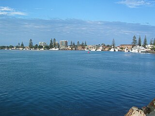
Tuncurry is a coastal town in the Mid North Coast region of New South Wales, Australia, in the Mid-Coast Council LGA, about 308 km (191 mi) north north east of Sydney. It is immediately adjacent to its twin town of Forster, which is the larger of the two towns.

<span class="mw-page-title-main">Karuah River</span> River in New South Wales, Australia

Karuah River, an open semi-mature tide dominated drowned valley estuary is located in the Mid North Coast and Hunter regions of New South Wales, Australia.

Coolongolook River, a watercourse of the Mid-Coast Council system, is located in the Mid North Coast district of New South Wales, Australia.

The Crawford River, a perennial river of the Mid-Coast Council system, is located in the Mid North Coast region of New South Wales, Australia.

Mammy Johnsons River, a mostly perennial river of the Mid-Coast Council system, is located in the Mid North Coast and Upper Hunter regions of New South Wales, Australia.

<span class="mw-page-title-main">Telegherry River</span> River in New South Wales, Australia

Telegherry River, a perennial river of the Mid-Coast Council system, is located in the Mid North Coast and Upper Hunter regions of New South Wales, Australia.

The Branch River, a watercourse of the Mid-Coast Council system, is located in the Mid North Coast and Upper Hunter regions of New South Wales, Australia.

<span class="mw-page-title-main">Tuross River</span> River in New South Wales, Australia

The Tuross River, an open semi-mature wave dominated barrier estuary or perennial stream, is located in the South Coast region of New South Wales, Australia.

<span class="mw-page-title-main">Wallamba River</span> River in New South Wales, Australia

Wallamba River, a watercourse of the Mid-Coast Council system, is located in the Mid North Coast district of New South Wales, Australia.

Wallingat River, a watercourse of the Mid-Coast Council system, is located in the Mid North Coast district of New South Wales, Australia.

Wang Wauk River, a perennial river of the Great Lakes system, is located in the Mid North Coast region of New South Wales, Australia.

Wards River, a mostly perennial river of the Mid-Coast Council system, is located in the Mid North Coast and Upper Hunter regions of New South Wales, Australia.

<span class="mw-page-title-main">Terrigal Lagoon</span> Body of water

Terrigal Lagoon, an intermittently closed intermediate saline coastal lagoon, is located on the Central Coast region of New South Wales, Australia. Terrigal Lagoon is located between the towns of Terrigal and Wamberal, and adjacent to the east coast, about 85 kilometres (53 mi) north of Sydney.

Smiths Lake, an intermittently closed youthful saline coastal lagoon, is located within the Mid-Coast Council local government area in the Mid North Coast region of New South Wales, Australia. Smiths Lake is located adjacent to the village of Smiths Lake, and adjacent to the east coast, about 274 kilometres (170 mi) north of Sydney.

<span class="mw-page-title-main">Mid-Coast Council</span> Local government area in New South Wales, Australia

MidCoast Council is a local government area (LGA) located in the Mid North Coast region of New South Wales, Australia. The council was formed on 12 May 2016 through a merger of the Gloucester Shire, Great Lakes and City of Greater Taree councils.

References

  1. 1 2 Roy, P. S; Williams, R. J; Jones, A. R; Yassini, I; et al. (2001). "Structure and Function of South-east Australian Estuaries". Estuarine, Coastal and Shelf Science . 53: 351–384. doi:10.1006/ecss.2001.0796.
  2. 1 2 3 4 5 "Estuaries of NSW: Smiths Lake". Office of Environment and Heritage. Government of New South Wales . Retrieved 20 March 2013.
  3. 1 2 "Wallis Lake". Great Lakes Tourism. Great Lakes Council . Retrieved 20 March 2013.
  4. 1 2 3 "Wallis Lake". Geographical Names Register (GNR) of NSW. Geographical Names Board of New South Wales . Retrieved 20 March 2013. OOjs UI icon edit-ltr-progressive.svg
  5. 1 2 "Map of Wallis Lake, NSW". Bonzle Digital Atlas of Australia. Retrieved 20 March 2013.
  6. "Dredging planned for famous Wallis Lake oysters". Australia: ABC News. 27 June 2012. Retrieved 20 March 2013.