This article needs additional citations for verification .(August 2008) |
Natural freshwater lakes in Australia are rare due to the general absence of glacial and tectonic activity in Australia.[ citation needed ]
This article needs additional citations for verification .(August 2008) |
Natural freshwater lakes in Australia are rare due to the general absence of glacial and tectonic activity in Australia.[ citation needed ]
Most lakes in Australia fall within one of five categories. Excluding lakes and lagoons created by man-made dams for water storage and other purposes, one can identify the following:
The following is a list of prominent natural lakes and lagoons in the sector of Antarctica claimed by Australia as the Australian Antarctic Territory:
| Order | Name | Type | Region | Designation | Area | Image | Notes | |
|---|---|---|---|---|---|---|---|---|
| ha | acre | |||||||
| 1 | Braunsteffer Lake | Glacial | Princess Elizabeth Land | 0.0769 | 0.19 | [2] | ||
| 2 | Club Lake | Glacial | [3] | |||||
| 3 | Collerson Lake | Glacial | [4] | |||||
| 4 | Dingle Lake | Glacial | 68 | 168 | [5] | |||
| 5 | Krok Lake | Glacial | [6] | |||||
| 6 | Station Tarn | Glacial | ||||||
| 7 | Stinear Lake | Glacial | ||||||
| 8 | Lake Vereteno | Glacial | ||||||
| 9 | Lake Zvezda | Glacial | ||||||
In the Australian Capital Territory there are no prominent naturally-formed lakes and lagoons. Artificial lakes include Bendora Dam, Cotter Dam, Corin Dam, Lake Burley Griffin, Lake Ginninderra, Lake Tuggeranong, and Stranger Pond.
The following is a list of prominent natural lakes and lagoons in New South Wales:
| Order | Name | Type | Region | Designation | Area | Image | Notes | |
|---|---|---|---|---|---|---|---|---|
| ha | acre | |||||||
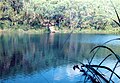
| 1 | Lake Albina | Glacial | Snowy Mountains | 0.66 | 2 |  | [7] | |
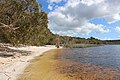
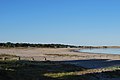
| 2 | Avoca Lake | Coastal | Central Coast | 70 | 173 |  | [8] | |
| 3 | Lake Bathurst | Freshwater ephemeral | Southern Tablelands | 10 | 25 | |||
| 4 | Blue Lake | Freshwater ephemeral; Glacial | Snowy Mountains |
| 16 | 40 |  | [9] |
| 5 | Budgewoi Lake | Coastal | Central Coast | 1,400 | 3,459 | |||
| 6 | Lake Cathie | Coastal | ||||||
| 7 | Chipping Norton Lake | Freshwater ephemeral | Greater Sydney |  | ||||
| 8 | Lake Cootapatamba | Glacial | Snowy Mountains |  | ||||
| 9 | Lake Cowal | Freshwater ephemeral | Central West | |||||
| 10 | Dee Why Lagoon | Coastal lagoon | Northern Beaches |  | ||||
| 11 | Lake George | Freshwater ephemeral | Southern Tablelands |  | ||||
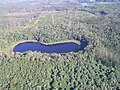
| 12 | Glenbrook Lagoon | Freshwater ephemeral | Blue Mountains |  | ||||
| 13 | Glenrock Lagoon | Coastal lagoon | ||||||
| 14 | Headley Tarn | Glacial | ||||||
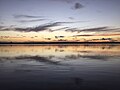
| 15 | Lake Illawarra | Coastal | Illawarra | | ||||
| 16 | Lake Macquarie | Coastal | Hunter |  | ||||
| 17 | Menindee Lakes | Freshwater ephemeral | Far West |  | ||||
| 18 | Lake Moore | Freshwater ephemeral | ||||||
| 19 | Lake Mungo | Saline | Far West |  | ||||
| 20 | Lake Munmorah | Coastal | Central Coast | |||||
| 21 | Myall Lakes | Coastal | Mid North Coast | 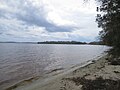 | ||||
| 22 | Narrabeen Lagoon | Coastal | Northern Beaches | 220 | 544 |  | [10] | |
| 23 | Narran Lakes | Freshwater ephemeral | ||||||
| 24 | Smiths Lake | Coastal | Mid North Coast | |||||
| 25 | St Georges Basin | Coastal | South Coast / Jervis Bay Territory | |||||
| 26 | Tabourie Lake | Coastal | Mid North Coast | |||||
| 27 | Terrigal Lagoon | Coastal lagoon | Central Coast | |||||
| 28 | Tuggerah Lake | Coastal | Central Coast |  | ||||
| 29 | Lake Urana | Saline | Far West | |||||
| 30 | Wallaga Lake | Freshwater ephemeral | ||||||
| 31 | Wallis Lake | Coastal | Mid North Coast | |||||
| 32 | Wamberal Lagoon | Coastal lagoon | Central Coast | |||||
| 33 | Wattle Grove Lake | Freshwater ephemeral | ||||||
| 34 | Willandra Lakes | Saline | Far West | |||||
| 35 | Lake Wollumboola | Coastal | Mid North Coast | |||||
| 36 | Wonboyn Lake | Coastal | Mid North Coast | |||||
| 37 | Lake Woytchugga | Freshwater ephemeral | ||||||
| 38 | Peery Lake | Freshwater ephemeral | Far West | Ramsar | 5,026 | 12,420 | 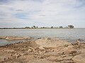 | |
The following is a list of prominent natural lakes and lagoons in the Northern Territory:
| Order | Name | Type | Region | Designation | Area | Image | Notes | |
|---|---|---|---|---|---|---|---|---|
| ha | acre | |||||||
| 1 | Lake Amadeus | Saline | South-west | 103,200 | 255,013 | 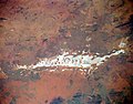 | [11] | |
| 2 | Corella Lake | Freshwater ephemeral | ||||||
| 3 | Lake Mackay | Saline | Great Sandy Desert; Gibson Desert; Tanami Desert | 349,400 | 863,386 |  | ||
| 4 | Lake Neale | Saline | South-west | 30,000 | 74,132 | [12] | ||
| 5 | Numby Numby | Sinkhole | Gulf of Carpentaria |  | ||||
| 6 | Lake Sylvester | Freshwater ephemeral | Barkly Tableland | 200,000 | 494,211 | |||
| 7 | Tarrabool Lake | Freshwater ephemeral | Barkly Tableland | Tarrabool Lake – Eva Downs Swamp System Important Bird Area; Register of the National Estate; DIWA | 118,600 | 293,067 |  | |
| 8 | Lake Woods | Freshwater ephemeral | Barkly Tableland | Important Bird Area; Longreach Waterhole Protected Area (part) | 118,600 | 293,067 | | |
| 9 | Lake Lewis | Saline ephemeral | ||||||
The following is a list of prominent natural lakes and lagoons in Queensland:
The following is a list of prominent natural lakes and lagoons in South Australia:
The following is a list of prominent natural lakes and lagoons in Tasmania:
| Order | Name | Type | Region | Designation | Area | Image | Notes | |
|---|---|---|---|---|---|---|---|---|
| ha | acre | |||||||
| 1 | Lake Beatrice | Freshwater | Western | 55 | 136 | [22] | ||
| 2 | Lake Dora | Freshwater | Western | 48 | 119 | [23] | ||
| 3 | Dove Lake | Cirque freshwater | Central Highlands | Cradle Mountain-Lake St Clair National Park | 86 | 213 | 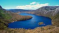 | [24] [25] [26] |
| 4 | Lake Dulverton | Freshwater ephemeral | Southern Midlands | 230 | 568 | [27] [28] | ||
| 5 | Lake Edgar | Fault scarp pond | South West | Tasmanian Wilderness World Heritage Area | 147 | 363 | [29] | |
| 6 | Lake Fidler | Meromictic | South West | Tasmanian Wilderness World Heritage Area | ||||
| 7 | Lake Flannigan | Freshwater | King Island | Game reserve (pending as at 2005) | 150 | 371 | 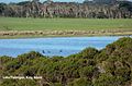 | |
| 8 | Great Lake | Freshwater | Central Highlands | 17,600 | 43,491 | | [30] | |
| 9 | Jocks Lagoon | Dystrophic lake | Central Northern | Ramsar site | 18 | 44 | [31] | |
| 10 | Little Waterhouse Lake | Freshwater coastal | North East | Ramsar Site | 10 | 25 |  | [32] |
| 11 | Lake Meston | Freshwater | Central Northern | Walls of Jerusalem National Park | ||||
| 12 | Orielton Lagoon | Dystrophic coastal lagoon | South East Coast | Ramsar Site | 3,334 | 8,240 | | [33] |
| 13 | Lake Selina | Glacial | West Coast | |||||
| 14 | Lake St Clair | Freshwater | Central Highlands | Cradle Mountain-Lake St Clair National Park | 4,500 | 11,120 |  | |
| 15 | Lake Westwood | Glacial | West Coast | 35 | 86 | [34] | ||
The following is a list of prominent natural lakes and lagoons in Victoria.
| Order | Name | Type | Region | Designation | Area | Image | Notes | |
|---|---|---|---|---|---|---|---|---|
| ha | acre | |||||||
| 1 | Lake Batyo Catyo | Freshwater ephemeral | 230 | 568 | ||||
| 2 | Lake Corangamite | Saline | 23000 | 56834 | | |||
| 3 | Gippsland Lakes | Coastal |  | |||||
| 4 | Lake Hindmarsh | Freshwater ephemeral | Wimmera | 13500 | 33000 | |||
| 5 | Mallacoota Inlet | Coastal | ||||||
| 6 | Murtnaghurt Lagoon | Saline | 81 | 200 | ||||
| 7 | Lake Victoria | Coastal lake | 139 | 340 |  | |||
| 8 | Lake Tali Karng | Freshwater | Alpine | 14 | 35 | | ||
| 9 | Pink Lake (Victoria) | Saline | Wimmera | 45 | 111 | |||
The following is a list of prominent natural lakes and lagoons in Western Australia:
| Order | Name | Type | Region | Designation | Area | Image | Notes | |
|---|---|---|---|---|---|---|---|---|
| ha | acre | |||||||
| 1 | Angove Lake | Freshwater | Great Southern | Two Peoples Bay Nature Reserve | 33 | 82 | ||
| 2 | Lake Anneen | Saline | Mid West | 12,000 | 29,653 | |||
| 3 | Lake Baghdad | Saline | Rottnest Island | |||||
| 4 | Lake Ballard | Saline ephemeral | Goldfields–Esperance | 4,900 | 12,108 |  | [35] | |
| 5 | Lake Barlee | Saline | Mid West | 198,000 | 489,269 |  | [36] | |
| 6 | Bibra Lake | Freshwater | Perth | Beeliar Regional Park | ||||
| 7 | Lake Boonderoo | Freshwater | Goldfields-Esperance | 2,500 | 6,178 | |||
| 8 | Booragoon Lake | Freshwater | Perth | Beeliar Regional Park | [37] | |||
| 9 | Boyd Lagoon | Saline lagoon | Gibson Desert | 870 | 2,150 | [38] | ||
| 10 | Lake Breaden | Saline | Gibson Desert | 2,600 | 6,425 | [39] [40] | ||
| 11 | Lake Bryde-East Lake Bryde | Freshwater wetland | Great Southern | Lake Bryde Nature Reserve | 1,900 | 4,695 | [41] | |
| 12 | Lake Burnside | Saline | Gibson Desert | 42,000 | 103,784 | [42] | ||
| 13 | Lake Carey | Saline | Goldfields-Esperance | |||||
| 14 | Lake Carnegie | Ephemeral | Goldfields-Esperance | 571,400 | 1,411,960 |  | [43] [44] | |
| 16 | Lake Dora | Saline | Pilbara | 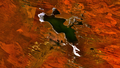 | ||||
| 17 | Dumbleyung Lake | Saline | Great Southern | Dumbleyung Lake Nature Reserve | 5,200 | 12,849 |  | |
| 18 | Lake Dundas | Saline | Goldfields-Esperance | |||||
| 19 | Forrestdale Lake | Brackish seasonal groundwater | Perth | Forrestdale Lake Nature Reserve; Forrestdale and Thomsons Lakes Ramsar Site | 245 | 605 | | [45] |
| 20 | Lake Gore | Seasonal freshwater | Goldfields-Esperance | Lake Gore Nature Reserve; Lake Gore Ramsar Site | 740 | 1,829 | [46] | |
| 21 | Lake Gregory | Seasonal freshwater | Kimberley | Paraku Indigenous Protected Area | ||||
| 22 | Herdsman Lake | Freshwater | Perth | Herdsman Lake Regional Park | 300 | 741 |  | [47] |
| 23 | Lake Hillier | Saline | Goldfields-Esperance | Recherche Archipelago Nature Reserve | 1.5 | 4 |  | [48] |
| 24 | Hutt Lagoon | Saline | Mid West |  | ||||
| 25 | Lake Jasper | Freshwater | South West | 4,500 | 11,120 | [49] | ||
| 26 | Lake Joondalup | Freshwater | Perth | Yellagonga Regional Park |  | |||
| 27 | Jualbup Lake | Freshwater | Perth | Shenton Park |  | |||
| 15 | Kumpupintil Lake | Saline endorheic | Pilbara | 33,000 | 81,545 |  | [50] | |
| 28 | Lake Lefroy | Saline ephemeral | Goldfields-Esperance | |||||
| 29 | Lake Mackay | Saline | Great Sandy Desert | 349,400 | 863,386 | | [51] | |
| 30 | Lake McLarty | Freshwater | South West | Lake McLarty Nature Reserve; Peel-Yalgorup System Ramsar site | ||||
| 31 | Lake Macleod | Freshwater | Gascoyne | 150,000 | 370,658 | 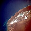 | ||
| 32 | Loch McNess | Freshwater | Perth | Yanchep National Park |  | [52] | ||
| 33 | Lake Magenta | Saline ephemeral | Wheatbelt | Lake Magenta Nature Reserve | 11,000 | 27,182 | [53] | |
| 34 | Lake Maitland | Dry saline | Mid West | |||||
| 35 | Lake Monger | Freshwater | Perth | Lake Monger Reserve | 70 | 173 | ||
| 36 | Lake Monginup | Freshwater | Goldfields-Esperance | Lake Monginup Nature Reserve | 32 | 79 |  | [54] |
| 37 | Lake Muir | Freshwater | South West | Muir-Byenup System Ramsar Site | 4 | 10 | 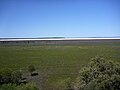 | [55] [56] |
| 38 | Lake Nabberu | Saline | Mid West | 18,000 | 44,479 | [57] | ||
| 39 | Lake Newell | Goldfields-Esperance | 2,600 | 6,425 | [58] | |||
| 40 | North Lake | Freshwater | Perth | Beeliar Regional Park | ||||
| 41 | Perry Lakes | Freshwater | Perth | Perry Lakes Reserve | 12.6 | 31 | [59] | |
| 42 | Perth Wetlands | Wetlands | Perth | Herdsman Lake Regional Park | ||||
| 43 | Pink Lake | Saline | Goldfields-Esperance | 99 | 245 | 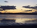 | [60] | |
| 44 | Lake Seppings | Freshwater | South West | Lake Seppings Nature Reserve |  | [61] | ||
| 45 | Serpentine Lakes | Saline | Great Victoria Desert | Mamungari Conservation Park | 9,700 | 23,969 | 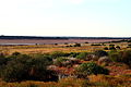 | [20] |
| 46 | Lake Shaster | Hypersaline | Goldfields-Esperance | Lake Shaster Nature Reserve | 479 | 1,184 | [62] | |
| 47 | Lake Thetis | Saline | Mid West | |||||
| 48 | Thomsons Lake | Brackish seasonal groundwater | Perth | Thomsons Lake Nature Reserve; Forrestdale and Thomsons Lakes Ramsar Site | 538 | 1,329 | ||
| 49 | Toolibin Lake | Perched freshwater | Wheatbelt | Toolibin Lake Nature Reserve; Toolibin Lake Ramsar Site | 300 | 741 | [63] | |
| 50 | Lake Warden | Saline | Goldfields-Esperance | Lake Warden Nature Reserve | 59 | 146 | [64] | |
| 51 | Lake Way | Dry saline | Mid-West | 46,000 | 113,668 | [65] | ||
| 52 | Lake Wooleen | Intermittent freshwater | Mid-West | 5,500 | 13,591 | |||
{{cite web}}: CS1 maint: archived copy as title (link) ![]() Media related to Lakes of Australia at Wikimedia Commons
Media related to Lakes of Australia at Wikimedia Commons