
Narawntapu National Park is a national park in the Australian state of Tasmania. It lies on Tasmania's north coast, adjoining Bass Strait, between Port Sorell in the west and the mouth of the Tamar River in the east. It lies about 20 km east of Devonport, 60 km north-west of Launceston and 250 km north of Hobart.

The China–Australia Migratory Bird Agreement (CAMBA) is a bilateral treaty between Australia and China that aims to protect migratory birds and their environment between the two countries. Throughout all six Articles, the treaty defines what a migratory bird is, outlines key prohibitions for both contracting parties and determines the responsibilities of both nations to protect migratory birds and their habitats. The CAMBA was first developed on 20 October 1986, and came into force on 1 September 1988. Eighty-one bird species are listed in the agreement, as shown in the CAMBA Annex listed below.

Lake Alexandrina is a coastal freshwater lake located between the Fleurieu and Kangaroo Island and Murray and Mallee regions of South Australia, about 100 kilometres (62 mi) south-east of Adelaide. The lake adjoins the smaller Lake Albert and a coastal lagoon called The Coorong to its southeast, before draining into the Great Australian Bight via a short, narrow opening known as Murray Mouth.

Midway Point is a residential locality in the local government area (LGA) of Sorell in the South-east LGA region of Tasmania. The locality is about 5 kilometres (3.1 mi) south-west of the town of Sorell. The 2016 census recorded a population of 2859 for the state suburb of Midway Point. It is located on a small peninsula with Orielton Lagoon on its eastern side and Pittwater on its southern and western sides. The suburb meets the mid-way point of the Sorell Causeway from Hobart to Sorell, hence the name. Mcgees Bridge is connected to Midway Point on the Pittwater side. The suburb lies close to Hobart International Airport and is approximately 21 km to Hobart via the Tasman Highway. In recent years Midway Point has become a popular commuter town for people working in Hobart.

Cape Barren Island, officially truwana / Cape Barren Island, is a 478-square-kilometre (185 sq mi) island in Bass Strait, off the north-east coast of Tasmania, Australia. It is the second-largest island of the Furneaux Group, with the larger Flinders Island to the north, and the smaller Clarke Island to the south. The highest point on the island is Mount Munro at 715 metres (2,346 ft). Mount Munro is named after James Munro, a former convict turned sealer who, from the 1820s, lived for more than 20 years with various indigenous women on nearby Preservation Island.

Pedra Branca is a rock islet in the Southern Ocean, off the southern coast of Tasmania, Australia. The island is situated approximately 26 km (16 mi) south southeast of South East Cape and is contained within the Southwest National Park, part of the Tasmanian Wilderness World Heritage Site. An erosional remnant of the Tasmanian mainland, the island is approximately 270 m (890 ft) long, 100 m (330 ft) wide, with an elevation of 60 m (200 ft) above sea level. The island is estimated to have separated from the Tasmanian mainland at least 15,000 years ago.
Kathleen Island is a steeply cliffed island that lies within Port Davey, an oceanic inlet, located in the south west region of Tasmania, Australia. The island has an area of approximately 11.35 hectares and is contained with the Southwest National Park, part of the Tasmanian Wilderness World Heritage Site and the Port Davey/Bathurst Harbour Marine Nature Reserve.
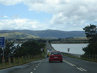
The Sorell Causeway is a causeway that carries the Tasman Highway across Pitt Water-Orielton Lagoon, from the western side of Midway Point to Sorell in the south-east of Tasmania, Australia. The causeway and adjacent Mcgees Bridge provide vital links between Hobart and two of Tasmania's principal tourist attractions - Port Arthur Historic Site on the Tasman Peninsula and the picturesque East Coast via the Tasman Highway.

Ralphs Bay is a body of water in south-east Tasmania, Australia. It is semi-enclosed by the Tranmere / Rokeby peninsula and the South Arm peninsula. Sea access to the bay is from the River Derwent.

The Quill Lakes is a wetland complex in Saskatchewan, Canada that encompasses the endorheic basin of three distinct lake wetlands: Big Quill Lake, Middle Quill Lake, and Little Quill Lake. On May 27, 1987, it was designated a wetland of international importance via the Ramsar Convention. It was the first Canadian site in the North American Waterfowl Management Plan, is a site in the International Biological Programme and Saskatchewan Heritage Marsh Program, and was designated a Western Hemisphere Shorebird Reserve Network site of International significance in May, 1994. The site is an important staging and breeding area for spring and fall migration of shorebirds. The site qualifies as an Important Bird Area (IBA) of Canada for its globally and nationally significant migratory and breeding populations of more than a dozen species of birds. The IBA is designated as Quill Lakes .
The Albatross Island, part of the Hunter Island Group, is an 18-hectare (44-acre) island and nature reserve located in Bass Strait, that lies between north-west Tasmania and King Island, Australia. The Peerapper name for the island is Tangatema.
The Fitzroy Islands comprise a group of four rocky islets that lie within the upper reaches of Payne Bay in Port Davey, an oceanic inlet, located in the south west region of Tasmania, Australia. The islands have a combined area of approximately 0.18 hectares and are contained with the Southwest National Park, part of the Tasmanian Wilderness World Heritage Site and the Port Davey/Bathurst Harbour Marine Nature Reserve.
Munday Island is a small island that lies between Port Davey, an oceanic inlet, and Bathurst Channel, located in the south west region of Tasmania, Australia. The island is contained with the Southwest National Park, part of the Tasmanian Wilderness World Heritage Site and the Port Davey/Bathurst Harbour Marine Nature Reserve.
Robbins Island is a 9,900-hectare (24,000-acre) island located in Bass Strait, lying off the northwest coast of Tasmania, Australia. The island, separated from the Tasmanian mainland by a highly tidal area known as Robbins Passage, lies south to the adjacent Walker Island.

The Birchs Inlet, also spelt Birch's Inlet or Birches Inlet, is a narrow cove or coastal inlet on the south-western side of Macquarie Harbour on the west coast of Tasmania, Australia. The inlet is located within the Southwest National Park, part of the Tasmanian Wilderness World Heritage Area.

The South Arm Important Bird Area is a disjunct tract of mainly intertidal land on the eastern outskirts of Hobart, Tasmania, Australia.

Logan Lagoon is a 2172 ha wetland Conservation Area on Flinders Island, the largest of the Furneaux Group at the eastern end of Bass Strait, which is part of the Australian state of Tasmania.
Jocks Lagoon is an 18-hectare (44-acre) freshwater coastal lagoon in north-eastern Tasmania, Australia. In 1982, it was designated as a wetland of international importance under the Ramsar Convention.

Coal River is a river in southern Tasmania. With headwaters near Tunnack, it flows through the Coal River Valley and the town of Richmond, and empties into Pitt Water. In Richmond, the river is crossed by the historically significant Richmond Bridge, the oldest bridge built in Australia that is still in use.
Orielton is a rural locality in the local government area of Sorell in the Central and Hobart regions of Tasmania, Australia. It is located about 10 kilometres (6 mi) north-west of the town of Sorell. The 2016 census determined a population of 355 for the state suburb of Orielton.

