Lake Edgar

Last updated

Lake Edgar
Relief Map of Tasmania.png
Red pog.svg
Lake Edgar
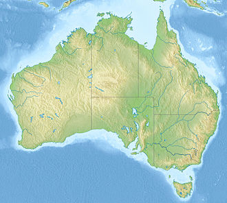
Australia relief map.jpg
Red pog.svg
Lake Edgar
Lake Edgar Tasmania.png
Map
Location South West Tasmania
Coordinates 43°01′15″S146°20′28″E / 43.02083°S 146.34111°E / -43.02083; 146.34111
Type former lake, Fault scarp pond
Primary inflows Huon River
Primary outflows Huon River
Basin  countriesAustralia
Surface area1.4 square kilometres (0.54 sq mi)
Max. depth3 metres (9.8 ft)
Surface elevation289 metres (948 ft)

Lake Edgar was a natural fault scarp pond on the upper reaches of the Huon River in South West Tasmania.

Contents

Description

Lake Edgar was actually two small lakes that were created when the Edgar fault caused the plains below Mount Anne, on the upper reaches of the Huon River, to move upwards by little more than 6 metres (20 ft), causing the river to dam and divert northwards around Scotts Peak. The lake was eventually inundated when the Lake Pedder was flooded as part of a hydroelectric power scheme in 1972. Lake Edgar should not be confused with the Edgar pond which was created when the Edgar Dam intersected one of the smaller tributaries of Lake Edgar.

The Lake Edgar Fault originally formed in the Cambrian as a sinistral wrench fault with a displacement of 12 kilometres (7.5 mi). It was reactivated in the Quaternary. The fault passes through the west part of the Edgar Dam. The fault is about 25–33 kilometres (16–21 mi) long. the fault dips to the west 60–70 degrees. The fault ruptured twice in the Quaternary period, with the early rupture around 25 kiloares (27,000,000 sq ft) and the last rupture since glaciation (less than 10 kiloares (11,000,000 sq ft)). The two Quaternary ruptures each elevated the western side by 2.5 metres (8 ft 2 in). This is the only fault known to have ruptured twice in the Quaternary period. The fault was discovered by Carey and Newstead in 1960. It cracks up Precambrian rocks in the Jubilee Element. The fault dammed up the water to form a lake. This was later split by partial draining. Lake Edgar is the southern of the two small lakes formed. Average rainfall is 2,500 millimetres (98 in) per year. Sediment would have rapidly filled the lake if it was old. The earthquakes associated with the formation of the uplifts would be of magnitude 6.6 to 7.

The fault separated graphitic phyllite in the east from metasiltstone, argillite, quartz sandstone conglomerate on the west. The Hydro Electric Commission dug a trench through the fault and dug pits to determine if water would leak through the fault when the Edgar Dam was built. The fault possibly continues through weak talc containing ultrabasic rocks and into the Gell River Fault about 30 kilometres (19 mi) north, which has an older Late Pleistocene displacement. [1]

See also

Related Research Articles

<span class="mw-page-title-main">Lake Pedder</span> Lake in South West Tasmania, Australia

Lake Pedder, once a glacial outwash lake, is a man-made impoundment and diversion lake located in the southwest of Tasmania, Australia. In addition to its natural catchment from the Frankland Range, the lake is formed by the 1972 damming of the Serpentine and Huon rivers by the Hydro Electric Commission of Tasmania for the purposes of hydroelectric power generation.

<span class="mw-page-title-main">Lake Gordon</span> Reservoir in Tasmania, Australia

Lake Gordon is a man-made reservoir created by the Gordon Dam, located on the upper reaches of the Gordon River in the south-west region of Tasmania, Australia.

<span class="mw-page-title-main">Gordon River</span> River in Tasmania, Australia

The Gordon River is a major perennial river located in the central highlands, south-west, and western regions of Tasmania, Australia.

The Great Lake, officially yingina / Great Lake, is a natural lake and man-made reservoir that is located in the central northern region of Tasmania, Australia.

Lake Margaret is a concrete-faced gravity dam with an uncontrolled spillway across the Yolande River, located on the north side of Mount Sedgwick, in the West Coast Range, West Coast of Tasmania, Australia.

<span class="mw-page-title-main">Huon River</span> River in Tasmania, Australia

The Huon River is a perennial river located in the south-west and south-east regions of Tasmania, Australia. At 174 kilometres (108 mi) in length, the Huon River is the fifth-longest in the state, with its course flowing east through the fertile Huon Valley and emptying into the D'Entrecasteaux Channel, before flowing into the Tasman Sea.

<span class="mw-page-title-main">Gordon Power Station</span> Power station in Tasmania, Australia

The Gordon Power Station is the largest conventional hydroelectric power station in Tasmania, Australia; located in the South West region of the state. The power station is situated on Gordon River. Water from Lake Gordon descends 183 metres (600 ft) underground past the Gordon Dam and into the power station.

<span class="mw-page-title-main">South West Tasmania</span> Region in Tasmania, Australia

South West Tasmania is a region in Tasmania that has evoked curiosity as to its resources over the duration of European presence on the island.

Bathurst Harbour is a shallow bay located in the south west region of Tasmania, Australia. Bathurst Harbour is contained within the Port Davey/Bathurst Harbour Marine Nature Reserve, and the Southwest National Park, part of the Tasmanian Wilderness World Heritage Area.

The Gordon River Road, sometimes called the Strathgordon Road, (B61), is a road in the south western region of Tasmania, Australia.

<span class="mw-page-title-main">Gordon Dam</span> Dam in South West Tasmania, Australia

The Gordon Dam, also known as the Gordon River Dam, is a major gated double curvature concrete arch dam with a controlled spillway across the Gordon River, located in Southwest National Park, Tasmania, Australia. The impounded reservoir is called Lake Gordon.

The Serpentine River is a major perennial river located in the south-west and western regions of Tasmania, Australia.

<span class="mw-page-title-main">Scotts Peak Dam Road</span> Road in Tasmania, Australia

The Scotts Peak Dam Road is the most southerly point of road access into Southwest National Park, Tasmania, Australia.

The Scotts Peak Dam is a rockfill embankment dam without a spillway across the Huon River, located in the South West region of Tasmania, Australia.

The Serpentine Dam is a rockfill embankment dam with a concrete face and a controlled spillway across the Serpentine River, located in the South West region of Tasmania, Australia.

The Edgar Dam is an earthfill embankment saddle dam without a spillway, located offstream in the South West region of Tasmania, Australia.

The Weld Valley is a valley located in southern Tasmania. It is an area of aboriginal cultural heritage and natural history within the Tasmanian Wilderness World Heritage Area. The valley stretches north-west of Huonville and is approximately 50 kilometres (31 mi) west of Hobart.

The Anne River is a perennial river located in the south-west region of Tasmania, Australia. At 20 kilometres (12 mi) in length, the Anne River is extremely steep and flows through parts of the Tasmanian Wilderness World Heritage Area.

The Armenia Fault is an oblique sinistral strike-slip fault in the department of Quindío in west-central Colombia. The fault is part of the megaregional Romeral Fault System and has a total length of approximately 32 kilometres (20 mi) and runs along an average northwest to southeast strike of 023.2 ± 11 in the Central Ranges of the Colombian Andes. The fault shows Holocene activity with a surface rupture produced in 2001.

The Ibagué Fault is a major dextral slightly oblique strike-slip fault in the department of Tolima in central Colombia. The fault has a total length of 123.9 kilometres (77.0 mi) and runs along an average east-northeast to west-southwest strike of 067.9 ± 11 cross-cutting the Central Ranges of the Colombian Andes.

References

  1. Kevin McCue; R. Van Dissen; G. Gibson; V. Jensen; B. Boreham (October 2003). "The Lake Edgar Fault: an active fault in Southwestern Tasmania, Australia, with repeated displacement in the Quaternary" (PDF). Annals of Geophysics. 46number=5 (5). doi: 10.4401/ag-3448 .