Gordon Splits

Last updated

Gordon Splits
Relief Map of Tasmania.png
Red pog.svg
Location of the Gordon Splits in Tasmania
Location South West Tasmania
Coordinates 42°44′24″S145°51′00″E / 42.74000°S 145.85000°E / -42.74000; 145.85000 Coordinates: 42°44′24″S145°51′00″E / 42.74000°S 145.85000°E / -42.74000; 145.85000
Official name Tasmanian Wilderness
Location Oceania
Criteria iii, iv, vi, vii, viii, ix, x
Reference 181
Inscription1982 (6th Session)

The Gordon Splits is a notable section of gorges of the Gordon River, located in South West Tasmania, Australia. The once impassable gorges are situated on the lower Gordon River in the Franklin-Gordon Wild Rivers National Park, part of the Tasmanian Wilderness World Heritage Area. [1] The splits has also been an important location of focus within the larger environmental campaign for wilderness preservation in South West Tasmania. [2]

Gordon River river in western Tasmania

The Gordon River is a major perennial river located in the central highlands, south-west, and western regions of Tasmania, Australia.

South West Tasmania is a region in Tasmania that has evoked curiosity as to its resources over the duration of European presence on the island.

Tasmania island state of Australia

Tasmania is an island state of Australia. It is located 240 km (150 mi) to the south of the Australian mainland, separated by Bass Strait. The state encompasses the main island of Tasmania, the 26th-largest island in the world, and the surrounding 334 islands. The state has a population of around 533,308 as of March 2019. Just over forty percent of the population resides in the Greater Hobart precinct, which forms the metropolitan area of the state capital and largest city, Hobart.

Contents

Location and features

The earlier works of Charles Whitham and others suggested that the river went underground at some point. It was not until in 1928 that three piners (J.Hadmar Sticht, G.W. Harrison and Charles Abel) were described as having passed through them in March of that year.

Charles Whitham was the author of the oft-reprinted Western Tasmania: A land of Riches and Beauty, which was a comprehensive study of the geographical features of West Coast, Tasmania and the conditions of the region in the 1920s.

It was reported in the Mercury newspaper of 12 April 1928 under the title The Gordon River - Exploration of the Splits - Showplace of Tasmania - Sprent Falls alone worth the trip. [3]

The section of river is very difficult to access and apart from Olegas Truchanas, Les Southwell and Peter Dombrovskis - few others are known to have successfully traversed the section in the time of European presence in Tasmania. Following the initial journey by Truchanas in 1954 and the complete journey in 1958 [4] through the splits, the photographs taken by Truchanas were destroyed in the 1967 Tasmanian fires. Southwell and others in the 1970s tended to free float on an inflatable water mattress through the splits to alleviate some of the issues arising from using fixed structure boats travelling through.

Olegas Truchanas was a Lithuanian-Australian conservationist and nature photographer.

Peter Dombrovskis Australian photographer

Peter Dombrovskis was an Australian photographer, known for his Tasmanian scenes. In 2003 he was posthumously inducted into the International Photography Hall of Fame, the first Australian photographer to reach this milestone.

1967 Tasmanian fires series of bushfires in Australia

The 1967 Tasmanian fires were an Australian natural disaster which occurred on 7 February 1967, an event which came to be known as the Black Tuesday bushfires. They were the most deadly bushfires that Tasmania has ever experienced, leaving 62 people dead, 900 injured and over seven thousand homeless.

Photographs by Truchanas, [5] Les Southwell, [6] and Dombrovskis [7] show the steep narrow nature of the splits dramatically in their photographs. More recent aerial photographs can be found like Joe Shemesh's in the Huon Pine book of Kerr and McDermott. [8]

Later description

Geraldine Brooks wrote a piece in the National Times of 24–30 May 1981 which Peter Thompson quoted in his Power in Tasmania as an evocative overview of the splits and their context.

Geraldine Brooks (writer) Australian-American journalist and author

Geraldine Brooks is an Australian-American journalist and novelist whose 2005 novel March won the Pulitzer Prize for Fiction.

The Splits are a geological phenomenon. Six hundred million years ago, the powerful waters of the Gordon River wore a deep erosion slot through a rugged spine of quartzite. The river runs across the grain of the countryside, instead of following it. The result is rare and spectacular.

From the air, the Splits seem to grasp the Gordon River like giant rocky pincers, squeezing its wide flow into narrow strips of deep water about 100 metres long.

From the river bank below them, they appear like pieces of a giant's unsolved jigsaw, crggy masses and voids of sparkling quartzite, frozen a few metres apart, never quite meshing in the first Split, the rock rises vertically for about 100 metres before it merges with the gentler mountainside [9]

See also

Films

Related Research Articles

Franklin River river in western Tasmania

The Franklin River is a major perennial river located in the Central Highlands and western regions of Tasmania, Australia. The river is located in the Franklin-Gordon Wild Rivers National Park at the mid northern area of the Tasmanian Wilderness World Heritage Area. Its source is situated at the western edge of the Central Highlands and it flows west towards the West Coast.

Lake Pedder lake in Tasmania, Australia

Lake Pedder, once a glacial outwash lake, is a man-made impoundment and diversion lake located in the southwest of Tasmania, Australia. In addition to its natural catchment from the Frankland Range, the lake is formed by the 1972 damming of the Serpentine and Huon rivers by the Hydro Electric Commission of Tasmania for the purposes of hydroelectric power generation.

Franklin Dam controversy planned dam in Tasmania, Australia

The Franklin Dam or Gordon-below-Franklin Dam project was a proposed dam on the Gordon River in Tasmania, Australia, that was never constructed. The movement that eventually led to the project's cancellation became one of the most significant environmental campaigns in Australian history.

Strahan, Tasmania Town in Tasmania, Australia

Strahan, is a small town and former port on the west coast of Tasmania. It is now a significant locality for tourism in the region.

The Wilderness Society (Australia) originally Tasmanian, now Australian conservation group

The Wilderness Society (TWS) is an Australian, community-based, not-for-profit non-governmental environmental advocacy organisation. Its vision is to "transform Australia into a society that protects, respects and connects with the natural world that sustains us."

West Coast Piners were groups of men who worked on the West Coast of Tasmania, Australia, logging Huon pine.

South West Wilderness

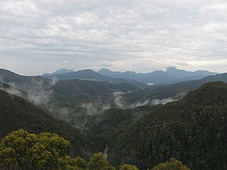
The South West Wilderness of Tasmania, Australia is a remote and inaccessible region of South West Tasmania containing unspoilt scenery, rugged peaks, wild rivers, unique flora and fauna, and a long and rugged coastline. Parts of the wilderness are more than 50 km from the nearest road, so the only access to the area is by foot, air or sea.

Serpentine River (Tasmania) river in Tasmania, Australia

The Serpentine River is a major perennial river located in the south-west and western regions of Tasmania, Australia.

Scotts Peak Dam Road road in Tasmania

The Scotts Peak Dam Road is the most southerly point of road access into the south western region of Tasmania, Australia.

Olegas is an opera based on the life of Lithuanian-born Tasmanian wilderness photographer Olegas Truchanas. Music for the opera was composed by Constantine Koukias a Tasmanian composer and opera director of Greek ancestry based in Amsterdam, where he is known by his Greek name of Konstantin Koukias. The libretto was written by Natasha Cica.

Weld Valley valley in southern Tasmania

The Weld Valley, located in southern Tasmania, is an area of aboriginal cultural heritage and natural history within the Tasmanian Wilderness World Heritage Area. The valley stretches north-west of Huonville and is approximately 50 kilometres (31 mi) west of Hobart.

Engineer Range is a mountain range in Western Tasmania, Australia.

Spero River river in Tasmania, Australia

The Spero River is a perennial river located in the West Coast or South West region of Tasmania, Australia.

<i>Tasmanias Wilderness Battles</i>

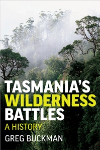
Tasmania's Wilderness Battles: A History is a 2008 book by environmentalist Greg Buckman, who has "spent [his life] fighting Tasmanian environmental battles." The book looks at the wilderness areas of Tasmania which have been the focus of extensive conflict over environmental issues. Buckman presents a record of some of the significant events in that conflict, primarily from the viewpoint of an environmentalist.

Prince of Wales Range (Tasmania) Mountain range in Tasmania

The Prince of Wales Range is a mountain range in the South West Wilderness, Tasmania, Australia. It is situated north and parallel to the Denison River. It lies to the west of Lake Gordon, and southeast of Frenchmans Cap.

Denison River is a river in the South West Tasmania. It is within the South West Wilderness, and drains into the Gordon River below the Gordon Splits. Its catchment starts in the south of the King William Range.

Max Rupert Angus, FRSA was an Australian painter, best known for his watercolour paintings of Tasmanian landscapes.

References

  1. "Wilderness Resources". Archived from the original on 30 August 2007.
  2. "History of the Franklin River Campaign 1976-83". The Wilderness Society. Archived from the original on 1 September 2007.
  3. Kerr, Garry and McDermott, Harry (1999) The Huon Pine Story Portland, Vic Mainsail Books ISBN   0-9577917-0-4 - in the chapter The Gordon River and its Tributaries 1896-1942 - section on pages 67-70 - Above the Gordon Splits - including a long quote from the Mercury article: as well as air photos of the first and second split
  4. Gee, H.M. (1978) The Wild Rivers pp161-171 in The South West Book
  5. Gordon Splits, 1958 picture by Truchanas - see http://nla.gov.au/nla.pic-vn3790531
  6. Australian Heritage Photographic Database search results (Detail)
  7. Gordon Splits, World Heritage Area, southwest Tasmania, ca. 1981 [picture] - Peter Dombrovskis - see http://nla.gov.au/nla.pic-vn3915741
  8. Kerr, Garry and McDermott, Harry (1999) The Huon Pine Story Portland, Vic Mainsail Books ISBN   0-9577917-0-4 - in the chapter The Gordon River and its Tributaries 1896-1942 - air photos of the first (page 70) and second split (page 67)
  9. Thompson, Peter (1981) Power in Tasmania Hawthorn, Victoria Australian Conservation Foundation. ISBN   0-85802-064-5 page 64