Melaleuca, Tasmania

Last updated

Melaleuca
Tasmania
Melaleuca Airstrip SW Tas.jpg
A tourist plane prepares for take-off from Melaleuca.
Australia Tasmania location map.svg
Red pog.svg
Melaleuca
Coordinates 43°25′19.2″S146°9′46.8″E / 43.422000°S 146.163000°E / -43.422000; 146.163000 Coordinates: 43°25′19.2″S146°9′46.8″E / 43.422000°S 146.163000°E / -43.422000; 146.163000
Population5 (?)[ citation needed ]
Postcode(s) none
LGA(s) Huon Valley Council
State electorate(s) Franklin
Federal division(s) Franklin

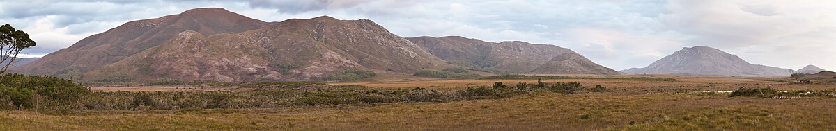
Melaleuca is a remote locality (former settlement) in the south-west area of Tasmania, Australia.

Contents

Access is only by sea via Port Davey, by air [1] or by foot.

The locality now consists of a couple of buildings and a bird hide where the orange-bellied parrot can be viewed, and is a tourist attraction. Melaleuca has a gravel airstrip, which is used by small aircraft, which service hiking needs and, which brings tourists to the remote South West Wilderness region of the state. Two hiking trails meet at Melaleuca: the Port Davey Track and the South Coast Track.

From the 1930s until the area gained World Heritage status, Melaleuca had been the location leased for mining ventures. [2]

Bathurst Range - Melaleuca.jpg
Looking west from Melaleuca to the Bathurst Range

Deny King

From 1936 until his death in 1991, Melaleuca was home to tin miner Deny King who discovered the extinct shrub, Banksia kingii as well as a species of eyebright, Euphrasia kingii and the endangered King's lomatia or King's holly, Lomatia tasmanica . King also built the walkers' accommodation and airstrip and in 1975 was made a Member of the Order of Australia for his services to the community. [3]

Climate

Climate data for Melaleuca, Port Davey (6 m AMSL; BOM 1946-1999)
MonthJanFebMarAprMayJunJulAugSepOctNovDecYear
Average high °C (°F)19.2
(66.6)
19.0
(66.2)
17.8
(64.0)
15.5
(59.9)
13.1
(55.6)
11.8
(53.2)
11.7
(53.1)
12.0
(53.6)
13.9
(57.0)
15.2
(59.4)
16.3
(61.3)
19.2
(66.6)
15.4
(59.7)
Average low °C (°F)9.6
(49.3)
9.5
(49.1)
8.7
(47.7)
7.7
(45.9)
6.1
(43.0)
3.9
(39.0)
3.9
(39.0)
4.6
(40.3)
5.7
(42.3)
6.2
(43.2)
7.3
(45.1)
8.6
(47.5)
6.8
(44.2)
Average rainfall mm (inches)135.2
(5.32)
114.6
(4.51)
151.5
(5.96)
207.7
(8.18)
234.2
(9.22)
217.5
(8.56)
238.8
(9.40)
235.7
(9.28)
200.2
(7.88)
194.6
(7.66)
154.9
(6.10)
162.3
(6.39)
2,142.5
(84.35)
Average rainy days (≥ 0.2 mm)17.114.117.320.421.920.422.223.021.422.219.618.2237.8
Source: [4]

Related Research Articles

<span class="mw-page-title-main">Southwest National Park</span> National park in Tasmania, Australia

Southwest National Park is an Australian national park located in the south-west of Tasmania, bounded by the Franklin-Gordon Wild Rivers National Park to the north and the Hartz Mountains National Park to the east. It is a part of a chain of national parks and state reserves that make up the Tasmanian Wilderness World Heritage Area. Covering an area of 6,183 km2 (2,387 sq mi), it is Tasmania's largest national park.

<span class="mw-page-title-main">Strahan, Tasmania</span> Town and port in Tasmania, Australia

Strahan, is a small town and former port on the west coast of Tasmania. It is now a significant locality for tourism in the region.

<span class="mw-page-title-main">Macquarie Harbour</span> Large inlet on the West Coast of Tasmania

Macquarie Harbour is a shallow fjord in the West Coast region of Tasmania, Australia. It is approximately 315 square kilometres (122 sq mi), and has an average depth of 15 metres (49 ft), with deeper places up to 50 metres (160 ft). It is navigable by shallow-draft vessels. The main channel is kept clear by the presence of a rock wall on the outside of the channel's curve. This man-made wall prevents erosion and keeps the channel deep and narrow, rather than allowing the channel to become wide and shallow. A reported Aboriginal name for the harbour is Parralaongatek.

<span class="mw-page-title-main">Overland Track</span> Hiking trail in Tasmania, Australia

The Overland Track is an Australian bushwalking track, traversing Cradle Mountain-Lake St Clair National Park, within the Tasmanian Wilderness World Heritage Area. It's walked by more than nine thousand people each year, with numbers limited in the warmer months. Officially the track runs for 65 kilometres (40 mi) from Cradle Mountain to Lake St Clair however many choose to extend it by walking along Lake St Clair for an extra day, bringing it to 82 kilometres (51 mi). It winds through terrain ranging from glacial mountains, temperate rainforest, wild rivers and alpine plains.

<i>Lomatia tasmanica</i> Tasmanian shrub from the family Proteaceae

Lomatia tasmanica, commonly known as King's lomatia, is a shrub of the family Proteaceae native to Tasmania. Growing up to 8 metres (26 ft) tall, the plant has shiny green pinnate (lobed) leaves and bears red flowers in the summer, but yields neither fruit nor seeds. King's lomatia is unusual because all of the remaining plants are genetically identical clones. Because it has three sets of chromosomes and is therefore sterile, reproduction occurs only vegetatively: when a branch falls, that branch grows new roots, establishing a new plant that is genetically identical to its parent.

<span class="mw-page-title-main">West Coast, Tasmania</span> Region in Tasmania, Australia

The West Coast of Tasmania is mainly isolated rough country, associated with wilderness, mining and tourism. It served as the location of an early convict settlement in the early history of Van Diemen's Land, and contrasts sharply with the more developed and populous northern and eastern parts of the island state.

<span class="mw-page-title-main">Regatta Point, Tasmania</span> Port and locality in Western Tasmania, Australia

Regatta Point is the location of a port and rail terminus on Macquarie Harbour.

<span class="mw-page-title-main">South West Wilderness</span>

The South West Wilderness of Tasmania, Australia is a remote and inaccessible region of South West Tasmania containing unspoilt scenery, rugged peaks, wild rivers, unique flora and fauna, and a long and rugged coastline. Parts of the wilderness are more than 50 km from the nearest road, so the only access to the area is by foot, air or sea.

<i>Banksia kingii</i> Extinct species of tree or shrub in the family Proteaceae found in Tasmania

Banksia kingii is an extinct species of tree or shrub in the plant genus Banksia. It is known only from fossil leaves and fruiting "cones" found in Late Pleistocene sediment at Melaleuca Inlet in western Tasmania. These were discovered by Deny King in the workings of his tin mine. The climate was most likely as cool as or cooler than it is at Melaleuca now , and possibly wetter, over 2400 mm annually.

<span class="mw-page-title-main">South West Tasmania</span> Region in Tasmania, Australia

South West Tasmania is a region in Tasmania that has evoked curiosity as to its resources over the duration of European presence on the island.

<span class="mw-page-title-main">South Coast Track</span> Hiking trail in Southwest National Park, Tasmania, Australia

The South Coast Track is a bushwalking track located in the South Coast region of Tasmania, Australia. The 85-kilometre (53 mi) track traverses remote wilderness within the Southwest National Park, part of the Tasmanian Wilderness World Heritage Site, and is managed as a wilderness walk. The Tasmanian Parks & Wildlife Service recommend that experienced bushwalkers can take six-to-eight days to cover the track in one direction.

Bathurst Harbour is a shallow bay located in the south west region of Tasmania, Australia. Bathurst Harbour is contained within the Port Davey/Bathurst Harbour Marine Nature Reserve, and the Southwest National Park, part of the Tasmanian Wilderness World Heritage Area.

Port Davey is an oceanic inlet located in the south west region of Tasmania, Australia.

The Davey River is a perennial river located in the south-west region of Tasmania, Australia.

<span class="mw-page-title-main">South Coast Tasmania</span> Coastal area in Tasmania, Australia

South Coast Tasmania runs from the South East Cape to the South West Cape of Tasmania. South Coast Tasmania is sometimes conflated with the South West Tasmania wilderness region.

Munday Island is a small island that lies between Port Davey, an oceanic inlet, and Bathurst Channel, located in the south west region of Tasmania, Australia. The island is contained with the Southwest National Park, part of the Tasmanian Wilderness World Heritage Site and the Port Davey/Bathurst Harbour Marine Nature Reserve.

The Port Davey Track, officially the Old Port Davey Track, is a bushwalking track located in the south western region of Tasmania, Australia. The 70-kilometre (43 mi) track traverses remote wilderness within the Southwest National Park, part of the Tasmanian Wilderness World Heritage Site, and is managed as a wilderness walk. The Tasmanian Parks & Wildlife Service recommend that experienced bushwalkers can take four-to-five days to cover the track in one direction.

Charles Denison (Deny) King was an Australian naturalist, ornithologist, environmentalist, painter and tin miner. He spent fifty-five years living in Melaleuca in Port Davey, part of the remote South West Wilderness of Tasmania where he discovered the extinct shrub, Banksia kingii, among other major exploits.

The Bathurst Channel is a narrow offshore stretch of water that links Port Davey with Bathurst Harbour in the South West region of Tasmania, Australia. The Bathurst Channel is contained within the Port Davey/Bathurst Harbour Marine Nature Reserve, and the Southwest National Park, part of the Tasmanian Wilderness World Heritage Area.

The High Rocky Point is a coastal landmark, located on the south western coast of Tasmania, Australia. The point, contained within the Southwest National Park, part of the Tasmanian Wilderness World Heritage Site, lies to the south of Point Hibbs and north of Low Rocky Point that is located approximately 20 kilometres (12 mi) away. The Wanderer River is located to the north of the point.

References

  1. "Visitors Guide to Tasmania's National Parks - Southwest National Park". Tasmania Parks and Wildlife Service. Archived from the original on 12 October 2008. Retrieved 12 March 2007.
  2. King, C.D. and Fenton, J. Small Mining Settlements; pp. 48-53 in Gee, Helen and Fenton, Janet (eds) (1978) The South West Book  : A Tasmanian Wilderness. Hawthorn, Vic: Australian Conservation Foundation. ISBN   0-85802-054-8; later edition, same title (1983) Sydney, NSW: William Collins Pty. Ltd., ISBN   0-00-217305-0; also Thwaites, J.B., King of the South-West (Jack King, tin miner at Melaleuca) pp. 57-60; also Mattingley, C. King of the Wilderness (2001) ISBN   1-877008-41-9
  3. "King, Charles Dennison". It's an Honour. Australian Government.
  4. http://www.bom.gov.au/climate/averages/tables/cw_097007_All.shtml [ bare URL ]