Kathleen Island is a steeply cliffed island that lies within Port Davey, an oceanic inlet, located in the south west region of Tasmania, Australia. The island has an area of approximately 11.35 hectares and is contained with the Southwest National Park, part of the Tasmanian Wilderness World Heritage Site and the Port Davey/Bathurst Harbour Marine Nature Reserve.
The Shanks Islands form a group of five small rocky islets located close to the south-western coast of Tasmania, Australia. Situated near where the mouth of Port Davey meets the Southern Ocean, the islets have a combined area of 2.72 hectares and are part of the Swainson Islands Group. They comprise part of the Southwest National Park and the Tasmanian Wilderness World Heritage Site.

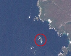
The Trumpeter Islets comprise a group of two unpopulated islets, with a combined area of about a hectare, located close to the south-western coast of Tasmania, Australia. Situated some 6 kilometres (3.7 mi) where the mouth of Port Davey meets the Southern Ocean, the 1-hectare (2.5-acre) island is part of the Trumpeter Islets Group, and comprises part of the Southwest National Park and the Tasmanian Wilderness World Heritage Site.

The Wild Wind Islets comprise a group of five steep rocky unpopulated islets located close to the south-western coast of Tasmania, Australia. Situated some 2 kilometres (1.2 mi) south of where the mouth of Port Davey meets the Southern Ocean, the 3.95-hectare (9.8-acre) islets are one of the eight islands that comprise the Mutton Bird Islands Group. The Wild Wind Islets are part of the Southwest National Park and the Tasmanian Wilderness World Heritage Site.
South East Mutton Bird Islet is a steep unpopulated islet located close to the south-western coast of Tasmania, Australia. Situated 2 kilometres (1.2 mi) south of where the mouth of Port Davey meets the Southern Ocean, the 0.52-hectare (1.3-acre) islet is one of the eight islands that comprise the Mutton Bird Islands Group. The South East Mutton Bird Islet is part of the Southwest National Park and the Tasmanian Wilderness World Heritage Site.
South West Mutton Bird Islet is a dome-shaped unpopulated islet located close to the south-western coast of Tasmania, Australia. Situated some 2 kilometres (1.2 mi) south of where the mouth of Port Davey meets the Southern Ocean, the 0.52-hectare (1.3-acre) islet is one of the eight islands that comprise the Mutton Bird Islands Group. The South West Mutton Bird Islet is part of the Southwest National Park and the Tasmanian Wilderness World Heritage Site.
Mutton Bird Island is an irregularly shaped unpopulated island located close to the south-western coast of Tasmania, Australia. Situated some 2 kilometres (1.2 mi) south of where the mouth of Port Davey meets the Southern Ocean, the 44-hectare (110-acre) is the largest of the eight islands that comprise the Mutton Bird Islands Group. The Mutton Bird Island is part of the Southwest National Park and the Tasmanian Wilderness World Heritage Site.
Sugarmouse Island is an unpopulated islet located close to the south-western coast of Tasmania, Australia. Situated some 2 kilometres (1.2 mi) south of where the mouth of Port Davey meets the Southern Ocean, the 0.54-hectare (1.3-acre) islet is one of the eight islands that comprise the Mutton Bird Islands Group. Sugarmouse Island is part of the Southwest National Park and the Tasmanian Wilderness World Heritage Site.
The East Pyramids comprise a group of three steep, rocky unpopulated islets located close to the south-western coast of Tasmania, Australia. Situated some 2 kilometres (1.2 mi) south of where the mouth of Port Davey meets the Southern Ocean, the 6.69-hectare (16.5-acre) islets are one of the eight islands that comprise the Mutton Bird Islands Group. The East Pyramids are part of the Southwest National Park and the Tasmanian Wilderness World Heritage Site.
Sugarloaf Rock is a steep, rocky unpopulated islet located close to the south-western coast of Tasmania, Australia. Situated some 2 kilometres (1.2 mi) south of where the mouth of Port Davey meets the Southern Ocean, the 3.56-hectare (8.8-acre) islet is one of the eight islands that comprise the Mutton Bird Islands Group. Sugarloaf Rock is part of the Southwest National Park and the Tasmanian Wilderness World Heritage Site.
Wendar Island comprises a main unpopulated island and five immediately adjacent islets located close to the south-western coast of Tasmania, Australia. Situated some 2 kilometres (1.2 mi) south of where the mouth of Port Davey meets the Southern Ocean, the 5.8-hectare (14-acre) island and islets are one of the eight islands that comprise the Mutton Bird Islands Group. The Mutton Bird Island is part of the Southwest National Park and the Tasmanian Wilderness World Heritage Site.
The Big Caroline Rock is an unpopulated island located close to the south-western coast of Tasmania, Australia. Situated near where the mouth of Port Davey meets the Southern Ocean, the 2.2-hectare (5.4-acre) island is part of the Swainson Islands Group, and comprises part of the Southwest National Park and the Tasmanian Wilderness World Heritage Site.
Swainson Island is an unpopulated island with an adjacent islet, located close to the south-western coast of Tasmania, Australia. Situated near where the mouth of Port Davey meets the Southern Ocean, the 4.14-hectare (10.2-acre) island is part of the Swainson Islands Group, and comprises part of the Southwest National Park and the Tasmanian Wilderness World Heritage Site.
The Hay Island is an unpopulated island located close to the south-western coast of Tasmania, Australia. Situated near where the mouth of Port Davey meets the Southern Ocean, the 1.85-hectare (4.6-acre) island with an elevation of 78 metres (256 ft) above sea level, is part of the Swainson Islands Group, and comprises part of the Southwest National Park and the Tasmanian Wilderness World Heritage Site.
Lourah Island is an unpopulated island located close to the south-western coast of Tasmania, Australia. Situated within Port Davey, the 4.86-hectare (12.0-acre) island is part of the Swainson Islands Group, and comprises part of the Southwest National Park and the Tasmanian Wilderness World Heritage Site.
The Mavourneen Rocks is a group of four steep, rocky islets that lie within Port Davey, an oceanic inlet, located in the south west region of Tasmania, Australia. The islets have a combined area of approximately 0.88 hectares and are contained with the Southwest National Park, part of the Tasmanian Wilderness World Heritage Site and the Port Davey/Bathurst Harbour Marine Nature Reserve.
West Pyramid is an unpopulated steep-sided island located close to the south-western coast of Tasmania, Australia. Situated some 1 kilometre (0.62 mi) north of the mouth of Port Davey where it meets the Southern Ocean, the 2.5-hectare (6.2-acre) island is part of the Trumpeter Islets Group, and comprises part of the Southwest National Park and the Tasmanian Wilderness World Heritage Site.
Hobbs Island, also known as Green Island, is an unpopulated island located close to the south-western coast of Tasmania, Australia. Situated some 1 kilometre (0.62 mi) north of where the mouth of Port Davey meets the Southern Ocean, the 9.7-hectare (24-acre) island is part of the Trumpeter Islets Group, and comprises part of the Southwest National Park and the Tasmanian Wilderness World Heritage Site.

The Melaleuca to Birchs Inlet Important Bird Area comprises a 2315 km2 section of coast and sub-coastal land in South West Tasmania. It stretches southward from the southern end of Birchs Inlet, encompasses Melaleuca and Port Davey, and extends to Louisa Bay on the coast facing the Maatsuyker Island group. The area is rugged, with extensive beaches and coastal plains rising to rocky mountains. It contains a mosaic of temperate rainforest, eucalypt forest, moorland and buttongrass plains.

The Phillip Island Important Bird Area comprises a 20 km2 strip of coastline along the south and west coasts of Phillip Island, Victoria, in south-eastern Australia.
