Sorell, Tasmania

Last updated

Sorell
Hobart,  Tasmania
Sorell Tasmania, Information Centre.JPG
St George's Parish Hall containing the Tourist Information Centre in 2007 - Gordon Street, Sorell
Australia Hobart location map.svg
Red pog.svg
Sorell
Sorell, Tasmania
Coordinates 42°47′S147°34′E / 42.783°S 147.567°E / -42.783; 147.567
Population3,597 (SAL 2021) [1]
Established1808
Postcode(s) 7172
Location
LGA(s) Sorell Council
Region Hobart
State electorate(s) Lyons
Federal division(s) Lyons
Mean max temp [2] Mean min temp [2] Annual rainfall [2]
17.6 °C
64 °F
8.2 °C
47 °F
495.0 mm
19.5 in

Sorell is a town in Tasmania, Australia, north-east of Hobart. It is located on the Tasman Highway at the junction with the Arthur Highway. Sorell is one of Tasmania's oldest towns, being first settled in 1808 as a small farming community and becoming an official township in 1821. [3] At the 2006 census, Sorell had a population of 1,546, [4] and at the 2011 census, a population of 2,476. [5] and at the 2016 census, a population of 2,907. [6]

Contents

History

Pre-contact

The Mumirimina People of the Oyster Bay Tribe traditionally lived in the Sorell area. [7]

Post-contact

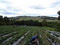
Sorell was first explored by Europeans by a party from Risdon Cove in 1803. [8] This first exploration was done by Lieutenant Governor Collins, who originally named the area Pitt Water after the current Chancellor of the Exchequer. [7] Sorell was later renamed after Lieutenant Governor William Sorell by Governor Lachlan Macquarie on a tour. [7] Fertile land was discovered, [8] and it was first settled in 1808, but remained an isolated farming community until 1821 when the town was established. [7] Th Sorell Post Office opened on 1 June 1832. [9] Historically, it was a granary for the colony, [7] and became known as the "granary of Australia." [8] It was known as a major town on the route from Hobart to Port Arthur on the Tasman Peninsula.[ citation needed ] It was the centre of an agricultural area and an important market town.[ citation needed ] It is now a dormitory town of Hobart,[ citation needed ] as well as the seat of the Sorell Council, which was established in 1862. [7]

Telegraph service was introduced in 1876, a railway in 1892, a water supply in 1916, and electricity in 1930. In 1872 the Sorell Causeway was opened across Pitt Water, considerably shortening the route to Hobart, which otherwise relied on ferries or a route through Richmond. [7]

Infrastructure

Sorell is served by Sorell School, the oldest continually operating public school in Australia, opened in 1821. [10] It is a co-educational primary and secondary school, serving years K-12. Sorell is served by a Libraries Tasmania library, a Service Tasmania office, and Australia Post Office.

Sorell Plaza shopping centre, built in the mid 2000s, provides a supermarket and other major retail outlets. It was purchased by SCA Property Group, a subsidiary of Woolworths, in 2019. [11] Gateway Shopping Center includes a competing supermarket and small retail.

Sorell falls within the Anglican Parish of South East Tasmania, based at St George's Church, and the Parish of Richmond, with services at St Thomas's Church. Historically, it was also served by the Presbyterian Scots Church, designed by James Blackburn, which is now a private residence. [12]

Sorell has a number of historic buildings, including the Sorell Barracks, constructed to house soldiers during the Black War. These and other historic buildings - including the railway house, the old Sorell Library (now an antiques centre), and the Gordon Highlander Hotel, form a heritage walk. [13] The area also has a local historical society [14] as well as a Freemasons Lodge (Lodge Pembroke). [15]

Climate

Sorell has an oceanic climate (Köppen: Cfb), with very mild summers and cool winters. Average maxima vary from 22.7 °C (72.9 °F) in January to 12.6 °C (54.7 °F) in July while average minima fluctuate between 12.2 °C (54.0 °F) in January to 4.2 °C (39.6 °F) in July. Mean average annual precipitation is rather low: 495.0 mm (19.49 in), but is rather frequent (spread across 139.5 precipitation days above the 1.0 mm (0.039 in) threshold). Expectedly, the town is not very sunny: experiencing 44.8 clear days and 169.1 cloudy days per annum. Extreme temperatures have ranged from 41.4 °C (106.5 °F) on 31 January 2020 to −3.9 °C (25.0 °F) on 23 June 1972. [16] All climate data was sourced from Hobart Airport, which is 7.5 km (4.7 mi) southeast of Sorell.

Climate data for Sorell (42º49'48"S, 147º30'00"E, 4 m AMSL) (1958-2022 normals & extremes)
MonthJanFebMarAprMayJunJulAugSepOctNovDecYear
Record high °C (°F)41.4
(106.5)
39.8
(103.6)
38.1
(100.6)
31.8
(89.2)
25.6
(78.1)
19.6
(67.3)
20.4
(68.7)
23.7
(74.7)
31.1
(88.0)
33.4
(92.1)
38.5
(101.3)
40.8
(105.4)
41.4
(106.5)
Mean daily maximum °C (°F)22.7
(72.9)
22.4
(72.3)
20.9
(69.6)
18.2
(64.8)
15.3
(59.5)
13.0
(55.4)
12.6
(54.7)
13.5
(56.3)
15.5
(59.9)
17.4
(63.3)
19.1
(66.4)
20.8
(69.4)
17.6
(63.7)
Mean daily minimum °C (°F)12.2
(54.0)
12.1
(53.8)
10.9
(51.6)
8.8
(47.8)
6.7
(44.1)
4.7
(40.5)
4.2
(39.6)
4.7
(40.5)
6.1
(43.0)
7.6
(45.7)
9.3
(48.7)
10.9
(51.6)
8.2
(46.7)
Record low °C (°F)3.7
(38.7)
3.4
(38.1)
2.2
(36.0)
−0.6
(30.9)
−2.2
(28.0)
−3.9
(25.0)
−3.2
(26.2)
−2.0
(28.4)
−2.3
(27.9)
−1.0
(30.2)
1.7
(35.1)
2.7
(36.9)
−3.9
(25.0)
Average precipitation mm (inches)40.2
(1.58)
34.9
(1.37)
36.3
(1.43)
40.1
(1.58)
37.3
(1.47)
34.2
(1.35)
41.4
(1.63)
47.2
(1.86)
40.2
(1.58)
47.2
(1.86)
44.3
(1.74)
52.1
(2.05)
495.0
(19.49)
Average precipitation days (≥ 0.2 mm)9.08.210.110.411.411.313.213.913.713.612.811.9139.5
Average afternoon relative humidity (%)50515356616463605654535256
Average dew point °C (°F)9.0
(48.2)
9.5
(49.1)
8.8
(47.8)
7.4
(45.3)
6.3
(43.3)
5.1
(41.2)
4.4
(39.9)
4.3
(39.7)
4.7
(40.5)
5.7
(42.3)
7.0
(44.6)
8.0
(46.4)
6.7
(44.0)
Mean monthly sunshine hours 254.2223.2207.7177.0145.7129.0148.8176.7189.0229.4222.0244.92,347.6
Percent possible sunshine 55575450494751555356515253
Source: Bureau of Meteorology (1958-2022 normals & extremes) [2]

Related Research Articles

<span class="mw-page-title-main">Hobart</span> Capital city of Tasmania, Australia

Hobart ( HOH-bart; is the capital and most populous city of the island state of Tasmania, Australia. Located in Tasmania's south-east on the estuary of the River Derwent, it is the southernmost capital city in Australia. Despite containing nearly half of Tasmania's population, Hobart is the least-populated Australian state capital city, and second-smallest by population and area after Darwin if territories are taken into account. Its skyline is dominated by the 1,271-metre kunanyi / Mount Wellington, and its harbour forms the second-deepest natural port in the world, with much of the city's waterfront consisting of reclaimed land. The metropolitan area is often referred to as Greater Hobart, to differentiate it from the City of Hobart, one of the seven local government areas that cover the city. It has a mild maritime climate.

<span class="mw-page-title-main">Swansea, Tasmania</span> Town in Tasmania, Australia

Swansea is a town in the heart of Tasmania's east coast, on the north-west shore of Great Oyster Bay and overlooking Freycinet National Park. It was the first municipality in Australia to be established after Hobart and Sydney. At the 2021 census, Swansea had a population of 997.

Kingston is a town on the outskirts of Hobart, Tasmania, Australia. Nestled 12 km south of the city between and around several hills, Kingston is the seat of the Kingborough Council, and today serves as the gateway between Hobart and the D'Entrecasteaux Channel region, which meets the Derwent River nearby. It is one of the fastest-growing regions in Tasmania. The Kingston-Huntingfield statistical area had an estimated population of 13,473 in June 2021.

Richmond is a town in Tasmania about 25 km north-east of Hobart, in the Coal River region, between the Midland Highway and Tasman Highway. At the 2006 census, Richmond had a population of 880.

<span class="mw-page-title-main">Midway Point, Tasmania</span> Suburb of Hobart, Tasmania, Australia

Midway Point is a residential locality in the local government area (LGA) of Sorell in the South-east LGA region of Tasmania. The locality is about 5 kilometres (3.1 mi) south-west of the town of Sorell. The 2016 census recorded a population of 2859 for the state suburb of Midway Point. It is located on a small peninsula with Orielton Lagoon on its eastern side and Pittwater on its southern and western sides. The suburb meets the mid-way point of the Sorell Causeway from Hobart to Sorell, hence the name. Mcgees Bridge is connected to Midway Point on the Pittwater side. The suburb lies close to Hobart International Airport and is approximately 21 km to Hobart via the Tasman Highway. In recent years Midway Point has become a popular commuter town for people working in Hobart.

Cambridge is a suburb in the greater area of Hobart, capital of Tasmania, Australia. It is in the City of Clarence local government area. The suburb is situated in close proximity to Hobart International Airport and the Cambridge Aerodrome, and is approximately 18 km to Hobart via the Tasman Highway. In recent years Cambridge had developed an Industrial estate and has become a popular commuter town for people working in Hobart.

<span class="mw-page-title-main">Hamilton, Tasmania</span> Town in Tasmania, Australia

Hamilton is a rural locality in the local government area (LGA) of Central Highlands in the Central LGA region of Tasmania. The locality is about 73 kilometres (45 mi) north-west of the city of Hobart. The 2016 census recorded a population of 241 for the suburb of Hamilton.

Nugent is a rural locality in the local government areas (LGA) of Glamorgan–Spring Bay and Sorell in the South-east LGA region of Tasmania. The locality is about 18 kilometres (11 mi) north-east of the town of Sorell. The 2016 census gives a population of 101 for the state suburb of Nugent. The town has a marine west coast, warm summer climate. Altitude is the main determinant of local climate in the region, and droughts are almost non-existent. The town experiences early autumn rainfall.

Glenlusk is a rural locality in the local government areas (LGA) of Derwent Valley (6%) and Glenorchy (94%) in the South-east and Hobart LGA regions of Tasmania. The locality is about 8 kilometres (5.0 mi) west of the town of Glenorchy. The 2016 census recorded a population of 200 for the state suburb of Glenlusk. It is a semi-rural suburb of Hobart. It is west of Chigwell.

Mornington is a residential locality in the local government area (LGA) of Clarence in the Hobart LGA region of Tasmania. The locality is about 4 kilometres (2.5 mi) north-east of the town of Rosny Park. The 2016 census recorded a population of 2265 for the state suburb of Mornington.

<span class="mw-page-title-main">Sorell Council</span> Local government area in Tasmania, Australia

Sorell Council is a local government body in Tasmania, situated in the south-east of the state. The Sorell local government area is classified as rural and has a population of 15,218. The major centres of the region include Dodges Ferry, Dunalley, Primrose Sands and the principal town of Sorell.

Dodges Ferry is a rural / residential locality in the local government area (LGA) of Sorell in the South-east LGA region of Tasmania. The locality is about 13 kilometres (8.1 mi) south-east of the town of Sorell. The 2016 census recorded a population of 2467 for the state suburb of Dodges Ferry.

<span class="mw-page-title-main">Triabunna</span> Town in Tasmania, Australia

Triabunna is a rural residential locality in the local government area (LGA) of Glamorgan–Spring Bay in the South-east LGA region of Tasmania. The locality is about 86 kilometres (53 mi) north-east of the city of Hobart. The 2021 census has a population of 905 for the state suburb of Triabunna.

<span class="mw-page-title-main">Geeveston</span> Town in Tasmania, Australia

Geeveston is a small town in the south of Tasmania in Australia near the Huon River, 62 km (39 mi) south west of Hobart, making it Australia's most southerly administrative centre. The town takes its name from William Geeves, an English settler who was given a land grant by Lady Jane Franklin in the area then known as Lightwood Bottom. The settlement Geeves set up was renamed Geeves Town in 1861, and the name eventually became Geeveston. Geeveston is for local government purposes included in the area of the Huon Valley Council and is part of the division of Franklin for both Australian House of Representatives and Tasmanian House of Assembly electoral purposes.

Nubeena is a town and fishing village on the Tasman Peninsula, Tasmania, Australia a township of Tasman Council, and seat of the municipality. At the 2016 census, Nubeena had a population of 481. It is the largest settlement on the peninsula.

Dunalley is a rural / residential locality in the local government areas (LGA) of Sorell (37%) and Tasman (63%) in the South-east LGA region of Tasmania. The locality is about 31 kilometres (19 mi) south-east of the town of Sorell. The 2021 census recorded a population of 304 for the state suburb of Dunalley. It is a small fishing village on the east coast of Tasmania.

Lewisham is a locality and suburb in the local government area of Sorell, in the Sorell and surrounds region of Tasmania. It is located about 35 kilometres (22 mi) north-east of the town of Hobart. The 2021 census determined a population of 799 for the locality of Lewisham.

Carlton River is a locality and small rural community in the local government area of Sorell, in the Sorell and surrounds region of Tasmania. It is located about 45 kilometres (28 mi) east of the town of Hobart. The shore of Flinders Channel forms part of the southern boundary. The 2016 census determined a population of 265 for the state suburb of Carlton River.

Connellys Marsh is a rural locality in the local government area (LGA) of Sorell in the South-east LGA region of Tasmania. The locality is about 21 kilometres (13 mi) south-east of the town of Sorell. The 2021 Census recorded a population of 40 for the state suburb of Connellys Marsh. It is a small rural community in the Sorell and surrounds region of Tasmania. It is located about 47 kilometres (29 mi) east of the town of Hobart. The shore of Flinders Channel forms the southern boundary.

Orielton is a rural locality in the local government area of Sorell in the Central and Hobart regions of Tasmania, Australia. It is located about 10 kilometres (6 mi) north-west of the town of Sorell. The 2016 census determined a population of 355 for the state suburb of Orielton.

References

  1. Australian Bureau of Statistics (28 June 2022). "Sorell (suburb and locality)". Australian Census 2021 QuickStats. Retrieved 28 June 2022.  OOjs UI icon edit-ltr-progressive.svg
  2. 1 2 3 4 "Hobart Airport West Climate Statistics (1958-2022) (nearest AWS)". Bureau of Meteorology . Retrieved 8 September 2024.
  3. "Visitor Information - Sorell Council". Archived from the original on 2 December 2017. Retrieved 2 December 2017.
  4. Australian Bureau of Statistics (25 October 2007). "Sorell (State Suburb)". 2006 Census QuickStats. Retrieved 23 November 2011.
  5. Australian Bureau of Statistics (31 October 2012). "Sorell (State Suburb)". 2011 Census QuickStats. Retrieved 7 January 2012. OOjs UI icon edit-ltr-progressive.svg
  6. Australian Bureau of Statistics (27 June 2017). "Sorell (State Suburb)". 2016 Census QuickStats. Retrieved 24 December 2017. OOjs UI icon edit-ltr-progressive.svg
  7. 1 2 3 4 5 6 7 "History". Sorell Council. Retrieved 5 July 2024.
  8. 1 2 3 Turnbull, Paul. "Sorell". Companion to Tasmanian History. Centre for Tasmanian Historical Studies, University of Tasmania. Retrieved 5 July 2024.
  9. Premier Postal History. "Post Office List". Premier Postal Auctions. Archived from the original on 29 September 2018. Retrieved 16 June 2012.
  10. "Pioneer School - Sorell History Society". Sorell History Society. Archived from the original on 4 November 2021. Retrieved 4 November 2021.
  11. Johanson, Simon (6 August 2019). "SCA digests Vicinity's malls but profit falls". The Sydney Morning Herald. Archived from the original on 4 November 2021. Retrieved 4 November 2021.
  12. "Sorell, TAS". Aussie Towns. Aussie Towns. Archived from the original on 22 October 2021. Retrieved 4 November 2021.
  13. "Sorell Heritage Walk" (PDF). Sorell Council. Archived (PDF) from the original on 4 November 2021. Retrieved 4 November 2021.
  14. "Sorell History Society | researching and recording the history of the Sorell Municipality". Archived from the original on 6 December 2017. Retrieved 6 December 2017.
  15. https://www.facebook.com/masoniclodgepembroke/ [ user-generated source ]
  16. "Hobart Airport West Climate (1958-2022)". FarmOnline Weather. Retrieved 8 September 2024.