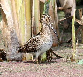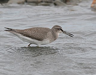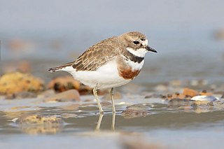
The South Arm Important Bird Area is a disjunct tract of mainly intertidal land on the eastern outskirts of Hobart, Tasmania, Australia.

The South Arm Important Bird Area is a disjunct tract of mainly intertidal land on the eastern outskirts of Hobart, Tasmania, Australia.
The site comprises several separate tidal inlets, with a collective total area of 46 km2, that together form a diverse and extensive system of wetlands providing habitat for large numbers of waders, or shorebirds. The components include Ralphs Bay, Mortimer Bay, Calvert's Lagoon, South Arm Neck, Barilla Bay, Orielton Lagoon, the seaward side of the Sorell Causeway over Pitt Water, and Pipe Clay Lagoon in Frederick Henry Bay. These are mainly estuarine sand and mud flats with significant areas of saltmarsh. The system is the southernmost destination for migratory waders in the East Asian – Australasian Flyway. [1]
The wetland system has been identified by BirdLife International as an Important Bird Area (IBA) because it supports well over 1% of the global population of pied oystercatchers. [2] Other waders using the wetlands in relatively large numbers include red-necked stints, curlew sandpipers, Far Eastern curlews and sooty oystercatchers. [1]
The Sorell Causeway and the rocky shoreline of Pitt Water have the largest concentration of the endemic viviparous sea star Patiriella vivipara. The saltmarsh around Barilla Bay is one of the few Tasmanian localities of the rare chequered blue butterfly ( Theclinesthes serpentata). [1]

Narawntapu is a national park in Tasmania, Australia. It lies on Tasmania's north coast, adjoining Bass Strait, between Port Sorell in the west and the mouth of the Tamar River in the east. It lies about 20 km east of Devonport, 60 km north-west of Launceston and 250 km north of Hobart.
The Mud Islands reserve is located within Port Phillip, about 90 km (56 mi) south-west of Melbourne, Australia, lying 10 km (6.2 mi) inside Port Phillip Heads, 7 km (4.3 mi) north of Portsea and 9 km (5.6 mi) east of Queenscliff. The land area of about 50 hectares is made up of three low-lying islands surrounding a shallow tidal 35-hectare (86-acre) lagoon connected to the sea by three narrow channels. The shapes and configuration of the islands change over the years due to movement of sand by tidal currents.

Roebuck Bay is a bay on the coast of the Kimberley region of Western Australia. Its entrance is bounded in the north by the town of Broome, and in the south by Bush Point and Sandy Point. It is named after HMS Roebuck, the ship captained by William Dampier when he explored the coast of north-western Australia in 1699. The Broome Bird Observatory lies on the northern coast of the bay.

Eighty Mile Beach, also spelled Eighty-mile Beach or 80-mile Beach, lies along the north-west coast of Western Australia about half-way between the towns of Broome and Port Hedland. It is a beach some 220 kilometres (140 mi) in length, forming the coastline where the Great Sandy Desert approaches the Indian Ocean. It is one of the most important sites for migratory shorebirds, or waders, in Australia, and is recognised as a wetland of international importance under the Ramsar Convention on Wetlands.
Ralphs Bay is a body of water in south-east Tasmania, Australia. It is semi-enclosed by the Tranmere / Rokeby peninsula and the South Arm peninsula. Sea access to the bay is from the River Derwent.

Lake Victoria is a 139-hectare (340-acre) shallow saline lake on the Bellarine Peninsula, Victoria in Australia, close to the township of Point Lonsdale and part of the Lonsdale Lakes Nature Reserve administered by Parks Victoria.

The Swan Bay is a shallow, 30-square-kilometre (12 sq mi) marine embayment at the eastern end of the Bellarine Peninsula in Port Phillip, Victoria, Australia. The township of Queenscliff lies at its southern end, and St Leonards at its northern. It is partly separated from Port Phillip by Swan Island, Duck Island and Edwards Point. Most of the area is included in the Port Phillip Heads Marine National Park as well as being listed as a wetland of international importance under the Ramsar Convention as part of the Port Phillip Bay and Bellarine Peninsula Ramsar Site. The bay is part of the Swan Bay and Port Phillip Bay Islands Important Bird Area, identified as such by BirdLife International because of its importance for orange-bellied parrots, waders and seabirds.
The Orielton Lagoon is a shallow dystrophic lagoon located west of Sorell in south east Tasmania, Australia.
The Port Phillip Bay and Bellarine Peninsula Ramsar Site is one of the Australian sites listed under the Ramsar Convention as a wetland of international importance. It was designated on 15 December 1982, and is listed as Ramsar Site No.266. Much of the site is also part of either the Swan Bay and Port Phillip Bay Islands Important Bird Area or the Werribee and Avalon Important Bird Area, identified as such by BirdLife International because of their importance for wetland and waterbirds as well as for orange-bellied parrots. It comprises some six disjunct, largely coastal, areas of land, totalling 229 km2, along the western shore of Port Phillip and on the Bellarine Peninsula, in the state of Victoria. Wetland types protected include shallow marine waters, estuaries, freshwater lakes, seasonal swamps, intertidal mudflats and seagrass beds.

The Gulf Plains Important Bird Area comprises 8868 km2 of the low-lying coastal plains bordering the south-eastern corner of the Gulf of Carpentaria in north-west Queensland, Australia. It was identified by BirdLife International as an Important Bird Area (IBA) because of its importance to global populations of waders and other birds.

The Hunter Estuary Wetlands comprise a group of associated wetlands at and near the mouth of the Hunter River in the city of Newcastle, New South Wales, Australia. Some 30 km2 of the wetlands has been recognised as being of international importance by designation under the Ramsar Convention. It was listed on 21 February 1984 as Ramsar site 287. A larger area of the wetlands has been identified by BirdLife International as an Important Bird Area (IBA). The wetlands are recognised as the most important area in New South Wales for waders, or shorebirds.

The Marion Bay Important Bird Area is on the south-western side of Marion Bay, south-eastern Tasmania, Australia. It includes two sandy, high-energy, oceanic beaches, Marion Bay Beach and North Bay Beach, encompasses the privately owned Long Spit Nature Reserve, and extends through the entrance of Blackman Bay to the intertidal mudflats within. The beaches and mudflats form a single system used by waders, or shorebirds; the storm-swept beaches of the outer bay contrast with and complement the sheltered mudflats and sand-bars of the inner bay.

The Milingimbi Islands Important Bird Area comprises 94 km2 of land in the Milingimbi, or Crocodile Islands group, of the Northern Territory of Australia. The area is traditionally owned Aboriginal land. The mudflats are an important staging site for migratory waders, or shorebirds.

Moulting Lagoon Important Bird Area is a composite wetland site in eastern Tasmania, Australia. It comprises two adjacent and hydrologically continuous wetlands – Moulting Lagoon and the Apsley Marshes – at the head of Great Oyster Bay, near the base of the Freycinet Peninsula, between the towns of Swansea and Bicheno. Both components of the site are listed separately under the Ramsar Convention as wetlands of international significance. Moulting Lagoon is so named because it is a traditional moulting place for black swans. It is an important site for waterbirds.

The Port McArthur Tidal Wetlands System comprises a 994 km2 tract of tidal wetlands on the south-west coast of the Gulf of Carpentaria in the Northern Territory of Australia. The land extends along the coast opposite the Sir Edward Pellew Group of Islands, incorporating the estuaries of the McArthur and Wearyan Rivers. It is an important site for waders, or shorebirds.

The Robbins Passage and Boullanger Bay Important Bird Area is a 238 km2 tract of land at the western end of the north coast of Tasmania, south-eastern Australia. It comprises extensive areas of intertidal mudflats and saltmarsh with adjacent farmland. It is an important site for waders, or shorebirds.

The Rubicon Estuary is an estuary on the central coast of northern Tasmania, south-eastern Australia, lying next to the town of Port Sorell.
Shallow Inlet is a marine inlet, opening onto Waratah Bay on the western side of the Yanakie Isthmus in South Gippsland, Victoria, south-eastern Australia. It lies close to the small holiday communities of Sandy Point and Yanakie, as well as to Wilsons Promontory and the Wilsons Promontory National Park.

The Swan Bay and Port Phillip Bay Islands Important Bird Area comprises a cluster of disparate sites centred at the eastern end of the Bellarine Peninsula, and the southern end of Port Phillip, in Victoria, south-eastern Australia. As well as providing core wintering habitat for orange-bellied parrots, it is important for waders, or shorebirds, and seabirds.

Tourville and Murat Bays Important Bird Area is an important bird area in South Australia with a combined area of 117 square kilometres, located west to the town of Ceduna on the north-west corner of the Eyre Peninsula in the Great Australian Bight. It is considered to be an important area because of the resident populations of waders, or shorebirds.
Coordinates: 42°52′07″S147°31′55″E / 42.86861°S 147.53194°E