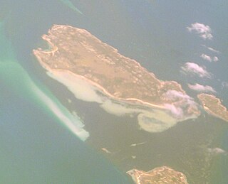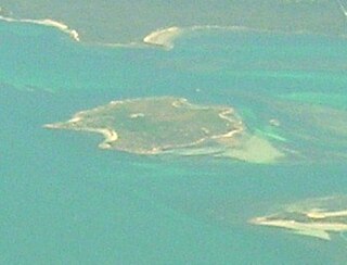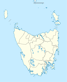
Waterhouse Island, part of the Waterhouse Island Group, is a 287-hectare (710-acre) granite island situated in Banks Strait, part of Bass Strait, lying close to the north-eastern coast of Tasmania, Australia.

Preservation Island is a low and undulating granite and calcarenite island, with an area of 207 ha, in south-eastern Australia. It is part of Tasmania’s Preservation Island Group, lying in eastern Bass Strait south-west of Cape Barren Island in the Furneaux Group, and is an important historic site.

Craggy Island is a rugged granite island, with an area of 38.88 ha, in south-eastern Australia. It is part of Tasmania’s Bass Pyramid Group lying in northern Bass Strait between Flinders Island and the Kent Group.

The Bass Pyramid, part of the Furneaux Group, is a small, two sectioned oval, steep-sided 100-square-metre (1,100 sq ft) unpopulated granite island, located in Bass Strait, lying north of the Flinders Island and south of the Kent Group, in Tasmania, Australia. A rock bridge connects the two sections.

The Passage Island, part of the Passage Group within the Furneaux Group, is a 253-hectare (630-acre) granite and dolerite island, located in Bass Strait south of Cape Barren Island, in Tasmania, in south-eastern Australia.

The Forsyth Island, part of the Passage Group within the Furneaux Group, is a 167-hectare (410-acre) granite island, located in Bass Strait south of Cape Barren Island, in Tasmania, in south-eastern Australia. With the Passage and Gull islands, the Forsyth Island forms part of the Forsyth, Passage and Gull Islands Important Bird Area (IBA), identified as such by BirdLife International because it supports over 1% of the world populations of little penguins and black-faced cormorants.

The Moriarty Rocks, part of the Passage Group within the Furneaux Group, are a group of two major unpopulated granite rocks, and several smaller ones, with a combined area of 2.46 hectares, located in Bass Strait, south of Cape Barren Island, west of the Low Islets, and west of the Spike and Clarke islands, in Tasmania, in south-eastern Australia. The rocks are contained within a nature reserve.
Key Island, with the adjacent Key Reef, is a granite island, with an area of 6 ha, in south-eastern Australia. It is part of Tasmania’s Long Island Group, lying in eastern Bass Strait west of Cape Barren Island in the Furneaux Group. The ketch 'Grace Victoria Holyman' was wrecked near here in Thunder & Lightning Bay in 1897.

The Anderson Island, also known as Woody Island, part of the Tin Kettle Island Group of the Furneaux Group, is a 166-hectare (410-acre) granite island, located in Bass Strait, lying northeast of Tasmania, in south-eastern Australia. Anderson Island lies between Flinders and Cape Barren Islands and is partly a pastoral lease used for grazing sheep and cattle. The island is joined at low tide to nearby Little Anderson and Tin Kettle Islands by extensive intertidal mudflats. The island is supposed to be named after John Anderson, a sealer living on the island by 1842.

Tin Kettle Island is a long, sandy island, with an area of 176 ha, in south-eastern Australia. It is part of Tasmania’s Tin Kettle Island Group, lying in eastern Bass Strait between Flinders and Cape Barren Islands in the Furneaux Group. The island is joined at low tide to nearby Anderson and Little Andersons by extensive intertidal mudflats. The island is farmed, mainly cattle grazing. The island is part of the Franklin Sound Islands Important Bird Area, identified as such by BirdLife International because it holds over 1% of the world populations of six bird species.

Little Dog Island is a square, flat granite island, with an area of 83 ha, in south-eastern Australia. It is part of Tasmania’s Great Dog Island Group, lying in eastern Bass Strait between Flinders and Cape Barren Islands in the Furneaux Group. It is a game reserve. It was previously grazed, a usage now ceased. The island is part of the Franklin Sound Islands Important Bird Area, identified as such by BirdLife International because it holds over 1% of the world populations of six bird species.

The Great Dog Island, also known as Big Dog Island, and part of the Great Dog Group within the Furneaux Group, is a 354-hectare (870-acre) granite island, located in Bass Strait, lying south of the Flinders Island and north of the Cape Barren Island, in Tasmania, in south-eastern Australia.

Vansittart Island, also known as Gun Carriage Island, is a granite island with an area of 800 hectares. The island is part of Tasmania's Vansittart Island Group, lying in eastern Bass Strait between Flinders and Cape Barren Islands in the Furneaux Group.

The Babel Island, part of the Babel Group within the Furneaux Group, is a 440-hectare (1,100-acre) granite island, located in Bass Strait, lying off the east coast of Flinders Island, Tasmania, south of Victoria, Australia. The privately owned island was named by Matthew Flinders from the noises made by the seabirds there.

Prime Seal Island is a long island, with a high central ridge and an area of 1220 ha, in south-eastern Australia. It is part of Tasmania’s Prime Seal Island Group, lying in eastern Bass Strait west of Flinders in the Furneaux Group. Geologically, it is limestone overlying granite and has notable karst features, including caves. It is leased for farming and is extensively grazed by sheep and cattle as well as the native Tasmanian pademelons.

Swan Island, part of the Waterhouse Island Group, is a 239-hectare (590-acre) granite island situated in Banks Strait, part of Bass Strait, lying close to the north-eastern coast of Tasmania, Australia.

The George Rocks, also historically known as King George's Rocks, is part of the Waterhouse Island Group, a group of three adjacent uninhabited granite islets and associated reefs with a combined area of 7 hectares, situated in Banks Strait, part of Bass Strait, lying close to the north-eastern coast of Tasmania, Australia.

The Nuggets is a close group of four granite islets, with a combined area of 6.76 hectares, in south-eastern Australia. They lie close to the eastern coast of Tasmania near the Freycinet Peninsula., and are near Cape Tourville, about 7 km north of Wineglass Bay and about 22 km north of Schouten Island.
Visscher Island is an island, with an area of 3.4 ha, in south-eastern Tasmania, in Australia.

Eddystone Point lies on the north-east coast of Tasmania, Australia at 40.994 S/148.349 E.


