Little Green Island is a granite island, with an area of 87 hectares, in south-eastern Australia. It is part of Tasmania’s Great Dog Island Group, lying in eastern Bass Strait between Flinders and Cape Barren Islands in the Furneaux Group. It is partly a conservation area, and partly private property, used for grazing livestock. The island has been degraded by repeated burning and grazing. Commercial muttonbirding took place until 1957, and recreational muttonbirding since then. The island is part of the Franklin Sound Islands Important Bird Area, identified as such by BirdLife International because it holds over 1% of the world populations of six bird species.

Schouten Island, part of the Schouten Island Group, is an island with an area of approximately 28 square kilometres (11 sq mi) lying close to the eastern coast of Tasmania, Australia, located 1.6 kilometres (0.99 mi) south of the Freycinet Peninsula and is a part of Freycinet National Park. The Paredarerme name for the island is Tiggana marraboona.

Erith Island, the second largest island in the Kent Group, is a densely vegetated and unpopulated 323-hectare (800-acre) granite island with steep slopes, located in the Bass Strait, lying off the north-east coast of Tasmania, between the Furneaux Group and Wilsons Promontory in Victoria, Australia.

Hogan Island, the largest island of the Hogan Group, is a 232-hectare (570-acre) granite island, located in northern Bass Strait, that lies between the Furneaux Group in north-east Tasmania, and Wilsons Promontory in Victoria, Australia. The island has a maximum elevation of 116 metres (381 ft) AHD .

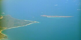
The Passage Island, part of the Passage Group within the Furneaux Group, is a 253-hectare (630-acre) granite and dolerite island, located in Bass Strait south of Cape Barren Island, in Tasmania, in south-eastern Australia.

Badger Island, part of the Badger Group within the Furneaux Group, is a 1,242-hectare (3,070-acre) unpopulated low-lying granite and limestone island, located in Bass Strait, lying west of the Flinders and Cape Barren islands, Tasmania, south of Victoria, in south-eastern Australia.
The Mount Chappell Island, part of the Badger Group within the Furneaux Group, is a 323-hectare (800-acre) unpopulated granite island with a distinctive central hill, located in Bass Strait, lying west of the Flinders and Cape Barren islands, Tasmania, south of Victoria, in south-eastern Australia.
The Anderson Island, also known as Woody Island, part of the Tin Kettle Island Group of the Furneaux Group, is a 166-hectare (410-acre) granite island, located in Bass Strait, lying northeast of Tasmania, in south-eastern Australia. Anderson Island lies between Flinders and Cape Barren Islands and is partly a pastoral lease used for grazing sheep and cattle. The island is joined at low tide to nearby Little Anderson and Tin Kettle Islands by extensive intertidal mudflats. The island is supposed to be named after John Anderson, a sealer living on the island by 1842.

The Great Dog Island, also known as Big Dog Island, and part of the Great Dog Group within the Furneaux Group, is a 354-hectare (870-acre) granite island, located in Bass Strait, lying south of the Flinders Island and north of the Cape Barren Island, in Tasmania, in south-eastern Australia.

Vansittart Island, also known as Gun Carriage Island, is a granite island with an area of 800 hectares. The island is part of Tasmania's Vansittart Island Group, lying in eastern Bass Strait between Flinders and Cape Barren Islands in the Furneaux Group.

Inner Sister Island, part of the Sister Islands Conservation Area, is a granite and dolerite island, with an area of 748 hectares (2.89 sq mi), located in Bass Strait, Tasmania, Australia.

Outer Sister Island, part of the Sister Islands Conservation Area, is a granite and dolerite island, with an area of 545 hectares (2.10 sq mi), located in Bass Strait, Tasmania, Australia.

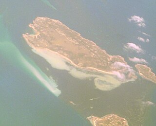
Prime Seal Island is a long island, with a high central ridge and an area of 1220 ha, in south-eastern Australia. It is part of Tasmania’s Prime Seal Island Group, lying in eastern Bass Strait west of Flinders in the Furneaux Group. Geologically, it is limestone overlying granite and has notable karst features, including caves. It is leased for farming and is extensively grazed by sheep and cattle as well as the native Tasmanian pademelons.
The East Kangaroo Island, part of the Big Green Group within the Furneaux Group, is a 157-hectare (390-acre) unpopulated limestone island with granite outcrops and dolerite dykes, located in the Bass Strait, west of the Flinders Island, in Tasmania, in south-eastern Australia.
The Ninth Island, part of the Waterhouse Island Group, is a 32-hectare (79-acre) uninhabited granite island situated in Bass Strait, lying close to the north-eastern coast of Tasmania, Australia. In November 2018, it was listed for sale for the fourth time, at $1.98 million. The property for sale is a landlocked title within a conservation covenant, preventing access to the island by any means except helicopter.

The Foster Islands, part of the Waterhouse Island Group, are two small granite islands with a combined area of 48 hectares situated in Banks Strait, part of Bass Strait, lying close to the north-eastern coast of Tasmania, Australia. The islands form part of Small Bass Strait Island nature reserve.
The Little Swan Island, part of the Waterhouse Island Group, is a 12.64-hectare (31.2-acre) uninhabited granite island situated in Banks Strait, part of Bass Strait, lying close to the north-eastern coast of Tasmania, Australia.

Swan Island, part of the Waterhouse Island Group, is a 239-hectare (590-acre) granite island situated in Banks Strait, part of Bass Strait, lying close to the north-eastern coast of Tasmania, Australia.
The George Rocks, also historically known as King George's Rocks, is part of the Waterhouse Island Group, a group of three adjacent uninhabited granite islets and associated reefs with a combined area of 7 hectares, situated in Banks Strait, part of Bass Strait, lying close to the north-eastern coast of Tasmania, Australia.
The St Helens Island, part of the Waterhouse Island Group, is a 51-hectare (130-acre) granite island situated in the Tasman Sea, lying close to the north-eastern coast of Tasmania, Australia.