
The Tasman National Park is a national park in eastern Tasmania, Australia, approximately 56 kilometres (35 mi) east of Hobart. The 107.5-square-kilometre (41.5 sq mi) park is situated on part of both the Forestier and Tasman peninsulas and encompasses all of Tasman Island.

Maatsuyker Island is an island located close to the south coast of Tasmania, Australia. The 186-hectare (0.72 sq mi) island is part of the Maatsuyker Islands Group, and comprises part of the Southwest National Park and the Tasmanian Wilderness World Heritage Site.

De Witt Island, also known as Big Witch, is an island located close to the south-western coast of Tasmania, Australia. The 516-hectare (1.99 sq mi) island is the largest of the Maatsuyker Islands Group, and comprises part of the Southwest National Park and the Tasmanian Wilderness World Heritage Site. The island is listed on the Australian Register of the National Estate.

Pedra Branca is a rock islet or small island, located in the Southern Ocean, off the southern coast of Tasmania, Australia. The island is situated approximately 26 km (16 mi) south southeast of South East Cape and is contained within the Southwest National Park, part of the Tasmanian Wilderness World Heritage Site. An erosional remnant of the Tasmanian mainland, the island is approximately 270 m (890 ft) long, 100 m (330 ft) wide, with an elevation of 60 m (200 ft) above sea level. The island is estimated to have separated from the Tasmanian mainland at least 15,000 years ago.

Eddystone is a tower-shaped rock or small island, located in the Southern Ocean, off the southern coast of Tasmania, Australia. The island is situated approximately 27 km (17 mi) from the South East Cape on a bearing of 149° and is contained within the Southwest National Park, part of the Tasmanian Wilderness World Heritage Site. An erosional remnant of the Tasmanian mainland with an elevation of 30 m (98 ft) above sea level, the island is estimated to have separated from the Tasmanian mainland at least 15,000 years ago.

Mewstone is an unpopulated island, composed of muscovite granite, located close to the south coast of Tasmania, Australia. The 13.1-hectare (32-acre) island has steep cliffs and a small flat summit and is part of the Pedra Branca group, lying 12 kilometres (7.5 mi) southeast of Maatsuyker Island, and 22 kilometres (14 mi) off the south coast of Tasmania. Mewstone comprises part of the Southwest National Park and the Tasmanian Wilderness World Heritage Site.

The St Helens Island, part of the Waterhouse Island Group, is a 51-hectare (130-acre) granite island situated in the Tasman Sea, lying close to the north-eastern coast of Tasmania, Australia.
The Paddys Island, part of the Waterhouse Island Group, is a 4.6-hectare (11-acre) uninhabited granite island situated in the Tasman Sea, lying close to the north-eastern coast of Tasmania, Australia.

The Tasman Island, part of the Tasman Island Group, is an oval island with an area of 1.2 square kilometres (0.46 sq mi), lying close to the south-eastern coast of Tasmania, Australia. The island is located in the Tasman Sea, situated off the Tasman Peninsula and is contained within the Tasman National Park.
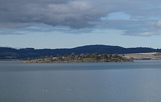
The Wedge Island, part of the Tasman Island Group, is an island with an area of 43 hectares lying close to the south-eastern coast of Tasmania, Australia. The island is located in Storm Bay, situated off the Tasman Peninsula.
Spectacle Island is a 3.5-hectare (8.6-acre) island in south-eastern Australia. It is part of the Sloping Island Group, lying close to the south-eastern coast of Tasmania around the Tasman and Forestier Peninsulas. Recorded breeding seabird and wader species are little penguin, short-tailed shearwater and pied oystercatcher.
Little Spectacle Island is a small island, with an area of 0.62 ha, part of the Sloping Island Group, lying close to the south-eastern coast of Tasmania, Australia around the Tasman and Forestier Peninsulas, and adjacent Spectacle Island.
Barren Island is a small island, with an area of 0.53 ha, in south-eastern Australia. It is part of the Sloping Island Group, lying close to the south-eastern coast of Tasmania around the Tasman and Forestier Peninsulas.
Hog Island is a small island and nature reserve, with an area of 0.35 hectares, part of the Sloping Island Group, lying in the Frederick Henry Bay, close to the south-eastern coast of Tasmania, Australia. The island is situated around the Tasman and Forestier Peninsulas.
Sloping Island, incorporating the adjacent Sloping Reef, is an island nature reserve, with an area of 117 ha, in Tasmania in south-eastern Australia. It is part of the Sloping Island Group, lying close to the south-eastern coast of Tasmania around the Tasman and Forestier Peninsulas.
Visscher Island is an island, with an area of 3.4 ha, in south-eastern Tasmania, in Australia.
The Dart Island, part of the Tasman Island Group, is an island, lying close to the south-eastern coast of Tasmania, Australia. The island is located in Norfolk Bay, situated off the Tasman Peninsula.
Woody Island is an island in south-eastern Australia. It is part of the Sloping Island Group, lying close to the south-eastern coast of Tasmania around the Tasman and Forestier Peninsulas.
The Sloping Island Group is a group of small islands in south-eastern Tasmania in Australia. They lie close to the south-eastern coast of Tasmania around the Tasman and Forestier Peninsulas.
The Tasman Island Group is a group of islands near the Tasman Peninsula in south-east Tasmania, Australia.
