Councils of Tasmania are the 29 administrative districts of the Australian state of Tasmania. Local government areas (LGAs), more generally known as councils, are the tier of government responsible for the management of local duties such as road maintenance, town planning and waste management.

The Storm Bay is a large bay in the south-east region of Tasmania, Australia.
The electoral division of Denison was an electorate of the Tasmanian House of Assembly from 1909 to 2018. It was located in Hobart on the western shore of the River Derwent and includes the suburbs below Mount Wellington. Denison was named after Sir William Denison, who was Lieutenant Governor of Van Diemen's Land (1847–55), and Governor of New South Wales (1855–61). The electorate shared its name and boundaries with the federal division of Denison. The seat was abolished in September 2018 and replaced by the Division of Clark, in line with its federal namesake.

South Arm is a rural residential locality in the local government area of Clarence in the Hobart region of Tasmania. The locality is about 32 kilometres (20 mi) south-east of the town of Rosny Park. The 2016 census has a population of 880 for the state suburb of South Arm.
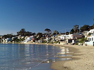
Opossum Bay is a rural residential locality in the local government area of Clarence in the Hobart region of Tasmania. The locality is about 37 kilometres (23 mi) south-east of the town of Rosny Park. The 2016 census has a population of 329 for the state suburb of Opossum Bay.
Ralphs Bay is a body of water in south-east Tasmania, Australia. It is semi-enclosed by the Tranmere / Rokeby peninsula and the South Arm peninsula. Sea access to the bay is from the River Derwent.
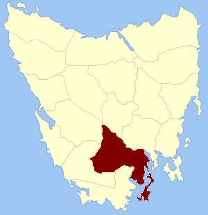
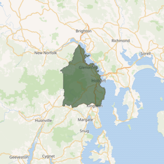
Buckingham Land District is one of the twenty land districts of Tasmania which are part of the Lands administrative divisions of Tasmania. It was formerly Buckingham County, one of the 18 counties of Tasmania and one of the first eleven proclaimed in 1836 and is bordered to the north by the River Derwent, and to the south by the Huon River. It includes Bruny Island. Hobart is located in the county. It was named after the then county of England.
Spectacle Island is a 3.5-hectare (8.6-acre) island in south-eastern Australia. It is part of the Sloping Island Group, lying close to the south-eastern coast of Tasmania around the Tasman and Forestier Peninsulas. Recorded breeding seabird and wader species are little penguin, short-tailed shearwater and pied oystercatcher.
Little Spectacle Island is a small island, with an area of 0.62 ha, part of the Sloping Island Group, lying close to the south-eastern coast of Tasmania, Australia around the Tasman and Forestier Peninsulas, and adjacent Spectacle Island.
Barren Island is a small island, with an area of 0.53 ha, in south-eastern Australia. It is part of the Sloping Island Group, lying close to the south-eastern coast of Tasmania around the Tasman and Forestier Peninsulas.
Sloping Island, incorporating the adjacent Sloping Reef, is an island nature reserve, with an area of 117 ha, in south-eastern Australia. It is part of the Sloping Island Group, lying close to the south-eastern coast of Tasmania around the Tasman and Forestier Peninsulas.

Smooth Island, is a privately owned island with an area of 59.31 ha lying close to the south-eastern coast of Tasmania, Australia. The island is part of the Sloping Island Group situated in Norfolk Bay and surrounded by the Tasman and Forestier Peninsulas. The towns Dunalley and Murdunna are nearby. Smooth Island differs from other Tasmanian islands as it has an unencumbered freehold title down to the high-water mark.
Fulham Island is a privately owned island with an area of 10 hectares. It is part of the Sloping Island Group, lying close to the south-eastern coast of Tasmania around the Tasman and Forestier Peninsulas in Tasmania, Australia.
Visscher Island is an island, with an area of 3.4 ha, in south-eastern Tasmania, in Australia.
Iron Pot is a small flat sandstone island with an area of 1.27 ha in south-eastern Australia. It is part of the Betsey Island Group, lying close to the south-eastern coast of Tasmania around the entrance to the River Derwent. It is the site of Iron Pot Lighthouse Tasmania's first lighthouse.
Green Island is a small island nature reserve with an area of 4.17 ha close to the south-eastern coast of Tasmania, Australia at the entrance to the River Derwent.

King George Island is an island in south-eastern Australia. It is part of the Sloping Island Group, lying close to the south-eastern coast of Tasmania around the Tasman and Forestier Peninsulas. The island was once inhabited and farmed and contains the ruins of two buildings on its eastern side. A conservation covenant is in place on this island.
The Sloping Island Group is a group of small islands in south-eastern Tasmania in Australia. They lie close to the south-eastern coast of Tasmania around the Tasman and Forestier Peninsulas.

The South-east Tasmania Important Bird Area encompasses much of the land retaining forest and woodland habitats, suitable for breeding swift parrots and forty-spotted pardalotes, from Orford to Recherche Bay in south-eastern Tasmania, Australia.

Cape Pillar is a location in southern Tasmania, on the Tasman Peninsula in the Tasman National Park, adjacent to Tasman Island.