Lakes Argyle and Kununurra Ramsar Site

Last updated

Lakes Argyle and Kununurra Ramsar Site
Western Australia
Lake argyle.jpg
View of Lake Argyle from space, looking south-east, with the Ord River valley and Lake Kununurra at lower left
Australia Western Australia relief location map.png
Red pog.svg
Lakes Argyle and Kununurra Ramsar Site
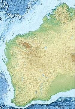
Location in Western Australia
Coordinates 16°19′S128°44′E / 16.317°S 128.733°E / -16.317; 128.733 Coordinates: 16°19′S128°44′E / 16.317°S 128.733°E / -16.317; 128.733
Established7 June 1990 [1]
Area1,500 km2 (579.2 sq mi) [1]
Footnotes
Official nameLakes Argyle and Kununurra
Designated7 June 1990
Reference no.478 [2]

The Lakes Argyle and Kununurra Ramsar Site comprises an extensive system of artificial freshwater reservoirs, with their associated permanent wetlands, formed by damming the Ord River in the eastern part of the Kimberley region of northern Western Australia. The reservoirs include Lake Argyle and Lake Kununurra. There are numerous endemic plants and a rich fauna. The 1,500 km2 (580 sq mi) site was designated a wetland of international importance under the Ramsar Convention on 7 June 1990, making it Ramsar Site 478. [1]
Contents

Description

Radjah shelduck Ohar radza Tadorna rajah RB1.jpg
Radjah shelduck
Rakali, or water-rat Hydromys chrysogaster - Gould.jpg
Rakali, or water-rat
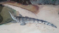
Freshwater crocodile Australianfreshwatercrocodile.jpg
Freshwater crocodile

The diversion dam on the Ord River was completed in 1963 as the first stage of the Ord River Irrigation Scheme. It flooded the Ord valley upstream towards the site of the Argyle Dam, creating Lake Kununurra and subsidiary wetlands such as Lily Creek Lagoon and the Packsaddle Swamps. The Argyle Dam was completed in 1972 as the second stage of the scheme, creating Lake Argyle. The town of Kununurra was built at the site of the diversion dam, adjoining Lake Kununurra and Lily Creek Lagoon. Human use of the area includes irrigated tropical agriculture, diamond mining and exploration, and with tourism becoming increasingly important. [1]

Flora and fauna

Water levels in Lake Argyle fluctuate annually by about 3 metres (9.8 ft) but those in Lake Kununurra and its associated wetlands are kept constant except for short periods when levels are lowered to control weed growth. There are dead trees throughout the wetland system which were killed by permanent flooding following dam construction. The lakes are deep and there are large areas of open water without aquatic plants. The large fluctuation in water levels in Lake Argyle has prevented vegetation establishment along most of the shoreline. However, because water levels are stable in Lake Kununurra and its associated wetlands, they have developed densely vegetated margins, with aquatic plants fringed by bulrushes, grassland and savanna woodland. Tree species found on the wetland margins include broad-leaved paperbark, Eucalyptus microtheca , river red gum, Nauclea orientalis , Sesbania formosa and Lophostemon grandiflorus . [3]

The lakes form an important dry season refuge for waterbirds, with regular numbers of over 20,000 and sometimes of up to 200,000 individuals. Lake Argyle contains some of the largest aggregations of waterbirds in northern Australia. Abundant species include glossy ibis (with up to 6,000 counted), magpie goose (10,500), wandering whistling duck (11,000), plumed whistling duck (4,300), radjah shelduck (900), Pacific black duck (16,000), grey teal (17,200), pink-eared duck (1,800), hardhead (51,400), green pygmy goose (1,500) and Eurasian coot (50,000). The two lakes are a stronghold of the comb-crested jacana. Over 200 terrestrial and aquatic bird species have been recorded in the area, which also supports several kinds of microbats, the little red and black flying-foxes, rakali, and large numbers of freshwater crocodiles. [3]

See also

Related Research Articles

Tulare Lake Freshwater dry lake in the southern San Joaquin Valley, California, United States

Tulare Lake is a freshwater dry lake with residual wetlands and marshes in the southern San Joaquin Valley, California, United States. After Lake Cahuilla disappeared in the 17th century, Tulare Lake was the largest freshwater lake west of the Mississippi River and the second-largest freshwater lake entirely in the United States, based upon surface area. A remnant of Pleistocene-era Lake Corcoran, Tulare Lake dried up after its tributary rivers were diverted for agricultural irrigation and municipal water uses.

Kununurra, Western Australia Town in the Kimberley region of Western Australia

Kununurra is a town in far northern Western Australia located at the eastern extremity of the Kimberley approximately 45 kilometres (28 mi) from the border with the Northern Territory. Kununurra was initiated to service the Ord River Irrigation Scheme.

A Ramsar site is a wetland site designated to be of international importance under the Ramsar Convention. The Convention on Wetlands, known as the Ramsar Convention, is an intergovernmental environmental treaty established in 1971 by UNESCO, which came into force in 1975. It provides for national action and international cooperation regarding the conservation of wetlands, and wise sustainable use of their resources. Ramsar identifies wetlands of international importance, especially those providing waterfowl habitat.

Lake Argyle

Lake Argyle is Western Australia's largest and Australia's second largest freshwater man-made reservoir by volume. The reservoir is part of the Ord River Irrigation Scheme and is located near the East Kimberley town of Kununurra. The lake flooded large parts of the Shire of Wyndham-East Kimberley on the Kimberley Plateau about 80 kilometres (50 mi) inland from the Joseph Bonaparte Gulf, close to the border with the Northern Territory.

Lake Corangamite

Lake Corangamite, a hypersaline endorheic lake, is located near Colac in the Lakes and Craters region of the Victorian Volcanic Plains of south-west Victoria, Australia. The lake's salinity levels have increased dramatically as the lake level has dropped in recent decades. It is Australia's largest permanent saline lake, covering approximately 230 square kilometres (89 sq mi) with a circumference of 150 kilometres (93 mi). It forms part of the Ramsar-listed Western District Lakes wetland site. The indigenous name of the lake is recorded as Kronimite.

Ord River River in Kimberley region of Western Australia

The Ord River is a 651-kilometre long (405 mi) river in the Kimberley region of Western Australia. The river's catchment covers 55,100 square kilometres (21,274 sq mi).

Colorado River Delta River in Mexico

The Colorado River Delta is the region where the Colorado River flows into the Gulf of California in eastern Mexicali Municipality in the north of the state of Baja California in northwesternmost Mexico. The delta is part of a larger geologic region called the Salton Trough. Historically, the interaction of the river's flow and the ocean's tide created a dynamic environment, supporting freshwater, brackish, and saltwater species. Within the delta region, the river split into multiple braided channels and formed a complex estuary and terrestrial ecosystems. The use of water upstream and the accompanying reduction of freshwater flow has resulted in the loss of most of the wetlands of the area, as well as drastic changes to the aquatic ecosystems. However, a scheme is currently in place which aims to rejuvenate the wetlands by releasing a pulse of water down the river delta.

Maharana Pratap Sagar

Maharana Pratap Sagar in India, also known as Pong Reservoir or Pong Dam Lake was created in 1975, by building the highest earthfill dam in India on the Beas River in the wetland zone of the Siwalik Hills of the Dehra Gopipur Division Kangra district of the state of Himachal Pradesh. Town of Gopipur is submerged in the reservoir, many families were displaced while flooding of reservoir. Named in the honour of Maharana Pratap (1540–1597), the reservoir or the lake is a well-known wildlife sanctuary and one of the 27 international wetland sites declared in India by the Ramsar Convention. The reservoir covers an area of 24,529 hectares, and the wetlands portion is 15,662 hectares.

Classification of wetlands has been a problematical task, with the commonly accepted definition of what constitutes a wetland being among the major difficulties. A number of national wetland classifications exist. In the 1970s, the Ramsar Convention on Wetlands of International Importance introduced a first attempt to establish an internationally acceptable wetland classification scheme.

Lake Gore

Lake Gore is a seasonal and semi-permanent freshwater lake in the Goldfields-Esperance region of Western Australia located approximately 24 km (15 mi) west of Esperance. It is an important site for waterbirds.

Yanga National Park Protected area in New South Wales, Australia

The Yanga National Park is a newly formed national park, located near the township of Balranald in south- western New South Wales. It covers an area of 66,734 hectares which includes 1,932 hectares of Yanga Nature Reserve, and has a frontage of 170 kilometres (110 mi) on the Murrumbidgee River. It is largely located in the Lower Murrumbidgee Floodplain, which is included on A Directory of Important Wetlands in Australia because of its importance as a breeding site for waterbirds when flooded.

Reedy Lake

Reedy Lake, historically also known as Lake Reedy, is a shallow 5.5-square-kilometre (2.1 sq mi) intermittent freshwater lake or swamp on the lower reaches of the Barwon River, on the Bellarine Peninsula southeast of Geelong in the Australian state of Victoria.

Lake Kununurra

Lake Kununurra is a freshwater man-made reservoir located in the Ord River valley. The lake was formed in 1963 by the construction of the Ord Diversion Dam in Kununurra, northern Western Australia, which was built to supply water to the Ord River Irrigation Area. Prior to the diversion dam construction a natural permanent waterhole held back by the Bandicoot Bar was known as "Carlton Reach", which was reputed to be the largest waterhole in the Kimberley.

Ord River Floodplain

The Ord River floodplain is the floodplain of the lower Ord River in the Shire of Wyndham-East Kimberley, in the Kimberley region of northern Western Australia. It lies within the Victoria Bonaparte IBRA bioregion and contains river, seasonal creek, tidal mudflat and floodplain wetlands, with extensive stands of mangroves, that support saltwater crocodiles and many waterbirds. It is recognised as an internationally important wetland area, with 1,384 km2 of it designated on 7 June 1990 as Ramsar Site 477 under the Ramsar Convention on Wetlands.

Moulting Lagoon Important Bird Area

Moulting Lagoon Important Bird Area is a composite wetland site in eastern Tasmania, Australia. It comprises two adjacent and hydrologically continuous wetlands – Moulting Lagoon and the Apsley Marshes – at the head of Great Oyster Bay, near the base of the Freycinet Peninsula, between the towns of Swansea and Bicheno. Both components of the site are listed separately under the Ramsar Convention as wetlands of international significance. Moulting Lagoon is so named because it is a traditional moulting place for black swans. It is an important site for waterbirds.

North Victorian Wetlands

The North Victorian Wetlands, also known as the Kerang Wetlands, comprise an extensive series of over 100 freshwater, brackish and saline lakes and swamps on the floodplain of the Loddon River where it enters the Murray valley, in the vicinity of the town of Kerang, in northern Victoria, south-eastern Australia. They are important for a variety, and sometimes large numbers, of waterbirds.

Ord Irrigation Area Important Bird Area

The Ord Irrigation Area Important Bird Area is an area of land used for irrigated agriculture along the Ord River in the vicinity of the town of Kununurra in the Kimberley region of north-western Australia. It has been identified by BirdLife International as a 220 km2 Important Bird Area (IBA) for its significance for birds, especially estrildid finches.

Jocks Lagoon

Jocks Lagoon is an 18-hectare (44-acre) freshwater coastal lagoon in north-eastern Tasmania, Australia. In 1982 it was designated a wetland of international importance under the Ramsar Convention.

Little Waterhouse Lake Lake in Tasmania, Australia

Little Waterhouse Lake is a freshwater coastal lagoon in the Waterhouse Conservation Area of north-eastern Tasmania, Australia. In 1982 it was designated a wetland of international importance under the Ramsar Convention.

Nagi Bird Sanctuary Indian nature site

Nagi Bird Sanctuary is located in Jhajha Jamui district of south Bihar, near the Jharkhand border. It was declared a bird sanctuary on 25 February 1984 as per Section 18 of the Wildlife (Protection) Act, 1972. The final notification under Section 26A of the act was issued on 4 September 2009. Thousands of migrating birds congregate in the reservoir during the winter season, especially from November to February. The area of the sanctuary is 2.1 square kilometres. It is home to over 133 bird species. There are also a variety of dragonflies, damselflies and butterflies which are yet to be studied and documented. In 2004, Nagi Dam Bird Sanctuary was declared an Important Bird Area (IBA) by BirdLife International. The area overlapping with the IBA is 791 ha.

References

  1. 1 2 3 4 "The Annotated Ramsar List: Australia". The Ramsar Convention on Wetlands. 4 January 2000. Archived from the original on 19 September 2011. Retrieved 13 May 2010.
  2. "Lakes Argyle and Kununurra". Ramsar Sites Information Service. Retrieved 25 April 2018.
  3. 1 2 "Information Sheet on Ramsar Wetlands: Lakes Argyle and Kununurra" (PDF). Wetlands International. 1998. Archived from the original (PDF) on 22 June 2011. Retrieved 13 May 2010.