Lake Barrine

Last updated

Lake Barrine
(Barany)
Lakebarrinephoto.jpg
View from a cruise
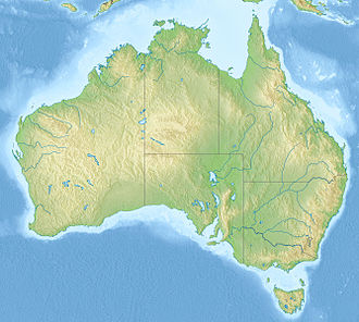
Australia relief map.jpg
Red pog.svg
Lake Barrine
(Barany)
Australia Queensland relief location map.jpg
Red pog.svg
Lake Barrine
(Barany)
Location Lake Barrine, Queensland
Coordinates 17°15′01″S145°38′07″E / 17.25028°S 145.63528°E / -17.25028; 145.63528 Coordinates: 17°15′01″S145°38′07″E / 17.25028°S 145.63528°E / -17.25028; 145.63528
Type Crater lake
Primary inflows precipitation
Basin  countriesAustralia
Max. width1,230 m (4,040 ft)
Average depth35 m (115 ft)
Max. depth65 m (213 ft)
Shore length14.5 km (2.8 mi)
Surface elevation730 m (2,400 ft)
1 Shore length is not a well-defined measure.

Lake Barrine is a freshwater lake on the eastern parts of Atherton Tableland in the locality of Lake Barrine, in the Tablelands Region of Far North Queensland, Australia, close to Lake Eacham. The lake and surrounds are protected within the Crater Lakes National Park and are accessible via the Gillies Highway. [1]

Contents

Origin

Lake Barrine was formed over 17,000 years ago [2] when a large volcano erupted, leaving a crater that over time filled up with water to create a lake. The crater or maar was formed as a result of a series of volcanic explosions. These explosions were caused by the hot molten rock coming into contact with groundwater. This caused a build-up of steam, gases and pressure which blasted the central core from the volcano. This massive explosion left a huge crater, which filled with rainwater to create Lake Barrine. Local Aboriginals called the lake Barany. [1]

Description

Viewed from the forest trail that encircles the lake Lake Barrine with a view of the tea rooms and cruise boat.JPG
Viewed from the forest trail that encircles the lake

The largest of the natural volcanic lakes in the area, Lake Barrine is 730 m above sea level. It is about 1 km in diameter, with a shoreline of almost 4.5 km, an average depth of 35 m and a maximum depth of 65 m. [3] No streams or springs feed the crystal clear lake; it is filled only by rainwater. During the wet season a small creek flows out of the lake. It joins Toohey Creek which is a tributary of the Mulgrave River. [1]

Facilities

There are walking tracks around the lake and tour operators offer cruises on the lake. [4] Facilities at the lake include picnic grounds, a kiosk and a pre-war tea house which was built in 1926. [1] Visitors may also swim in the lake and partake in birdwatching. Camping and domestic animals are prohibited near the lake.

Fauna and flora

Ferns and palm trees on the forest walk Flora of Lake Barrine.JPG
Ferns and palm trees on the forest walk

The surrounding rainforest contains giant kauri ( Agathis microstachya ), red cedar ( Toona ciliata ) and flowering umbrella trees ( Heptapleurum actinophyllum ). Wildlife common in the area include eastern water dragons, giant eels, saw-shelled turtles, scrub pythons ( Morelia kinghorni ), pied cormorants, black ducks, plumed whistling ducks, black coot, whistling kites, brahminy kites, black kites, white-breasted sea eagles and dusky moorhens.

The aquatic environment include a few native species including Speckled_longfin_eel Anguilla Reinhardtii, Bony Bream Nematalosa ereb and the Lake Eacham rainbowfish Melanotaenia eachamensis. Despite being lake with no rivers or creeks feeding into Lake Barrine the spotted tilapia Tilapia mariae has found its way into the National Park and are now in plague proportions in this freshwater Ecosystem. [5]

World War II

During World War II the teahouse was used by the Australian Army as a convalescent home. [6]

See also

Related Research Articles

<span class="mw-page-title-main">Crater Lakes National Park</span> Protected area in Queensland, Australia

Crater Lakes is a national park in Far North Queensland, Queensland, Australia, 1367 km northwest of Brisbane. The park contains two volcanically-formed lakes, Lake Barrine and Lake Eacham (Yidyam). Both lakes have walking trails around the lake; boat tours are also given at Lake Barrine.

<span class="mw-page-title-main">Yungaburra</span> Town in Queensland, Australia

Yungaburra is a rural town and locality in the Tablelands Region, Queensland, Australia. In the 2016 census, the locality of Yungaburra had a population of 1,239 people.

<span class="mw-page-title-main">Atherton Tableland</span> Fertile plateau in northern Queensland, Australia

The Atherton Tableland is a fertile plateau, which is part of the Great Dividing Range in Queensland, Australia. It has very deep, rich basaltic soils and the main industry is agriculture. The principal river flowing across the plateau is the Barron River, which was dammed to form the irrigation reservoir named Lake Tinaroo.

<span class="mw-page-title-main">Lake Eacham (Queensland)</span> Crater lake in Queensland, Australia

Lake Eacham is a popular lake of volcanic origin on the Atherton Tableland of Queensland, Australia, within the World Heritage listed Wet Tropics of Queensland. It is within the locality of Lake Eacham in the Tablelands Region local government area.

<span class="mw-page-title-main">Tinaroo Dam</span> Dam in Far North Queensland

The Tinaroo Dam, officially the Tinaroo Falls Dam, is a major ungated concrete gravity dam with a central ogee spillway across the Barron River located on the Atherton Tableland in Far North Queensland, Australia. The dam's purpose includes irrigation for the Mareeba-Dimbulah Irrigation Scheme, water supply, hydroelectricity, and recreation. Completed between 1953 and 1958, the dam creates the impounded reservoir, Lake Tinaroo.

<span class="mw-page-title-main">The Pinnacles (Atherton Tableland)</span>

The Pinnacles are a series of seven volcanic cinder cones on the Atherton Tableland, near Yungaburra, Queensland, Australia. They were formed more than 350 000 years ago.

<span class="mw-page-title-main">Atherton State High School</span> Public school in Atherton, Queensland, Australia

Atherton State High School (ASHS) is a co-educational, state secondary school in Atherton, Queensland.

The Mount Hypipamee Crater, also known as The Crater is a huge diatreme located south-east of Herberton on the Atherton Tableland in Far North Queensland, Australia. It is 61 metres in diameter and 82 metres deep.

<span class="mw-page-title-main">Mount Quincan</span> Mountain in Queensland, Australia

Mount Quincan is a volcanic mountain near Yungaburra on the Atherton Tableland in Far North Queensland, Australia.

<span class="mw-page-title-main">Shire of Eacham</span> Local government area in Queensland, Australia

The Shire of Eacham was a local government area of Queensland. It was located on the Atherton Tableland, a plateau forming part of the Great Dividing Range west of the city of Cairns. The shire, administered from the town of Malanda, covered an area of 1,126.4 square kilometres (434.9 sq mi), and existed as a local government entity from 1910 until 2008, when it amalgamated with several other councils in the Tableland area to become the Tablelands Region.

<span class="mw-page-title-main">Shire of Atherton</span> Local government area in Queensland, Australia

The Shire of Atherton was a local government area of Queensland. It was located on the Atherton Tableland, a plateau forming part of the Great Dividing Range west of the city of Cairns. The shire, administered from the town of Atherton, covered an area of 623.1 square kilometres (240.6 sq mi), and existed as a local government entity from 1881 until 2008, when it amalgamated with several other councils in the Tableland area to become the Tablelands Region.

<span class="mw-page-title-main">Gillies Highway</span>

The Gillies Highway is a road that runs from Gordonvale in the Cairns Region through the Gillies Range to Atherton in the Tablelands Region, both in Queensland, Australia. It is also known as the Gillies Range Road and was originally known as the Cairns Range Road.

<span class="mw-page-title-main">Lake Euramoo</span> Lake in Queensland, Australia

Lake Euramoo is a shallow dumbbell-shaped volcanic crater lake in Danbulla, Tablelands Region, Far North Queensland, Australia. It was formed about 23,000 years ago by two massive explosions from groundwater superheating.

Grafton Volcano is a buried volcano in New Zealand's Auckland volcanic field that underlies much of the Auckland suburb of Grafton. First recognised in 2010, it includes the Outhwaite Park scoria cone that was first mapped by Hochstetter (1864) and inferred by later geologists to be a late phase vent of adjacent Pukekawa Volcano. Borehole drilling and building excavations in the Grafton-Auckland Domain area during the 1990s and 2000s provided new subsurface geological information that allowed geologists to recognise the buried Grafton Volcano.

The Cairns District Rugby League was formed on 5 August 1918 and is the administrative body for the game of rugby league football in Cairns, Queensland. The CDRL runs senior, junior and women's club competitions and has its headquarters at Barlow Park. The competition changed its name to Far North Queensland Rugby League in 2023.

<span class="mw-page-title-main">Malanda Falls Swimming Pool</span> Historic site in Queensland, Australia

Malanda Falls Swimming Pool is a heritage-listed swimming pool at Malanda Falls Park, Malanda, Tablelands Region, Queensland, Australia. It was built from 1906 onwards. It was added to the Queensland Heritage Register on 5 February 2010.

<span class="mw-page-title-main">Lake Eacham Hotel</span> Historic site in Queensland, Australia

Lake Eacham Hotel is a heritage-listed hotel at 6-8 Kehoe Place, Yungaburra, Tablelands Region, Queensland, Australia. It was built in 1910 by Side Brothers. It was added to the Queensland Heritage Register on 21 October 1992.

<span class="mw-page-title-main">Yungaburra Community Centre</span> Historic site in Queensland, Australia

Yungaburra Community Centre is a heritage-listed community hall at 19 Cedar Street, Yungaburra, Tablelands Region, Queensland, Australia. It was built from 1910 to c. 1926. It is also known as Tivoli picture theatre, Williams Estate Hall, and Yungaburra Hall. It was added to the Queensland Heritage Register on 21 October 1992.

The Ngajanji, also written Ngadyan, and Ngadjon-Jii are an Indigenous Australian people of the rainforest region south of Cairns, in northern Queensland. They form one of 8 groups, the others being Yidin, Mamu, Dyirbal, Girramay, Warrgamay, Waruŋu and Mbabaram, of the Dyirbal tribes.

Lake Barrine is a rural locality in the Tablelands Region, Queensland, Australia. In the 2016 census, Lake Barrine had a population of 152 people.

References

  1. 1 2 3 4 Shilton, Peter (2005). Natural areas of Queensland. Mount Gravatt, Queensland: Goldpress. pp. 48–51. ISBN   0-9758275-0-2.
  2. Head, M. J.; Taylor, L. J.; Walker, D. (1994). "ANU Radiocarbon Date List XI: Radiocarbon Dates from Lakes Barrine and Eacham, Atherton Tableland, North Queensland, Australia". Radiocarbon. 36 (1): 73–94. doi: 10.1017/S003382220001434X . ISSN   0033-8222.
  3. Timms, B.V. (1976). "Morphology of Lakes Barrine, Eacham and Euramoo, Atherton Tableland, North Queensland". Proceedings of the Royal Society of Queensland. 87: 81–84.
  4. About Lake Barrine. Department of National Parks, Recreation, Sport and Racing. Retrieved on 29 December 2012.
  5. Brandel, Phil (16 January 2020). "Tilapia at plague proportions". The Express. Retrieved 27 January 2022.
  6. Official website Accessed 22 September 2013