Dimbulah, Queensland

Last updated

Dimbulah
Queensland
Machine Planting with Spray Lines, Mareeba Dimbulah Irrigation System, c 1958.jpg
Farming at Dumbula, circa 1958
Australia Queensland location map.svg
Red pog.svg
Dimbulah
Coordinates 17°08′56″S145°06′39″E / 17.1488°S 145.1108°E / -17.1488; 145.1108 (Dimbulah (town centre))
Population366 (UCL 2021) [1]
Established1876
Postcode(s) 4872
Elevation407 m (1,335 ft)
Area703.7 km2 (271.7 sq mi)
Time zone AEST (UTC+10:00)
Location
LGA(s) Shire of Mareeba
State electorate(s)
Federal division(s) Kennedy
Mean max tempMean min tempAnnual rainfall
35 °C
95 °F
10.5 °C
51 °F
783.2 mm
30.8 in
Localities around Dimbulah:
Chillagoe Thornborough Thornborough
Chillagoe Dimbulah Mutchilba
Petford Irvinebank Irvinebank

Dimbulah is a rural town and locality in Far North Queensland, Australia, 114 kilometres (71 mi) from Cairns by road, on the Atherton Tableland. [2] [3] It is within the local government area of Shire of Mareeba (between 2008 and 2013, it was within the Tablelands Region). In the 2021 census, the locality of Dimbulah had a population of 975 people, [4] a decrease from the 1,050 people in the 2016 census. [5]

Contents

Geography

Molybdenite from Wolfram Camp near Dimbulah Molybdenite (Wolfram Camp, Dinbulah, Queensland, Australia) (19057113310).jpg
Molybdenite from Wolfram Camp near Dimbulah

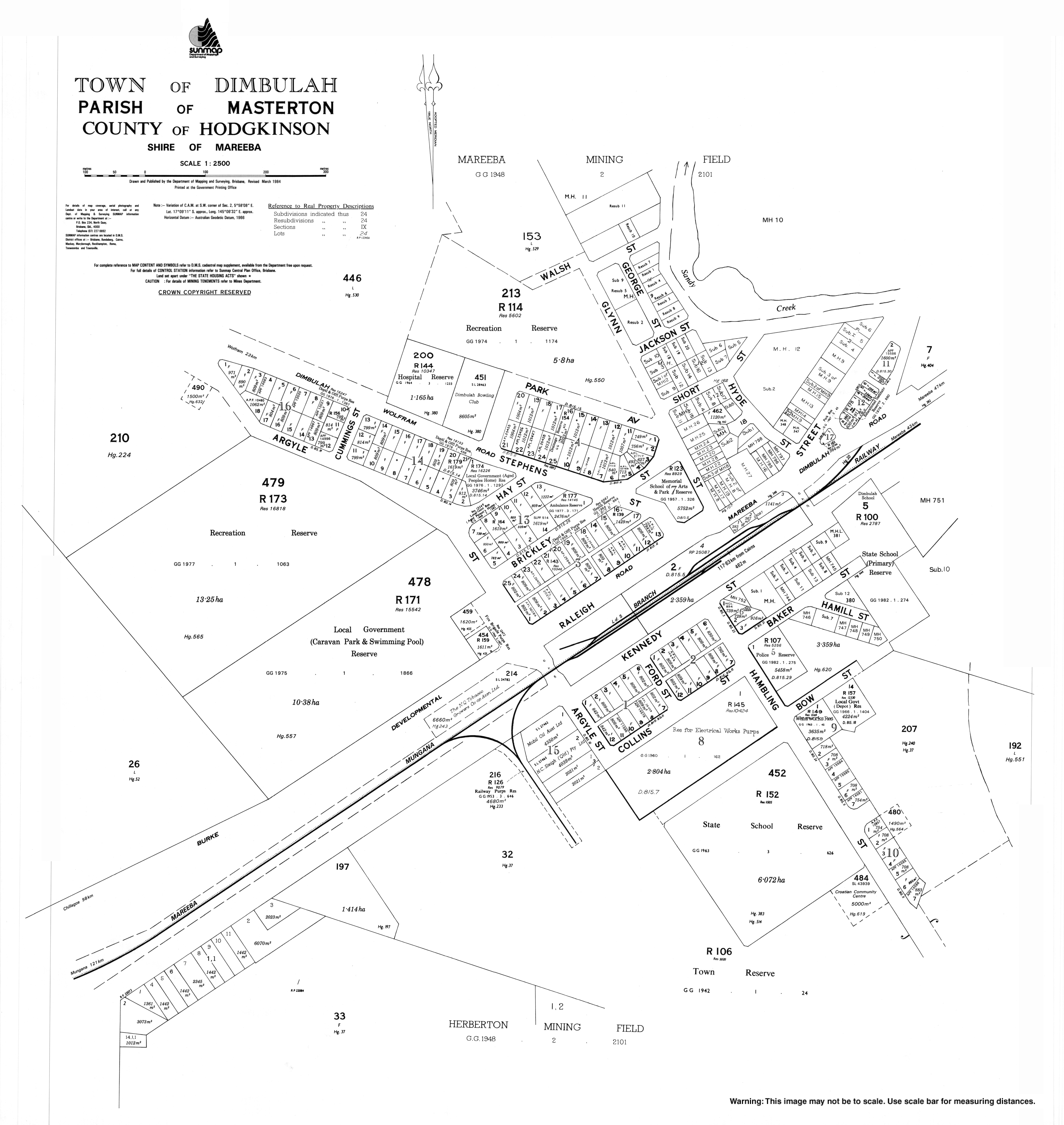
Dimbulah is approximately 100 kilometres (62 mi) south-west of Cairns. The town was established near the Walsh River as a watering point for trains servicing the Hodgkinson goldfields to the north-west along with the former mining town of Wolfram which is also located to the north-west of the locality. There are historical ruins of early mining there as well as a present-day open cut mine.[ citation needed ]

The Tablelands railway line passes through the locality which is served by the following railway stations (from north to south):

Due to the availability of water, Dimbulah also established itself as an agricultural area. However, the Walsh River alone was not reliable enough as a source of water for irrigation. The establishment of Tinaroo Dam and the Mareeba-Dimbulah irrigation scheme provided water security which led to the establishment of many large-scale agricultural enterprises, starting with the expansion of the tobacco industry.[ citation needed ]

The soils types in the Dimbulah area are particularly suited to tobacco farming due to being based on granitic sand. The 'lighter' soils facilitated the cultivation of a lighter style of tobacco leaf which was in high demand. Some of the soil types in the area include: Murphy, Algoma, Price and Cobra. These soils are mostly colluvial soils derived from weathered metamorphic rock as well as older alluvium derived from granitic rock.[ citation needed ]

The main vegetation is low open woodlands consisting mainly of the eucalypts such as bloodwood, box along with melaleucas and a grass cover of kangaroo grass and spear grass. [7]

Climate

Local residents enjoy a tropical climate with hot, wet summers and dry, mild winters.

History

The town was established in 1876 to service the Tyrconnell Gold Mine, one of the richest mines on the Hodgkinson Gold Fields. The name "Dimbulah" is thought to have come from the local Indigenous Australian word for "long waterhole", referring to the Walsh River that runs nearby the town. Dimboola Post Office opened by 1900 and was renamed Dimbulah in 1904. [8]

The area around Dimbulah was originally home to the Djankun [9] and Kuku Djungan tribe. During the 1920s the Queensland Government forcibly removed most of their children, forcing the tribe to scatter.[ citation needed ]

In the early 1900s the area received an influx of Italian migrants and in 1928 tobacco was introduced, becoming the area's major industry soon after. At its peak, there were 800 growers in the area, producing over 8,000 tonnes (60% of national yield) of tobacco a year. "The Way Back In" is an Australian heritage project that documents a small selection of Australian heritage within the Italian communities in Dimbulah, Innisfail and Cairns.[ citation needed ]

Boonmoo Provisional School opened circa July 1910 and closed circa April 1912. [10] It was on Boonmoo Road ( 17°14′43″S145°04′35″E / 17.24527°S 145.07642°E / -17.24527; 145.07642 (Boonmoo Provisional School (former)) ). [11] [12]

Dimbulah Provisional School opened on 28 September 1914. On 1 December 1914, it became Dimbulah State School. On 25 January 1965, it was expanded to include a secondary department. [10] The school celebrated its centenary on 27 September 2014. [13]

The Dimbulah parish of the Roman Catholic Diocese of Cairns was established in 1963. [14]

St Anthony's Catholic School opened in January 1966 by the Sisters of St Joseph with an initial enrolment of 64 students. The Sisters operated the school for 22 years, after which it was operated by the Roman Catholic Diocese of Cairns. [10] [15]

The Dimbulah Public Library opened in 1995 with a minor refurbishment in 2013. [16]

Demographics

In the 2011 census, the locality of Dimbulah had a population of 1,414. [17]

In the 2016 census, the locality of Dimbulah had a population of 1,050 people. [5]

In the 2021 census, the locality of Dimbulah had a population of 975 people. [4]

Heritage listings

Dimbulah has a number of sites listed on the Queensland Heritage Register including:

Economy

Tobacco remained the dominant crop until recent years when government policy compelled its demise. Recent attempts at alternative crops such as tea trees, mangoes, sugar cane, coffee, lemons, limes, avocados, papaws, papayas, peanuts, soya beans, lychees, grapes and cash crops (pumpkins, melons, etc.) have met with mixed success. [20] Farming is a significant employment option in Dimbulah and many travelers, including backpackers, are employed as short-term farm labourers, particularly during the busy mango harvest from November to January.

Education

Dimbulah State School Dimbulah State School, 2023.jpg
Dimbulah State School

Dimbulah State School is a government primary and secondary (Prep-10) school for boys and girls at 48-50 Kennedy Street ( 17°08′56″S145°06′47″E / 17.1489°S 145.1131°E / -17.1489; 145.1131 (Dimbulah State School) ). [21] [22] In 2018, the school had an enrolment of 150 students with 17 teachers (14 full-time equivalent) and 13 non-teaching staff (9 full-time equivalent). [23]

St Anthony's School is a Catholic primary (Prep-6) school for boys and girls at 3 Hyde Street ( 17°08′50″S145°06′42″E / 17.1473°S 145.1118°E / -17.1473; 145.1118 (St Anthony's School) ). [21] [24] In 2018, the school had an enrolment of 37 students with 8 teachers (5 full-time equivalent) and 10 non-teaching staff (4 full-time equivalent). [23]

There are no schools offering education to Year 12 in Dimbulah. The nearest government secondary school with education to Year 12 is Mareeba State High School in Mareeba to the north-east. However, it would be too distant from some parts of Dimbulah and distance education and boarding schools would be other options. [25]

Also available are:

Amenities

Junction Hotel, Dimbulah, circa 1930 (still operating 2017) Junction Hotel at Dimbulah, circa 1930.jpg
Junction Hotel, Dimbulah, circa 1930 (still operating 2017)

The Mareeba Shire operates a public library at Shire Hall at the corner of Raleigh Street and Burke Development Road. [26]

The Dimbulah branch of the Queensland Country Women's Association meets at the QCWA Hall at 22 Brickley Street. [27]

St Anthony's Catholic Church is in Raleigh Street. It is within the Dimbulah Parish of the Roman Catholic Diocese of Cairns which is administered from the Atherton parish. [14]

Accommodation is available at the town's caravan park or the Junction Hotel.

As at 2021, the town's retail facilities include a Bendigo Community Bank with 24-hour ATM, Australia Post office, Dimbulah Chemist, Dimbulah Health & Beauty, Camp 64 Museum Cafe, Junction Hotel, bakery, butcher, TGT hardware store, mini mart, One Stop convenience store and two petrol stations.

Community groups include the Dimbulah Community Centre, Men's Shed, Lions Club, Chamber of Commerce, museum association, and several other faith-based groups.

There are many sporting clubs including swimming (with an Olympic-sized pool), tennis, horse & pony, lawn bowls, Rhee Taekwon-Do, and soccer/football.

Services include Police station, Queensland Health clinic, fixed wireless NBN, and 4G mobile service (Telstra and Optus). Nearby properties access NBN via SkyMuster satellite or mobile broadband.

Events

Important local events include the annual Lion's Festival and the Great Wheelbarrow Race both held annually in May.[ citation needed ]

St Anthony's Catholic Church celebrates the Feast Day of St Anthony of Padua on the 3rd Sunday of June with a special mass, followed by a procession, barbeque and pesca (a lucky dip which takes its name from the Italian pesca miracolosa, the miraculous catch of fish). [14]

Transport

Public transport from Cairns is possible, although infrequent, on Trans North's bus service which stops at Mareeba, 45 kilometres (28 mi) from Dimbulah. The Savannahlander tourist train stops in Dimbulah as well but does not operate year-round.

Notable people

Related Research Articles

<span class="mw-page-title-main">Gordonvale, Queensland</span> Suburb of Cairns, Queensland, Australia

Gordonvale is a rural sugar-growing town and locality situated on the southern side of Cairns in the Cairns Region, Queensland, Australia. In the 2021 census, the locality of Gordonvale had a population of 6,944 people.

<span class="mw-page-title-main">Chillagoe, Queensland</span> Town in Queensland, Australia

Chillagoe is a rural town and locality in the Shire of Mareeba, Queensland, Australia. In the 2016 census the locality of Chillagoe had a population of 251 people.

<span class="mw-page-title-main">Atherton, Queensland</span> Town in Queensland, Australia

Atherton is a rural town and locality in the Tablelands Region, Queensland, Australia. In the 2016 census, Atherton had a population of 7,331 people.

<span class="mw-page-title-main">Kuranda, Queensland</span> Town in Queensland, Australia

Kuranda is a rural town and locality on the Atherton Tableland in the Shire of Mareeba, Queensland, Australia. In the 2016 census, Kuranda had a population of 3,008 people. It is 25 kilometres (16 mi) from Cairns, via the Kuranda Range road. It is surrounded by tropical rainforest and adjacent to the Wet Tropics of Queensland World Heritage listed Barron Gorge National Park.

<span class="mw-page-title-main">Mareeba</span> Town in Queensland, Australia

Mareeba is a rural town and locality in the Shire of Mareeba in Far North Queensland, Australia. Between 2008 and 2013, it was within the Tablelands Region. The town's name is derived from an Aboriginal word meaning meeting of the waters. In the 2021 census, the locality of Mareeba had a population of 11,825 people.

<span class="mw-page-title-main">Savannahlander</span> Australian passenger train service

The Savannahlander is an Australian passenger train service that operates in Far North Queensland. It travels on the Tablelands railway line and the Etheridge railway line from the coastal city of Cairns to Forsayth.

<span class="mw-page-title-main">Kairi, Queensland</span> Town in Queensland, Australia

Kairi is a rural town and locality in the Tablelands Region, Queensland, Australia. In the 2016 census, Kairi had a population of 442 people.

<span class="mw-page-title-main">Mutchilba, Queensland</span> Town in Queensland, Australia

Mutchilba is a rural town and locality in the Shire of Mareeba, in Far North Queensland, Australia. It is known for its production of mangoes.

<span class="mw-page-title-main">Mount Molloy, Queensland</span> Town in Queensland, Australia

Mount Molloy is a rural town and locality in the Shire of Mareeba, Queensland, Australia. It is a historic mining and timber town, 55 kilometres (34 mi) north of Cairns. The dominant industry in the area is cattle grazing; the town itself consists of a few shops and an old hotel. In the 2021 census, the locality of Mount Molloy had a population of 266 people.

<span class="mw-page-title-main">Shire of Mareeba</span> Local government area in Queensland, Australia

The Shire of Mareeba is a local government area at the base of Cape York Peninsula in Far North Queensland, inland from Cairns. The shire, administered from the town of Mareeba, covered an area of 53,491 square kilometres (20,653.0 sq mi), and existed as a local government entity from 1879 until 2008, when it amalgamated with several councils in the Atherton Tableland area to become the Tablelands Region.

<span class="mw-page-title-main">Irvinebank</span> Town in Queensland, Australia

Irvinebank is a rural town and locality in the Shire of Mareeba, Queensland, Australia. In the 2021 census, the locality of Irvinebank had a population of 113 people.

<span class="mw-page-title-main">South Johnstone, Queensland</span> Town in Queensland, Australia

South Johnstone is a rural town and locality in the Cassowary Coast Region, Queensland, Australia. In the 2021 census, the locality of South Johnstone had a population of 456 people.

<span class="mw-page-title-main">Kingsborough, Queensland</span> Town in Queensland, Australia

Kingsborough is a small historic mining town in the locality of Thornborough in the Shire of Mareeba, Queensland, Australia. It was part of the Hodgkinson Minerals Area.

<span class="mw-page-title-main">Tablelands railway line</span> Railway line in Queensland, Australia

The Tablelands railway line is a railway line in North Queensland, Australia. It was opened in a series of sections between 1887 and 1916. It commences at Cairns and at its maximum extent, reached Ravenshoe at the southern end of the Atherton Tableland. The rail system served by this line was unusual for Queensland in that the majority of lines that connected to it were built by private companies and later purchased by the Queensland Government.

<span class="mw-page-title-main">Redlynch, Queensland</span> Suburb of Cairns, Queensland, Australia

Redlynch is a semi-rural town and suburb of Cairns in the Cairns Region, Queensland, Australia. In the 2016 census, the suburb of Redlynch had a population of 9,728 people.

<span class="mw-page-title-main">Almaden, Queensland</span> Town in Queensland, Australia

Almaden is a rural town and locality in the Shire of Mareeba, Queensland, Australia. In the 2016 census, the locality of Almaden had a population of 71 people.

<span class="mw-page-title-main">Feluga, Queensland</span> Suburb of Cassowary Coast Region, Queensland, Australia

Feluga is a rural locality in the Cassowary Coast Region, Queensland, Australia. In the 2016 census Feluga had a population of 251 people.

Biboohra is a rural town and locality in the Shire of Mareeba, Queensland, Australia. In the 2021 census, the locality of Biboohra had a population of 561 people.

<span class="mw-page-title-main">Petford</span> Suburb of Shire of Mareeba, Queensland, Australia

Petford is a rural locality in the Shire of Mareeba, Queensland, Australia. In the 2021 census, Petford had a population of 22 people.

Chewko is a rural locality in the Shire of Mareeba, Queensland, Australia. In the 2016 census Chewko had a population of 194 people.

References

  1. Australian Bureau of Statistics (28 June 2022). "Dimbulah (urban centre and locality)". Australian Census 2021.  OOjs UI icon edit-ltr-progressive.svg
  2. "Dimbulah – town (entry 9976)". Queensland Place Names. Queensland Government . Retrieved 12 June 2016.
  3. "Dimbulah – locality (entry 48608)". Queensland Place Names. Queensland Government . Retrieved 12 June 2016.
  4. 1 2 Australian Bureau of Statistics (28 June 2022). "Dimbulah (SAL)". 2021 Census QuickStats. Retrieved 28 February 2023. OOjs UI icon edit-ltr-progressive.svg
  5. 1 2 Australian Bureau of Statistics (27 June 2017). "Dimbulah (SSC)". 2016 Census QuickStats. Retrieved 20 October 2018. OOjs UI icon edit-ltr-progressive.svg
  6. 1 2 3 4 5 6 7 "Railway stations and sidings - Queensland". Queensland Open Data. Queensland Government. 2 October 2020. Archived from the original on 5 October 2020. Retrieved 5 October 2020.
  7. DNR Mareeba 1997
  8. Premier Postal History. "Post Office List". Premier Postal Auctions. Archived from the original on 15 May 2014. Retrieved 10 May 2014.
  9. "Tindale's Catalogue of Australian Aboriginal Tribes". South Australia Museum Archives. Archived from the original on 28 April 2013. Retrieved 1 July 2013.
  10. 1 2 3 Queensland Family History Society (2010), Queensland schools past and present (Version 1.01 ed.), Queensland Family History Society, ISBN   978-1-921171-26-0
  11. "Queensland Two Mile series sheet 2m404" (Map). Queensland Government. 1943. Retrieved 4 December 2023.
  12. "Queensland Globe". State of Queensland . Retrieved 4 December 2023.
  13. 100 years at Dimbulah State School, Australian Broadcasting Corporation, 17 November 2014, archived from the original on 22 October 2015, retrieved 25 August 2022
  14. 1 2 3 "Dimbulah Parish". Roman Catholic Diocese of Cairns . Archived from the original on 18 November 2020. Retrieved 18 November 2020.
  15. "Our History". St Anthony's School, Dimbulah. Archived from the original on 25 September 2022. Retrieved 25 August 2022.
  16. "Queensland Public Library Statistical Bulletin 2016-17" (PDF). Public Libraries Connect. November 2017. Archived (PDF) from the original on 30 January 2018. Retrieved 15 January 2018.
  17. Australian Bureau of Statistics (31 October 2012). "Dimbulah". 2011 Census QuickStats. Retrieved 13 March 2016. OOjs UI icon edit-ltr-progressive.svg
  18. "La Société Française des Métaux Rares treatment plant (former) (entry 602583)". Queensland Heritage Register . Queensland Heritage Council. Retrieved 14 July 2013.
  19. "Thermo Electric Ore Reduction Corporation Mill (entry 602240)". Queensland Heritage Register . Queensland Heritage Council. Retrieved 14 July 2013.
  20. "About Dimbulah". Dimbulah Community Centre. 30 September 2015. Retrieved 25 January 2024.
  21. 1 2 "State and non-state school details". Queensland Government. 9 July 2018. Archived from the original on 21 November 2018. Retrieved 21 November 2018.
  22. "Dimbulah State School". Dimbulah State School. 6 February 2020. Archived from the original on 31 October 2022. Retrieved 25 August 2022.
  23. 1 2 "ACARA School Profile 2018". Australian Curriculum, Assessment and Reporting Authority. Archived from the original on 27 August 2020. Retrieved 28 January 2020.
  24. "St Anthony's School". Archived from the original on 12 March 2019. Retrieved 21 November 2018.
  25. "Queensland Globe". State of Queensland . Retrieved 25 August 2022.
  26. "Dimbulah Library". Public Libraries Connect. Archived from the original on 15 January 2018. Retrieved 15 January 2018.
  27. "Branch Locations". Queensland Country Women's Association. Archived from the original on 26 December 2018. Retrieved 26 December 2018.
  28. Marshall, Matt (28 February 2007). "Good Sheppard". Rugby League Week . Retrieved 20 March 2017.[ dead link ]
  29. "Mother. Cairns, 1930s – William Yang". Queensland Art Gallery | Gallery of Modern Art. Archived from the original on 18 February 2020. Retrieved 18 February 2020.
  30. "My Family in North Queensland – What's On – Exhibitions – Cairns Art Gallery". Cairns Art Gallery. Archived from the original on 27 February 2020. Retrieved 18 February 2020.