Julatten, Queensland

Last updated

Julatten
Queensland
Lascar Abattoir Swamp (4560467504).jpg
Lascar Abattoir Swamp, Julatten, 2008
Australia Queensland location map.svg
Red pog.svg
Julatten
Coordinates 16°36′25″S145°20′35″E / 16.6069°S 145.3430°E / -16.6069; 145.3430 (Julatten (town centre))
Population1,020 (2021 census) [1]
 • Density6.62/km2 (17.15/sq mi)
Postcode(s) 4871
Area154.0 km2 (59.5 sq mi)
Time zone AEST (UTC+10:00)
Location
LGA(s) Shire of Mareeba
State electorate(s) Cook
Federal division(s) Kennedy
Localities around Julatten:
Shannonvale Shannonvale Cassowary
Mount Carbine Julatten Mowbray
Mount Molloy Mount Molloy Mount Molloy

Julatten is a rural town and locality in the Shire of Mareeba, Queensland, Australia. [2] [3] In the 2021 census, the locality of Julatten had a population of 1,020 people. [1]

Contents

Geography

Julatten is on the eastern edge of the Atherton Tableland (about 450 metres (1,476 ft) above sea level). The steep north-eastern part of the locality consists of protected areas being the Mount Lewis National Park and the Mowbray National Park. [4]

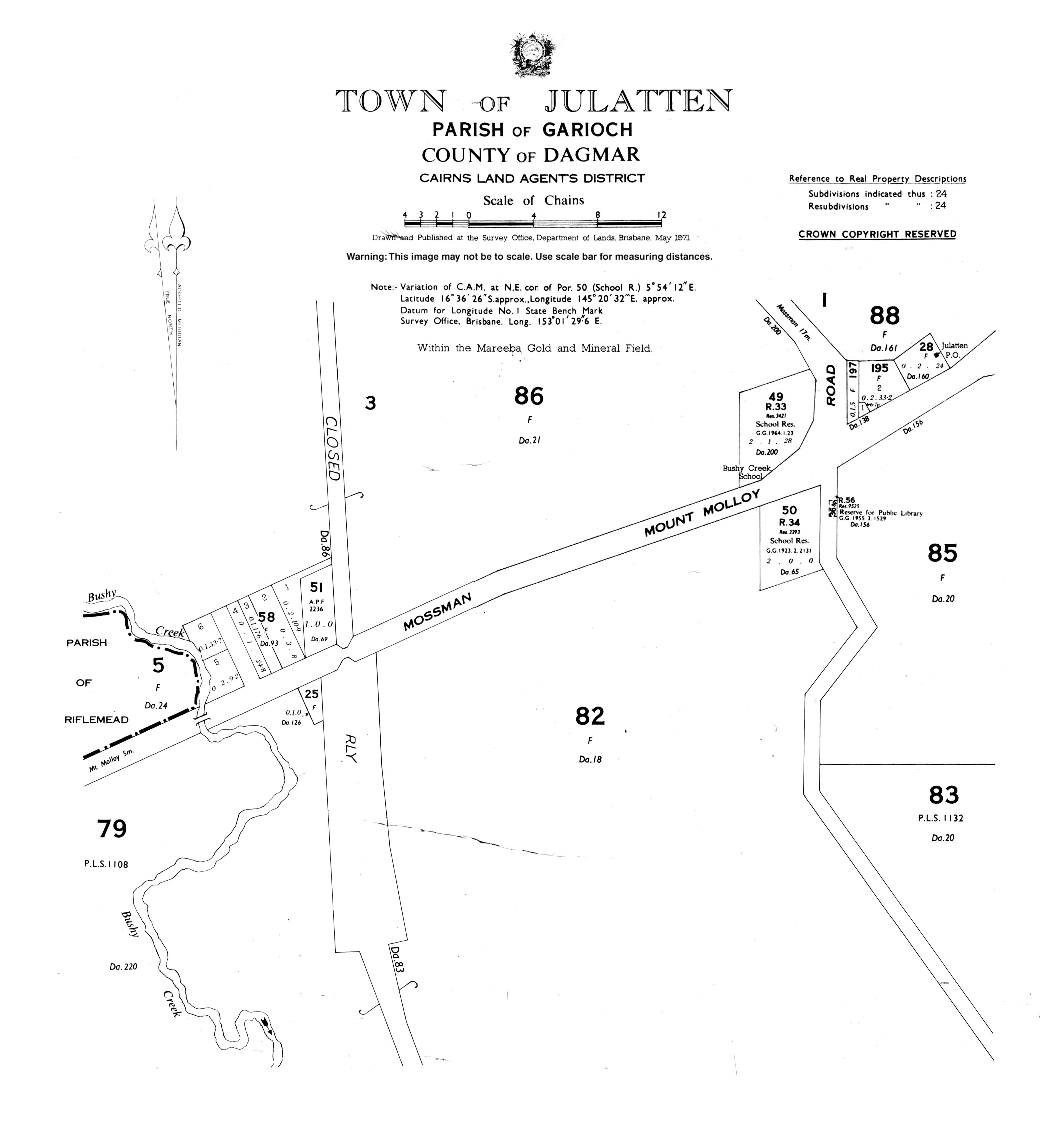
The Mossman - Mount Molloy Road (also known as the Rex Range Road) traverses the locality from the north-east on the coastal plain up to the south-west passing through the area of Julatten on the tableland. [4]

Julatten produces sugar cane and beef cattle and has barramundi farms.

History

The area, which was settled in the early 1920s and originally known as Bushy Creek, takes its name from the railway station, which in turn was named by the Queensland Railways Department and is an Aboriginal word meaning small creek. The railway was opened to Rumula on 5 December 1926. [2]

Bushy Creek State School opened on 27 August 1923. It was renamed Julatten State School in 1975. [5] [6]

In 1926, Charles May of Mossman proposed that a road should be built across the Great Dividing Range to connect Julatten with Mossman. After difficulties in choosing a route, The Mossman - Mount Molloy Road was officially opened on 2 January 1949 by the Queensland Minister for Agriculture Harold Collins. It was also named the Rex Range Road in honour of R.D. Rex, the Chairman of Douglas Shire who persisted in his efforts to see the road built. In January 2020, a memorial to Charles May was established on a lookout [7]

Euluma State School opened circa 1935 and closed circa 1951. [8]

Demographics

In the 2016 census, the locality of Julatten had a population of 1,091 people. [9]

In the 2021 census, the locality of Julatten had a population of 1,020 people. [1]

Education

Julatten State School, 2023 Julatten State School, 2023.jpg
Julatten State School, 2023

Julatten State School is a government primary (Prep-6) school for boys and girls at 1141 Euluma Creek Road ( 16°36′28″S145°20′32″E / 16.6077°S 145.3421°E / -16.6077; 145.3421 (Julatten State School) ). [10] [11] In 2016, the school had an enrolment of 69 students with 6 teachers (4 full-time equivalent) and 6 non-teaching staff (4 full-time equivalent). [12] In 2018, the school had an enrolment of 57 students with 5 teachers (4 full-time equivalent) and 5 non-teaching staff (3 full-time equivalent). [13]

There is no secondary school in Julatten. The nearest secondary school is Mossman State High School in Mossman to the north. [4]

Attractions

View from the Mossman Mount Molloy Road Lookout looking north towards the Coral Sea, 2016 View from the Mossman Mount Molloy Road Lookout, Julatten, 2016.jpg
View from the Mossman Mount Molloy Road Lookout looking north towards the Coral Sea, 2016
Monument commemorating the 1982 sealing of the Rex Range section of the Mossman Mount Molloy Road, 2016 Monument commemorating the 1982 sealing of the Rex Range section of the Mossman Mount Molloy Road, 2016 01.jpg
Monument commemorating the 1982 sealing of the Rex Range section of the Mossman Mount Molloy Road, 2016

On the ascent/descent of the range on the Mossman - Mount Molloy Road is the Lyons Lookout with a good view across the coastal areas to the north-east. [14] There is a memorial commemorating the sealing of the road. [15]

Julatten is a good area to see Wet Tropics bird species including endemic species. [16]

Buff breasted paradise kingfisher, 2014 Buff breasted paradise kingfisher.jpg
Buff breasted paradise kingfisher, 2014

Related Research Articles

<span class="mw-page-title-main">Atherton, Queensland</span> Town in Queensland, Australia

Atherton is a rural town and locality in the Tablelands Region, Queensland, Australia. In the 2021 census, the locality of Atherton had a population of 7,724 people.

<span class="mw-page-title-main">Kuranda, Queensland</span> Town in Queensland, Australia

Kuranda is a rural town and locality on the Atherton Tableland in the Shire of Mareeba, Queensland, Australia. It is 25 kilometres (16 mi) from Cairns, via the Kuranda Range road. It is surrounded by tropical rainforest and adjacent to the Wet Tropics of Queensland World Heritage listed Barron Gorge National Park. In the 2021 census, the locality of Kuranda had a population of 3,273 people.

<span class="mw-page-title-main">Mareeba</span> Town in Queensland, Australia

Mareeba is a rural town and locality in the Shire of Mareeba in Far North Queensland, Australia. Between 2008 and 2013, it was within the Tablelands Region. The town's name is derived from an Aboriginal word meaning meeting of the waters. In the 2021 census, the locality of Mareeba had a population of 11,825 people.

<span class="mw-page-title-main">Mount Mulligan, Queensland</span> Town in Queensland, Australia

Mount Mulligan is a former mining town and now a rural locality in the Shire of Mareeba, Queensland, Australia. In the 2021 census, the locality of Mount Mulligan had "no people or a very low population".

<span class="mw-page-title-main">Mutchilba, Queensland</span> Town in Queensland, Australia

Mutchilba is a rural town and locality in the Shire of Mareeba, in Far North Queensland, Australia. It is known for its production of mangoes.

<span class="mw-page-title-main">Mount Molloy, Queensland</span> Town in Queensland, Australia

Mount Molloy is a rural town and locality in the Shire of Mareeba, Queensland, Australia. It is a historic mining and timber town, 55 kilometres (34 mi) north of Cairns. The dominant industry in the area is cattle grazing; the town itself consists of a few shops and an old hotel. In the 2021 census, the locality of Mount Molloy had a population of 266 people.

<span class="mw-page-title-main">Irvinebank</span> Town in Queensland, Australia

Irvinebank is a rural town and locality in the Shire of Mareeba, Queensland, Australia. In the 2021 census, the locality of Irvinebank had a population of 113 people.

<span class="mw-page-title-main">Mount Carbine, Queensland</span> Town in Queensland, Australia

Mount Carbine is a rural town and locality in the Shire of Mareeba, Queensland, Australia. In the 2021 census, the locality of Mount Carbine had a population of 94 people.

<span class="mw-page-title-main">Watsonville, Queensland</span> Town in Queensland, Australia

Watsonville is a rural town and locality in the Shire of Mareeba, Queensland, Australia. In the 2021 census, the locality of Watsonville had a population of 176 people.

Bellevue is a rural locality in the Shire of Mareeba, Queensland, Australia. In the 2021 census, Bellevue had "no people or a very low population".

<span class="mw-page-title-main">Almaden, Queensland</span> Town in Queensland, Australia

Almaden is a rural town and locality in the Shire of Mareeba, Queensland, Australia. In the 2021 census, the locality of Almaden had a population of 41 people.

<span class="mw-page-title-main">Arriga, Queensland</span> Suburb of Shire of Mareeba, Queensland, Australia

Arriga is a rural locality in the Shire of Mareeba, Queensland, Australia. It has Queensland's largest wind farm. In the 2021 census, Arriga had a population of 1,323 people.

Cassowary is a rural locality in the Shire of Douglas, Queensland, Australia. In the 2021 census, Cassowary had a population of 119 people.

<span class="mw-page-title-main">Miallo, Queensland</span> Suburb of Shire of Douglas, Queensland, Australia

Miallo is a rural locality in the Shire of Douglas, Queensland, Australia. In the 2021 census, Miallo had a population of 406 people.

Biboohra is a rural town and locality in the Shire of Mareeba, Queensland, Australia. In the 2021 census, the locality of Biboohra had a population of 561 people.

Butchers Creek is a rural locality in the Tablelands Region, Queensland, Australia. In the 2021 census, Butchers Creek had a population of 85 people.

<span class="mw-page-title-main">Petford</span> Suburb of Shire of Mareeba, Queensland, Australia

Petford is a rural locality in the Shire of Mareeba, Queensland, Australia. In the 2021 census, Petford had a population of 22 people.

Fossilbrook is a rural locality in the Shire of Mareeba, Queensland, Australia. In the 2021 census, Fossilbrook had "no people or a very low population".

<span class="mw-page-title-main">Craiglie</span> Suburb of Shire of Douglas, Queensland, Australia

Craiglie is a coastal rural locality in the Shire of Douglas, Queensland, Australia. In the 2021 census, Craiglie had a population of 1,062 people.

<span class="mw-page-title-main">Shannonvale, Queensland</span> Suburb of Mossman, Queensland, Australia

Shannonvale is a rural locality in the Shire of Douglas, Queensland, Australia. Most of the locality forms part of the UNESCO World Heritage-listed Wet Tropics of Queensland, In the 2021 census, Shannonvale had a population of 194 people.

References

  1. 1 2 3 Australian Bureau of Statistics (28 June 2022). "Julatten (SAL)". 2021 Census QuickStats. Retrieved 28 February 2023. OOjs UI icon edit-ltr-progressive.svg
  2. 1 2 "Julatten – town in Shire of Mareeba (entry 17424)". Queensland Place Names. Queensland Government . Retrieved 28 December 2020.
  3. "Julatten – locality in Shire of Mareeba (entry 48686)". Queensland Place Names. Queensland Government . Retrieved 28 December 2020.
  4. 1 2 3 "Queensland Globe". State of Queensland . Retrieved 24 February 2021.
  5. Queensland Family History Society (2010), Queensland schools past and present (Version 1.01 ed.), Queensland Family History Society, ISBN   978-1-921171-26-0
  6. "Opening and closing dates of Queensland Schools". Queensland Government . Retrieved 18 April 2019.
  7. "Charles May Memorial Unveiling". Douglas Shire Council. 8 January 2020. Retrieved 27 January 2025.
  8. Queensland Family History Society (2010), Queensland schools past and present (Version 1.01 ed.), Queensland Family History Society, ISBN   978-1-921171-26-0
  9. Australian Bureau of Statistics (27 June 2017). "Julatten (SSC)". 2016 Census QuickStats. Retrieved 20 October 2018. OOjs UI icon edit-ltr-progressive.svg
  10. "State and non-state school details". Queensland Government. 9 July 2018. Archived from the original on 21 November 2018. Retrieved 21 November 2018.
  11. "Julatten State School" . Retrieved 21 November 2018.
  12. "Annual Report 2016" (PDF). Julatten State School. Archived (PDF) from the original on 2 October 2017. Retrieved 2 October 2017.
  13. "ACARA School Profile 2018". Australian Curriculum, Assessment and Reporting Authority . Retrieved 28 January 2020.
  14. "Lyons Lookout – lookout in Shire of Mareeba (entry 20312)". Queensland Place Names. Queensland Government . Retrieved 2 October 2017.
  15. "Memorial at Lyons Lookout" (Map). Google Maps . Retrieved 24 February 2021.
  16. "Information on Birding in Tropical North Queensland". Birding Queensland. Archived from the original on 14 September 2017. Retrieved 2 October 2017.