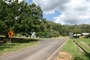
Shannonvale, Queensland

Last updated

Shannonvale
Queensland
Australia Queensland location map.svg
Red pog.svg
Shannonvale
Coordinates 16°30′47″S145°19′28″E / 16.5130°S 145.3244°E / -16.5130; 145.3244 (Shannonvale (centre of locality)) Coordinates: 16°30′47″S145°19′28″E / 16.5130°S 145.3244°E / -16.5130; 145.3244 (Shannonvale (centre of locality))
Population202 (2016 census) [1]
 • Density2.385/km2 (6.177/sq mi)
Postcode(s) 4873
Area84.7 km2 (32.7 sq mi)
Time zone AEST (UTC+10:00)
LGA(s) Shire of Douglas
State electorate(s) Cook
Federal Division(s) Leichhardt
Suburbs around Shannonvale:
Syndicate Mossman Gorge Mossman
Bonnie Doon
Mount Carbine Shannonvale Cassowary
Mount Carbine Julatten Julatten

Shannonvale is a rural locality in the Shire of Douglas, Queensland, Australia. [2] In the 2016 census Shannonvale had a population of 202 people. [1]

Contents

Geography

The Great Dividing Range passes through the location, which has the following named peaks: [3]

History

In the 2016 census Shannonvale had a population of 202 people. [1]

Related Research Articles

Mossman, Queensland Town in Queensland, Australia

Mossman is a town and a locality in Far North Queensland, Australia, on the Mossman River. It is within the local government area of Shire of Douglas. In the 2016 census, Mossman had a population of 1,937 people.

Mount Ommaney, Queensland Suburb of Brisbane, Queensland, Australia

Mount Ommaney is a south-western riverside suburb in the City of Brisbane, Queensland, Australia. The mountain of the same name is located within the locality. In the 2016 census, Mount Ommaney had a population of 2,360 people.

Bloomfield, Queensland Suburb of Shire of Cook, Queensland, Australia

Bloomfield is a town in the Shire of Cook and a coastal locality which is split between the Shire of Cook and the Shire of Douglas in Queensland, Australia. The neighbourhood of Ayton is within the locality. In the 2016 census, Bloomfield had a population of 204 people.

Kamerunga, Queensland Suburb of Cairns, Queensland, Australia

Kamerunga is a suburb of Cairns in the Cairns Region, Queensland, Australia. In the 2016 census Kamerunga had a population of 1,049 people.

Bare Hill is a mountain in the locality of Koah in the Shire of Mareeba in North Queensland, Australia. It is located in the Bare Hill Conservation Park and is noted for its significant Aboriginal rock art. Bare Hill rises to 841 metres (2,759 ft) above sea level.

Lawn Hill, Queensland Suburb of Shire of Burke, Queensland, Australia

Lawn Hill is an outback locality split between the Shire of Burke and the City of Mount Isa in Queensland, Australia. The locality is on the Queensland border with the Northern Territory. In the 2016 census Lawn Hill had a population of 19 people.

Majors Creek, Queensland Suburb of City of Townsville, Queensland, Australia

Majors Creek is a locality split between the City of Townsville and the Shire of Burdekin, Queensland, Australia. In the 2016 census Majors Creek had a population of 329 people.

Miallo, Queensland Suburb of Shire of Douglas, Queensland, Australia

Miallo is a locality in the Shire of Douglas, Queensland, Australia. In the 2016 census, Miallo had a population of 376 people.

Mount Fox, Queensland Suburb of Shire of Hinchinbrook, Queensland, Australia

Mount Fox is a rural locality in the Shire of Hinchinbrook, Queensland, Australia. In the 2016 census Mount Fox had a population of 87 people.

Cordelia, Queensland Suburb of Shire of Hinchinbrook, Queensland, Australia

Cordelia is a rural locality in the Shire of Hinchinbrook, Queensland, Australia. In the 2016 census Cordelia had a population of 210 people.

Chewko Suburb of Shire of Mareeba, Queensland, Australia

Chewko is a rural locality in the Shire of Mareeba, Queensland, Australia. In the 2016 census Chewko had a population of 194 people.

Mowbray, Queensland Suburb of Shire of Douglas, Queensland, Australia

Mowbray is a coastal locality in the Shire of Douglas, Queensland, Australia. In the 2016 census, Mowbray had a population of 321 people.

Mount Gardiner, Queensland Suburb of Livingstone Shire, Queensland, Australia

Mount Gardiner is a rural locality in the Livingstone Shire, Queensland, Australia. In the 2016 census Mount Gardiner had a population of 34 people.

Gheerulla Suburb of Sunshine Coast Region, Queensland, Australia

Gheerulla is a rural locality in the Sunshine Coast Region, Queensland, Australia. In the 2016 census Gheerulla had a population of 214 people.

Whyanbeel Suburb of Shire of Douglas, Queensland, Australia

Whyanbeel is a rural locality in the Shire of Douglas, Queensland, Australia. In the 2016 census, Whyanbeel had a population of 160 people.

Minerva, Queensland Suburb of Central Highlands Region, Queensland, Australia

Minerva is a rural locality in the Central Highlands Region, Queensland, Australia. In the 2016 census Minerva had a population of 48 people.

Kunwarara, Queensland Suburb of Livingstone Shire, Queensland, Australia

Kunwarara is a rural locality in the Livingstone Shire, Queensland, Australia. In the 2016 census Kunwarara had a population of 71 people.

Mamu, Queensland Suburb of Cassowary Coast Region, Queensland, Australia

Mamu is a rural locality in the Cassowary Coast Region, Queensland, Australia. In the 2016 census Mamu had a population of 0 people.

Gulngai, Queensland Suburb of Cassowary Coast Region, Queensland, Australia

Gulngai is a rural locality in the Cassowary Coast Region, Queensland, Australia. In the 2016 census, Gulngai had a population of 0 people.

Walter Hill, Queensland Suburb of Cassowary Coast Region, Queensland, Australia

Walter Hill is a rural locality in the Cassowary Coast Region, Queensland, Australia. In the 2016 census, Walter Hill had a population of 0 people.

References

  1. 1 2 3 Australian Bureau of Statistics (27 June 2017). "Shannonvale (SSC)". 2016 Census QuickStats. Retrieved 20 October 2018. OOjs UI icon edit-ltr-progressive.svg
  2. "Shannonvale - locality in Shire of Douglas (entry 48865)". Queensland Place Names. Queensland Government . Retrieved 27 December 2020.
  3. "Queensland Globe". State of Queensland . Retrieved 26 January 2021.
  4. 1 2 3 4 "Mountain peaks and capes - Queensland". Queensland Open Data. Queensland Government. 12 November 2020. Archived from the original on 25 November 2020. Retrieved 25 November 2020.
  5. "Mount Demi - mountain in Douglas Shire (entry 9715)". Queensland Place Names. Queensland Government . Retrieved 25 November 2020.
  6. "Perseverance Mountain - mountain in Douglas Shire (entry 26490)". Queensland Place Names. Queensland Government . Retrieved 25 November 2020.
  7. "Round Mountain - mountain in Douglas Shire (entry 29185)". Queensland Place Names. Queensland Government . Retrieved 25 November 2020.
  8. "The Bluff - mountain in Douglas Shire (entry 50300)". Queensland Place Names. Queensland Government . Retrieved 25 November 2020.