Daintree is a rural town and locality in the Shire of Douglas, Queensland, Australia. In the 2016 census, Daintree had a population of 129 people.

Cape Tribulation is a headland and coastal locality in the Shire of Douglas in northern Queensland, Australia. In the 2016 census, Cape Tribulation had a population of 118 people.

Mossman is a rural town and locality in the Shire of Douglas, Queensland, Australia. It is the administrative centre for the Douglas Shire Council In the 2016 census, the locality of Mossman had a population of 1,937 people.

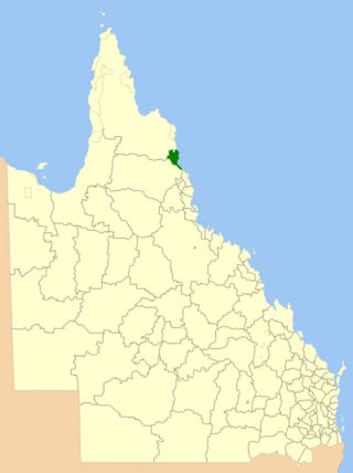
The Shire of Douglas is a local government area in Far North Queensland. It is located on the coast north of the city of Cairns. The shire, administered from the town of Mossman, covers an area of 2,428 square kilometres (937.5 sq mi), and existed as a local government entity from 1880 until 2008, when it was amalgamated with the City of Cairns to become the Cairns Region. Following a poll in 2013, the Shire of Douglas was re-established on 1 January 2014.

The Wujal Wujal Aboriginal Shire is a local government area in Far North Queensland, Australia. It is managed as a Deed of Grant in Trust under the Local Government Act 2004.

Bloomfield is a town in the Shire of Cook and a coastal locality which is split between the Shire of Cook and the Shire of Douglas in Queensland, Australia. The neighbourhood of Ayton is within the locality. In the 2016 census, Bloomfield had a population of 204 people.

Palmer is a rural locality in the Shire of Cook, Queensland, Australia. In the 2021 census, Palmer had a population of 46 people.
Bonnie Doon is a coastal rural locality in the Shire of Douglas, Queensland, Australia. In the 2016 census, Bonnie Doon had a population of 372 people.
Cassowary is a rural locality in the Shire of Douglas, Queensland, Australia. In the 2016 census Cassowary had a population of 119 people.
Mowbray is a coastal locality in the Shire of Douglas, Queensland, Australia. In the 2016 census, Mowbray had a population of 321 people.

Whyanbeel is a rural locality in the Shire of Douglas, Queensland, Australia. In the 2016 census, Whyanbeel had a population of 160 people.
Killaloe is a coastal rural locality in the Shire of Douglas, Queensland, Australia. In the 2016 census, Killaloe had a population of 116 people.

Rocky Point is a coastal rural locality in the Shire of Douglas, Queensland, Australia. In the 2016 census, Rocky Point had a population of 129 people.

Newell is a coastal town and rural locality in the Shire of Douglas, Queensland, Australia. It is a sugarcane growing district.
Cooya Beach is a coastal town and locality in the Shire of Douglas, Queensland, Australia. In the 2016 census, the locality of Cooya Beach had a population of 546 people.

Oak Beach is a coastal town and locality in the Shire of Douglas, Queensland, Australia. In the 2016 census, the locality of Oak Beach had a population of 195 people.

Lower Daintree is a coastal rural locality in the Shire of Douglas, Queensland, Australia. In the 2021 census, Lower Daintree had a population of 83 people.

Forest Creek is a locality in the Shire of Douglas, Queensland, Australia. In the 2021 census, Forest Creek had a population of 136 people.
Finlayvale is a rural locality in the Shire of Douglas, Queensland, Australia. In the 2016 census, Finlayvale had a population of 32 people.
Mount Mulgrave is a rural locality in the Shire of Mareeba, Queensland, Australia. In the 2016 census, Mount Mulgrave had a population of 0 people.


