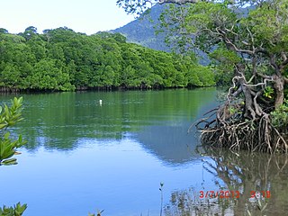
Mossman is a rural town and locality in the Shire of Douglas, Queensland, Australia. It is the administrative centre for the Douglas Shire Council In the 2016 census, the locality of Mossman had a population of 1,937 people.

Bloomfield is a town in the Shire of Cook and a coastal locality which is split between the Shire of Cook and the Shire of Douglas in Queensland, Australia. The neighbourhood of Ayton is within the locality. In the 2016 census, Bloomfield had a population of 204 people.

Miallo is a rural locality in the Shire of Douglas, Queensland, Australia. In the 2016 census, Miallo had a population of 376 people.
Biboohra is a rural town and locality in the Shire of Mareeba, Queensland, Australia. In the 2021 census, the locality of Biboohra had a population of 561 people.

Mowbray is a coastal locality in the Shire of Douglas, Queensland, Australia. In the 2021 census, Mowbray had a population of 362 people.

Cow Bay is a coastal locality in the Shire of Douglas, Queensland, Australia. In the 2021 census, Cow Bay had a population of 220 people.

Rocky Point is a coastal rural locality in the Shire of Douglas, Queensland, Australia. In the 2016 census, Rocky Point had a population of 129 people.

Mulgrave is a rural locality in the Shire of Burdekin, Queensland, Australia. In the 2021 census, Mulgrave had a population of 19 people.
Kirknie is a rural locality in the Shire of Burdekin, Queensland, Australia. In the 2021 census, Kirknie had a population of 70 people.

Newell is a coastal town and rural locality in the Shire of Douglas, Queensland, Australia. It is a sugarcane growing district.
Cooya Beach is a coastal town and locality in the Shire of Douglas, Queensland, Australia. In the 2016 census, the locality of Cooya Beach had a population of 546 people.

Oak Beach is a coastal town and locality in the Shire of Douglas, Queensland, Australia. In the 2016 census, the locality of Oak Beach had a population of 195 people.

Diwan is a coastal locality in the Shire of Douglas, Queensland, Australia. In the 2021 census, Diwan had a population of 169 people.
Humeburn is a locality in the Shire of Paroo, Queensland, Australia. In the 2021 census, Humeburn had a population of 9 people.

Lower Daintree is a coastal rural locality in the Shire of Douglas, Queensland, Australia. In the 2021 census, Lower Daintree had a population of 83 people.

Kimberley is a coastal locality in the Shire of Douglas, Queensland, Australia. In the 2021 census, Kimberley had a population of 28 people.

Forest Creek is a locality in the Shire of Douglas, Queensland, Australia. In the 2021 census, Forest Creek had a population of 136 people.
Garrawalt is a rural locality in the Shire of Hinchinbrook, Queensland, Australia.
Jaffa is a rural locality in the Cassowary Coast Region, Queensland, Australia. In the 2021 census, Jaffa had a population of 35 people.
Maadi is a rural locality in the Cassowary Coast Region, Queensland, Australia. In the 2021 census, Maadi had a population of 49 people.


