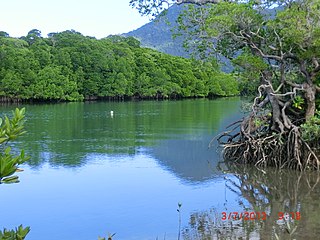
Port Douglas is a coastal town and locality in the Shire of Douglas, Queensland, Australia, approximately 60 km north of Cairns.

Woody Island is about 25 km (16 mi) northeast of Port Douglas in Trinity Bay, Far North Queensland, Australia.
Low Island is an island lying about 25 km (16 mi) north-east of Port Douglas in Trinity Bay, North Queensland. It is around 2 hectares or 0.02 square km in size. It is part of the Low Isles, along with Woody Island, an uninhabited coral and mangrove island. The isles are surrounded by 55 acres (220,000 m2) of reef. The Low Islets are a Marine National Park Zone. Day visitors come to the island on a daily basis via a number of commercial operators. There is a lagoon where private vessel can moor or anchor outside the reef protection markers overnight, but there is no overnight accommodation on the island. There is a weather station and an active lighthouse. No fishing is allowed in the lagoon or within a buffer zone around the islands. Motorised water sports are not permitted in the locality. There is a 6 knot limit. No open fires of any sort or dogs permitted on either island. No island access between sunset and sunrise.

Mount Carbine is a rural town and locality in the Shire of Mareeba, Queensland, Australia. In the 2021 census, the locality of Mount Carbine had a population of 94 people.

Low Isles Light, also known as Low Islets Light or Low Island Light, is an active lighthouse located on Low Island, a coral cay which together with Woody Island forms the Low Isles group, about 13 kilometres (8.1 mi) northeast of Port Douglas, Queensland, Australia. The island is situated on the western edge of the main shipping channel into the harbour of Port Douglas, and it marks the entrance to the channel. Built in 1878, it was the first lighthouse in Far North Queensland and more specifically the first to light the Inner Passage of the Great Barrier Reef. Its construction is typical to Queensland lighthouses of the time, timber frame clad with galvanized iron, and it is the fourth lighthouse of this type constructed in Queensland, though it is the first of them to use portholes.
Rossville is a town and coastal locality in the Shire of Cook, Queensland, Australia. In the 2021 census, the locality of Rossville had a population of 253 people.

Bloomfield is a rural town in the Shire of Cook and a coastal locality which is split between the Shire of Cook and the Shire of Douglas in Queensland, Australia. The neighbourhood of Ayton is within the locality. In the 2021 census, the locality of Bloomfield had a population of 228 people.

Miallo is a rural locality in the Shire of Douglas, Queensland, Australia. In the 2021 census, Miallo had a population of 406 people.

Mowbray is a coastal locality in the Shire of Douglas, Queensland, Australia. In the 2021 census, Mowbray had a population of 362 people.

Cow Bay is a coastal locality in the Shire of Douglas, Queensland, Australia. In the 2021 census, Cow Bay had a population of 220 people.

Whyanbeel is a rural locality in the Shire of Douglas, Queensland, Australia. In the 2021 census, Whyanbeel had a population of 172 people.

Rocky Point is a coastal rural locality in the Shire of Douglas, Queensland, Australia. In the 2021 census, Rocky Point had a population of 145 people.

Newell is a coastal town and rural locality in the Shire of Douglas, Queensland, Australia. It is a sugarcane growing district.
Cooya Beach is a coastal town and locality in the Shire of Douglas, Queensland, Australia. In the 2021 census, the locality of Cooya Beach had a population of 523 people.

Oak Beach is a coastal town and locality in the Shire of Douglas, Queensland, Australia. In the 2021 census, the locality of Oak Beach had a population of 186 people.

Diwan is a coastal locality in the Shire of Douglas, Queensland, Australia. In the 2021 census, Diwan had a population of 169 people.

Lower Daintree is a coastal rural locality in the Shire of Douglas, Queensland, Australia. In the 2021 census, Lower Daintree had a population of 83 people.

Kimberley is a coastal locality in the Shire of Douglas, Queensland, Australia. In the 2021 census, Kimberley had a population of 28 people.

Forest Creek is a locality in the Shire of Douglas, Queensland, Australia. In the 2021 census, Forest Creek had a population of 136 people.

Lizard is an offshore locality consisting of a number of islands in the Great Barrier Reef area of the Coral Sea within the Shire of Cook, Queensland, Australia. It includes Lizard Island. In the 2021 census, Lizard had a population of 65 people.


