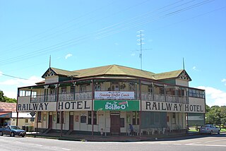
Moonie is a rural town in the Western Downs Region and a locality split between the Western Downs Region and the Goondiwindi Region in Queensland, Australia. At the 2016 Census, Moonie had a population of 189.

Jambin is a town and locality in the Shire of Banana, Queensland, Australia.

Banks Creek is a rural locality split between the City of Brisbane and Somerset Region in Queensland, Australia. The locality is also split for the purposes of state and federal elections. In the 2016 census, Banks Creek had a population of 5 people.

Imbil is a rural town and locality in the Gympie Region, Queensland, Australia. In the 2016 census, Imbil had a population of 924 people.

The Aboriginal Shire of Woorabinda is a local government area in Central Queensland, Australia.

Gunalda is a town in the Gympie Region and a locality split between Gympie Region and Fraser Coast Region in Queensland, Australia. In the 2016 census, Gunalda had a population of 392 people.

Bells Creek is a mostly rural locality in the Sunshine Coast Region, Queensland, Australia. In the 2016 census, Bells Creek had a population of 94 people.

Anduramba is a rural locality in the Toowoomba Region, Queensland, Australia. In the 2016 census, Anduramba had a population of 77 people.

Captains Mountain is a locality in the Toowoomba Region, Queensland, Australia. In the 2016 census, Captains Mountain had a population of 77 people.

Spring Creek is a locality split between the Toowoomba Region and the Southern Downs Region, Queensland, Australia.

North Isis is a locality in the Bundaberg Region, Queensland, Australia.

Cassowary is a locality in the Shire of Douglas, Queensland, Australia.

Miallo is a locality in the Shire of Douglas, Queensland, Australia. In the 2016 census, Miallo had a population of 376 people.

Cawdor is a rural locality in the Toowoomba Region, Queensland, Australia. In the 2016 census, Cawdor had a population of 356 people.

Upper Pilton is a locality split between the Toowoomba Region and the Southern Downs Region, both in Queensland, Australia. In the 2016 census, Upper Pilton had a population of 63 people.

Irvingdale is a locality split between the Toowoomba Region and the Western Downs Region, both in Queensland, Australia. In the 2016 census, Irvingdale had a population of 194 people.

Western Creek is a locality in the Toowoomba Region, Queensland, Australia. In the 2016 census, Western Creek had a population of 15 people.

Bulli Creek is a locality in the Toowoomba Region, Queensland, Australia. In the 2016 census, Bulli Creek had a population of 6 people.

Sabine is a rural locality in the Toowoomba Region, Queensland, Australia. In the 2016 census, Sabine had a population of 9 people.

Bamboo Creek is a rural locality in the Cassowary Coast Region, Queensland, Australia. In the 2016 census, Bamboo Creek had a population of 94 people.


