Koah

Last updated

Koah
Queensland
Gane Brothers felling a large tree with a crosscut saw, near Koah, North Queensland, circa 1930.jpg
Gane Brothers felling a large tree with a crosscut saw, near Koah, circa 1930
Australia Queensland location map.svg
Red pog.svg
Koah
Coordinates 16°54′21″S145°33′27″E / 16.9058°S 145.5575°E / -16.9058; 145.5575 (Koah (centre of locality))
Population676 (2021 census) [1]
 • Density3.0018/km2 (7.775/sq mi)
Postcode(s) 4881
Area225.2 km2 (87.0 sq mi)
Time zone AEST (UTC+10:00)
Location
LGA(s) Shire of Mareeba
State electorate(s)
Federal division(s)
Suburbs around Koah:
Biboohra Mona Mona Kuranda
Biboohra Koah Speewah
Mareeba Lamb Range Barron Gorge

Koah is a rural locality in the Shire of Mareeba, Queensland, Australia. [2] In the 2021 census, Koah had a population of 676 people. [1]

Contents

Geography

The Barron River enters the locality from the north-west (Biboorha) and loosely follows the locality's northern boundary before exiting to the north-east (Mona Mona / Kuranda). The Clohesy River rises in the south of the locality and flows north through the locality becoming a tributary of the Barron River in the north of the locality ( 16°49′19″S145°30′45″E / 16.822003°S 145.512503°E / -16.822003; 145.512503 (Clohesy River (mouth)) ). [3] The river was named after Thomas Clohesy, a police inspector who served in North Queensland for many years. [4]

The Tablelands railway line enters the locality from the north-east (Kuranda) and passes through the north of the locality (but south of the river), before exiting to the north-west (Bibhoora). The locality is served by Koah railway station ( 16°49′26″S145°30′33″E / 16.8240°S 145.5092°E / -16.8240; 145.5092 (Koah railway station) ). [5] [6]

The Kennedy Highway enters the locality from the east (Kuranda / Speewah) and exits to the south-west (Mareeba). [6]

Bare Hill lies in the south of the locality ( 16°59′09″S145°35′37″E / 16.9859°S 145.5937°E / -16.9859; 145.5937 (Bare Hill) ), rising 841 metres (2,759 ft) above sea level. [7] [8]

Many parts of the locality are within protected areas. The Bilwon State Forest is in the west and north-west of the locality. In the south-west of the locality are the Dinden State Fores and the Dinden West Forest Reserve. The Bare Hill Conservation Park is in the south of the locality and the Dinden National Park is in the south-east of the locality. [9]

Apart from the protected areas, the land use is a mixture of rural residential housing and crop growing along the Clohesy River and grazing on native vegetation away from the river. [10]

Demographics

In the 2016 census, Koah had a population of 602 people. [11]

In the 2021 census, Koah had a population of 676 people. [1]

Education

There are no schools in Koah. The nearest government primary schools are Mareeba State School in neighbouring Mareeba to the south-west, Biboohra State School in neighbouring Biboohra to the west, and Kuranda State School in Kuranda to the east. The nearest government secondary schools are Kuranda District State College in Kuranda and Mareeba State High School in Mareeba. [12]

Amenities

Mususeci Park is at 322 Koah Road ( 16°52′33″S145°33′00″E / 16.8759°S 145.5499°E / -16.8759; 145.5499 (Musumeci Park) ). [13] The park features Koah Hall, facilities for tennis and basketball, and a playground. [14] The park also hosts the Koah Fural Fire Service. [15]

Events

Koah Hall hosts regular classes and workshops. The Koah Monthly Markets are held at the hall on the first Saturday of every month (excluding January and February). [14]

Related Research Articles

<span class="mw-page-title-main">Dimbulah, Queensland</span> Town in Queensland, Australia

Dimbulah is a rural town and locality in Far North Queensland, Australia, 114 kilometres (71 mi) from Cairns by road, on the Atherton Tableland. It is within the local government area of Shire of Mareeba. In the 2021 census, the locality of Dimbulah had a population of 975 people, a decrease from the 1,050 people in the 2016 census.

<span class="mw-page-title-main">Kuranda, Queensland</span> Town in Queensland, Australia

Kuranda is a rural town and locality on the Atherton Tableland in the Shire of Mareeba, Queensland, Australia. It is 25 kilometres (16 mi) from Cairns, via the Kuranda Range road. It is surrounded by tropical rainforest and adjacent to the Wet Tropics of Queensland World Heritage listed Barron Gorge National Park. In the 2021 census, the locality of Kuranda had a population of 3,273 people.

<span class="mw-page-title-main">Mareeba</span> Town in Queensland, Australia

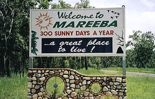
Mareeba is a rural town and locality in the Shire of Mareeba in Far North Queensland, Australia. Between 2008 and 2013, it was within the Tablelands Region. The town's name is derived from an Aboriginal word meaning meeting of the waters. In the 2021 census, the locality of Mareeba had a population of 11,825 people.

<span class="mw-page-title-main">Clifton Beach, Queensland</span> Suburb of Cairns, Queensland, Australia

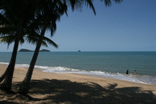
Clifton Beach is a coastal suburb in the Cairns Region, Queensland, Australia. In the 2021 census, Clifton Beach had a population of 3,192 people.

<span class="mw-page-title-main">Mutchilba, Queensland</span> Town in Queensland, Australia

Mutchilba is a rural town and locality in the Shire of Mareeba, in Far North Queensland, Australia. It is known for its production of mangoes.

<span class="mw-page-title-main">Mount Molloy, Queensland</span> Town in Queensland, Australia

Mount Molloy is a rural town and locality in the Shire of Mareeba, Queensland, Australia. It is a historic mining and timber town, 55 kilometres (34 mi) north of Cairns. The dominant industry in the area is cattle grazing; the town itself consists of a few shops and an old hotel. In the 2021 census, the locality of Mount Molloy had a population of 266 people.

<span class="mw-page-title-main">Shire of Mareeba</span> Local government area in Queensland, Australia

The Shire of Mareeba is a local government area at the base of Cape York Peninsula in Far North Queensland, inland from Cairns. The shire, administered from the town of Mareeba, covered an area of 53,491 square kilometres (20,653.0 sq mi), and existed as a local government entity from 1879 until 2008, when it amalgamated with several councils in the Atherton Tableland area to become the Tablelands Region.

<span class="mw-page-title-main">Irvinebank</span> Town in Queensland, Australia

Irvinebank is a rural town and locality in the Shire of Mareeba, Queensland, Australia. In the 2021 census, the locality of Irvinebank had a population of 113 people.

<span class="mw-page-title-main">Mount Carbine, Queensland</span> Town in Queensland, Australia

Mount Carbine is a rural town and locality in the Shire of Mareeba, Queensland, Australia. In the 2021 census, the locality of Mount Carbine had a population of 94 people.

<span class="mw-page-title-main">Watsonville, Queensland</span> Town in Queensland, Australia

Watsonville is a rural town and locality in the Shire of Mareeba, Queensland, Australia. In the 2021 census, the locality of Watsonville had a population of 176 people.

Bare Hill is a mountain in the locality of Koah in the Shire of Mareeba in North Queensland, Australia. It is located in the Bare Hill Conservation Park and is noted for its significant Aboriginal rock art. Bare Hill rises to 841 metres (2,759 ft) above sea level.

<span class="mw-page-title-main">Arriga, Queensland</span> Suburb of Shire of Mareeba, Queensland, Australia

Arriga is a rural locality in the Shire of Mareeba, Queensland, Australia. It has Queensland's largest wind farm. In the 2021 census, Arriga had a population of 1,323 people.

Biboohra is a rural town and locality in the Shire of Mareeba, Queensland, Australia. In the 2021 census, the locality of Biboohra had a population of 561 people.

<span class="mw-page-title-main">Etna Creek</span> Suburb of Livingstone Shire, Queensland, Australia

Etna Creek is a rural locality in the Livingstone Shire, Queensland, Australia. In the 2021 census, Etna Creek had a population of 1,029 people.

<span class="mw-page-title-main">Chewko</span> Suburb of Shire of Mareeba, Queensland, Australia

Chewko is a rural locality in the Shire of Mareeba, Queensland, Australia. In the 2021 census, Chewko had a population of 213 people.

<span class="mw-page-title-main">Whyanbeel</span> Suburb of Shire of Douglas, Queensland, Australia

Whyanbeel is a rural locality in the Shire of Douglas, Queensland, Australia. In the 2021 census, Whyanbeel had a population of 172 people.

<span class="mw-page-title-main">Barron, Queensland</span> Suburb of Cairns, Queensland, Australia

Barron is a suburb of Cairns in the Cairns Region, Queensland, Australia. In the 2021 census, Barron had a population of 68 people.

<span class="mw-page-title-main">Macalister Range, Queensland</span> Suburb of Cairns Region, Queensland, Australia

Macalister Range is a coastal locality in the Cairns Region, Queensland, Australia. In the 2021 census, Macalister Range had "no people or a very low population".

Speewah is a locality in the Shire of Mareeba, Queensland, Australia. In the 2021 census, Speewah had a population of 850 people.

Glendale is a rural locality in the Shire of Livingstone, Queensland, Australia. In the 2021 census, Glendale had a population of 600 people.

References

  1. 1 2 3 Australian Bureau of Statistics (28 June 2022). "Koah (SAL)". 2021 Census QuickStats. Retrieved 28 February 2023. OOjs UI icon edit-ltr-progressive.svg
  2. "Koah – locality in Shire of Mareeba (entry 48707)". Queensland Place Names. Queensland Government . Retrieved 28 December 2020.
  3. "Layers: Locality; Mountains and ranges; Contours; Watercourses". Queensland Globe. Queensland Government. Archived from the original on 19 December 2017. Retrieved 4 September 2024.
  4. "Clohesy River – watercourse in the Shire of Mareeba (entry 7466)". Queensland Place Names. Queensland Government . Retrieved 6 September 2024.
  5. "Railway stations and sidings - Queensland". Queensland Open Data. Queensland Government. 2 October 2020. Archived from the original on 5 October 2020. Retrieved 5 October 2020.
  6. 1 2 "Layers: Locality; Road and rail". Queensland Globe. Queensland Government. Archived from the original on 19 December 2017. Retrieved 4 September 2024.
  7. "Mountain peaks and capes - Queensland". Queensland Open Data. Queensland Government. 12 November 2020. Archived from the original on 25 November 2020. Retrieved 25 November 2020.
  8. "Bare Hill – mountain in Mareeba Shire (entry 1606)". Queensland Place Names. Queensland Government . Retrieved 25 November 2020.
  9. "Layers: Locality; Protected areas and forests; Land use". Queensland Globe. Queensland Government. Archived from the original on 19 December 2017. Retrieved 5 September 2024.
  10. "Layers: Locality; Protected areas and forests; Land use; Land parcel". Queensland Globe. Queensland Government. Archived from the original on 19 December 2017. Retrieved 5 September 2024.
  11. Australian Bureau of Statistics (27 June 2017). "Koah (SSC)". 2016 Census QuickStats. Retrieved 20 October 2018. OOjs UI icon edit-ltr-progressive.svg
  12. "Layers: Locality; Schools and school catchments". Queensland Globe. Queensland Government. Archived from the original on 19 December 2017. Retrieved 4 September 2024.
  13. "Parks & Recreation Areas". Mareeba Shire Council. Archived from the original on 24 May 2024. Retrieved 5 September 2024.
  14. 1 2 "Koah Hall". Archived from the original on 28 February 2024. Retrieved 6 September 2024.
  15. "Musumeci Park". Google Street View . Google. September 2021. Retrieved 6 September 2024.