Hurricane, Queensland

Last updated

Hurricane
Queensland
Australia Queensland location map.svg
Red pog.svg
Hurricane
Coordinates 16°31′18″S144°36′55″E / 16.5216°S 144.6152°E / -16.5216; 144.6152 (Hurricane (centre of locality))
Population0 (2021 census) [1]
 • Density0.0000/km2 (0.0000/sq mi)
Postcode(s) 4871
Area1,060.5 km2 (409.5 sq mi)
Time zone AEST (UTC+10:00)
Location195 km (121 mi) NW of Cairns
LGA(s) Shire of Mareeba
State electorate(s) Cook
Federal division(s)
Suburbs around Hurricane:
Groganville Lakeland Desailly
Bellevue Hurricane Mount Carbine
Nychum Mount Mulligan Mount Mulligan

Hurricane is a rural locality in the Shire of Mareeba, Queensland, Australia. [2] In the 2021 census, Hurricane had "no people or a very low population". [1]

Contents

Geography

Hurricane is located west of Mount Carbine and the Mulligan Highway, and is on the Mitchell River, which flows through the eastern section and then forms the south-western boundary. [3] The Hodgkinson River, a tributary of the Mitchell, also flows through the eastern section. The St George River, also a tributary of the Mitchell, flows through the northern section and forms part of the north-western boundary. Much of the land in Hurricane consists of shaly or greywacke ridges. [4]

The land use is grazing on native vegetation. [5]

Demographics

In the 2016 census Hurricane had a population of 17 people. [6]

In the 2021 census, Hurricane had "no people or a very low population". [1]

Economy

There are a number of homesteads in the locality, including cattle stations: [7] [8]

The entry gate to Hurricane station homestead is 195 kilometres (121 mi) north-west of Cairns via the Captain Cook Highway, Kennedy Highway, Mulligan Highway and Hurricane Road.

Attractions

Karma Waters station provides a bush camping experience for a limited number of guests. [9]

Related Research Articles

<span class="mw-page-title-main">Chillagoe, Queensland</span> Town in Queensland, Australia

Chillagoe is a rural town and locality in the Shire of Mareeba, Queensland, Australia. In the 2021 census, the locality of Chillagoe had a population of 214 people.

<span class="mw-page-title-main">Lakeland, Queensland</span> Town in Queensland, Australia

Lakeland is a rural town and locality in the Shire of Cook, Queensland, Australia. In the 2021 census, the locality of Lakeland had a population of 333 people.

<span class="mw-page-title-main">Mareeba</span> Town in Queensland, Australia

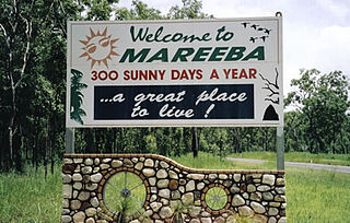
Mareeba is a rural town and locality in the Shire of Mareeba in Far North Queensland, Australia. Between 2008 and 2013, it was within the Tablelands Region. The town's name is derived from an Aboriginal word meaning meeting of the waters. In the 2021 census, the locality of Mareeba had a population of 11,825 people.

<span class="mw-page-title-main">Mutchilba, Queensland</span> Town in Queensland, Australia

Mutchilba is a rural town and locality in the Shire of Mareeba, in Far North Queensland, Australia. It is known for its production of mangoes.

<span class="mw-page-title-main">Mount Molloy, Queensland</span> Town in Queensland, Australia

Mount Molloy is a rural town and locality in the Shire of Mareeba, Queensland, Australia. It is a historic mining and timber town, 55 kilometres (34 mi) north of Cairns. The dominant industry in the area is cattle grazing; the town itself consists of a few shops and an old hotel. In the 2021 census, the locality of Mount Molloy had a population of 266 people.

<span class="mw-page-title-main">Irvinebank</span> Town in Queensland, Australia

Irvinebank is a rural town and locality in the Shire of Mareeba, Queensland, Australia. In the 2021 census, the locality of Irvinebank had a population of 113 people.

<span class="mw-page-title-main">Mount Carbine, Queensland</span> Town in Queensland, Australia

Mount Carbine is a rural town and locality in the Shire of Mareeba, Queensland, Australia. In the 2021 census, the locality of Mount Carbine had a population of 94 people.

Groganville is a rural locality in the Shire of Mareeba, Queensland, Australia. It was formerly a mining town. In the 2021 census, the locality of Groganville had "no people or a very low population".

<span class="mw-page-title-main">Almaden, Queensland</span> Town in Queensland, Australia

Almaden is a rural town and locality in the Shire of Mareeba, Queensland, Australia. In the 2021 census, the locality of Almaden had a population of 41 people.

Biboohra is a rural town and locality in the Shire of Mareeba, Queensland, Australia. In the 2021 census, the locality of Biboohra had a population of 561 people.

<span class="mw-page-title-main">Petford</span> Suburb of Shire of Mareeba, Queensland, Australia

Petford is a rural locality in the Shire of Mareeba, Queensland, Australia. In the 2021 census, Petford had a population of 22 people.

Strathmore is a locality split between the Shire of Mareeba and the Shire of Etheridge, in Queensland, Australia. In the 2021 census, Strathmore had "no people or a very low population".

<span class="mw-page-title-main">Southedge</span> Suburb of Shire of Mareeba, Queensland, Australia

Southedge is a rural locality in the Shire of Mareeba, Queensland, Australia. In the 2021 census, Southedge had a population of 21 people.

Rookwood is a rural locality in the Shire of Mareeba, Queensland, Australia. In the 2021 census, Rookwood had a population of 9 people.

Nychum is a rural locality in the Shire of Mareeba, Queensland, Australia. In the 2021 census, Nychum had "no people or a very low population".

Desailly is a rural locality in the Shire of Mareeba, Queensland, Australia. In the 2021 census, Desailly had "no people or a very low population".

Maramie is a locality in the Shire of Carpentaria, Queensland, Australia. In the 2021 census, Maramie had a population of 28 people.

<span class="mw-page-title-main">Amber, Queensland</span> Suburb of Shire of Mareeba, Queensland, Australia

Amber is a rural locality in the Shire of Mareeba, Queensland, Australia. In the 2021 census, Amber had "no people or a very low population".

Wrotham is a rural locality in the Shire of Mareeba, Queensland, Australia. In the 2021 census, Wrotham had a population of 27 people.

Barwidgi is a rural locality in the Shire of Mareeba, Queensland, Australia. In the 2021 census, Barwidgi had "no people or a very low population".

References

  1. 1 2 3 Australian Bureau of Statistics (28 June 2022). "Hurricane (SAL)". 2021 Census QuickStats. Retrieved 28 February 2023. OOjs UI icon edit-ltr-progressive.svg
  2. "Hurricane – locality in Shire of Mareeba (entry 48675)". Queensland Place Names. Queensland Government . Retrieved 28 December 2020.
  3. Google (10 March 2019). "Hurricane, Queensland" (Map). Google Maps . Google. Retrieved 10 March 2019.
  4. "Karma Waters Station - Location". Archived from the original on 2 January 2021. Retrieved 10 March 2019.
  5. "Queensland Globe". State of Queensland . Retrieved 1 January 2021.
  6. Australian Bureau of Statistics (27 June 2017). "Hurricane (SSC)". 2016 Census QuickStats. Retrieved 20 October 2018. OOjs UI icon edit-ltr-progressive.svg
  7. "Homesteads - Queensland". Queensland Open Data. Queensland Government. 18 November 2020. Archived from the original on 24 November 2020. Retrieved 24 November 2020.
  8. "Karma Waters Station - Adjoining properties". Archived from the original on 2 January 2021. Retrieved 9 March 2019.
  9. "Karma Waters Station - Camping". Archived from the original on 2 January 2021. Retrieved 10 March 2019.