Lakeland, Queensland

Last updated

Map all coordinates using: OpenStreetMap
Lakeland
Queensland
Lakeland-downs-cape-york-queensland-australia.jpg
Lakeland Downs
Australia Queensland location map.svg
Red pog.svg
Lakeland
Coordinates 15°51′33″S144°51′24″E / 15.8591°S 144.8566°E / -15.8591; 144.8566 (Lakeland (town centre))
Population299 (2016 census) [1]
 • Density0.06311/km2 (0.16345/sq mi)
Postcode(s) 4871
Area4,738.0 km2 (1,829.4 sq mi)
Time zone AEST (UTC+10:00)
Location
LGA(s) Shire of Cook
State electorate(s) Cook
Federal division(s) Leichhardt
Localities around Lakeland:
Laura Cooktown Rossville
Palmer Lakeland Bloomfield
Dedin
Groganville Hurricane
Desailly
Spurgeon
Mount Carbine

Lakeland is a rural town and locality in the Shire of Cook, Queensland, Australia. [2] [3] In the 2016 census, the locality of Lakeland had a population of 299 people. [1]

Contents

Geography

Road signs, 2013 Lakeland QLD 4871, Australia - panoramio.jpg
Road signs, 2013

Lakeland is a small farming centre on the Cape York Peninsula. It is at the junction of the main Peninsula Developmental Road (which is paved all the way from Cairns to Lakeland), and the Mulligan Highway (formerly the Cooktown Developmental Road). [4]

An area of basalt in the Lakeland region contains locally significant groundwater supplies which feed numerous springs, and also provides irrigation water and fertile soils for farming. [5]

Lakeland has the following mountains:

History

James Earl (24 October 1835 - 14 October 1905) of Butchers Hill, Lakeland. James Earl (24 October 1835 - 14 October 1905) of Butchers Hill, Lakeland. Cooktown and Laura River area, Queensland.jpg
James Earl (24 October 1835 – 14 October 1905) of Butchers Hill, Lakeland.

Yalanji (also known as Kuku Yalanji, Kuku Yalaja, Kuku Yelandji, and Gugu Yalanji) is an Australian Aboriginal language of Far North Queensland. The traditional lands of the Western Yalanji people commence just north of the township of Lakeland and continue southwards past the southern boundary of the locality of Lakeland. [30]

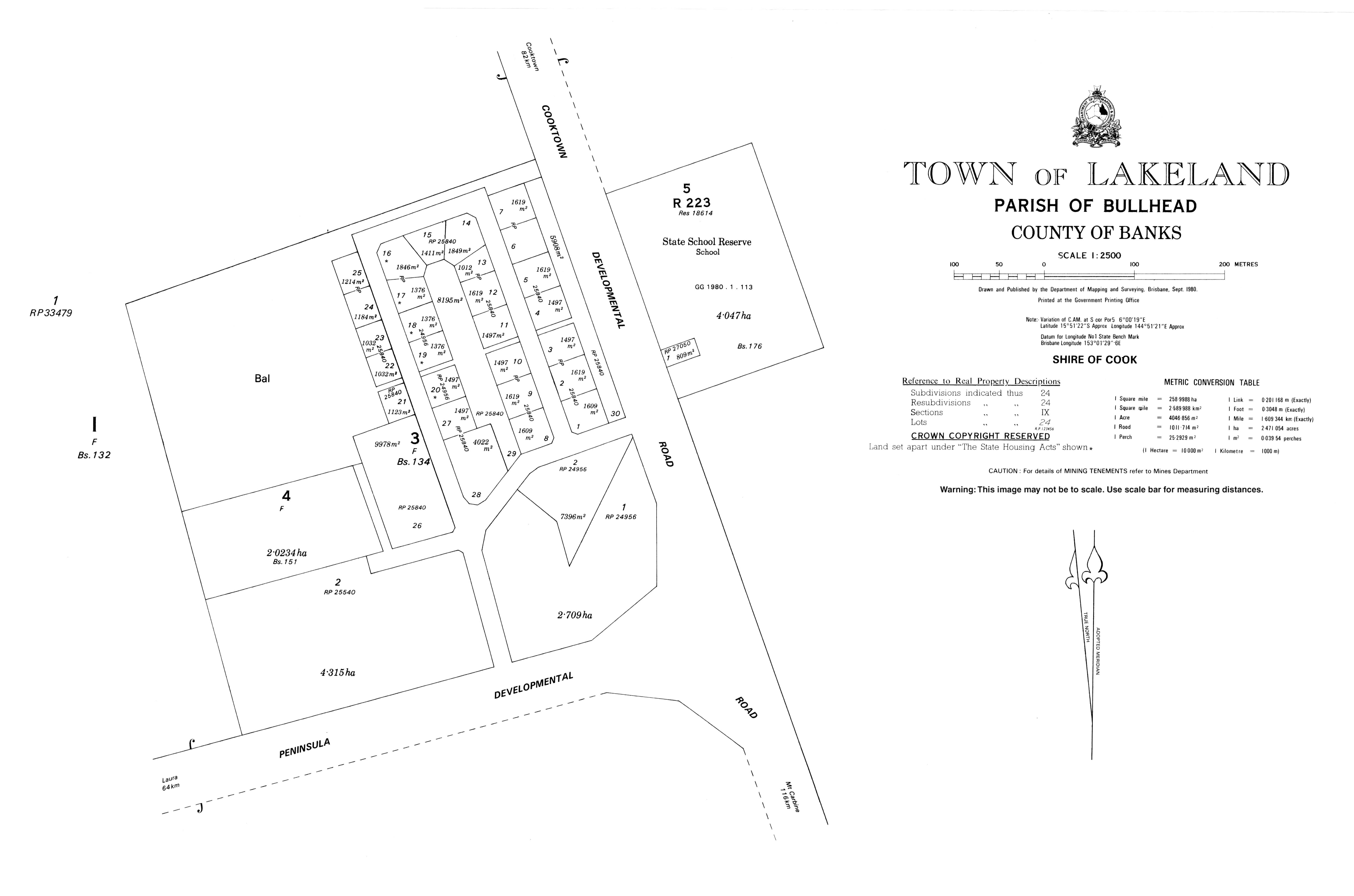
James Earl was granted a lease to occupy pastoral land in March 1877. He named his station Butchers Hill after Butcher Hill Farm in Littleport, Cambridgeshire, England where he lived as a child. It was also known as Turalba Station. The locality was variously known as being in the Cooktown or Laura districts. [31] [32] In September 1899 Earl's daughter Sarah Campbell Earl of Turalba Station married Samuel William Wellington Cook, a part owner of the adjacent Spring Vale Station. [33] These two stations comprise the majority of the current locality of Lakeland.

Mining had commenced on the West Normanby Goldfield by the end of 1874. [34] This goldfield should not be confused with the Normanby Goldfield near Bowen, which opened in 1871. Mining continued intermittently, depending on gold prices, until 1999. [35]

The Normanby Diggings Native Mounted Police camp was located on the West Normanby River just south-east of Butchers Hill and operated for 7 years between 1885 and 1892. [36]

The Normanby Reefs Post Office was renamed Earlton (Earltown) Post Office in 1890. [37] It was closed in December 1892. [38] [39]

Clive J Foyster was an entrepreneur, mining company chief and farmer who bought Butchers Hill in 1968. In a private venture known as Lakeland Downs development began with the clearing of land intended for agriculture, and two irrigation dams were constructed. Dry land and irrigated cropping commenced with plantings of maize and sorghum and later of peanuts and coffee. [40] [41] [42] More intensive cattle grazing also commenced. Eventually 70,000 acres (28,000 hectares ) were cleared. [43] In the 1980s Lakeland Downs was sold, divided into freehold farms averaging about 990 acres (400 ha). [44] [30]

Lakeland Downs is named for William (Billy) Lakeland who was one of the earliest prospectors of Cape York Peninsula. [45] [46] The township of Lakeland Downs came into being to service this development, and is now known as Lakeland. [41]

Butcher's Hill State School opened on 23 August 1969. The first teacher was Lorraine Woergoetter. Within two years it had been renamed Lakeland Downs State School. [47] [48] [40]

In the 2011 census, the locality of Lakeland had a population of 227 people. [49]

In the 2016 census, the locality of Lakeland had a population of 299 people. [1]

Heritage listings

Stone pitching at Nuggety Gully, 2014 (mobile phone in lower left for scale) Nuggety Gully stone pitching (2014).jpg
Stone pitching at Nuggety Gully, 2014 (mobile phone in lower left for scale)

Lakeland has a number of heritage-listed sites, including:

Economy

Salvinia molesta is a floating fern. It becomes a thick mat which can smother native aquatic plants, alter stream flow and deplete oxygen levels for aquatic organisms. It is most likely to grow in freshwater creeks and in wetlands, and is usually spread by the movement of water plants, aquariums or watercraft. Biosecurity Queensland and Cook Shire Council are working on the complete eradication of salvinia as well as hymenachne (marsh grass), which is another aquatic weed. Report any suspected outbreaks to Cook Shire Council. Salvinia molesta kz01.jpg
Salvinia molesta is a floating fern. It becomes a thick mat which can smother native aquatic plants, alter stream flow and deplete oxygen levels for aquatic organisms. It is most likely to grow in freshwater creeks and in wetlands, and is usually spread by the movement of water plants, aquariums or watercraft. Biosecurity Queensland and Cook Shire Council are working on the complete eradication of salvinia as well as hymenachne (marsh grass), which is another aquatic weed. Report any suspected outbreaks to Cook Shire Council.

At Lakeland, most of the irrigation water comes from farm dams. Licenses are required to extract surface or bore water for irrigation purposes. In 2012 there were 16 licenses to impound water in the Normanby catchment, with most occurring in the Lakeland area. Many of the dams are located on small creeks. Honey Dam is the largest and is located on Bullhead Creek, which flows into the Laura River. Dams are only permitted to store wet season run off. [51]

The main products are cattle and cropping, including bananas. [52]

Education

Lakeland State School is a government primary (Early Childhood-6) school for boys and girls on the corner of Peninsula Developmental Road and the Mulligan Highway ( 15°51′25″S144°51′24″E / 15.8569°S 144.8568°E / -15.8569; 144.8568 (Lakeland State School) ). [53] [54] In 2018, the school had an enrolment of 17 students with 2 teachers and 4 non-teaching staff (2 full-time equivalent). [55]

Cooktown orchid - Dendrobium bigibbum. Queensland 2008 Dendrobium bigibbum 47 Philippine Pde Palm Beach IMGP4301.jpg
Cooktown orchid - Dendrobium bigibbum . Queensland 2008

There is no secondary school in Lakeland. The nearest government secondary school is Cooktown State School in Cooktown to the north-east. Given the distances involved, distance education and boarding school are other options. [4]

Environmental

The Lakeland Agricultural Area Water Quality Monitoring Program is a project to work with landowners to monitor water quality. [56]

Northern quoll - Dasyurus hallucatus. Queensland, 2009 Dasyurus hallucatus -Queensland-8.jpg
Northern quoll - Dasyurus hallucatus. Queensland, 2009

In 2016 the Queensland Government purchased Springvale Station, a 56,295-hectare (139,110-acre) property situated in the east of the locality. Springvale Station was purchased to add to the State’s protected area network and complement activities being taken to reduce sediment run-off entering the Normanby River catchment that flows into Princess Charlotte Bay and the Great Barrier Reef. The Department of Environment and Science contracted Cape York Natural Resource Management (Cape York NRM) to work with Traditional Owners, Griffith University, the Department of Agriculture and Fisheries, and erosion, water quality and vegetation scientists to develop the Springvale Erosion Management Plan. [57] [58] [59]

Springvale Station Nature Refuge provides important habitat for endangered or vulnerable flora and fauna including the Cooktown orchid, ghost bat, northern quoll, red goshawk, spectacled flying-fox, spotted-tailed quoll, Semon’s leaf nosed bat and large eared-horseshoe bat. There is no public access on the Nature Refuge. [57]

Amenities

Lakeland Coffee House and Store, 2014 Lakeland Coffee House and Store, 2014.jpg
Lakeland Coffee House and Store, 2014

Lakeland has a hotel, a cafe, and roadhouse and a hardware store.[ citation needed ]

Attractions

James Earl Lookout is off the Mulligan Highway, 14.7 kilometres (9.1 mi) SSE of the town ( 15°58′30″S144°49′44″E / 15.9751°S 144.8289°E / -15.9751; 144.8289 (James Earl Lookout) ). [60]

Transport

Lakeland Airport (YLND) is located north of the township, beside the Mulligan Highway. [61]

Related Research Articles

<span class="mw-page-title-main">Blackall, Queensland</span> Town in Queensland, Australia

Blackall is a rural town and locality in the Blackall-Tambo Region, Queensland, Australia. In the 2016 census the locality of Blackall had a population of 1,416 people.

<span class="mw-page-title-main">Laura, Queensland</span> Town in Queensland, Australia

Laura is a rural town and locality in the Shire of Cook, Queensland, Australia. In the 2016 census the locality of Laura had a population of 228 people.

<span class="mw-page-title-main">Cape Tribulation, Queensland</span> Suburb of Shire of Douglas, Queensland, Australia

Cape Tribulation is a headland and coastal locality in the Shire of Douglas in northern Queensland, Australia. In the 2021 census, Cape Tribulation had a population of 123 people.

<span class="mw-page-title-main">Normanby River</span> River in northern Queensland, Australia

The Normanby River, comprising the East Normanby River, the West Normanby River, the East Normanby River North Branch, the East Normanby River South Branch and the Granite Normanby River, is a river system in Far North Queensland, Australia.

<span class="mw-page-title-main">Inkerman, Queensland</span> Town in Queensland, Australia

Inkerman is a rural town and locality in the Shire of Burdekin, Queensland, Australia. In the 2016 census, the locality of Inkerman had a population of 145 people.

<span class="mw-page-title-main">Irvinebank</span> Town in Queensland, Australia

Irvinebank is a rural town and locality in the Shire of Mareeba, Queensland, Australia. In the 2021 census, the locality of Irvinebank had a population of 113 people.

<span class="mw-page-title-main">Cooktown, Queensland</span> Town in Queensland, Australia

Cooktown is a coastal town and locality in the Shire of Cook, Queensland, Australia. Cooktown is at the mouth of the Endeavour River, on Cape York Peninsula in Far North Queensland where James Cook beached his ship, the Endeavour, for repairs in 1770. Both the town and Mount Cook which rises up behind the town were named after James Cook.

<span class="mw-page-title-main">Mount Carbine, Queensland</span> Town in Queensland, Australia

Mount Carbine is a rural town and locality in the Shire of Mareeba, Queensland, Australia. In the 2016 census, the locality of Mount Carbine had a population of 101 people.

Adavale is a rural town and locality in the Shire of Quilpie, Queensland, Australia. In the 2016 census, the locality of Adavale had a population of 93 people. By 2021, the population was down to 72.

<span class="mw-page-title-main">Gunnawarra, Queensland</span> Suburb of Tablelands Region, Queensland, Australia

Gunnawarra is a rural locality in the Tablelands Region, Queensland, Australia. In the 2021 census, Gunnawarra had a population of 27 people.

<span class="mw-page-title-main">Bloomfield, Queensland</span> Suburb of Shire of Cook, Queensland, Australia

Bloomfield is a town in the Shire of Cook and a coastal locality which is split between the Shire of Cook and the Shire of Douglas in Queensland, Australia. The neighbourhood of Ayton is within the locality. In the 2016 census, Bloomfield had a population of 204 people.

<span class="mw-page-title-main">Iron Range, Queensland</span> Suburb of Shire of Cook, Queensland, Australia

Iron Range is a coastal locality in the Shire of Cook, Queensland, Australia. The town of Portland Road is on a north-east headland in the locality. In the 2021 census, Iron Range had a population of 30 people.

<span class="mw-page-title-main">Mowbray, Queensland</span> Suburb of Shire of Douglas, Queensland, Australia

Mowbray is a coastal locality in the Shire of Douglas, Queensland, Australia. In the 2021 census, Mowbray had a population of 362 people.

Desailly is a rural locality in the Shire of Mareeba, Queensland, Australia. In the 2016 census Desailly had a population of 0 people.

<span class="mw-page-title-main">Shannonvale, Queensland</span> Suburb of Shire of Douglas, Queensland, Australia

Shannonvale is a rural locality in the Shire of Douglas, Queensland, Australia. In the 2016 census Shannonvale had a population of 202 people.

<span class="mw-page-title-main">Porcupine, Queensland</span> Suburb of Shire of Flinders, Queensland, Australia

Porcupine is an outback locality in the Shire of Finders, Queensland, Australia. In the 2021 census, Porcupine had a population of 39 people.

<span class="mw-page-title-main">Lyndhurst, Queensland</span> Suburb of Shire of Etheridge, Queensland, Australia

Lyndhurst is a rural locality in the Shire of Etheridge, Queensland, Australia. In the 2021 census, Lyndhurst had a population of 11 people.

Humeburn is a locality in the Shire of Paroo, Queensland, Australia. In the 2021 census, Humeburn had a population of 9 people.

Garrawalt is a rural locality in the Shire of Hinchinbrook, Queensland, Australia.

<span class="mw-page-title-main">Amber, Queensland</span> Suburb of Shire of Mareeba, Queensland, Australia

Amber is a rural locality in the Shire of Mareeba, Queensland, Australia. In the 2016 census, Amber had a population of 0 people.

References

  1. 1 2 3 Australian Bureau of Statistics (27 June 2017). "Lakeland (SSC)". 2016 Census QuickStats. Retrieved 20 October 2018. OOjs UI icon edit-ltr-progressive.svg
  2. "Lakeland – town in Shire of Cook (entry 18830)". Queensland Place Names. Queensland Government . Retrieved 19 July 2021.
  3. "Lakeland – locality in Shire of Cook (entry 46131)". Queensland Place Names. Queensland Government . Retrieved 19 July 2021.
  4. 1 2 "Queensland Globe". State of Queensland . Retrieved 22 December 2021.
  5. "Story Map Series". qgsp.maps.arcgis.com. Physical features. Retrieved 1 March 2023.
  6. 1 2 3 4 5 6 7 8 9 10 11 12 13 14 15 16 17 18 19 20 21 22 23 24 25 26 27 28 "Mountain peaks and capes - Queensland". Queensland Open Data. Queensland Government. 12 November 2020. Archived from the original on 25 November 2020. Retrieved 25 November 2020.
  7. "Belle View Peak – mountain in Cook Shire (entry 2177)". Queensland Place Names. Queensland Government . Retrieved 25 November 2020.
  8. "Hamilton Peak – mountain in Cook Shire (entry 15279)". Queensland Place Names. Queensland Government . Retrieved 25 November 2020.
  9. "Macdonalds Hill – mountain in Cook Shire (entry 20395)". Queensland Place Names. Queensland Government . Retrieved 25 November 2020.
  10. "Mount Amy – mountain in Cook Shire (entry 554)". Queensland Place Names. Queensland Government . Retrieved 25 November 2020.
  11. "Mount Byerley – mountain in Cook Shire (entry 5553)". Queensland Place Names. Queensland Government . Retrieved 25 November 2020.
  12. "Mount Earl – mountain in Cook Shire (entry 11022)". Queensland Place Names. Queensland Government . Retrieved 25 November 2020.
  13. "Mount Emily – mountain in Cook Shire (entry 11614)". Queensland Place Names. Queensland Government . Retrieved 25 November 2020.
  14. "Mount Eykin – mountain in Cook Shire (entry 12096)". Queensland Place Names. Queensland Government . Retrieved 25 November 2020.
  15. "Mount Fahey – mountain in Cook Shire (entry 12110)". Queensland Place Names. Queensland Government . Retrieved 25 November 2020.
  16. "Mount Gibson – mountain in Cook Shire (entry 13690)". Queensland Place Names. Queensland Government . Retrieved 25 November 2020.
  17. "Mount Janet – mountain in Cook Shire (entry 17064)". Queensland Place Names. Queensland Government . Retrieved 25 November 2020.
  18. "Mount Lukin – mountain in Cook Shire (entry 20256)". Queensland Place Names. Queensland Government . Retrieved 25 November 2020.
  19. "Mount Macdonald – mountain in Cook Shire (entry 20391)". Queensland Place Names. Queensland Government . Retrieved 25 November 2020.
  20. "Mount Mccormack – mountain in Cook Shire (entry 21323)". Queensland Place Names. Queensland Government . Retrieved 25 November 2020.
  21. "Mount Mclean – mountain in Cook Shire (entry 21436)". Queensland Place Names. Queensland Government . Retrieved 25 November 2020.
  22. "Mount Murray – mountain in Cook Shire (entry 23622)". Queensland Place Names. Queensland Government . Retrieved 25 November 2020.
  23. "Mount Pike – mountain in Cook Shire (entry 26722)". Queensland Place Names. Queensland Government . Retrieved 25 November 2020.
  24. "Mount Sellheim – mountain in Cook Shire (entry 30383)". Queensland Place Names. Queensland Government . Retrieved 25 November 2020.
  25. "North Sampson Mountain – mountain in Cook Shire (entry 24716)". Queensland Place Names. Queensland Government . Retrieved 25 November 2020.
  26. "Racecourse Mountain – mountain in Cook Shire (entry 27886)". Queensland Place Names. Queensland Government . Retrieved 25 November 2020.
  27. "Shields Sugarloaf – mountain in Cook Shire (entry 30735)". Queensland Place Names. Queensland Government . Retrieved 25 November 2020.
  28. "The Brothers – mountain in Cook Shire (entry 33881)". Queensland Place Names. Queensland Government . Retrieved 25 November 2020.
  29. "The Twins – mountain in Cook Shire (entry 34170)". Queensland Place Names. Queensland Government . Retrieved 25 November 2020.
  30. 1 2 "LAKELAND LOCAL AREA PLAN BACKGROUND REPORT" (PDF). Cook Shire Council . August 2017. p. 2. Retrieved 19 February 2023.
  31. Pike, Glenville (1983). The last frontier. Internet Archive. Mareeba, North Queensland : Pinevale Publications. p. 94. ISBN   978-0-9593785-0-4.
  32. "THE SKETCHER". The Queenslander . Vol. XLIX, no. 1058. Queensland, Australia. 1 February 1896. p. 213. Archived from the original on 18 February 2023. Retrieved 18 February 2023 via National Library of Australia.
  33. "Family Notices". The Northern Miner . Queensland, Australia. 14 October 1899. p. 4. Archived from the original on 18 February 2023. Retrieved 18 February 2023 via National Library of Australia.
  34. 1 2 "Nuggety Gully Water Race and Chinese Camp (entry 600426)". Queensland Heritage Register . Queensland Heritage Council. Retrieved 7 July 2013.
  35. Denaro, T J (July 2013). Queensland Geological Record 2013/02 Orogenic gold and gold–antimony mineralisation in the Hodgkinson and Broken River Provinces, north Queensland (PDF). Geological Survey of Queensland. p. 19. ISBN   978-1-922067-26-5. ISSN   1039-5547. Archived (PDF) from the original on 18 February 2023. Retrieved 18 February 2023.{{cite book}}: |website= ignored (help)
  36. "Normanby Diggings [Camp]". FRONTIER CONFLICT AND THE NATIVE MOUNTED POLICE IN QUEENSLAND. 13 December 2016. Archived from the original on 18 February 2023. Retrieved 18 February 2023.
  37. "Current News". The Queenslander . Queensland, Australia. 22 November 1890. p. 1002. Archived from the original on 18 February 2023. Retrieved 15 February 2023 via National Library of Australia.
  38. "Telegraph Department Postal Guide". The Telegraph . No. 6289. Queensland, Australia. 13 December 1892. p. 4. Retrieved 17 February 2023 via National Library of Australia.
  39. Wallace, Lennie (2012). The Battlers of Butcher's Hill. Boolarong Press. p. 18. ISBN   978-1-921920-69-1 . Retrieved 19 February 2023.
  40. 1 2 Wallace, Lennie (2012). The Battlers of Butcher's Hill. Boolarong Press. Appendix. ISBN   978-1-921920-69-1 . Retrieved 19 February 2023.
  41. 1 2 Wallace, Lennie (2012). The Battlers of Butcher's Hill. Boolarong Press. p. 101. ISBN   978-1-921920-69-1 . Retrieved 19 February 2023.
  42. "Legislative Assembly Hansard 1969 Parliamentary Debates" (PDF). Queensland Parliament . 13 November 1969. pp. 1495, 1496. Retrieved 2 February 2023.
  43. Pike, Glenville (1983). The last frontier. Internet Archive. Mareeba, North Queensland : Pinevale Publications. p. 2. ISBN   978-0-9593785-0-4.
  44. "Strategic Business Case. Technical Feasibility Report for Preferred Option. Lakeland Irrigation Area Project" (PDF). SMEC Australia Pty Limited. 27 February 2019. p. 2. Retrieved 19 February 2023.
  45. "Lakeland and Laura". Cape York and Cooktown. Tourism Cape York. Archived from the original on 19 July 2014. Retrieved 31 July 2014.
  46. "Queensland Places - Cape York - William Lakeland". State Library Of Queensland . 7 July 2017. Archived from the original on 16 April 2021. Retrieved 22 December 2021.
  47. Queensland Family History Society (2010), Queensland schools past and present (Version 1.01 ed.), Queensland Family History Society, ISBN   978-1-921171-26-0
  48. "ArchivesSearch | Queensland State Archives | Queensland Government". www.archivessearch.qld.gov.au. Retrieved 19 February 2023.
  49. Australian Bureau of Statistics (31 October 2012). "Lakeland (SSC)". 2011 Census QuickStats. Retrieved 31 May 2014. OOjs UI icon edit-ltr-progressive.svg
  50. "Invasive plants — Cook Shire Council". www.cook.qld.gov.au. Retrieved 3 March 2023.
  51. Howley, Christina; Shellberg, Jeff; Stephan, Kim; Brooks, Andrew (4 April 2014). "Normanby Catchment Water Quality Management Plan" (PDF). Department of Environment and Science Queensland Government . 3.4.
  52. "Story Map Series". qgsp.maps.arcgis.com. Economic values. Retrieved 4 March 2023.
  53. "State and non-state school details". Queensland Government. 9 July 2018. Archived from the original on 21 November 2018. Retrieved 21 November 2018.
  54. "Lakeland State School". Lakeland State School. 27 March 2020. Archived from the original on 22 December 2021. Retrieved 11 May 2022.
  55. "ACARA School Profile 2018". Australian Curriculum, Assessment and Reporting Authority. Archived from the original on 27 August 2020. Retrieved 28 January 2020.
  56. Lister, Ben (21 September 2021). "Lakeland Agricultural Area Water Quality Monitoring Program". Cape York NRM. Archived from the original on 28 October 2022. Retrieved 18 February 2023.
  57. 1 2 The State of Queensland, Department of Environment and Science (7 July 2022). "Springvale Station Nature Refuge | Coastal catchment management". Queensland Government . Archived from the original on 16 February 2023. Retrieved 16 February 2023. Creative Commons by small.svg  This article incorporates textfrom this source, which is available under the CC BY 4.0 license.
  58. One Search (2018). "Springvale Station erosion management plan". State Library of Queensland . Archived from the original on 16 February 2023. Retrieved 16 February 2023.
  59. Contributed. "Solution at hand for saving Great Barrier Reef". news.griffith.edu.au. Archived from the original on 16 February 2023. Retrieved 16 February 2023.
  60. "Tourist points - Queensland". Queensland Open Data. Queensland Government. 18 November 2020. Archived from the original on 24 November 2020. Retrieved 24 November 2020.
  61. "Lakeland Airport - YLND - Airport Guide". AirportGuide. Archived from the original on 14 August 2021. Retrieved 18 February 2023.

Further reading