
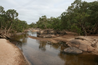
Cape York Peninsula is a large peninsula located in Far North Queensland, Australia. It is the largest unspoiled wilderness in northern Australia. The land is mostly flat and about half of the area is used for grazing cattle. The relatively undisturbed eucalyptus-wooded savannahs, tropical rainforests and other types of habitat are now recognised and preserved for their global environmental significance. Although much of the peninsula remains pristine, with a diverse repertoire of endemic flora and fauna, some of its wildlife may be threatened by industry and overgrazing as well as introduced species and weeds.

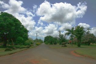
Weipa is a coastal mining town in the local government area of Weipa Town in Queensland. It is the largest town on the Cape York Peninsula. It exists because of the enormous bauxite deposits along the coast. The Port of Weipa is mainly involved in exports of bauxite. There are also shipments of live cattle from the port.

Laura is a rural town and locality in the Shire of Cook, Queensland, Australia. In the 2016 census the locality of Laura had a population of 228 people.
Hope Vale is a town within the Aboriginal Shire of Hope Vale and a coastal locality split between the Aboriginal Shire of Hope Vale and the Shire of Cook, both in Queensland, Australia. It is an Aboriginal community. In the 2016 census, the locality of Hope Vale had a population of 1,015 people.

Coen is a town and coastal locality in the Shire of Cook, Queensland, Australia. The town of Coen is inland on the Peninsula Developmental Road, the main road on the Cape York Peninsula in far northern Queensland. In the 2016 census, Coen had a population of 364 people.

Daintree is a rural town and locality in the Shire of Douglas, Queensland, Australia. In the 2016 census, Daintree had a population of 129 people.

North Queensland or the Northern Region is the northern part of the Australian state of Queensland that lies just south of Far North Queensland. Queensland is a massive state, larger than many countries, and its tropical northern part has been historically remote and undeveloped, resulting in a distinctive regional character and identity.

Kowanyama is a town and coastal locality in the Aboriginal Shire of Kowanyama, Queensland, Australia.

Pormpuraaw is a coastal town and a locality in the Aboriginal Shire of Pormpuraaw, Queensland, Australia. Pormpuraaw is an Aboriginal community situated on the west coast of Cape York Peninsula approximately halfway between Karumba and Weipa on the Edward River. It is 650 kilometres (400 mi) by road from Cairns. Pormpuraaw currently has a 4-man police station.

Injinoo is a coastal town in the Northern Peninsula Area Region and a locality split between Northern Peninsula Area Region and the Shire of Torres in Far North Queensland, Australia. It is on the north-western coast of Cape York Peninsula. In the 2016 census, Injinoo had a population of 561 people.\

Mapoon is a coastal town in the Aboriginal Shire of Mapoon and a locality split between the Aboriginal Shire of Mapoon and the Shire of Cook in Queensland, Australia. In the 2016 census, Mapoon had a population of 317 people.

Napranum is a remote town in the locality of Mission River in the Aboriginal Shire of Napranum, Queensland, Australia. At the 2016 census, the town of Napranum had a population of 950.

The Shire of Cook is a local government area in Far North Queensland, Australia. The Shire covers most of the eastern and central parts of Cape York Peninsula, the most northerly section of the Australian mainland.

The Aboriginal Shire of Kowanyama is a special local government area which is located on western Cape York Peninsula in Queensland, Australia. It is managed under a Deed of Grant in Trust under the Local Government Act 2004.

Bloomfield is a town in the Shire of Cook and a coastal locality which is split between the Shire of Cook and the Shire of Douglas in Queensland, Australia. The neighbourhood of Ayton is within the locality. In the 2016 census, Bloomfield had a population of 204 people.
Archer River is a rural locality in the Shire of Cook, Queensland, Australia. In the 2016 census Archer River had a population of 22 people.
Edward River is a rural locality in the Shire of Cook, Queensland, Australia. In the 2016 census Edward River had a population of 0 people.

Weipa Town is a local government area in Far North Queensland, Australia. It covers the town of Weipa on the western coast of the Cape York Peninsula, including the localities of Rocky Point, Trunding, Nanum, Evans Landing, and Weipa Airport. It is an unusual local government area as it is not governed and managed by a council elected by residents but rather by the company Rio Tinto Aluminium through a governing body called the Weipa Town Authority. In June 2018, Weipa Town had a population of 4,240.

The Aboriginal Shire of Napranum is a local government area in Far North Queensland, Australia. It is on the western side of the Cape York Peninsula around Weipa.
Mount Mulgrave is a rural locality in the Shire of Mareeba, Queensland, Australia. In the 2016 census, Mount Mulgrave had a population of 0 people.
