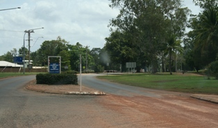
Nanum is a coastal locality in Weipa Town in Far North Queensland, Australia. [2]
Nanum is a coastal locality in Weipa Town in Far North Queensland, Australia. [2]
Nanum is situated between Trunding and Evans Landing, near the mouth of the Mission River. Approximately half of the land is used for residential housing while the remainder is undeveloped. [3]
Nanum was established in the 1990s as the residential area of Weipa needed to grow southward. [4]
In the 2006 census, Nanum had a population of 728 people. [5]
In the 2011 census, Nanum had a population of 815 people. [1]

Weipa is a coastal mining town in the local government area of Weipa Town in Queensland, Australia. It is the largest town on the Cape York Peninsula. It exists because of the enormous bauxite deposits along the coast. The Port of Weipa is mainly involved in exports of bauxite. There are also shipments of live cattle from the port.

Peregian Beach is a beach and small coastal town on the Sunshine Coast, Queensland, Australia. It is a suburb split between two local government areas with the eastern coastal in the Shire of Noosa and the western hinterland part in the Sunshine Coast Region.. In the 2016 census, Peregian Beach had a population of 3,791 people.

Bramston Beach is a coastal town and locality in Cairns Region, Queensland, Australia. In the 2016 census, Bramston Beach had a population of 174 people.

Horseshoe Bay is a bay, town and suburb on Magnetic Island in the City of Townsville, Queensland, Australia. It is a major tourist accommodation and recreation centre on the island. In the 2016 census, Horseshoe Bay had a population of 578 people.

Highworth is a mix-use locality in the Sunshine Coast Region, Queensland, Australia. In the 2016 census, Highworth had a population of 301 people.

Jambin is a town and locality in the Shire of Banana, Queensland, Australia.

Karara is a town and locality in the Darling Downs region within the Queensland, Australia. It is in the Southern Downs Region local government area. In the 2016 census, Karara had a population of 123 people.

Mooroobool is a suburb of Cairns in the Cairns Region, Queensland, Australia. In the 2016 census, Mooroobool had a population of 7,222 people.

Cranley is a rural locality in the Toowoomba Region, Queensland, Australia. In the 2016 census, Cranley had a population of 1446 people.

Prince Henry Heights is a residential locality on the outskirts of Toowoomba in the Toowoomba Region, Queensland, Australia. In the 2016 census, Prince Henry Heights had a population of 571 people.

Rockville is a residential locality in the Toowoomba Region, Queensland, Australia. In the 2016 census, Rockville had a population of 3,237 people.

Taranganba is a town and locality on the tropical Central Queensland coast in Australia. It is within the local government area of Shire of Livingstone.

Kepnock is a suburb of Bundaberg in the Bundaberg Region, Queensland, Australia. In the 2016 census, Kepnock had a population of 4,441 people.

Avoca is a suburb of Bundaberg in the Bundaberg Region, Queensland, Australia. In the 2016 census, Avoca had a population of 4,904 people.

Witta is a rural town and locality in the Sunshine Coast Region, Queensland, Australia. In the 2016 census, Witta had a population of 1,201 people.

Weipa Town is a local government area in Far North Queensland, Australia. It covers the town of Weipa on the western coast of the Cape York Peninsula, including the localities of Rocky Point, Trunding, Nanum, Evans Landing, and Weipa Airport. It is an unusual local government area as it is not governed and managed by a council elected by residents but rather by the company Rio Tinto Aluminium through a governing body called the Weipa Town Authority. In June 2018, Weipa Town had a population of 4,240.

Rocky Point is a coastal locality in the Weipa Town, Queensland, Australia. In the 2016 census, Rocky Point had a population of 1957 people.

Trunding is a coastal locality in the Weipa Town, Queensland, Australia. In the 2016 census, Trunding had a population of 962 people.

Evans Landing is a rural locality in the Weipa Town, Queensland, Australia. In the 2016 census Evans Landing had a population of 62 people.

Blackbutt North is a rural locality in the South Burnett Region, Queensland, Australia. In the 2016 census, Blackbutt North had a population of 438 people.