
Cape York Peninsula is a peninsula located in Far North Queensland, Australia. It is the largest wilderness in northern Australia. The land is mostly flat and about half of the area is used for grazing cattle. The relatively undisturbed eucalyptus-wooded savannahs, tropical rainforests and other types of habitat are now recognised and preserved for their global environmental significance. Although much of the peninsula remains pristine, with a diverse repertoire of endemic flora and fauna, some of its wildlife may be threatened by industry and overgrazing as well as introduced species and weeds.

Weipa is a coastal mining town in the local government area of Weipa Town in Queensland. It is the largest town on the Cape York Peninsula. It exists because of the enormous bauxite deposits along the coast. The Port of Weipa is mainly involved in exports of bauxite. There are also shipments of live cattle from the port.

Normanton is an outback town and coastal locality in the Shire of Carpentaria, Queensland, Australia. At the 2021 census, the locality of Normanton had a population of 1,391 people, and the town of Normanton had a population of 1,326 people.

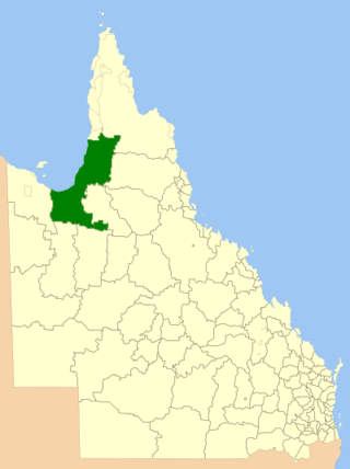
The Shire of Aurukun is a local government area in Far North Queensland, Australia. The shire covers part of western Cape York Peninsula, the most northerly section of the Australian mainland.
Aurukun is a town and coastal locality in the Shire of Aurukun and the Shire of Cook in Far North Queensland, Australia. It is an Indigenous community. In the 2016 census, the locality of Aurukun had a population of 1,269 people.

Kowanyama is a town and coastal locality in the Aboriginal Shire of Kowanyama, Queensland, Australia.

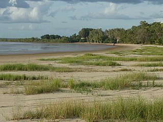
Pormpuraaw is a coastal town and a locality in the Aboriginal Shire of Pormpuraaw, Queensland, Australia. Pormpuraaw is an Aboriginal community situated on the west coast of Cape York Peninsula approximately halfway between Karumba and Weipa on the Edward River. It is 650 kilometres (400 mi) by road from Cairns. Pormpuraaw currently has a 4-man police station.

Mapoon is a coastal town in the Aboriginal Shire of Mapoon and a locality split between the Aboriginal Shire of Mapoon and the Shire of Cook in Queensland, Australia. In the 2016 census, Mapoon had a population of 317 people.

Keppel Bay is a bay in Central Queensland, Australia at the mouth of the Fitzroy River on the coast of the Coral Sea.

Burketown is an isolated outback town and coastal locality in the Shire of Burke, Queensland, Australia. In the 2016 census, the locality of Burketown had a population of 238 people.
The Shire of Carpentaria is a local government area in Far North Queensland, Australia on the Gulf of Carpentaria, for which it is named.
The Edward River is a river in Far North Queensland, Australia.
Nanum is a coastal residential locality in Weipa Town, Far North Queensland, Australia. In the 2016 census Nanum had a population of 921 people.
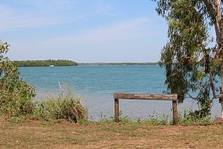
The Embley River is a river in Far North Queensland, Australia.

Weipa Town is a local government area in Far North Queensland, Australia. It covers the town of Weipa on the western coast of the Cape York Peninsula, including the localities of Rocky Point, Trunding, Nanum, Evans Landing, and Weipa Airport. It is an unusual local government area as it is not governed and managed by a council elected by residents but rather by the company Rio Tinto Aluminium through a governing body called the Weipa Town Authority. In June 2018, Weipa Town had a population of 4,240.
Guthalungra is a rural town and coastal locality in the Whitsunday Region, Queensland, Australia. In the 2016 census, the locality of Guthalungra had a population of 112 people.
The Winduwinda were an indigenous Australian people of Queensland.
Mission River is a coastal rural locality split between the Shire of Cook and the Aboriginal Shire of Napranum in Queensland, Australia. In the 2016 census, Mission River had a population of 987 people.

Carpentaria is a coastal locality in the Shire of Carpentaria, Queensland, Australia. In the 2021 census, Carpentaria had a population of 25 people.
Duyfken Point is a point in the locality of Mission River, Shire of Cook, Queensland, Australia.

