Embley River

Last updated

Embley
Australia Queensland relief location map.jpg
Red pog.svg
Location of Embley River mouth in Queensland
EtymologyIn honour of John Embley [1]
Location
Country Australia
State Queensland
Region Far North Queensland
Physical characteristics
SourceEmbley Range
  location Cape York Peninsula
  elevation21 m (69 ft)
Mouth Gulf of Carpentaria
  location
Nanum
  coordinates
12°40′15″S141°50′54″E / 12.67083°S 141.84833°E / -12.67083; 141.84833
  elevation
0 m (0 ft)
Length54 km (34 mi)
Basin size4,622 km2 (1,785 sq mi)
Basin features
Tributaries 
  leftHey River
[2]

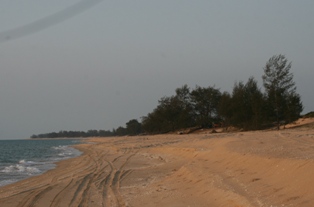
The Embley River is a river in Far North Queensland, Australia.

The headwaters of the river rise on the coastal plain of the Cape York Peninsula and flow in a north westerly direction eventually discharging at Evans Landing into Albatross Bay near Nanum just south of Weipa and into the Gulf of Carpentaria.

The river has a catchment area of 4,622 square kilometres (1,785 sq mi) of which an area of 392 square kilometres (151 sq mi) is composed of estuarine wetlands. [3] From source to mouth, the Embley River is joined by five tributaries including the Hey River. The Embley River descends 21 metres (69 ft) over its 54-kilometre (34 mi) course. [2]

The river was named in 1895 by John Douglas CBE after the surveyor, John Thomas Embley (1858-1937), while Douglas was Government Resident on Thursday Island. [1]

See also

Related Research Articles

<span class="mw-page-title-main">Balonne River</span> River in Queensland, Australia

The Balonne River, part of the Murray-Darling Basin system, is a short yet significant part of the inland river group of South West Queensland, Australia.

<span class="mw-page-title-main">Pennefather River</span> River in Queensland, Australia

The Pennefather River is a river located on the western Cape York Peninsula in Far North Queensland, Australia.

The Edward River is a river in Far North Queensland, Australia.

<span class="mw-page-title-main">Boyne River (Central Queensland)</span> River in Queensland, Australia

The Boyne River is a river in Central Queensland, Australia.

<span class="mw-page-title-main">Bohle River</span> River in Queensland, Australia

The Bohle River is a river in North Queensland, Australia.

The Alice River is a river located on the Cape York Peninsula of Far North Queensland, Australia.

The Walsh River is a river located on the Cape York Peninsula of Far North Queensland, Australia.

The Black River is a river in North Queensland, Australia.

The Haughton River is a river in North Queensland, Australia.

The Holroyd River is a river located on the Cape York Peninsula in Far North Queensland, Australia.

The Burrum River is a river in the Wide Bay-Burnett region of Queensland, Australia.

The Barratta Creek is a creek in North Queensland, Australia.

<span class="mw-page-title-main">Bowen River (Queensland)</span> River in Queensland, Australia

The Bowen River is a river in North Queensland, Australia.

The Hann River is a river in Far North Queensland, Australia.

The Mcdonald River, also known as the Macdonald River and locally as the Collett River, is a river in Far North Queensland, Australia.

The Mission River is a river in Far North Queensland, Australia.

<span class="mw-page-title-main">Mossman River</span> River in Far North Queensland, Australia

The Mossman River is a river in the Cape York Peninsula of Far North Queensland, Australia.

The Olive River is a river in the Cape York Peninsula of Far North Queensland, Australia.

The Saxby River is a river in North West Queensland, Australia.

The Stewart River is a river in the Cape York Peninsula of Far North Queensland, Australia.

References

  1. 1 2 "Embley River (entry 11595)". Queensland Place Names. Queensland Government . Retrieved 19 June 2015.
  2. 1 2 "Map of Embley River, QLD". Bonzle Digital Atlas of Australia. Retrieved 19 June 2015.
  3. "Embley River drainage basin". WetlandInfo. Queensland Government . Retrieved 19 June 2015.