Holroyd River

Last updated

Holroyd
Australia Queensland relief location map.jpg
Red pog.svg
Location of Holroyd River mouth in Queensland
EtymologyIn honour of Arthur Holroyd [1]
Location
Country Australia
State Queensland
Region Far North Queensland
Physical characteristics
Source McIlwraith Range
  locationbelow Mount White
  elevation187 m (614 ft)
Mouth Gulf of Carpentaria
  location
Kulinchin Outstation
  coordinates
14°09′54″S141°35′44″E / 14.16500°S 141.59556°E / -14.16500; 141.59556
  elevation
0 m (0 ft)
Length325 km (202 mi)
Basin size10,286 km2 (3,971 sq mi)
Discharge 
  average57 m3/s (2,000 cu ft/s)
Basin features
Tributaries 
  right Kendall River
[2]

The Holroyd River is a river located on the Cape York Peninsula in Far North Queensland, Australia.

Contents

Course and features

The headwaters of the river rise south of Mount White in the McIlwraith Range in the Great Dividing Range. It then flows westwards forming a series of braided channels and continuing through the uninhabited country until merging with the Kendall river near the Kulinchin Outstation and discharging into the Gulf of Carpentaria. The river is joined by eight tributaries including the Kendall River, Sandlewood Creek, Station Creek, Potlappa Creek, The Big Spring, First Spring, Christmas Creek and the Kendle River. [2]

The catchment area of the creek occupies an 10,286 square kilometres (3,971 sq mi) of which an area of 60 square kilometres (23 sq mi) is composed of estuarine wetlands. [3] A variety of landscapes are found within the catchment including tropical savannah woodlands, open grasslands, beach ridges, wetlands and paperbark stands. [4]

The river has a mean annual discharge of 1,799 gigalitres (3.957×10¹¹ imp gal; 4.752×10¹¹ US gal). [5]

The river was named in 1864 by the pastoralist Francis Lascelles Jardine after the explorer, doctor and politician Arthur Todd Holroyd. [1]

The traditional owners of the area are the Wik, Bakanh, Thaayorre and Kaanju peoples who inhabited the drainage basin for thousands of years. [4]

Kugu-Muminh is one of the traditional languages which includes the landscape within the local government boundaries of the Cook Shire. [6]

See also

Related Research Articles

<span class="mw-page-title-main">Fitzroy River (Queensland)</span> River in Queensland, Australia

The Fitzroy River is a river in Central Queensland, Australia. Its catchment covers an area of 142,665 square kilometres (55,083 sq mi), making it the largest river catchment flowing to the eastern coast of Australia. It is also the largest river basin that discharges onto the Great Barrier Reef.

<span class="mw-page-title-main">Balonne River</span> River in Queensland, Australia

The Balonne River, part of the Murray-Darling Basin system, is a short yet significant part of the inland river group of South West Queensland, Australia.

<span class="mw-page-title-main">Einasleigh River</span> River in Queensland, Australia

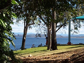
The Einasleigh River is a river in Far North Queensland, Australia. When combined with the Gilbert River, the river system is the largest river system in northern Australia.

<span class="mw-page-title-main">Boyne River (Central Queensland)</span> River in Queensland, Australia

The Boyne River is a river in Central Queensland, Australia.

<span class="mw-page-title-main">Jardine River</span> River in Queensland, Australia

The Jardine River, formally known as Deception River, is the largest river of the Cape York Peninsula in Far North Queensland, Australia.

The Settlement Creek is a creek in the Northern Territory and the state of Queensland, Australia.

The Nicholson River is a river in the Northern Territory and the state of Queensland, Australia.

<span class="mw-page-title-main">Gregory River (Australia)</span> River in Queensland and Northern Territory, Australia

The Gregory River is a river in the Northern Territory and the state of Queensland, Australia. The river is the largest perennial river in arid and semi-arid Queensland, one of the few permanently flowing rivers in the northwest of Queensland.

The Alice River is a river located on the Cape York Peninsula of Far North Queensland, Australia.

The Walsh River is a river located on the Cape York Peninsula of Far North Queensland, Australia.

The Coleman River is a river on the Cape York Peninsula in Far North Queensland, Australia.

The Haughton River is a river in North Queensland, Australia.

The Baffle Creek is a creek in Central Queensland, Australia.

The Burrum River is a river in the Wide Bay-Burnett region of Queensland, Australia.

The Waterpark Creek is a creek in Central Queensland, Australia.

The Barratta Creek is a creek in North Queensland, Australia.

<span class="mw-page-title-main">Bowen River (Queensland)</span> River in Queensland, Australia

The Bowen River is a river in North Queensland, Australia.

The Kendall River is a river in Far North Queensland, Australia.

The Mcdonald River, also known as the Macdonald River and locally as the Collett River, is a river in Far North Queensland, Australia.

The Mission River is a river in Far North Queensland, Australia.

References

  1. 1 2 "Holroyd River (entry 16021)". Queensland Place Names. Queensland Government . Retrieved 22 June 2015.
  2. 1 2 "Map of Holroyd River, QLD". Bonzle Digital Atlas of Australia. Retrieved 21 June 2015.
  3. "Holroyd river drainage basin". WetlandInfo. Queensland Government . Retrieved 21 June 2015.
  4. 1 2 "Holroyd River - Conservation and cultural values". The Wilderness Society . Retrieved 21 June 2015.
  5. "holroyd river sub-basin within the (Northern) Holroyd Plain sub-bioregion". Queensland Government . Retrieved 22 June 2015.
  6. CC BY icon-80x15.png This Wikipedia article incorporates CC-BY-4.0 licensed text from: "Indigenous languages map of Queensland". State Library of Queensland. State Library of Queensland . Retrieved 5 February 2020.