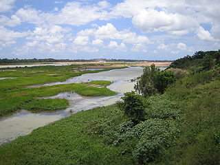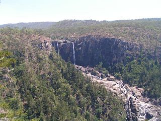
The Fitzroy River is a river in Central Queensland, Australia. Its catchment covers an area of 142,665 square kilometres (55,083 sq mi), making it the largest river catchment flowing to the eastern coast of Australia. It is also the largest river basin that discharges onto the Great Barrier Reef.

The Burdekin River is a river in North and Far North Queensland, Australia. The river rises on the northern slopes of Boulder Mountain at Valley of Lagoons, part of the western slope of the Seaview Range, and flows into the Coral Sea at Upstart Bay over 200 kilometres (124 mi) to the southeast of the source, with a catchment area of approximately 130,000 square kilometres (50,000 sq mi). The Burdekin River is Australia's largest river by (peak) discharge volume.

Ayr is a rural town and locality in the Shire of Burdekin, Queensland, Australia. It is the centre of a sugarcane-growing region and the administrative centre for the Burdekin Shire Council. In the 2016 census, the locality of Ayr had a population of 8,738 people.

The Calliope River is a river in Central Queensland, Australia.

The Herbert River is a river in Far North Queensland, Australia. The southernmost of Queensland's wet tropics river systems, it was named in 1864 by George Elphinstone Dalrymple explorer, after Robert George Wyndham Herbert, the first Premier of Queensland.

North Queensland or the Northern Region is the northern part of the Australian state of Queensland that lies just south of Far North Queensland. Queensland is a massive state, larger than many countries, and its tropical northern part has been historically remote and undeveloped, resulting in a distinctive regional character and identity.

The Burdekin Falls Dam, also known as the Burdekin Dam, is a concrete gravity dam with an uncontrolled spillway across the Burdekin River, located south west of Ayr, and Home Hill in the Shire of Burdekin, North Queensland, Australia. Built for the purpose of irrigation, the reservoir is called Lake Dalrymple. Burdekin Falls Dam is managed by SunWater. Water from the reservoir is also used to replenish downstream aquifers.

Millaroo is a rural town and locality in the Shire of Burdekin, Queensland, Australia. In the 2016 census, the locality of Millaroo had a population of 96 people.

The Belyando River, including the Belyando River (Western Branch), is a river system in Central Queensland, Australia. At 1,054 kilometres (655 mi) in length and with a catchment area of 35,000 square kilometres (14,000 sq mi), the Belyando River system is one of the longest rivers in Queensland.

The Johnstone River, comprising the North Johnstone River and the South Johnstone River, is a river system in Far North and North Queensland, Australia.

The Mulgrave River, incorporating the East Mulgrave River and the West Mulgrave River, is a river system in Far North Queensland, Australia. The 70-kilometre (43 mi)-long river flows towards the Coral Sea and is located approximately 50 kilometres (31 mi) south of Cairns.

The Clarke Range, part of the Great Dividing Range, is a rainforest-covered mountain range located in North Queensland, Australia. The range is located approximately 30 kilometres (19 mi) from the Coral Sea and 65 kilometres (40 mi) west of the coastal city of Mackay. The highest points are the summits of Mount William at about 1,270 metres (4,170 ft) AHD and Mount Dalrymple at 1,227 metres (4,026 ft) AHD .
Valley Of Lagoons is a rural locality in the Charters Towers Region, Queensland, Australia. In the 2016 census Valley Of Lagoons had a population of 48 people.
The Alice River is a river located on the Cape York Peninsula of Far North Queensland, Australia.
The Coleman River is a river on the Cape York Peninsula in Far North Queensland, Australia.
The Black River is a river in North Queensland, Australia.

The Bowen River is a river in North Queensland, Australia.
Basalt is a rural locality in the Charters Towers Region, Queensland, Australia. In the 2016 census, Basalt had a population of 190 people.
Breddan is a rural locality in the Charters Towers Region, Queensland, Australia. In the 2016 census, Breddan had a population of 485 people.
The Juru people also known as the ‘Yuru’ people are the proud Aboriginal people of the state of Queensland


