Daintree is a rural town and locality in the Shire of Douglas, Queensland, Australia. In the 2016 census, Daintree had a population of 129 people.

Wujal Wujal is a rural town and locality in the Wujal Wujal Aboriginal Shire, Queensland, Australia. In the 2016 census, Wujal Wujal had a population of 282 people. It is an Aboriginal community.

Maytown was the main township on the Palmer River Goldfields in Far North Queensland, Australia. It is now a ghost town within locality of Palmer in the Shire of Cook, having been active from c. 1874 to the 1920s. It was added to the Queensland Heritage Register on 1 June 2004.

Cape Tribulation is a headland and coastal locality in the Shire of Douglas in northern Queensland, Australia. In the 2016 census, Cape Tribulation had a population of 118 people.

Far North Queensland (FNQ) is the northernmost part of the Australian state of Queensland. Its largest city is Cairns and it is dominated geographically by Cape York Peninsula, which stretches north to the Torres Strait, and west to the Gulf Country. The waters of Torres Strait include the only international border in the area contiguous with the Australian mainland, between Australia and Papua New Guinea.

North Queensland or the Northern Region is the northern part of the Australian state of Queensland that lies just south of Far North Queensland. Queensland is a massive state, larger than many countries, and its tropical northern part has been historically remote and undeveloped, resulting in a distinctive regional character and identity.

The Palmer River is a river in Far North Queensland, Australia. The area surrounding the river was the site of a gold rush in the late 19th century which started in 1873.

Mossman Gorge is a rural locality in the Shire of Douglas, Queensland, Australia. In the 2016 census, Mossman Gorge had a population of 246 people.

The Kuku Yalanji, also known as Gugu-Yalanji, Kuku Yalandji or Kokojelandji, are an Aboriginal Australian people originating from the rainforest regions of Far North Queensland.

Mossman is a rural town and locality in the Shire of Douglas, Queensland, Australia. It is the administrative centre for the Douglas Shire Council In the 2016 census, the locality of Mossman had a population of 1,937 people.

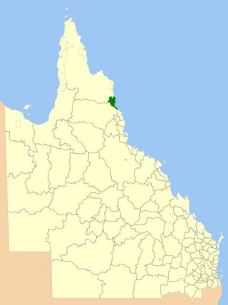
The Shire of Douglas is a local government area in Far North Queensland. It is located on the coast north of the city of Cairns. The shire, administered from the town of Mossman, covers an area of 2,428 square kilometres (937.5 sq mi), and existed as a local government entity from 1880 until 2008, when it was amalgamated with the City of Cairns to become the Cairns Region. Following a poll in 2013, the Shire of Douglas was re-established on 1 January 2014.

The Shire of Cook is a local government area in Far North Queensland, Australia. The Shire covers most of the eastern and central parts of Cape York Peninsula, the most northerly section of the Australian mainland.

The Bloomfield Falls is a cascade waterfall on the Bloomfield River near Cape Tribulation, close to Wujal Wujal in Queensland, Australia. It is within the Wet Tropics of Queensland World Heritage Area.

Cooktown is a coastal town and locality in the Shire of Cook, Queensland, Australia. Cooktown is at the mouth of the Endeavour River, on Cape York Peninsula in Far North Queensland where James Cook beached his ship, the Endeavour, for repairs in 1770. Both the town and Mount Cook which rises up behind the town were named after James Cook.

The Bloomfield Track, which is also known as the Coast Road or officially, the Cape Tribulation-Bloomfield Road, is a controversial four-wheel-drive road in Far North Queensland, Australia. The road's construction through untouched wilderness was the cause of protests and blockades in the early 1980s.

The Wujal Wujal Aboriginal Shire is a local government area in Far North Queensland, Australia. It is managed as a Deed of Grant in Trust under the Local Government Act 2004.

Bloomfield is a town in the Shire of Cook and a coastal locality which is split between the Shire of Cook and the Shire of Douglas in Queensland, Australia. The neighbourhood of Ayton is within the locality. In the 2016 census, Bloomfield had a population of 204 people.

Palmer is a rural locality in the Shire of Cook, Queensland, Australia. In the 2021 census, Palmer had a population of 46 people.

The Mossman River is a river in the Cape York Peninsula of Far North Queensland, Australia.
Mount Mulgrave is a rural locality in the Shire of Mareeba, Queensland, Australia. In the 2016 census, Mount Mulgrave had a population of 0 people.


