Kendall River (Queensland)

Last updated

Kendall
Australia Queensland relief location map.jpg
Red pog.svg
Location of Kendall River mouth in Queensland
EtymologyIn honour of Thomas Kendall [1]
Location
Country Australia
State Queensland
Region Far North Queensland
Physical characteristics
Source Great Dividing Range
  locationnorthwest of Bally Junction
  elevation154 m (505 ft)
Mouth confluence with the Holroyd River
  location
near the Kulinchin Outstation
  coordinates
14°12′21″S141°37′39″E / 14.20583°S 141.62750°E / -14.20583; 141.62750
  elevation
3 m (9.8 ft)
Length167 km (104 mi)
Basin size4,851 km2 (1,873 sq mi)
[2]

The Kendall River is a river in Far North Queensland, Australia.

Contents

The headwaters of the river rise in the Great Dividing Range and flows in a south westerly direction through mostly uninhabited country across Cape York Peninsula. It eventually discharges into the Holroyd River near the Kulinchin Outstation and then onto the Gulf of Carpentaria. [2]

The river has a catchment area of 4,851 square kilometres (1,873 sq mi), of which an area of 93 square kilometres (36 sq mi) is composed of palustrine wetlands. [3]

History

The traditional owners of the area are the Wik-Munkan [4] and Mimungkun peoples. [5]

Kugu Nganhcara (also known as Wik, Wiknantjara, Wik Nganychara, Wik Ngencherr) is a traditional language of the area, which includes the landscape within the local government boundaries of the Cook Shire. [6]

The river was named by the pastoralists, Francis Lascelles Jardine and Alexander William Jardine in 1863. It was originally known as Kendall Creek and was named after a poet friend of their surveyor, Thomas Henry Kendall. [1]

See also

Related Research Articles

<span class="mw-page-title-main">Fitzroy River (Queensland)</span> River in Queensland, Australia

The Fitzroy River is a river in Central Queensland, Australia. Its catchment covers an area of 142,665 square kilometres (55,083 sq mi), making it the largest river catchment flowing to the eastern coast of Australia. It is also the largest river basin that discharges onto the Great Barrier Reef.

The Staaten River is a river in northern Queensland, Australia, rising in the Great Dividing Range and flowing northwest into the Gulf of Carpentaria.

<span class="mw-page-title-main">Gilbert River (Queensland)</span> River in Queensland, Australia

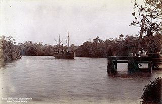
The Gilbert River is located in Far North Queensland, Australia. When combined with the Einasleigh River, the river system is the largest river system in northern Australia.

<span class="mw-page-title-main">Jardine River</span> River in Queensland, Australia

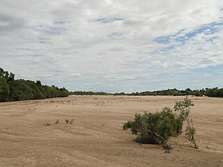
The Jardine River, formally known as Deception River, is the largest river of the Cape York Peninsula in Far North Queensland, Australia.

<span class="mw-page-title-main">Archer River</span> River in Queensland, Australia

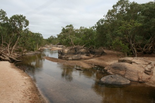
The Archer River is a river located on the Cape York Peninsula, Far North Queensland, Australia.

The Ducie River is a river located on the Cape York Peninsula in Far North Queensland, Australia.

The Calvert River is a river in the Northern Territory of Australia.

Buckingham River is a river in the Northern Territory of Australia.

<span class="mw-page-title-main">Keep River</span> River in the Northern Territory and Western Australia

The Keep River is a river located in the Victoria Bonaparte bioregion of Western Australia and the Northern Territory in Australia.

The Koolatong River is a river in the Northern Territory, Australia.

The Moyle River is a river in the Northern Territory, Australia.

<span class="mw-page-title-main">Goyder River</span> River in the Northern Territory of Australia

The Goyder River is a river in the Northern Territory of Australia.

The Walker River is a river in the Northern Territory, Australia.

The Robinson River is a river in Australia's Northern Territory.

The Nicholson River is a river in the Northern Territory and the state of Queensland, Australia.

<span class="mw-page-title-main">Lynd River</span> River in Australia

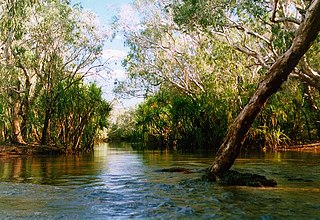
The Lynd River is a river located on the Cape York Peninsula in Far North Queensland, Australia.

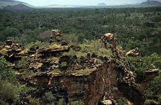
The Holroyd River is a river located on the Cape York Peninsula in Far North Queensland, Australia.

The Jackey Jackey Creek, also often called Jacky Jacky Creek, is a creek in the Cape York Peninsula region of Far North Queensland, Australia.

The Isaac River is a river and anabranch in Central Queensland, Australia.

<span class="mw-page-title-main">Proserpine River</span> River in Queensland, Australia

The Proserpine River is a river in Whitsunday Region of Queensland, Australia.

References

  1. 1 2 "Kendall River (entry 17925)". Queensland Place Names. Queensland Government . Retrieved 26 July 2015.
  2. 1 2 "Map of Kendall River, QLD". Bonzle Digital Atlas of Australia. Retrieved 26 July 2015.
  3. "Kendall River drainage basin". WetlandInfo. Queensland Government . Retrieved 26 July 2015.
  4. "Wik-Munkan". AusAnthrop Australian Aboriginal tribal database. Ausanthrop. Archived from the original on 26 September 2015. Retrieved 26 July 2015.
  5. "Mimungkun". AusAnthrop Australian Aboriginal tribal database. Ausanthrop. Archived from the original on 26 September 2015. Retrieved 26 July 2015.
  6. CC BY icon-80x15.png This Wikipedia article incorporates CC-BY-4.0 licensed text from: "Indigenous languages map of Queensland". State Library of Queensland. State Library of Queensland . Retrieved 5 February 2020.