Einasleigh River

Last updated

Einasleigh
Einasleigh River old and new Crossings - panoramio.jpg
Einasleigh River old and new crossings
Australia Queensland relief location map.jpg
Red pog.svg
Location of Einasleigh River mouth in Queensland
Location
Country Australia
State Queensland
Region Far North Queensland
Physical characteristics
Source Lyndhurst, Shire of Etheridge
  locationsoutheast of Georgetown
  coordinates 19°32′33″S144°16′50″E / 19.5424°S 144.2806°E / -19.5424; 144.2806
  elevation809 m (2,654 ft)
Mouth confluence with the Gilbert River
  coordinates
17°29′42″S142°16′14″E / 17.49500°S 142.27056°E / -17.49500; 142.27056
  elevation
79 m (259 ft)
Length618 km (384 mi)
Basin features
River system Gilbert River catchment
Tributaries 
  leftCopperfield River, Etheridge River
Lagoons Eight Mile Waterholes
[1]

The Einasleigh River is a river in Far North Queensland, Australia. When combined with the Gilbert River, the river system is the largest river system in northern Australia.[ citation needed ]

Contents

Course and features

The Einasleigh River rises in the locality of Lyndhurst in the Einasleigh Uplands within the Atherton Tableland, draining the western slopes of the Great Dividing Range below Mount Remarkable. The river flows generally north, northwest and then west. The river is joined by 33 tributaries from source to mouth including the Copperfield and Etheridge Rivers and numerous creeks before reaching its confluence with the Gilbert River north of Croydon. The Einasleigh River has a catchment area of 24,366 square kilometres (9,408 sq mi). [2] Following its confluence, the Gilbert River spills into a vast estuarine delta approximately 100 kilometres (62 mi) wide [3] that largely consists of tidal flats and mangrove swamps across the Gulf Country. The Einasleigh River descends 730 metres (2,400 ft) over its 618-kilometre (384 mi) course. [1]

East of Georgetown the river is crossed by the Einasleigh River Bridge that carries the Gulf Developmental Road.

The Einasleigh River is a seasonal stream and discharge can vary greatly depending on the intensity of the monsoon. When combined with the Gilbert River, the Einasleigh River has the sixth-highest discharge of any river in Australia,[ citation needed ] slightly less than that of the Potomac in North America. In an intense wet season, however, the discharge can be as large as that of the Fraser River in Canada, and in a mild wet season like that of 1951–52, the discharge can be as little as one tenth of the long term mean.[ citation needed ] It is estimated that runoff from the combined Gilbert-Einasleigh River system totals about 2.2 percent of the total runoff from Australia. [4] The record major flood of the Gilbert River was in January 1974 and the floods of February 1991 and in January and February 2009, caused widespread road closures and inundation of properties throughout the catchment. [3]

See also

Related Research Articles

<span class="mw-page-title-main">Fitzroy River (Queensland)</span> River in Queensland, Australia

The Fitzroy River is a river in Central Queensland, Australia. Its catchment covers an area of 142,665 square kilometres (55,083 sq mi), making it the largest river catchment flowing to the eastern coast of Australia. It is also the largest river basin that discharges onto the Great Barrier Reef.

<span class="mw-page-title-main">Cooper Creek</span> River in Queensland, South Australia

The Cooper Creek is a river in the Australian states of Queensland and South Australia. It was the site of the death of the explorers Burke and Wills in 1861. It is sometimes known as the Barcoo River from one of its tributaries and is one of three major Queensland river systems that flow into the Lake Eyre basin. The flow of the creek depends on monsoonal rains falling months earlier and many hundreds of kilometres away in eastern Queensland. It is 1,300 kilometres (810 mi) in length.

<span class="mw-page-title-main">Mitchell River (Queensland)</span> River in Queensland, Australia

The Mitchell River is a river in Far North Queensland, Australia. The river rises on the Atherton Tableland about 50 kilometres (31 mi) northwest of Cairns and flows about 750 kilometres (470 mi) northwest across Cape York Peninsula from Mareeba to the Gulf of Carpentaria.

<span class="mw-page-title-main">Stanley River (Queensland)</span> River in Queensland, Australia

The Stanley River is a perennial river in the South East region of Queensland, Australia. A major tributary of the Brisbane River, the Stanley River valley extends roughly 35 kilometres (22 mi) westwards from the area south of Maleny, through Woodford to Kilcoy before veering southwards.
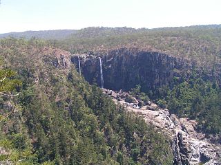
<span class="mw-page-title-main">Herbert River</span> River in Far North Queensland

The Herbert River is a river in Far North Queensland, Australia. The southernmost of Queensland's wet tropics river systems, it was named in 1864 by George Elphinstone Dalrymple explorer, after Robert George Wyndham Herbert, the first Premier of Queensland.

<span class="mw-page-title-main">Georgina River</span> River in Queensland, Australia

The Georgina River is the north-westernmost of the three major rivers of the Channel Country in Central West Queensland, that also flows through a portion of the Northern Territory, in central Australia. Part of the Lake Eyre basin, the Georgina flows in extremely wet years into Lake Eyre.

The Staaten River is a river in northern Queensland, Australia, rising in the Great Dividing Range and flowing northwest into the Gulf of Carpentaria.
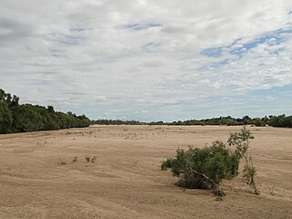
<span class="mw-page-title-main">Gilbert River (Queensland)</span> River in Queensland, Australia

The Gilbert River is located in Far North Queensland, Australia. When combined with the Einasleigh River, the river system is the largest river system in northern Australia.

<span class="mw-page-title-main">Normanby River</span> River in northern Queensland, Australia

The Normanby River, comprising the East Normanby River, the West Normanby River, the East Normanby River North Branch, the East Normanby River South Branch and the Granite Normanby River, is a river system in Far North Queensland, Australia.

<span class="mw-page-title-main">Belyando River</span> River in Queensland, Australia

The Belyando River, including the Belyando River (Western Branch), is a river system in Central Queensland, Australia. At 1,054 kilometres (655 mi) in length and with a catchment area of 35,000 square kilometres (14,000 sq mi), the Belyando River system is one of the longest rivers in Queensland.

<span class="mw-page-title-main">Johnstone River</span> River in Queensland, Australia

The Johnstone River, comprising the North Johnstone River and the South Johnstone River, is a river system in Far North and North Queensland, Australia.

<span class="mw-page-title-main">Mulgrave River</span> River in Queensland, Australia

The Mulgrave River, incorporating the East Mulgrave River and the West Mulgrave River, is a river system in Far North Queensland, Australia. The 70-kilometre (43 mi)-long river flows towards the Coral Sea and is located approximately 50 kilometres (31 mi) south of Cairns.

<span class="mw-page-title-main">Einasleigh, Queensland</span> Town in Queensland, Australia

Einasleigh is a town and a locality in the Shire of Etheridge, Queensland, Australia. In the 2016 census, the locality of Einasleigh had a population of 92 people.

The Nicholson River is a river in the Northern Territory and the state of Queensland, Australia.

The Coleman River is a river on the Cape York Peninsula in Far North Queensland, Australia.

The Mcdonald River, also known as the Macdonald River and locally as the Collett River, is a river in Far North Queensland, Australia.

The Mission River is a river in Far North Queensland, Australia.

The Esk River is a river in the Wet Tropics of Far North Queensland, Australia.

The Styx River is a river in the western portion of Central Queensland, Australia.

<span class="mw-page-title-main">Lyndhurst, Queensland</span> Suburb of Shire of Etheridge, Queensland, Australia

Lyndhurst is a locality in the Shire of Etheridge, Queensland, Australia. In the 2016 census, Lyndhurst had a population of 8 people.

References

  1. 1 2 "Map of Einasleigh River, QLD". Bonzle Digital Atlas of Australia. Retrieved 19 June 2015.
  2. "Einasleigh River drainage sub-basin — facts and maps". WetlandInfo. Department of Environment and Heritage Protection, Queensland Government . Retrieved 27 November 2015.
  3. 1 2 "Flood warning system for the Gilbert River". Bureau of Meteorology . Australian Government. Retrieved 27 November 2015.
  4. Brown, John Alexander Henstridge (1983). Australia’s Surface Water Resources. Canberra: Australian Government Publication Service.