Coleman River (Queensland)

Last updated

Coleman
Australia Queensland relief location map.jpg
Red pog.svg
Location of Coleman River mouth in Queensland
Location
Country Australia
State Queensland
Region Far North Queensland
Physical characteristics
Source Great Dividing Range
Source confluenceLittle Coleman River and Big Coleman River
  locationunder Lapunya Mount
  elevation229 m (751 ft)
Mouth Gulf of Carpentaria
  location
south of Pormpuraaw, Cape York
  coordinates
15°04′20″S141°38′59″E / 15.07222°S 141.64972°E / -15.07222; 141.64972
  elevation
0 m (0 ft)
Basin features
Tributaries 
  rightKing River (Queensland), Lukin River
[1]

The Coleman River is a river on the Cape York Peninsula in Far North Queensland, Australia. [2]

Contents

Course and features

Formed by the confluence of the Little Coleman River and Big Coleman River, the headwaters of the river rise under Lapunya Mount near The Lagoons in the Great Dividing Range and initially flows south. It flows past the Curlew Range and then turns west across the Boomerang Plain eventually discharging into the Gulf of Carpentaria between the mouth of the Mitchell River to the south and the settlement of Pormpuraaw to the north. From source to mouth, the Coleman River is joined by six tributaries including the King River and the Lukin River, and descends 234 metres (768 ft) over its 399-kilometre (248 mi) course. [1]

The catchment includes the Edward River sub-basin, and area occupies 737.6 square kilometres (285 sq mi). It contains the towns of Bamboo, Edward River, Glen Garland, Strath-Haven, Strathgordon, Strathmay and Yarraden, which includes the abandoned locale of Ebagoola. [3] The Archer River drainage basin bounds the catchment to the north and the Mitchell River Catchment to the south The river has a mean annual discharge of 520 gigalitres (680,100,000 cu yd). [4]

A total of 46 species of fish have been found in the river, including: the sailfin glassfish, barred grunter, shovel-nosed catfish, bigeye trevally, fly-specked hardyhead, golden gudgeon, pennyfish, mouth almighty, barramundi, oxeye herring, rainbowfish and seven-spot archerfish. [5]

History

The Olkola people inhabited the basin for thousands of years. [6]

Yir Yiront is an Australian Aboriginal language. Its traditional language region is in Western Cape York within the local government areas of Aboriginal Shire of Kowanyama and Shire of Cook, in the catchments of the Coleman River and Mitchell River. Following the removal of Aboriginal people from their traditional lands, it is also spoken in Pormpuraaw and Kowanyama. [7]

The river was named by the explorer William Hann in 1872. [8]

At the turn of the 20th century, a gold rush led to conflict with colonial Australians, resulting in several massacres of the Olkola. Between 2011 and 2014, the Olkola people negotiated a handback of traditionally held lands, part of which became Olkola National Park. [9]

See also

Related Research Articles

<span class="mw-page-title-main">Fitzroy River (Queensland)</span> River in Queensland, Australia

The Fitzroy River is a river in Central Queensland, Australia. Its catchment covers an area of 142,665 square kilometres (55,083 sq mi), making it the largest river catchment flowing to the eastern coast of Australia. It is also the largest river basin that discharges onto the Great Barrier Reef.

<span class="mw-page-title-main">Cape York Peninsula</span> Peninsula in Far North Queensland, Australia

Cape York Peninsula is a peninsula located in Far North Queensland, Australia. It is the largest wilderness in northern Australia. The land is mostly flat and about half of the area is used for grazing cattle. The relatively undisturbed eucalyptus-wooded savannahs, tropical rainforests and other types of habitat are now recognised and preserved for their global environmental significance. Although much of the peninsula remains pristine, with a diverse repertoire of endemic flora and fauna, some of its wildlife may be threatened by industry and overgrazing as well as introduced species and weeds.

<span class="mw-page-title-main">Mitchell River (Queensland)</span> River in Queensland, Australia

The Mitchell River is a river in Far North Queensland, Australia. The river rises on the Atherton Tableland about 50 kilometres (31 mi) northwest of Cairns and flows about 750 kilometres (470 mi) northwest across Cape York Peninsula from Mareeba to the Gulf of Carpentaria.

<span class="mw-page-title-main">Far North Queensland</span> Region in Queensland, Australia

Far North Queensland (FNQ) is the northernmost part of the Australian state of Queensland. Its largest city is Cairns and it is dominated geographically by Cape York Peninsula, which stretches north to the Torres Strait, and west to the Gulf Country. The waters of Torres Strait include the only international border in the area contiguous with the Australian mainland, between Australia and Papua New Guinea.

<span class="mw-page-title-main">Kowanyama, Queensland</span> Town in Queensland, Australia

Kowanyama is a town and coastal locality in the Aboriginal Shire of Kowanyama, Queensland, Australia.

<span class="mw-page-title-main">Pormpuraaw, Queensland</span> Town in Queensland, Australia

Pormpuraaw is a coastal town and a locality in the Aboriginal Shire of Pormpuraaw, Queensland, Australia. Pormpuraaw is an Aboriginal community situated on the west coast of Cape York Peninsula approximately halfway between Karumba and Weipa on the Edward River. It is 650 kilometres (400 mi) by road from Cairns. Pormpuraaw currently has a 4-man police station.

<span class="mw-page-title-main">Shire of Cook</span> Local government area in Queensland, Australia

The Shire of Cook is a local government area in Far North Queensland, Australia. The Shire covers most of the eastern and central parts of Cape York Peninsula, the most northerly section of the Australian mainland.

<span class="mw-page-title-main">Gilbert River (Queensland)</span> River in Queensland, Australia

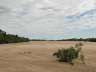
The Gilbert River is located in Far North Queensland, Australia. When combined with the Einasleigh River, the river system is the largest river system in northern Australia.

The Edward River is a river in Far North Queensland, Australia.

<span class="mw-page-title-main">Jardine River</span> River in Queensland, Australia

The Jardine River, formally known as Deception River, is the largest river of the Cape York Peninsula in Far North Queensland, Australia.

<span class="mw-page-title-main">Aboriginal Shire of Kowanyama</span> Local government area in Queensland, Australia

The Aboriginal Shire of Kowanyama is a special local government area which is located on western Cape York Peninsula in Queensland, Australia. It is managed under a Deed of Grant in Trust under the Local Government Act 2004.

The Thaayorre, or Kuuk Thaayore, are an Australian people living on the southwestern part of the Cape York Peninsula, Queensland in Australia, primarily in the settlement Pormpuraaw, having its foundation in the Edward River Mission.

The Uw Oykangand, otherwise known as the Kwantari, are an Aboriginal Australian people living on the southwestern part of the Cape York Peninsula, in the state of Queensland in Australia. Their neighbours to the northwest are the Yir-Yoront people. Their traditional lands are around the Alice River and the Crosbie River, and further west around the Mitchell River and into Gulf Country.

The Alice River is a river located on the Cape York Peninsula of Far North Queensland, Australia.

<span class="mw-page-title-main">Lynd River</span> River in Queensland, Australia

The Lynd River is a river located on the Cape York Peninsula in Far North Queensland, Australia.

The Walsh River is a river located on the Cape York Peninsula of Far North Queensland, Australia.

The Watson River is a river in Far North Queensland, Australia.

The Holroyd River is a river located on the Cape York Peninsula in Far North Queensland, Australia.

The Kendall River is a river in Far North Queensland, Australia.

<span class="mw-page-title-main">Mossman River</span> River in Far North Queensland, Australia

The Mossman River is a river in lower Cape York Peninsula, Queensland, Australia.

References

  1. 1 2 "Map of Coleman River". Bonzle Digital Atlas of Australia. Retrieved 16 June 2015.
  2. Science, jurisdiction=Queensland; sector=government; corporateName=Department of Environment and. "Coleman River drainage sub-basin — facts and maps". wetlandinfo.des.qld.gov.au. Retrieved 22 January 2023.{{cite web}}: CS1 maint: multiple names: authors list (link)
  3. "Coleman drainage basin". WetlandInfo. Queensland Government . Retrieved 28 October 2018.
  4. "Coleman River sub-basin within the Mitchell - Gilbert Fans sub-bioregion". WetlandInfo. Queensland Government . Retrieved 17 June 2015.
  5. "Coleman River catchment". Fish Atlas of North Australia. Retrieved 28 June 2015.
  6. "Olkola Country". Olkola Aboriginal Corporation. Archived from the original on 29 October 2018. Retrieved 28 October 2018.
  7. CC BY icon-80x15.png This Wikipedia article incorporates CC-BY-4.0 licensed text from: "Yir Yiront". Queensland Aboriginal and Torres Strait Islander languages map. State Library of Queensland . Retrieved 30 January 2020.
  8. "Coleman River (entry 7710)". Queensland Place Names. Queensland Government . Retrieved 28 June 2014.
  9. "Olkola Aboriginal Corporation". Olkola Aboriginal Corporation. Retrieved 28 October 2018.