
Cape York Peninsula is a peninsula located in Far North Queensland, Australia. It is the largest wilderness in northern Australia. The land is mostly flat and about half of the area is used for grazing cattle. The relatively undisturbed eucalyptus-wooded savannahs, tropical rainforests and other types of habitat are now recognised and preserved for their global environmental significance. Although much of the peninsula remains pristine, with a diverse repertoire of endemic flora and fauna, some of its wildlife may be threatened by industry and overgrazing as well as introduced species and weeds.

Weipa is a coastal mining town in the local government area of Weipa Town in Queensland. It is one of the largest towns on the Cape York Peninsula. It exists because of the enormous bauxite deposits along the coast. The Port of Weipa is mainly involved in exports of bauxite. There are also shipments of live cattle from the port.

Laura is a rural town and locality in the Shire of Cook, Queensland, Australia. In the 2016 census the locality of Laura had a population of 228 people.

Daintree is a rural town and locality in the Shire of Douglas, Queensland, Australia. In the 2016 census, Daintree had a population of 129 people.

Wujal Wujal, sometimes spelt Wudjil Wudjil, is a rural town and locality in the Wujal Wujal Aboriginal Shire, Queensland, Australia. It is an Aboriginal community. In the 2021 census, the locality of Wujal Wujal had a population of 276 people.

Cape Tribulation is a headland and coastal locality in the Shire of Douglas in northern Queensland, Australia. In the 2021 census, Cape Tribulation had a population of 123 people.

Far North Queensland (FNQ) is the northernmost part of the Australian state of Queensland. Its largest city is Cairns and it is dominated geographically by Cape York Peninsula, which stretches north to the Torres Strait, and west to the Gulf Country. The waters of Torres Strait include the only international border in the area contiguous with the Australian mainland, between Australia and Papua New Guinea.
Aurukun is a town and coastal locality in the Shire of Aurukun and the Shire of Cook in Far North Queensland, Australia. It is an Indigenous community. In the 2016 census, the locality of Aurukun had a population of 1,269 people.

Kowanyama is a town and coastal locality in the Aboriginal Shire of Kowanyama, Queensland, Australia.

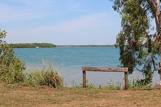
Pormpuraaw is a coastal town and a locality in the Aboriginal Shire of Pormpuraaw, Queensland, Australia. Pormpuraaw is an Aboriginal community situated on the west coast of Cape York Peninsula approximately halfway between Karumba and Weipa on the Edward River. It is 650 kilometres (400 mi) by road from Cairns. Pormpuraaw currently has a 4-man police station.

The Shire of Cook is a local government area in Far North Queensland, Australia. The Shire covers most of the eastern and central parts of Cape York Peninsula, the most northerly section of the Australian mainland.

The Bloomfield River is a river in the Wet Tropics of Far North Queensland, Australia, noted for its Bloomfield River cod fish species, found only in the river.

The Aboriginal Shire of Pormpuraaw is a special local government area which is located on western Cape York Peninsula in Queensland, Australia. It is managed under a Deed of Grant in Trust under the Local Government Act 2004.
The Thaayorre, or Kuuk Thaayore, are an Australian people living on the southwestern part of the Cape York Peninsula, Queensland in Australia, primarily in the settlement Pormpuraaw, having its foundation in the Edward River Mission.

The Wujal Wujal Aboriginal Shire is a local government area in Far North Queensland, Australia. It is managed as a Deed of Grant in Trust under the Local Government Act 2004.

Bloomfield is a town in the Shire of Cook and a coastal locality which is split between the Shire of Cook and the Shire of Douglas in Queensland, Australia. The neighbourhood of Ayton is within the locality. In the 2016 census, Bloomfield had a population of 204 people.

Palmer is a rural locality in the Shire of Cook, Queensland, Australia. In the 2021 census, Palmer had a population of 46 people.

The Mossman River is a river in lower Cape York Peninsula, Queensland, Australia.
Mission River is a coastal rural locality split between the Shire of Cook and the Aboriginal Shire of Napranum in Queensland, Australia. In the 2021 census, Mission River had a population of 974 people.
Mount Mulgrave is a rural locality in the Shire of Mareeba, Queensland, Australia. In the 2016 census, Mount Mulgrave had a population of 0 people.
