Shelburne, Queensland

Last updated

Shelburne
Queensland
Australia Queensland location map.svg
Red pog.svg
Shelburne
Coordinates 12°02′19″S142°58′35″E / 12.0386°S 142.9763°E / -12.0386; 142.9763 (Shelburne (centre of locality))
Population44 (SAL 2021) [1]
Postcode(s) 4874
Area10,006.8 km2 (3,863.6 sq mi)
Time zone AEST (UTC+10:00)
LGA(s) Shire of Cook
State electorate(s) Cook
Federal division(s) Leichhardt
Suburbs around Shelburne:
Mapoon Jardine River Coral Sea
Mapoon Shelburne Coral Sea
Wenlock Wenlock Iron Range

Shelburne is a northern coastal locality in the Shire of Cook, Queensland, Australia. [2] In the 2021 census, Shelburne had a population of 44 people. [3]

Contents

Geography

The Great Dividing Range enters the locality from the north (Jardine River) and exits to the south-west (Wenlock), but then forms the south-western boundary of the locality. [4]

The Pascoe River forms the south-eastern boundary of the locality, flowing into th Coral Sea.The eastern boundary of the locality is within the Coral Sea as the boundary of the locality encompasses a number of off-shore islands. [4]

Parts of Shelburn are protected areas. In the north of the locality is the Heathlands Resources Reserve. In the east of the locality is the Wuthathi (Shelburne Bay) National Park and the Bromley (Ampulin) National Park. In the south of the locality is the Bromley (Kungkaychi) National Park. [4] Apart from these protected areas, the predominant land use is grazing on native vegetation. [4]

History

In 1976, the Australian Conservation Foundation first proposed the establishment of a national park to protect Shelburne Bays' white silica sand dunes. In 1987, a silica sand mining project in the area was rejected by Prime Minister Bob Hawke because of environmental concerns and the adverse impact on the Aboriginal community who had sacred sites in the area. On 15 December 2016 the Queensland Treasurer Curtis Pitt announced that more than 118,000 hectares (290,000 acres) of land would be returned to the Wuthathi people with 40,000 hectares (99,000 acres) set aside to create the Wuthathi (Shelburne Bay) National Park which would be jointly managed by the Queensland Government and the Wuthathi people. [5] [6]

On 17 May 2017, the Queensland Government announced that 160,730 hectares (397,200 acres) of land set aside in 1986 for the development of a spaceport would be returned to the Wuthathi, Kuuku Ya’u and Northern Kaanju people. 40,350 hectares (99,700 acres) of the land would be used to establish Bromley (Ampulin) National and 10,680 hectares (26,400 acres) used to establish Bromley (Kungkaychi) National Parks, both of which would be jointly managed by the Bromley Aboriginal Corporation and the Queensland Government. [7]

Demographics

In the 2016 census, Shelburne had a population of 31 people. [8]

In the 2021 census, Shelburne had a population of 44 people. [3]

Education

There are no schools in Shelburne nor nearby. Options are distance education and boarding school. [9]

Attractions

There are a number of lookouts in Shelburne, including:

Related Research Articles

<span class="mw-page-title-main">Apudthama National Park</span> Protected area in Queensland, Australia

The Apudthama National Park is a national park in Queensland, Australia, 2,137 km (1,328 mi) northwest of Brisbane and about 900 km (559 mi) northwest of Cairns, on the tip of Cape York Peninsula.

<span class="mw-page-title-main">Seisia, Queensland</span> Town in Queensland, Australia

Seisia is a coastal town and a locality in the Northern Peninsula Area Region, Queensland, Australia. In the 2021 census, the locality of Seisia had a population of 293 people.

<span class="mw-page-title-main">Somerset, Queensland</span> Suburb of Shire of Torres, Queensland, Australia

Somerset is a coastal locality split between the Shire of Torres and the Northern Peninsula Area Region, Queensland, Australia. In the 2021 census, Somerset had a population of 0 people.

<span class="mw-page-title-main">Camp Mountain, Queensland</span> Suburb of City of Moreton Bay, Queensland, Australia

Camp Mountain is a rural locality in the City of Moreton Bay, Queensland, Australia. In the 2016 census, Camp Mountain had a population of 1,416 people.

<span class="mw-page-title-main">Cape Grenville</span> Point in Queensland, Australia

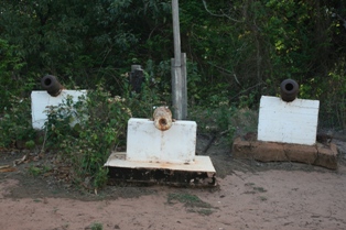
Cape Grenville, is a small, east-facing promontory along the Queensland, Australia coast of Cape York Peninsula. It lies between Shelburne Bay to the north and Temple Bay to the south. The nearest significant settlement is Weipa, along the western coast of Cape York.

Meridan Plains is a locality on the north-western edge of the Caloundra urban area in the Sunshine Coast Region, Queensland, Australia. Traditionally a rural area, the locality is attracting residential development from the expansion of Caloundra. In the 2021 census, Meridan Plains had a population of 4,589 people.

<span class="mw-page-title-main">Jollys Lookout, Queensland</span> Suburb of City of Moreton Bay, Queensland, Australia

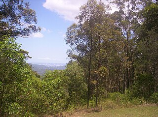
Jollys Lookout is a rural locality in the City of Moreton Bay, Queensland, Australia. In the 2016 census, Jollys Lookout had a population of 76 people.

<span class="mw-page-title-main">Rosslyn, Queensland</span> Town in Queensland, Australia

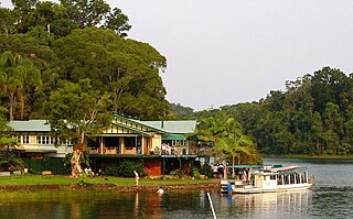
Rosslyn is a coastal town and locality in the Livingstone Shire, Queensland, Australia. In the 2016 census, the locality of Rosslyn had a population of 574 people.

<span class="mw-page-title-main">Lake Barrine, Queensland</span> Suburb of Tablelands Region, Queensland, Australia

Lake Barrine is a rural locality in the Tablelands Region, Queensland, Australia. In the 2021 census, Lake Barrine had a population of 170 people.

Opalton is a rural locality in the Shire of Winton, Queensland, Australia. In the 2016 census Opalton had a population of 64 people. The Opalton township is located adjacent to the Opalton Opal Field, one of the largest and most extensively worked opal deposits in Queensland.

Gheerulla is a rural locality in the Sunshine Coast Region, Queensland, Australia. In the 2016 census, Gheerulla had a population of 214 people.

The Wuthathi, also known as the Mutjati, are an Aboriginal Australian people of the state of Queensland. Anthropologist Norman Tindale distinguished the Mutjati from the Otati, whereas AIATSIS treats the two ethnonyms as variants related to the one ethnic group, the Wuthathi.

Maramie is a locality in the Shire of Carpentaria, Queensland, Australia. In the 2021 census, Maramie had a population of 28 people.

Black Snake is a rural locality in the Gympie Region, Queensland, Australia. In the 2021 census, Black Snake had a population of 88 people.

The Narrows is a coastal locality in the Gladstone Region, Queensland, Australia. In the 2021 census, The Narrows had a population of 0 people.

<span class="mw-page-title-main">Kimberley, Queensland</span> Suburb of Shire of Douglas, Queensland, Australia

Kimberley is a coastal locality in the Shire of Douglas, Queensland, Australia. In the 2021 census, Kimberley had a population of 28 people.

Dirnbir is a rural locality in the North Burnett Region, Queensland, Australia. In the 2021 census, Dirnbir had a population of 59 people.

Frankfield is a rural locality in the Isaac Region, Queensland, Australia. In the 2021 census, Frankfield had a population of 100 people.

<span class="mw-page-title-main">Mamu, Queensland</span> Suburb of Cassowary Coast Region, Queensland, Australia

Mamu is a rural locality in the Cassowary Coast Region, Queensland, Australia. In the 2021 census, Mamu had a population of 0 people.Mamu’s postcode is 4871.

Lumholtz is a rural locality in the Cassowary Coast Region, Queensland, Australia. In the 2021 census, Lumholtz had a population of 0 people.

References

  1. Australian Bureau of Statistics (28 June 2022). "Shelburne (suburb and locality)". Australian Census 2021 QuickStats. Retrieved 28 June 2022.  OOjs UI icon edit-ltr-progressive.svg
  2. "Shelburne – locality in Shire of Cook (entry 46139)". Queensland Place Names. Queensland Government . Retrieved 29 December 2017.
  3. 1 2 Australian Bureau of Statistics (28 June 2022). "Shelburne (SAL)". 2021 Census QuickStats. Retrieved 28 February 2023. OOjs UI icon edit-ltr-progressive.svg
  4. 1 2 3 4 "Queensland Globe". State of Queensland . Retrieved 4 January 2024.
  5. Sexton-McGrath, Kristy (15 December 2016). "Shelburne Bay handed back to the Wuthathi people after 20-year fight". ABC News . Australian Broadcasting Corporation. Archived from the original on 2 October 2018. Retrieved 5 June 2019.
  6. Pitt, Curtis; Bailey, Mark; Miles, Steven (15 December 2016). "Sands of Shelburne returned to Traditional Owners". Media Statements. Queensland Government. Archived from the original on 4 June 2019. Retrieved 5 June 2019.
  7. Palaszczuk, Annastacia; Miles, Steve; Furner, Mark (17 May 2017). "Bromley back in Traditional ownership". Media Statements. Queensland Government. Archived from the original on 25 March 2019. Retrieved 5 June 2019.
  8. Australian Bureau of Statistics (27 June 2017). "Shelburne (SSC)". 2016 Census QuickStats. Retrieved 20 October 2018. OOjs UI icon edit-ltr-progressive.svg
  9. "Layers: Locality; Schools and school catchments". Queensland Globe. Queensland Government. Archived from the original on 19 December 2017. Retrieved 4 January 2024.
  10. 1 2 "Tourist points - Queensland". Queensland Open Data. Queensland Government. 18 November 2020. Archived from the original on 24 November 2020. Retrieved 24 November 2020.
  11. "Nature, culture and history | Jardine River National Park, Heathlands Resources Reserve and Jardine River Resources Reserve". Parks and forests. Queensland Government. 20 September 2011. Archived from the original on 19 November 2023. Retrieved 4 January 2024.