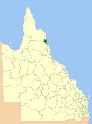
Mount Cook National Park is a protected area in the locality of Cooktown, in the Shire of Cook, Queensland, Australia.

Hebel is a rural town and locality in the Shire of Balonne, Queensland, Australia. It is on the border of Queensland and New South Wales. In the 2021 census, the locality of Hebel had a population of 62 people.

Normanton is an outback town and coastal locality in the Shire of Carpentaria, Queensland, Australia. At the 2021 census, the locality of Normanton had a population of 1,391 people, and the town of Normanton had a population of 1,326 people.

Laura is a rural town and locality in the Shire of Cook, Queensland, Australia. In the 2021 census, the locality of Laura had a population of 133 people.

Cameron Corner is an outback locality in the Shire of Bulloo, Queensland, Australia. It is on the Queensland border with New South Wales to the south and South Australia to the west. In the 2021 census, Cameron Corner had a population of 19 people.

The Shire of Richmond is a local government area in north western Queensland, Australia.

The Shire of Douglas is a local government area in Far North Queensland. It is located on the coast north of the city of Cairns. The shire, administered from the town of Mossman, covers an area of 2,428 square kilometres (937.5 sq mi), and existed as a local government entity from 1880 until 2008, when it was amalgamated with the City of Cairns to become the Cairns Region. Following a poll in 2013, the Shire of Douglas was re-established on 1 January 2014.

The Shire of Cook is a local government area in Far North Queensland, Australia. The Shire covers most of the eastern and central parts of Cape York Peninsula, the most northerly section of the Australian mainland.
Federal is a rural locality in the Shire of Noosa, Queensland, Australia. It is located in the Sunshine Coast hinterland near the towns of Cooran and Pomona. In the 2021 census, Federal had a population of 365 people.

Como is a rural locality in the Shire of Noosa, Queensland, Australia. In the 2021 census, Como had a population of 54 people.

Hungerford is an outback town in the Shire of Bulloo and a locality in the Shire of Bulloo and Shire of Paroo, South West Queensland, Australia. The locality is on the Queensland border with New South Wales.

Jundah is a rural town and locality in the Shire of Barcoo, Queensland, Australia. Jundah is the administrative centre of the Barcoo Shire local government area. In the 2021 census, the locality of Jundah had a population of 131 people.
Gilbert River is a rural locality in the Shire of Etheridge, Queensland, Australia. In the 2021 census, Gilbert River had a population of 32 people.

Dixie is a rural locality in the Shire of Cook, Queensland, Australia. In the 2021 census, Dixie had a population of 43 people.
Yarraden is a coastal rural locality in the Shire of Cook, Queensland, Australia. In the 2021 census, Yarraden had a population of 53 people.
Strathmore is a locality split between the Shire of Mareeba and the Shire of Etheridge, in Queensland, Australia. In the 2021 census, Strathmore had "no people or a very low population".
Nychum is a rural locality in the Shire of Mareeba, Queensland, Australia. In the 2021 census, Nychum had "no people or a very low population".
Hurricane is a rural locality in the Shire of Mareeba, Queensland, Australia. In the 2021 census, Hurricane had "no people or a very low population".
Kunwarara is a rural locality in the Livingstone Shire, Queensland, Australia. In the 2021 census, Kunwarara had a population of 69 people.
Marton is a town in the Shire of Cook, Queensland, Australia. The town is within the locality of Cooktown.


