
Mapoon is a coastal town in the Aboriginal Shire of Mapoon and a locality split between the Aboriginal Shire of Mapoon and the Shire of Cook in Queensland, Australia. In the 2021 census, the locality of Mapoon had a population of 469 people.

The Shire of Cook is a local government area in Far North Queensland, Australia. The Shire covers most of the eastern and central parts of Cape York Peninsula, the most northerly section of the Australian mainland.

The Wujal Wujal Aboriginal Shire is a local government area in Far North Queensland, Australia. It is managed as a Deed of Grant in Trust under the Local Government Act 2004.

Bloomfield is a rural town in the Shire of Cook and a coastal locality which is split between the Shire of Cook and the Shire of Douglas in Queensland, Australia. The neighbourhood of Ayton is within the locality. In the 2021 census, the locality of Bloomfield had a population of 228 people.

Dixie is a rural locality in the Shire of Cook, Queensland, Australia. In the 2021 census, Dixie had a population of 43 people.
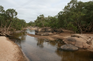
Archer River is a rural locality in the Shire of Cook, Queensland, Australia. In the 2021 census, Archer River had a population of 27 people.
Edward River is a rural locality in the Shire of Cook, Queensland, Australia. In the 2021 census, Edward River had "no people or a very low population".

Lakefield is a coastal locality in the Shire of Cook, Queensland, Australia. In the 2021 census, Lakefield had a population of 21 people.

Cawarral is a rural town and locality in the Livingstone Shire, Queensland, Australia. In the 2021 census, the locality of Cawarral had a population of 831 people.
The Aboriginal Shire of Lockhart River is a local government area in Far North Queensland, Australia.

The Aboriginal Shire of Napranum is a local government area in Far North Queensland, Australia. It is on the western side of the Cape York Peninsula around Weipa.
Cassowary is a rural locality in the Shire of Douglas, Queensland, Australia. In the 2021 census, Cassowary had a population of 119 people.
Jardine River is a coastal locality split between the Shire of Cook and the Shire of Torres in Queensland, Australia. In the 2021 census, Jardine River had "no people or a very low population".
Rookwood is a rural locality in the Shire of Mareeba, Queensland, Australia. In the 2021 census, Rookwood had a population of 9 people.
Mission River is a coastal rural locality split between the Shire of Cook and the Aboriginal Shire of Napranum in Queensland, Australia. In the 2021 census, Mission River had a population of 974 people.
Shelburne is a northern coastal locality in the Shire of Cook, Queensland, Australia. In the 2021 census, Shelburne had a population of 44 people.
Holroyd River is a locality in the Shire of Cook, Queensland, Australia. In the 2021 census, Holroyd River had "no people or a very low population".
Gwambegwine is a rural locality in the Shire of Banana, Queensland, Australia. In the 2021 census, Gwambegwine had a population of 27 people.
Highbury is a rural locality in the Shire of Mareeba, Queensland, Australia. In the 2021 census, Highbury had a population of 9 people.
Mount Mulgrave is a rural locality in the Shire of Mareeba, Queensland, Australia. In the 2021 census, Mount Mulgrave had a population of 11 people.
