Shire of Cook

Last updated

Shire of Cook
Queensland
Cook LGA Qld.png
Location within Queensland
Coordinates 15°28′05.4″S145°15′02″E / 15.468167°S 145.25056°E / -15.468167; 145.25056
Population4,445 (2018) [1]
 • Density0.042045/km2 (0.108897/sq mi)
Established1919
Area105,719 km2 (40,818.3 sq mi) [1]
MayorPeter Scott
Council seat Cooktown
Region Far North Queensland
State electorate(s) Cook
Federal division(s) Leichhardt
Cook Shire Council.png
Website Shire of Cook
LGAs around Shire of Cook:
Northern Peninsula Area
Gulf of Carpentaria
Torres Northern Peninsula Area
Mapoon
Napranum
Aurukun
Shire of Cook Coral Sea
Carpentaria Mareeba Douglas

The Shire of Cook (The Shire) is a local government area in Far North Queensland, Australia. The Shire covers most of the eastern and central parts of Cape York Peninsula, the most northerly section of the Australian mainland.

Contents

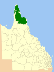
It covers an area of 105,718 square kilometres (40,817.9 sq mi), [1] and is the largest LGA in the state. The shire was established in 1919.

The Daintree and Hann Divisions were created on 11 November 1879 as two of 74 divisions around Queensland under the Divisional Boards Act 1879. [2] [3]

With the passage of the Local Authorities Act 1902, they became the Shires of Daintree and Hann on 31 March 1903. [2] [3] [4] [5]

On 16 January 1919, they merged to form the Shire of Cook. [4] [5] [6]

The Borough of Cooktown was proclaimed as a separate municipality on 3 April 1876 under the Municipal Institutions Act 1864. On 24 August 1932, the Town of Cooktown (the successor to the Borough of Cooktown) was absorbed back into Cook Shire. [6] [7]

Prior to 2005, a number of Aboriginal communities administered under Deed of Grant in Trust by community councils were part of the Shire's area, but they were formally excised and given a new status as Aboriginal Shires. This formed part of the Meeting Challenges, Making Choices strategy developed in response to the Cape York Justice Study undertaken by Justice Fitzgerald QC in November 2001. [8]

The Local Government Reform process in July 2007 concluded that amalgamation of the Shire would not result in any benefits to service delivery and management for the area, noting that it was (and is) the largest local government by area and had no community of interest with any neighbouring areas. The council was, however, reduced from seven to six councillors with an additional elected mayor. [9]

Towns and localities

The Shire of Cook includes the following settlements:

1 – shared with the Shire of Douglas

2 – shared with the Aboriginal Shire of Hope Vale

3 – shared with the Aboriginal Shire of Lockhart River

4 – shared with the Aboriginal Shire of Mapoon

And also a number of islands in the Coral Sea, including:

Libraries

The Cook Shire Council operate public libraries at Bloomfield and Cooktown. [10]

Chairmen and mayors

Population

The population of the Shire of Cook, along with Torres, Aurukun and Mornington, have been singled out by the Australian Bureau of Statistics (ABS), who conduct the quinquennial census, as particularly difficult to measure accurately. Reasons for this include cultural and language barriers, transport and geographical spread of the population, who are mostly located in isolated communities. As such, all figures are likely to be lower than the actual population on the census date. Additionally, prior to 1971, Aboriginal people who form a majority of the population were not counted in census statistics.

Until 1 July 2002, the Australian Bureau of Statistics included the Island and DOGIT councils within the Shire of Cook statistical local area. Information for the reduced Shire back to 1996 has been provided on the ABS website through the Time Series Profile.

YearPopulation
19332,068
19471,139
19541,545
19611,869
19662,463
19715,538
19766,128
19814,456
19864,776
19918,785
19965,232
20014,776
20064,653
20114,152
20164,226

Indigenous languages

Guugu Yimithirr (also known as Koko Yindjir, Gugu Yimidhirr, Guguyimidjir) is an Australian Aboriginal language of Hope Vale and the Cooktown area. The language region includes the local government area of the Aboriginal Shire of Hope Vale and the Shire of Cook, particularly the localities of Cape Bedford, Battle Camp and sections of the Normanby River and Annan River. [18]

Kuku-Thaypan (also known as Gugu Dhayban, Kuku Taipan, Thaypan) is an Australian Aboriginal language spoken in Hann River, Laura and Musgrave River and on Mornington Island, within the local government boundaries of the Cook Shire. [19]

Kuku Yalanji (also known as Gugu Yalanji, Kuku Yalaja, and Kuku Yelandji) is an Australian Aboriginal language of the Mossman and Daintree areas of North Queensland. The language region includes areas within the local government area of Shire of Douglas and Shire of Cook, particularly the localities of Mossman, Daintree, Bloomfield River, China Camp, Maytown, Palmer, Cape Tribulation and Wujal Wujal. [20]

Yupanguthi (also known as Yuputhimri, Jupangati, Yupangathi, Nggerikudi, Yupungati, Jupangati) is an Australian Aboriginal language spoken on Yupanguthi country. The Yupanguthi language region includes the landscape within the local government boundaries of the landscape within the local government boundaries of the Shire of Cook. [21]

Linngithigh (also known as Winda Winda and Linginiti) is an Australian Aboriginal language spoken by the Linngithigh people. The Linngithigh language region includes landscape within the local government boundaries of the Cook Shire Council: Western Cape York, Winda Winda Creek, Mission River, and Archer River. [22]

Luthigh (also known as Lotiga, Tepiti and Uradhi, see also Uradhi related languages) is an Australian Aboriginal language spoken by the Luthigh people. The traditional language area for Luthigh includes landscape within the local government boundaries of the Cook Shire: Eastern Cape York, Ducie River, Northern Peninsula, New Mapoon, Injinoo, and Cowal Creek. [23]

Yalanji (also known as Kuku Yalanji, Kuku Yalaja, Kuku Yelandji, and Gugu Yalanji) is an Australian Aboriginal language of Far North Queensland. The traditional language region is Mossman River in the south to the Annan River in the north, bordered by the Pacific Ocean in the east and extending inland to west of Mount Mulgrave. This includes the local government boundaries of the Shire of Douglas, the Shire of Cook and the Aboriginal Shire of Wujal Wujal and the towns and localities of Cooktown, Mossman, Daintree, Cape Tribulation and Wujal Wujal. It includes the head of the Palmer River, the Bloomfield River, China Camp, Maytown, and Palmerville. [24]

Yir Yiront (also known as Yiront, Jirjoront, Yir-yiront, and Kokomindjan) is an Australian Aboriginal language. Its traditional language region is in Western Cape York within the local government areas of Aboriginal Shire of Kowanyama and Shire of Cook, in the catchments of the Coleman River and Mitchell River. Following the removal of Aboriginal people from their traditional lands, it is also spoken in Pormpuraaw and Kowanyama. [25]

Kuuku Ya'u (also known as Gugu Yau, Yao, Ya'o, Koko Ya'o and Koka-yao) is an Australian Aboriginal language. The traditional language area of Kuuku Ya'u includes landscape within the local government boundaries of the Cook Shire: Eastern Cape York, Uu'ungun south to Claudie River and hinterland. [26]

Kuuk Thaayorre (also known as Koko-Daiyuri, Kuku Yak, Thayorre, and used as a generic name for several related languages/dialects) is an Australian Aboriginal Language spoken on Western Cape York, particularly in the area around Pormpuraaw (Edward River). The Thaayorre language region includes the landscape within Pormpuraaw Community Council and the Cook Shire Council. [27]

Related Research Articles

<span class="mw-page-title-main">Cape York Peninsula</span> Peninsula in Far North Queensland, Australia

Cape York Peninsula is a peninsula located in Far North Queensland, Australia. It is the largest wilderness in northern Australia. The land is mostly flat and about half of the area is used for grazing cattle. The relatively undisturbed eucalyptus-wooded savannahs, tropical rainforests and other types of habitat are now recognised and preserved for their global environmental significance. Although much of the peninsula remains pristine, with a diverse repertoire of endemic flora and fauna, some of its wildlife may be threatened by industry and overgrazing as well as introduced species and weeds.

<span class="mw-page-title-main">Weipa</span> Town in Queensland, Australia

Weipa is a coastal mining town in the local government area of Weipa Town in Queensland. It is the largest town on the Cape York Peninsula. It exists because of the enormous bauxite deposits along the coast. The Port of Weipa is mainly involved in exports of bauxite. There are also shipments of live cattle from the port.

<span class="mw-page-title-main">Laura, Queensland</span> Town in Queensland, Australia

Laura is a rural town and locality in the Shire of Cook, Queensland, Australia. In the 2016 census the locality of Laura had a population of 228 people.

<span class="mw-page-title-main">Daintree, Queensland</span> Town in Queensland, Australia

Daintree is a rural town and locality in the Shire of Douglas, Queensland, Australia. In the 2016 census, Daintree had a population of 129 people.

<span class="mw-page-title-main">Wujal Wujal</span> Town in Queensland, Australia

Wujal Wujal, sometimes spelt Wudjil Wudjil, is a rural town and locality in the Wujal Wujal Aboriginal Shire, Queensland, Australia. It is an Aboriginal community. In the 2021 census, the locality of Wujal Wujal had a population of 276 people.

<span class="mw-page-title-main">Maytown, Queensland</span> Historic site in Queensland, Australia

Maytown was the main township on the Palmer River Goldfields in Far North Queensland, Australia. It is now a ghost town within locality of Palmer in the Shire of Cook, having been active from c. 1874 to the 1920s. It was added to the Queensland Heritage Register on 1 June 2004.

<span class="mw-page-title-main">Cape Tribulation, Queensland</span> Suburb of Shire of Douglas, Queensland, Australia

Cape Tribulation is a headland and coastal locality in the Shire of Douglas in northern Queensland, Australia. In the 2021 census, Cape Tribulation had a population of 123 people.

<span class="mw-page-title-main">Far North Queensland</span> Region in Queensland, Australia

Far North Queensland (FNQ) is the northernmost part of the Australian state of Queensland. Its largest city is Cairns and it is dominated geographically by Cape York Peninsula, which stretches north to the Torres Strait, and west to the Gulf Country. The waters of Torres Strait include the only international border in the area contiguous with the Australian mainland, between Australia and Papua New Guinea.

<span class="mw-page-title-main">Palmer River</span> River in Queensland, Australia

The Palmer River is a river in Far North Queensland, Australia. The area surrounding the river was the site of a gold rush in the late 19th century which started in 1873.

<span class="mw-page-title-main">Kuku Yalanji</span> Aboriginal Australian people of Far North Queensland rainforest region

The Kuku Yalanji, also known as Gugu-Yalanji, Kuku Yalandji or Kokojelandji, are an Aboriginal Australian people originating from the rainforest regions of Far North Queensland.

<span class="mw-page-title-main">Mossman, Queensland</span> Town in Queensland, Australia

Mossman is a rural town and locality in the Shire of Douglas, Queensland, Australia. It is the administrative centre for the Douglas Shire Council In the 2016 census, the locality of Mossman had a population of 1,937 people.

<span class="mw-page-title-main">Shire of Douglas</span> Local government area in Queensland, Australia

The Shire of Douglas is a local government area in Far North Queensland. It is located on the coast north of the city of Cairns. The shire, administered from the town of Mossman, covers an area of 2,428 square kilometres (937.5 sq mi), and existed as a local government entity from 1880 until 2008, when it was amalgamated with the City of Cairns to become the Cairns Region. Following a poll in 2013, the Shire of Douglas was re-established on 1 January 2014.

<span class="mw-page-title-main">Bloomfield River</span> River in Far North Queensland, Australia

The Bloomfield River is a river in the Wet Tropics of Far North Queensland, Australia, noted for its Bloomfield River cod fish species, found only in the river.

<span class="mw-page-title-main">Cooktown, Queensland</span> Town in Queensland, Australia

Cooktown is a coastal town and locality in the Shire of Cook, Queensland, Australia. Cooktown is at the mouth of the Endeavour River, on Cape York Peninsula in Far North Queensland where James Cook beached his ship, the Endeavour, for repairs in 1770. Both the town and Mount Cook which rises up behind the town were named after James Cook.

<span class="mw-page-title-main">Wujal Wujal Aboriginal Shire</span> Local government area in Queensland, Australia

The Wujal Wujal Aboriginal Shire is a local government area in Far North Queensland, Australia. It is managed as a Deed of Grant in Trust under the Local Government Act 2004.

<span class="mw-page-title-main">Bloomfield, Queensland</span> Suburb of Shire of Cook, Queensland, Australia

Bloomfield is a town in the Shire of Cook and a coastal locality which is split between the Shire of Cook and the Shire of Douglas in Queensland, Australia. The neighbourhood of Ayton is within the locality. In the 2016 census, Bloomfield had a population of 204 people.

<span class="mw-page-title-main">Palmer, Queensland</span> Suburb of Shire of Cook, Queensland, Australia

Palmer is a rural locality in the Shire of Cook, Queensland, Australia. In the 2021 census, Palmer had a population of 46 people.

<span class="mw-page-title-main">Archer River, Queensland</span> Suburb of Shire of Cook, Queensland, Australia

Archer River is a rural locality in the Shire of Cook, Queensland, Australia. In the 2016 census Archer River had a population of 22 people.

<span class="mw-page-title-main">Mossman River</span> River in Far North Queensland, Australia

The Mossman River is a river in lower Cape York Peninsula, Queensland, Australia.

Mount Mulgrave is a rural locality in the Shire of Mareeba, Queensland, Australia. In the 2016 census, Mount Mulgrave had a population of 0 people.

References

  1. 1 2 3 "3218.0 – Regional Population Growth, Australia, 2017-18: Population Estimates by Local Government Area (ASGS 2018), 2017 to 2018". Australian Bureau of Statistics. Australian Bureau of Statistics. 27 March 2019. Retrieved 25 October 2019. Estimated resident population, 30 June 2018.
  2. 1 2 "Agency ID 813, Daintree Divisional Board". Queensland State Archives . Retrieved 10 September 2013.
  3. 1 2 "Agency ID 936, Hann Divisional Board". Queensland State Archives . Retrieved 10 September 2013.
  4. 1 2 "Agency ID 814, Daintree Shire Council". Queensland State Archives . Retrieved 10 September 2013.
  5. 1 2 "Agency ID 937, Hann Shire Council". Queensland State Archives . Retrieved 10 September 2013.
  6. 1 2 "Agency ID 603, Cook Shire Council". Queensland State Archives . Retrieved 10 September 2013.
  7. "Order in Council". Queensland Government Gazette . 6 August 1932. p. 138:400.
  8. McDougall, Scott (January 2006). Palm Island: Future Directions – Resource Officer Report (PDF). Brisbane, Queensland: Queensland Department of Aboriginal and Torres Strait Islander Policy. p. 27. Archived from the original (PDF) on 7 July 2007.
  9. Queensland Local Government Reform Commission (July 2007). Report of the Local Government Reform Commission (PDF). Vol. 2. pp. 93–96. ISBN   978-1-921057-11-3 . Retrieved 17 September 2009.[ permanent dead link ]
  10. "Cook Shire Council Libraries Service". Public Libraries Connect. State Library of Queensland. 20 September 2016. Retrieved 2 February 2018.
  11. Hargreaves, John Henry Queensland Parliament. Retrieved 15 May 2016.
  12. Pugh, Theophilus Parsons (1927). Pugh's Almanac for 1927 . Retrieved 13 June 2014.
  13. "Mayor Peter Scott". Cook Shire. Cook Shire Council. Archived from the original on 15 June 2014. Retrieved 15 June 2014.
  14. "2008 Cook Shire – Mayoral Election – Election Summary". results.ecq.qld.gov.au. Retrieved 4 December 2017.
  15. "2012 Cook Shire – Mayoral Election – Election Summary". results.ecq.qld.gov.au. Retrieved 4 December 2017.
  16. "2016 Cook Shire Council – Mayoral Election – Election Summary". results.ecq.qld.gov.au. Retrieved 4 December 2017.
  17. "2020 Local Government Elections: Saturday, 28 March 2020". Electoral Commission of Queensland. 2020. Archived from the original on 16 June 2020. Retrieved 16 June 2020.
  18. CC BY icon-80x15.png This Wikipedia article incorporates CC-BY-4.0 licensed text from: "Guugu Yimithirr". Queensland Aboriginal and Torres Strait Islander languages map. State Library of Queensland . Retrieved 28 January 2020.
  19. CC BY icon-80x15.png This Wikipedia article incorporates text from Indigenous Languages map of Queensland published by the State Library of Queensland under CC BY licence , accessed on 30 January 2020.
  20. CC BY icon-80x15.png This Wikipedia article incorporates CC-BY-4.0 licensed text from: "Kuku Yalanji". Queensland Aboriginal and Torres Strait Islander languages map. State Library of Queensland . Retrieved 28 January 2020.
  21. CC BY icon-80x15.png This Wikipedia article incorporates CC-BY-4.0 licensed text from: "Yupanguthi". Queensland’s Aboriginal and Torres Strait Islander Languages map. State Library of Queensland . Retrieved 28 January 2020.
  22. "Linngithigh". State Library of Queensland. Retrieved 30 January 2020.
  23. "Luthigh". State Library of Queensland. Retrieved 30 January 2020.
  24. CC BY icon-80x15.png This Wikipedia article incorporates CC-BY-4.0 licensed text from: "Yalanji". Queensland Aboriginal and Torres Strait Islander languages map. State Library of Queensland . Retrieved 5 February 2020.
  25. CC BY icon-80x15.png This Wikipedia article incorporates CC-BY-4.0 licensed text from: "Yir Yiront". Queensland Aboriginal and Torres Strait Islander languages map. State Library of Queensland . Retrieved 30 January 2020.
  26. "Kuuku Ya'u". State Library of Queensland. Retrieved 30 January 2020.
  27. "Kuuk Thaayorre". State Library of Queensland. Retrieved 30 January 2020.