Injinoo, Queensland

Last updated

Injinoo
Queensland
Injinoo-cape-york-queensland-australia.jpg
Injinoo, Cape York, Australia.
Australia Queensland location map.svg
Red pog.svg
Injinoo
Coordinates 10°54′22″S142°19′32″E / 10.9062°S 142.3255°E / -10.9062; 142.3255
Population498 (2021 census) [1]
 • Density0.6601/km2 (1.7097/sq mi)
Postcode(s) 4876
Area754.4 km2 (291.3 sq mi)
LGA(s)
State electorate(s) Cook
Federal division(s) Leichhardt
Localities around Injinoo:
Torres Strait Torres Strait Umagico
Gulf of Carpentaria Injinoo Jardine River
Gulf of Carpentaria Mapoon Jardine River

Injinoo (formerly Cowal Creek) is a coastal town in the Northern Peninsula Area Region and a locality split between Northern Peninsula Area Region and the Shire of Torres in Far North Queensland, Australia. [2] [3] [4] It is on the north-western coast of Cape York Peninsula. In the 2021 census, the locality of Injinoo had a population of 498 people. [1]

Contents

History

Luthigh (also known as Lotiga, Tepiti and Uradhi, see also Uradhi related languages) is an Australian Aboriginal language spoken by the Luthigh people. The traditional language area for Luthigh includes landscape within the local government boundaries of the Cook Shire: Eastern Cape York, Ducie River, Northern Peninsula, New Mapoon, Injinoo, and Cowal Creek. [5]

Uradhi (also known as Anggamudi, Ankamuti, Atampaya, Bawtjathi, and Lotiga) is an Australian Aboriginal language of the Western Cape York Peninsula. The traditional language region includes north of Mapoon and Duyfken Point and east of the coast strip to the north of Port Musgrave (Angkamuthi country) incorporating the mouth of the Ducie River, the lower reaches of the Dulhunty River and the upper reaches of the Skardon River in the north. Following the displacement of Indigenous people by British settlement, it was also spoken in the Northern Peninsula Area Region including the communities of New Mapoon, Injinoo and Cowal Creek. [6]

Injinoo Aboriginal Community was an Aboriginal settlement and later Anglican mission established on Cape York by a community led by a Wuthathi man, Allelic Whitesand.

Although self-sufficient, through fishing and gardening, the Community made requests to the then Church of England to establish a mission and school. Queensland government officials allowed the community to function through an elected Council.

After the Second World War, which saw a considerable military presence in the area, many Torres Strait Islanders began moving into Injinoo. Settlements were subsequently built at Bamaga, New Mapoon and Umagico to relocate evicted people from this and other areas of the Cape. In 1948 a reserve was created, with control of the area having been taken over by the Queensland Department of Native Affairs.

The official name of the community was changed from Cowal Creek to Injinoo on 2 September 1989. [2]

Demographics

In the 2006 census, the town of Injinoo had a population of 416 people. [7]

In the 2016 census, the locality of Injinoo had a population of 561 people. [8]

In the 2021 census, the locality of Injinoo had a population of 498 people. [1]

Education

The Injinoo Junior campus of the Northern Peninsula Area College is a government primary (Early Childhood-6) campus of Northern Peninsula Area State College at Bowie Street ( 10°54′21″S142°19′22″E / 10.9057°S 142.3228°E / -10.9057; 142.3228 (Northern Peninsula Area College - Injinoo Junior) ). [9] [10]

There are no secondary schools in Injinoo. The nearest government secondary school is the Senior Campus of the Northern Peninsula Area College in Bamaga to the north-east. [11]

Facilities

In 2012, the Indigenous Knowledge Centre was opened at Injinoo, operated by the Northern Peninsula Area Regional Council. [12] It has produced a video detailing traditional bush foods as part of a children's language workshop. [13]

Related Research Articles

<span class="mw-page-title-main">Cape York Peninsula</span> Peninsula in Far North Queensland, Australia

Cape York Peninsula is a peninsula located in Far North Queensland, Australia. It is the largest wilderness in northern Australia. The land is mostly flat and about half of the area is used for grazing cattle. The relatively undisturbed eucalyptus-wooded savannahs, tropical rainforests and other types of habitat are now recognised and preserved for their global environmental significance. Although much of the peninsula remains pristine, with a diverse repertoire of endemic flora and fauna, some of its wildlife may be threatened by industry and overgrazing as well as introduced species and weeds.

<span class="mw-page-title-main">Far North Queensland</span> Region in Queensland, Australia

Far North Queensland (FNQ) is the northernmost part of the Australian state of Queensland. Its largest city is Cairns and it is dominated geographically by Cape York Peninsula, which stretches north to the Torres Strait, and west to the Gulf Country. The waters of Torres Strait include the only international border in the area contiguous with the Australian mainland, between Australia and Papua New Guinea.

<span class="mw-page-title-main">Bamaga</span> Town in Queensland, Australia

Bamaga is an Indigneous town and locality about 40 kilometres (25 mi) from the northern tip of Cape York in the north of Queensland, Australia. It is within the Northern Peninsula Area Region. It is one of the northernmost settlements in continental Australia and is the administrative centre for the Northern Peninsula Area Regional Council.

<span class="mw-page-title-main">Seisia, Queensland</span> Town in Queensland, Australia

Seisia is a coastal town and a locality in the Northern Peninsula Area Region, Queensland, Australia. In the 2021 census, the locality of Seisia had a population of 293 people.
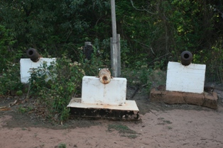
<span class="mw-page-title-main">Somerset, Queensland</span> Suburb of Shire of Torres, Queensland, Australia

Somerset is a coastal locality split between the Shire of Torres and the Northern Peninsula Area Region, Queensland, Australia. In the 2021 census, Somerset had "no people or a very low population".

<span class="mw-page-title-main">Kowanyama, Queensland</span> Town in Queensland, Australia

Kowanyama is a town and coastal locality in the Aboriginal Shire of Kowanyama, Queensland, Australia.

<span class="mw-page-title-main">Mapoon, Queensland</span> Town in Queensland, Australia

Mapoon is a coastal town in the Aboriginal Shire of Mapoon and a locality split between the Aboriginal Shire of Mapoon and the Shire of Cook in Queensland, Australia. In the 2021 census, the locality of Mapoon had a population of 469 people.

<span class="mw-page-title-main">Injinoo</span>

The Injinoo were an Indigenous Australian people of the Cape York Peninsula, and their name now applies to a tribal aggregation of remnants of various tribes of the Cape York Peninsula.

<span class="mw-page-title-main">New Mapoon, Queensland</span> Town in Queensland, Australia

New Mapoon is a town in the Northern Peninsula Area Region and coastal locality split between the Northern Peninsula Region and Shire of Torres, Queensland, Australia. In the 2021 census, the locality of New Mapoon had a population of 412 people.

Urradhi is a Paman language of the Cape York Peninsula of Queensland, Australia, and is apparently extinct. It was spoken by the Urradhi people. Urradhi proper is the south-western dialect of the language. The name is composed of urra "this" and the proprietive dhi "having". The south-eastern dialect of the same language, Wudhadhi, is made of the same elements, wudha being "this". These are part of a group of closely related and highly mutually intelligible dialects, these being Angkamuthi to the north of Urradhi, Atampaya inland from these, Utudhanamu inland north from Atampaya, Yantaykenu further north, being the language of the Bamaga area, Yadhaykenu on the east coast north of Wudhadhi, and Yaraytyana further north again. This group has no common language name, though Urradhi is commonly used as a cover name. It is unknown when it became extinct.

Luthigh is an extinct Paman language formerly spoken on the Cape York Peninsula of Queensland, Australia, by the Luthigh people. It is unknown when it became extinct. It constitutes a single language with Mpalitjanh. According to Sharp (1939), the neighboring Unjadi (Unyadi) language differed only marginally from that spoken by the Okara [Luthigh].

Anguthimri is an extinct Paman language formerly spoken on the Cape York Peninsula of Queensland, Australia, by the Anguthimri people who lived in the area from the mouth of the Mission River north to Pennefather River and west to Duyfken Point. It is unknown when it became extinct.

<span class="mw-page-title-main">Shire of Cook</span> Local government area in Queensland, Australia

The Shire of Cook is a local government area in Far North Queensland, Australia. The Shire covers most of the eastern and central parts of Cape York Peninsula, the most northerly section of the Australian mainland.

<span class="mw-page-title-main">Northern Peninsula Area Region</span> Local government area in Queensland, Australia

The Northern Peninsula Area Region is a local government area in Far North Queensland, Australia, covering areas on the northwestern coast of Cape York Peninsula. It was created in March 2008 out of three Aboriginal Shires and two autonomous Island Councils during a period of statewide local government reform.

<span class="mw-page-title-main">Port Musgrave</span> Estuarine bay in Far North Queensland

Port Musgrave is a shallow, almost enclosed, estuarine bay located on the western coast of the Cape York Peninsula in Far North Queensland, Australia.

The Ducie River is a river located on the Cape York Peninsula in Far North Queensland, Australia.

<span class="mw-page-title-main">Wujal Wujal Aboriginal Shire</span> Local government area in Queensland, Australia

The Wujal Wujal Aboriginal Shire is a local government area in Far North Queensland, Australia. It is managed as a Deed of Grant in Trust under the Local Government Act 2004.

<span class="mw-page-title-main">Aboriginal Shire of Mapoon</span> Local government area in Queensland, Australia

The Aboriginal Shire of Mapoon is a local government area in Far North Queensland, Australia. It is on the western coast of Cape York Peninsula on the Gulf of Carpentaria. In the 2021 census, the Aboriginal Shire of Mapoon had a population of 432 people.
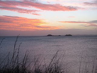
<span class="mw-page-title-main">Umagico, Queensland</span> Town in Queensland, Australia

Umagico is a town and coastal locality in the Northern Peninsula Area Region, Queensland, Australia. In the 2021 census, the locality of Umagico had a population of 394 people.

Duyfken Point is a point in the locality of Mission River, Shire of Cook, Queensland, Australia.

References

  1. 1 2 3 Australian Bureau of Statistics (28 June 2022). "Injinoo (SAL)". 2021 Census QuickStats. Retrieved 28 February 2023. OOjs UI icon edit-ltr-progressive.svg
  2. 1 2 "Injinoo – town in Northern Peninsula Area Region (entry 16700)". Queensland Place Names. Queensland Government . Retrieved 28 December 2017.
  3. "Injinoo – locality in Northern Peninsula Area Region (entry 46104)". Queensland Place Names. Queensland Government . Retrieved 28 December 2017.
  4. "Injinoo – locality in Shire of Torres (entry 48214)". Queensland Place Names. Queensland Government . Retrieved 28 December 2017.
  5. "Luthigh". State Library of Queensland. Archived from the original on 23 April 2021. Retrieved 30 January 2020.
  6. CC BY icon-80x15.png This Wikipedia article incorporates CC-BY-4.0 licensed text from: "Uradhi". Queensland Aboriginal and Torres Strait Islander languages map. State Library of Queensland . Retrieved 5 February 2020.
  7. Australian Bureau of Statistics (25 October 2007). "Injinoo (L) (Urban Centre/Locality)". 2006 Census QuickStats. Retrieved 29 May 2011.
  8. Australian Bureau of Statistics (27 June 2017). "Injinoo (SSC)". 2016 Census QuickStats. Retrieved 20 October 2018. OOjs UI icon edit-ltr-progressive.svg
  9. "State and non-state school details". Queensland Government. 9 July 2018. Archived from the original on 21 November 2018. Retrieved 21 November 2018.
  10. "Northern Peninsula Area College - Injinoo Junior" . Retrieved 21 November 2018.
  11. "Layers: Locality; Schools and school catchments". Queensland Globe. Queensland Government . Retrieved 27 August 2024.
  12. "Injinoo Indigenous Knowledge Centre | Public Libraries Connect". State Library of Queensland. Archived from the original on 30 January 2018. Retrieved 30 January 2018.
  13. "Injinoo Culture Love 2012 Bush Foods". Vimeo. Archived from the original on 28 August 2022. Retrieved 30 January 2018.

Commons-logo.svg Media related to Injinoo, Queensland at Wikimedia Commons