South Burnett Region

Last updated

South Burnett Region
Queensland
South burnett LGA Qld 2008.png
Location within Queensland
Population32,555 (2018) [1]
 • Density3.88392/km2 (10.0593/sq mi)
Established2008
Area8,382 km2 (3,236.3 sq mi) [1]
MayorBrett Wayne Otto
Council seat Kingaroy
State electorate(s) Callide
Federal Division(s)
South Burnett Regional Council Logo.jpg
Website South Burnett Region
LGAs around South Burnett Region:
North Burnett North Burnett Gympie
Western Downs South Burnett Region Gympie, Somerset
Western Downs Toowoomba Somerset

The South Burnett Region is a local government area in the South Burnett district of Queensland, Australia.

Contents

Origins

This Local Government was created in March 2008 as a result of the report of the Local Government Reform Commission released in July 2007.

Prior to the 2008 amalgamation, the South Burnett Region, located in the southern catchment of the Burnett River, existed as four distinct local government areas:

The report recommended the new local government area should not be divided into wards and should elect six councilors and a mayor however the Interim Steering Committee applied to the State Government for four wards based on the old shire boundaries. As the total population is just a few hundred short of the level set in the report for eight councilors and a mayor, application for this was also made.

Area and size

The South Burnett Region covers an area 8,382 square kilometres (3,236 sq mi), [1] containing a population of 32,555 [1] in June 2018 and has an estimated operating budget of A$42 m (as at 2008).

The Aboriginal community of Cherbourg has been excluded from the amalgamated area and continues to have its own local government.

Towns and localities

The South Burnett Region includes the following settlements:

Libraries

The South Burnett Regional Council operate public libraries at Blackbutt, Kingaroy, Murgon, Nanango, Proston, and Wondai. [2]

Mayor and Councillors

2008 election

On 15 March 2008, the first mayor elected to the South Burnett Region was David Ian Carter. [3]

The first councillors elected to the South Burnett Region were as follows:

2012 election

In the elections held on 28 April 2012, [10] Wayne Kratzmann was elected mayor; he was unopposed. [11]

The councillors elected were:

2016 election

In the elections held on 19 March 2016, [18] Keith Campbell was elected mayor; he was one of five candidates. [19]

The councillors elected were: [20]

2020 election

In the election held on 28 March 2020, Brett Wayne Otto was elected mayor. [21]

The councillors elected were: [21]

Related Research Articles

Shire of Winton Local government area in Queensland, Australia

The Shire of Winton is a local government area in Central West Queensland, Australia. It covers an area of 53,814 square kilometres (20,777.7 sq mi), and has existed as a local government entity since 1887. Its administrative centre is located in the town of Winton. It is named after Winton, Dorset, England, the birthplace of Robert Allen, the first white settler in the Winton (Queensland) area.

Shire of Diamantina Local government area in Queensland, Australia

The Shire of Diamantina is a local government area in Central West Queensland, bordering South Australia and the Northern Territory. Its administrative centre is in the town of Bedourie.

Shire of Flinders (Queensland) Local government area in Queensland, Australia

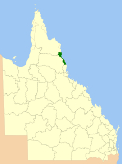
The Shire of Flinders is a local government area in north-western Queensland, Australia.

City of Ipswich Local government area in Queensland, Australia

The City of Ipswich is a local government area in Queensland, Australia, located in the southwest of the Brisbane metropolitan area, including the urban area surrounding the city of Ipswich and surrounding rural areas.

Moreton Bay Region Local government area in Queensland, Australia

The Moreton Bay Region is a local government area in the north of the Brisbane metropolitan area in South East Queensland, Australia. Established in 2008, it replaced three established local government areas, the City of Redcliffe and the Shires of Pine Rivers and Caboolture.

North Burnett Region Local government area in Queensland, Australia

The North Burnett Region is a local government area in Queensland, Australia in the northern catchment of the Burnett River. Established in 2008, it was preceded by several previous local government areas with histories extending back to the early 1900s.

Maranoa Region Local government area in Queensland, Australia

Maranoa Region is a local government area in South West Queensland, Australia. The town of Roma is the administrative headquarters of the region.

Cassowary Coast Region Local government area in Queensland, Australia

The Cassowary Coast Region is a local government area in the Far North Queensland region of Queensland, Australia, south of Cairns and centred on the towns of Innisfail, Cardwell and Tully. It was created in 2008 from a merger of the Shire of Cardwell and the Shire of Johnstone.

Tablelands Region Local government area in Queensland, Australia

The Tablelands Region is a local government area in Far North Queensland, Australia inland from the city of Cairns. Established in 2008, it was preceded by four previous local government areas which dated back more than a century. On 1 January 2014, one of those local government areas, the Shire of Mareeba, was re-established independent of the Tablelands Region.

Longreach Region Local government area in Queensland, Australia

The Longreach Region is a local government area in Central West Queensland, Australia. Established in 2008, it superseded three previous local government areas that had existed for more than a century.

Blackall-Tambo Region Local government area in Queensland, Australia

The Blackall-Tambo Region is a local government area in Central West Queensland, Australia. Established in 2008, it was preceded by two previous local government areas dating from the 1870s.

Bundaberg Region Local government area in Queensland, Australia

The Bundaberg Region is a local government area in the Wide Bay–Burnett region of Queensland, Australia, about 360 kilometres (220 mi) north of Brisbane, the state capital. It is centred on the city of Bundaberg, and also contains a significant rural area surrounding the city. It was created in 2008 from a merger of the City of Bundaberg with the Shires of Burnett, Isis and Kolan.

Toowoomba Region Local government area in Queensland, Australia

The Toowoomba Region is a local government area located in the Darling Downs part of Queensland, Australia. Established in 2008, it was preceded by several previous local government areas with histories extending back to the early 1900s and beyond.

Mackay Region Local government area in Queensland, Australia

The Mackay Region is a local government area located in North Queensland, Queensland, Australia. Established in 2008, it was preceded by three previous local government areas with modern histories extending back as far as 1869.

Fraser Coast Region Local government area in Queensland, Australia

The Fraser Coast Region is a local government area in the Wide Bay–Burnett region of Queensland, Australia, about 250 kilometres (160 mi) north of Brisbane, the state capital. It is centred on the twin cities of Hervey Bay and Maryborough, and also contains Fraser Island. It was created in 2008 from a merger of the Cities of Maryborough and Hervey Bay and the Shires of Woocoo and most of Tiaro. In June 2018 it had a population of 105,463.

Southern Downs Region Local government area in Queensland, Australia

The Southern Downs Region is a local government area in the Darling Downs region of Queensland, Australia, along the state's boundary with New South Wales. It was created in 2008 from a merger of the Shire of Warwick and the Shire of Stanthorpe.

Western Downs Region Local government area in Queensland, Australia

Western Downs Region is a local government area in Queensland, Australia. The Western Downs Regional Council manages an area of 37,937 square kilometres (14,648 sq mi), which is slightly smaller than Switzerland, although with a population of 34,467 in June 2018, it is over 228 times less densely populated.

Gympie Region Local government area in Queensland, Australia

The Gympie Region is a local government area in the Wide Bay–Burnett region of Queensland, Australia, about 170 kilometres (110 mi) north of Brisbane, the state capital. It is between the Sunshine Coast and Hervey Bay and centred on the town of Gympie. It was created in 2008 from a merger of the Shires of Cooloola and Kilkivan and part of the Shire of Tiaro.

Cairns Region Local government area in Queensland, Australia

The Cairns Region is a local government area in Far North Queensland, Queensland, Australia, centred on the regional centre of Cairns. It was established in 2008 by the amalgamation of the City of Cairns and the Shire of Douglas. However, following public protest and a referendum in 2013, on 1 January 2014, the Shire of Douglas was separated from the Cairns Region and re-established as a local government authority.

Northern Peninsula Area Region Local government area in Queensland, Australia

The Northern Peninsula Area Region is a local government area in Far North Queensland, Australia, covering areas on the northwestern coast of Cape York Peninsula. It was created in March 2008 out of three Aboriginal Shires and two autonomous Island Councils during a period of statewide local government reform. In June 2018, the area had a population of 3,069.

References

  1. 1 2 3 4 "3218.0 – Regional Population Growth, Australia, 2017-18: Population Estimates by Local Government Area (ASGS 2018), 2017 to 2018". Australian Bureau of Statistics. Australian Bureau of Statistics. 27 March 2019. Retrieved 25 October 2019. Estimated resident population, 30 June 2018.
  2. "Locate a library". South Burnett Regional Council . Archived from the original on 31 January 2018. Retrieved 31 January 2018.
  3. "2008 South Burnett Regional Council – Mayoral Election – Election Summary". Electoral Commission Queensland. Archived from the original on 15 May 2013. Retrieved 21 December 2013.
  4. "2008 South Burnett Regional Council – Councillor Election – Division 1 – Division Summary". Electoral Commission Queensland. Archived from the original on 6 April 2011. Retrieved 21 December 2013.
  5. "2008 South Burnett Regional Council – Councillor Election – Division 2 – Division Summary". Electoral Commission of Queensland. Archived from the original on 6 April 2011. Retrieved 21 December 2013.
  6. "2008 South Burnett Regional Council – Councillor Election – Division 3 – Division Summary". Electoral Commission of Queensland. Archived from the original on 6 April 2011. Retrieved 21 December 2013.
  7. "2008 South Burnett Regional Council – Councillor Election – Division 4 – Division Summary". Electoral Commission of Queensland. Archived from the original on 6 April 2011. Retrieved 21 December 2013.
  8. "2008 South Burnett Regional Council – Councillor Election – Division 5 – Division Summary". Electoral Commission Queensland. Archived from the original on 6 April 2011. Retrieved 21 December 2013.
  9. "2008 South Burnett Regional Council – Councillor Election – Division 6 – Division Summary". Electoral Commission Queensland. Archived from the original on 6 April 2011. Retrieved 21 December 2013.
  10. "2012 South Burnett Regional Council Mayoral / Councillor Election : 28 April 2012". Electoral Commission Queensland. Archived from the original on 23 February 2014. Retrieved 21 December 2013.
  11. "2012 South Burnett Regional Council – Mayoral Election – Election Summary". Electoral Commission Queensland. Archived from the original on 23 February 2014. Retrieved 21 December 2013.
  12. "2012 South Burnett Regional Council – Councillor Election – Division 1 – Division Summary". Electoral Commission Queensland. Archived from the original on 24 December 2013. Retrieved 21 December 2013.
  13. "2012 South Burnett Regional Council – Councillor Election – Division 2 – Division Summary". Electoral Commission Queensland. Archived from the original on 21 December 2013. Retrieved 21 December 2013.
  14. "2012 South Burnett Regional Council – Councillor Election – Division 3 – Division Summary". Electoral Commission Queensland. Archived from the original on 24 December 2013. Retrieved 21 December 2013.
  15. "2012 South Burnett Regional Council – Councillor Election – Division 4 – Division Summary". Electoral Commission Queensland. Archived from the original on 24 December 2013. Retrieved 21 December 2013.
  16. "2012 South Burnett Regional Council – Councillor Election – Division 5 – Division Summary". Electoral Commission Queensland. Archived from the original on 21 December 2013. Retrieved 21 December 2013.
  17. "2012 South Burnett Regional Council – Councillor Election – Division 6 – Division Summary". Electoral Commission Queensland. Archived from the original on 24 December 2013. Retrieved 21 December 2013.
  18. "Local government elections". Queensland Government. 30 March 2016. Archived from the original on 27 August 2016. Retrieved 27 August 2016.
  19. "2016 South Burnett Regional Council - Mayoral Election - Election Summary". Electoral Commission of Queensland. 20 April 2016. Archived from the original on 27 August 2016. Retrieved 27 August 2016.CS1 maint: BOT: original-url status unknown (link)
  20. "2016 South Burnett Regional Council - Councillor Election - Election Summary". Electoral Commission of Queensland. 20 April 2016. Archived from the original on 24 September 2016. Retrieved 27 August 2016.
  21. 1 2 "2020 Local Government Elections: Saturday, 28 March 2020". Electoral Commission of Queensland. 2020. Retrieved 16 June 2020.[ dead link ]

Coordinates: 26°32′25.6″S151°50′20.3″E / 26.540444°S 151.838972°E / -26.540444; 151.838972