
Kingaroy is a rural town and locality in the South Burnett Region, Queensland, Australia. The town is situated on the junction of the D'Aguilar and the Bunya Highways, 218 kilometres (135 mi) north-west of the state capital Brisbane and 141 kilometres (88 mi) south west of Gympie. In the 2021 census, the locality of Kingaroy had a population of 10,266 people.

Murgon is a rural town and locality in the South Burnett Region, Queensland, Australia. In the 2021 census, the locality of Murgon had a population of 2,220 people.

Mulgildie is a rural town and locality in the North Burnett Region, Queensland, Australia. In the 2021 census, the locality of Mulgildie had a population of 147 people.
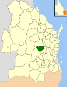
The Shire of Kingaroy was a local government area in the South Burnett area of Queensland, Australia, about 100 kilometres (62 mi) northwest of the capital, Brisbane. The shire covered an area of 2,420.3 square kilometres (934.5 sq mi), and existed as a local government area from 1912 until 2008, when it amalgamated with a number of other local government areas in the South Burnett area to become the South Burnett Region.

Wooroolin is a rural town and a locality in the South Burnett Region, Queensland, Australia.

Kumbia is a rural town and locality in the South Burnett Region, Queensland, Australia. In the 2021 census, the locality of Kumbia had a population of 301 people.

Booie is a rural locality in the South Burnett Region, Queensland, Australia. In the 2021 census, Booie had a population of 1,094 people.
Gordonbrook is a rural locality in the South Burnett Region, Queensland, Australia. In the 2021 census, Gordonbrook had a population of 184 people.

Haly Creek is a rural locality in the South Burnett Region, Queensland, Australia. In the 2021 census, Haly Creek had a population of 124 people.
Alice Creek is a rural locality in the South Burnett Region, Queensland, Australia. In the 2021 census, Alice Creek had a population of 50 people.
Coolabunia is a rural locality in the South Burnett Region, Queensland, Australia. In the 2021 census, Coolabunia had a population of 173 people.
Benair is a rural locality in the South Burnett Region, Queensland, Australia. In the 2021 census, Benair had a population of 151 people.

Brooklands is a rural locality in the South Burnett Region, Queensland, Australia. In the 2021 census, Brooklands had a population of 324 people.

Bunya Mountains is a locality split between the Western Downs Region and the South Burnett Region, Queensland, Australia. The town of Mount Mowbullan is located on the boundary of Bunya Mountains and the enclosed locality of Mowbullan. In the 2021 census, Bunya Mountains had a population of 110 people.
Cushnie is a rural locality in the South Burnett Region, Queensland, Australia. In the 2021 census, Cushnie had a population of 145 people.
Ellesmere is a rural locality in the South Burnett Region, Queensland, Australia. In the 2021 census, Ellesmere had a population of 334 people.
Goodger is a rural locality in the South Burnett Region, Queensland, Australia. In the 2021 census, Goodger had a population of 176 people.
Inverlaw is a rural locality in the South Burnett Region, Queensland, Australia. In the 2021 census, Inverlaw had a population of 190 people.
Mannuem is a rural locality in the South Burnett Region, Queensland, Australia. In the 2021 census, Mannuem had a population of 87 people.
Sandy Ridges is a rural locality in the South Burnett Region, Queensland, Australia. In the 2021 census, Sandy Ridges had a population of 111 people.
