Memerambi, Queensland

Last updated

Memerambi
Queensland
MemerambiShop.JPG
The "Stop Shop"
Australia Queensland location map.svg
Red pog.svg
Memerambi
Coordinates 26°26′59″S151°49′24″E / 26.4497°S 151.8233°E / -26.4497; 151.8233 (Memerambi (town centre))
Population338 (SAL 2021) [1]
Postcode(s) 4610
Area30.7 km2 (11.9 sq mi)
Time zone AEST (UTC+10:00)
Location
LGA(s) South Burnett Region
State electorate(s) Nanango
Federal division(s) Maranoa
Localities around Memerambi:
Wooroolin Wooroolin Corndale
Gordonbrook Memerambi Corndale
Crawford Crawford Kingaroy

Memerambi is a rural town and locality in the South Burnett Region, Queensland, Australia. [2] [3] In the 2021 census, the locality of Memerambi had a population of 338 people. [4]

Contents

Geography

The town is on the Bunya Highway, 239 kilometres (149 mi) north west of the state capital, Brisbane. [5]

The Nanango railway line ran immediately west of the highway with the town being served by the Memerambi railway station ( 26°27′06″S151°49′21″E / 26.4516°S 151.8225°E / -26.4516; 151.8225 (Memerambi railway station) ). [6]

History

The name Memerambi is an Aboriginal word for the sugargum tree. [2]

The town was surveyed on 7 May 1904 by surveyor Hector Munro. [2] On 17 October 1904, the first government land sales occurred in the new town of Memerambi with 58 town lots and 74 suburban lots on offer. [7]

On 19 December 1904, the final stage of the Nanango railway line from Murgon to Kingaroy was opened with Memeambi railway station serving the town. [8] This section of the line was closed in July 1964. [9]

Memerambi Provisional School opened on 16 October 1905. On 1 January 1909, it became Memerambi State School. The school celebrated its centenary on 15 October 2005. It was mothballed on 31 December 2006 and closed on 23 October 2007. [10] [11] The school was at 1-27 King Street ( 26°27′02″S151°49′40″E / 26.4505°S 151.8279°E / -26.4505; 151.8279 (Memerambi State School (former)) ). [12] [13] [5] The school's website was archived. [14]

Memerambi Methodist Church was built in 1908 at a cost of £100. It could seat 100 people. It was on the corner of Corndale Road and Earl Street ( 26°27′05″S151°49′26″E / 26.451455°S 151.824°E / -26.451455; 151.824 (Memerambi Methodist Church) ). In 1956, it was relocated to Corndale. [15]

A postal receiving office opened in Memerambi in 1909. Memerambi Post Office opened September 1910 and closed in 1978. [16]

All Saints' Anglican Church was dedicated on 9 April 1912. It closed circa 1966. [17]

Memerambi was once[ when? ] a bustling centre with a hotel, two general stores, saddlery, butcher, bank, mobile sawmill and cheese factory.[ citation needed ]

At the 2006 census, Memerambi and the surrounding area had a population of 541. [18]

In the 2016 census, the locality of Memerambi had a population of 272 people. [19]

In the 2021 census, the locality of Memerambi had a population of 338 people. [4]

Education

There are no schools in Memerambi. The nearest government primary schools are Wooroolin State School in neighbouring Wooroolin to the north and Crawford State School in neighbouring Crawford to the south. The nearest government secondary school is Kingaroy State High School in Kingaroy to the south. [5]

Facilities

Old closed shops on Bunya Highway, main street in Memerambi, 2023 Old closed shops on Bunya Highway, main street in Memerambi, 2023.jpg
Old closed shops on Bunya Highway, main street in Memerambi, 2023

Today[ when? ] businesses in Memerambi include 'Stop Shop' general store; clock repairs; large machinery & engineering works; pharmaceutical manufacturing; stock feed store; graziers; concreting & pool construction. [20]

Notable residents

Mr T. J. Kingston and family, first storekeepers of Memerambi, circa 1910 Mr T. J. Kingston and family, first storekeepers of Memerambi, circa 1910.jpg
Mr T. J. Kingston and family, first storekeepers of Memerambi, circa 1910

Mr and Mrs T.J Kingston were the first storekeepers in Memerambi. [21]

Arthur Benjamin Postle, a professional sprinter known as "The Crimson Flash", was acclaimed "the fastest man in the world" in 1906. He moved to Memerambi in 1913 and operated his own auctioning business there. [22]

Ben and Harry Young, of Memerambi, pioneers of the South Burnett peanut industry, planted the first commercial crop of peanuts in the South Burnett in 1919. These brothers were sons of a Chinese immigrant, Ah Young. Harry Young later designed the first peanut thresher in Queensland and Ben became a director of the Peanut Marketing Board. [23]

See also

Related Research Articles

<span class="mw-page-title-main">Kingaroy</span> Town in Queensland, Australia

Kingaroy is a rural town and locality in the South Burnett Region, Queensland, Australia. The town is situated on the junction of the D'Aguilar and the Bunya Highways, 218 kilometres (135 mi) north-west of the state capital Brisbane and 141 kilometres (88 mi) south west of Gympie. In the 2021 census, the locality of Kingaroy had a population of 10,266 people.

<span class="mw-page-title-main">Nanango</span> Town in Queensland, Australia

Nanango is a rural town and locality in the South Burnett Region, Queensland, Australia. In the 2021 census, the locality of Nanango had a population of 3,679 people.

<span class="mw-page-title-main">Murgon</span> Town in Queensland, Australia

Murgon is a rural town and locality in the South Burnett Region, Queensland, Australia. In the 2016 census, the locality of Murgon had a population of 2,378 people.

<span class="mw-page-title-main">Shire of Kingaroy</span> Local government area in Queensland, Australia

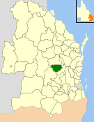
The Shire of Kingaroy was a local government area in the South Burnett area of Queensland, Australia, about 100 kilometres (62 mi) northwest of the capital, Brisbane. The shire covered an area of 2,420.3 square kilometres (934.5 sq mi), and existed as a local government area from 1912 until 2008, when it amalgamated with a number of other local government areas in the South Burnett area to become the South Burnett Region.

<span class="mw-page-title-main">South Burnett</span> Region in Queensland, Australia

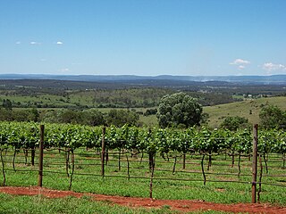
The South Burnett is a peanut growing and wine-producing area on the Great Dividing Range, north of the Darling Downs, in Queensland. It is with the basin of the Burnett River. The area is within two local government areas, South Burnett Region and Gympie Region.

<span class="mw-page-title-main">Tingoora</span> Town in Queensland, Australia

Tingoora is a rural town and a locality in the South Burnett Region, Queensland, Australia.

<span class="mw-page-title-main">Wooroolin, Queensland</span> Town in Queensland, Australia

Wooroolin is a rural town and a locality in the South Burnett Region, Queensland, Australia.

<span class="mw-page-title-main">Kumbia, Queensland</span> Town in Queensland, Australia

Kumbia is a rural town and locality in the South Burnett Region, Queensland, Australia. In the 2021 census, the locality of Kumbia had a population of 301 people.

<span class="mw-page-title-main">Theebine</span> Town in Queensland, Australia

Theebine is a rural town and locality split between the Gympie Region and the Fraser Coast Region, both in Queensland, Australia.

<span class="mw-page-title-main">Nanango railway line</span> Former railway line in Queensland, Australia

The Nanango railway line was a narrow-gauge branch railway located in Queensland, Australia. On 31 October 1882, parliament approved the construction of a branch line from Theebine west to Kilkivan after gold and copper were discovered in this region of Queensland, Australia. The section was opened in two stages – to Dickabram on 1 January 1886 after two crossings of the Mary River and to Kilkivan on 6 December 1886.

Tarong is a rural locality in the South Burnett Region, Queensland, Australia. In the 2021 census, Tarong had a population of 193 people.

Gordonbrook is a rural locality in the South Burnett Region, Queensland, Australia. In the 2016 census Gordonbrook had a population of 175 people.

Coolabunia is a rural locality in the South Burnett Region, Queensland, Australia.

<span class="mw-page-title-main">Brooklands, Queensland</span> Suburb of South Burnett Region, Queensland, Australia

Brooklands is a rural locality in the South Burnett Region, Queensland, Australia. In the 2021 census, Brooklands had a population of 324 people.

<span class="mw-page-title-main">Cinnabar, Queensland</span> Suburb of Gympie Region, Queensland, Australia

Cinnabar is a rural locality in the Gympie Region, Queensland, Australia. In the 2016 census, Cinnabar had a population of 72 people.

<span class="mw-page-title-main">Corndale, Queensland</span> Suburb of South Burnett Region, Queensland, Australia

Corndale is a rural locality in the South Burnett Region, Queensland, Australia. In the 2021 census, Corndale had a population of 58 people.

<span class="mw-page-title-main">Kinbombi</span> Town in Queensland, Australia

Kinbombi is a rural town and locality in the Gympie Region, Queensland, Australia. In the 2016 census, the locality of Kinbombi had a population of 37 people.

<span class="mw-page-title-main">Mondure</span> Town in Queensland, Australia

Mondure is a rural town and locality in the South Burnett Region, Queensland, Australia. In the 2016 census, Mondure had a population of 100 people.

South Nanango is a rural locality in the South Burnett Region, Queensland, Australia. In the 2016 census South Nanango had a population of 858 people.

<span class="mw-page-title-main">Mowbullan, Queensland</span> Suburb of Western Downs Region, Queensland, Australia

Mowbullan is a rural locality in the Western Downs Region, Queensland, Australia. In the 2021 census, Mowbullan had a population of 12 people.

References

  1. Australian Bureau of Statistics (28 June 2022). "Memerambi (suburb and locality)". Australian Census 2021 QuickStats. Retrieved 28 June 2022.  OOjs UI icon edit-ltr-progressive.svg
  2. 1 2 3 "Memerambi – town in South Burnett Region (entry 21580)". Queensland Place Names. Queensland Government . Retrieved 7 March 2022.
  3. "Memerambi – locality in South Burnett Region (entry 49594)". Queensland Place Names. Queensland Government . Retrieved 7 March 2022.
  4. 1 2 Australian Bureau of Statistics (28 June 2022). "Memerambi (SAL)". 2021 Census QuickStats. Retrieved 28 February 2023. OOjs UI icon edit-ltr-progressive.svg
  5. 1 2 3 "Queensland Globe". State of Queensland . Retrieved 8 April 2023.
  6. "Railway stations and sidings - Queensland". Queensland Open Data. Queensland Government. 2 October 2020. Archived from the original on 5 October 2020. Retrieved 5 October 2020.
  7. "CROWN LANDS". The Brisbane Courier . Vol. LXI, no. 14, 557. Queensland, Australia. 8 September 1904. p. 6. Archived from the original on 8 April 2023. Retrieved 9 January 2023 via National Library of Australia.
  8. "MEMERAMBI TOWNSHIP". The Brisbane Courier . No. 16, 252. Queensland, Australia. 12 February 1910. p. 14. Archived from the original on 8 April 2023. Retrieved 8 April 2023 via National Library of Australia.
  9. "Rail Trails". Visit South Burnett. Archived from the original on 2 March 2023. Retrieved 8 April 2023.
  10. Queensland Family History Society (2010), Queensland schools past and present (Version 1.01 ed.), Queensland Family History Society, ISBN   978-1-921171-26-0
  11. "Queensland state school - centre closures" (PDF). Queensland Government . 20 August 2013. Archived (PDF) from the original on 20 March 2022. Retrieved 6 April 2022.
  12. "Town of Memerambi" (Map). Queensland Government. 1979. Archived from the original on 20 April 2022. Retrieved 20 April 2022.
  13. "Parish of Wooroolin" (Map). Queensland Government. 1978. Archived from the original on 20 April 2022. Retrieved 20 April 2022.
  14. "Memerambi State School". 21 August 2006. Archived from the original on 21 August 2006. Retrieved 20 April 2022.
  15. Blake, Thom. "Memerambi Methodist Church". Queensland religious places database. Archived from the original on 8 November 2022. Retrieved 22 September 2022.
  16. Premier Postal History. "Post Office List". Premier Postal Auctions. Archived from the original on 15 May 2014. Retrieved 10 May 2014.
  17. Anglican Church of Southern Queensland. "Closed Churches". Archived from the original on 3 April 2019. Retrieved 3 July 2020.
  18. Australian Bureau of Statistics (25 October 2007). "Memerambi (Kingaroy Shire)". 2006 Census QuickStats. Retrieved 2 April 2009.
  19. Australian Bureau of Statistics (27 June 2017). "Memerambi (SSC)". 2016 Census QuickStats. Retrieved 20 October 2018. OOjs UI icon edit-ltr-progressive.svg
  20. "Memerambi Business Directory, Toowoomba se cnr - Queensland - Locafy Australia". 25 April 2012. Archived from the original on 25 April 2012. Retrieved 9 January 2023.
  21. "Mr T. J. Kingston and family". State Library of Queensland . 1910. Archived from the original on 8 April 2023. Retrieved 8 April 2023.
  22. Ross, J. R., "Postle, Arthur Benjamin (1881–1965)", Australian Dictionary of Biography, National Centre of Biography, Australian National University, archived from the original on 23 March 2023, retrieved 8 April 2023
  23. "History of the Australian Peanut Industry". Peanut Company of Australia. Archived from the original on 2 October 2009. Retrieved 17 October 2009.

Further reading