Nukku

Last updated

Map all coordinates using: OpenStreetMap
Nukku
Queensland
Australia Queensland location map.svg
Red pog.svg
Nukku
Coordinates 26°52′04″S152°04′49″E / 26.8677°S 152.0802°E / -26.8677; 152.0802 (Nukku (centre of locality))
Population40 (2021 census) [1]
 • Density2.7/km2 (7.1/sq mi)
Postcode(s) 4314
Area14.6 km2 (5.6 sq mi)
Time zone AEST (UTC+10:00)
LGA(s) South Burnett Region
State electorate(s) Nanango
Federal division(s) Maranoa
Suburbs around Nukku:
Yarraman Taromeo Blackbutt North
Gilla Nukku Blackbutt
Gilla Blackbutt South Blackbutt South

Nukku is a rural locality in the South Burnett Region, Queensland, Australia. [2] In the 2021 census Nukku had a population of 40 people. [1]

Contents

Geography

The D'Aguilar Highway passes through the south of the locality from west (Blackbutt) to east (Gilla). [3]

The land use is grazing on native vegetation. [3]

History

The locality takes its name from the Nukku railway station name, assigned on 19 December 1912 by the Queensland Railways Department. It is an Aboriginal word (Waka language, Dungibara dialect, Koolaburra clan), meaning watershed. [2]

The Brisbane Valley railway line from Benarkin via Blackbutt and Nukku to Gilla opened on 19 December 1912. [4] Nukku was served by the Nukku railway station ( 26°52′50″S152°04′06″E / 26.8805°S 152.0684°E / -26.8805; 152.0684 (Nukku railway station (former)) ). [5] The line closed in 1993. [6] The station building was relocated to Millar Street in Yarraman to be used as a workshop for a saddlery business and, in 2015, relocated to Blackbutt as a museum exhibit. [7] [8]

Nukku State School opened on 28 May 1928. It closed on 1967. [9] The school was located to the south of the D'Aguilar Highway near the Nukka Road Road junction (approx 26°52′52″S152°03′56″E / 26.8811°S 152.06555°E / -26.8811; 152.06555 (Nukku State School (former)) ). [10] [3] The former school building was relocated to Blackbutt to house the Roy Emerson Museum. [11] [12] [13]

In the 2016 census, Nukku had a population of 22 people. [14] In the 2021 census, the population was 40. [1]

On 1 February 2018, Nukku's postcode changed from 4306 to 4314. [15]

Education

There are no schools in Nukku. The nearest government primary school is Blackbutt State School in neighbouring Blackbutt to the east. The nearest government secondary schools are Yarraman State School (to Year 10) in neighbouring Yarraman to the north-west and Nanango State High School (to Year 12) in Nanango to the north. [3]

Notable residents

Tennis champion Roy Emerson attended Nukku State School for his early education. [16]

Related Research Articles

<span class="mw-page-title-main">Yarraman, Queensland</span> Town in Queensland, Australia

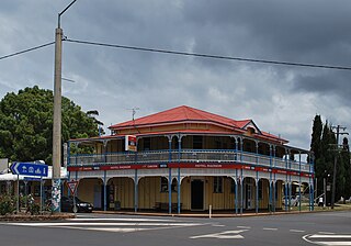
Yarraman is a rural town and locality in the Toowoomba Region, Queensland, Australia. In the 2021 census, the locality of Yarraman had a population of 1,127 people.

<span class="mw-page-title-main">Nanango</span> Town in Queensland, Australia

Nanango is a rural town and locality in the South Burnett Region, Queensland, Australia. In the 2021 census, the locality of Nanango had a population of 3,679 people.

<span class="mw-page-title-main">D'Aguilar Highway</span> Highway in Queensland, Australia

The D'Aguilar Highway is a two-lane highway linking the Bruce Highway near Caboolture with the Bunya Highway in Kingaroy in the state of Queensland, Australia. Major towns along the route include Woodford, Kilcoy, Blackbutt, Yarraman, and Nanango. The highway is approximately 164 km (102 mi) in length. The D'Aguilar Highway's highest elevation along its length is 527 m just north of Yarraman, and the lowest point is at 26.8 m just west of Caboolture.

<span class="mw-page-title-main">Blackbutt, Queensland</span> Town in Queensland, Australia

Blackbutt is a rural town and locality in the South Burnett Region, Queensland, Australia. In the 2016 census, Blackbutt had a population of 836 people.

<span class="mw-page-title-main">Brisbane Valley railway line</span>

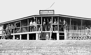
The Brisbane Valley railway line was a railway connection in Queensland, Australia connecting Ipswich, west of Brisbane, to the upper Brisbane River valley. Progressively opened between 1884 and 1913, the railway provided a vital transport link between Ipswich and Yarraman and forged development and prosperity along its path. The line acquired its serpentine reputation because it did not take a straight course when faced with a hill or gully.

<span class="mw-page-title-main">Moore, Queensland</span> Town in Queensland, Australia

Moore is a rural town and locality in the Somerset Region, Queensland, Australia. In the 2016 census, the locality of Moore had a population of 296 people.

<span class="mw-page-title-main">Tingoora</span> Town in Queensland, Australia

Tingoora is a rural town and a locality in the South Burnett Region, Queensland, Australia.

<span class="mw-page-title-main">Harlin</span> Town in Queensland, Australia

Harlin is a rural town and locality in the Somerset Region, Queensland, Australia. In the 2016 census, the locality of Harlin had a population of 173 people.

<span class="mw-page-title-main">Brisbane Valley Rail Trail</span> Rail trail in Queensland, Australia

The Brisbane Valley Rail Trail (BVRT) is a 161-kilometre (100 mi) recreation trail from Wulkuraka to Yarraman in Queensland, Australia. The trail follows the old Brisbane Valley railway line and is open to walkers, touring cyclists and horse riders. The trail details the history and landscape of the Brisbane Valley. It is the longest rail trail in Queensland.

<span class="mw-page-title-main">Benarkin</span> Town in Queensland, Australia

Benarkin is a rural town and locality in the South Burnett Region, Queensland, Australia. The nearby town of Blackbutt is the origin of the town and the two towns are often referred to as the joint entity Blackbutt-Benarkin. In the 2016 census, Benarkin had a population of 61 people.

<span class="mw-page-title-main">Colinton, Queensland</span> Suburb of Somerset Region, Queensland, Australia

Colinton is a rural locality in the Somerset Region, Queensland, Australia. In the 2016 census, Colinton had a population of 75 people.

<span class="mw-page-title-main">Upper Yarraman, Queensland</span> Suburb of Toowoomba Region, Queensland, Australia

Upper Yarraman is a rural locality in the Toowoomba Region, Queensland, Australia. In the 2016 census, Upper Yarraman had a population of 104 people.

The Kilkivan to Kingaroy Rail Trail is an 88-kilometre (55 mi) recreation trail from Kilkivan to Kingaroy. The trail follows the old Kingaroy Branch railway and is open to walkers, cyclists and horse riders.

Mount Stanley is a rural locality in the Somerset Region, Queensland, Australia. In the 2016 census Mount Stanley had a population of 7 people.

Teelah is a rural locality in the South Burnett Region, Queensland, Australia. In the 2016 census Teelah had a population of 68 people.

Gilla is a rural locality in the Toowoomba Region, Queensland, Australia. In the 2016 census Gilla had a population of 32 people.

Googa Creek is a rural locality in the Toowoomba Region, Queensland, Australia. In the 2016 census Googa Creek had a population of 43 people.

South Nanango is a rural locality in the South Burnett Region, Queensland, Australia. In the 2016 census South Nanango had a population of 858 people.

Glan Devon is a rural locality in the South Burnett Region, Queensland, Australia. In the 2021 census, Glan Devon had a population of 219 people.

Emu Creek is a rural locality in the Toowoomba Region, Queensland, Australia. In the 2021 census, Emu Creek had a population of 113 people.

References

  1. 1 2 3 Australian Bureau of Statistics (28 June 2022). "Nukku (SSC)". 2021 Census QuickStats. Retrieved 15 December 2021. OOjs UI icon edit-ltr-progressive.svg
  2. 1 2 "Nukku – locality in South Burnett Region (entry 46253)". Queensland Place Names. Queensland Government . Retrieved 29 December 2020.
  3. 1 2 3 4 "Queensland Globe". State of Queensland . Retrieved 22 August 2022.
  4. Kerr, John (1990). Triumph of narrow gauge : a history of Queensland Railways. Boolarong Publications. p. 224-225. ISBN   978-0-86439-102-5.
  5. "Railway stations and sidings - Queensland". Queensland Open Data. Queensland Government. 2 October 2020. Archived from the original on 5 October 2020. Retrieved 5 October 2020.
  6. "Steaming ahead on the Brisbane Valley rail trail". ABC Brisbane. Australian Broadcasting Corporation. 29 July 2010. Archived from the original on 13 December 2013. Retrieved 9 August 2012.
  7. Miller, Anne (4 June 2015). "Big Plans For Historic Building". southburnett.com.au. Archived from the original on 22 August 2022. Retrieved 22 August 2022.
  8. Miller, Anne (13 December 2017). "History On Show At Blackbutt". southburnett.com.au. Archived from the original on 14 May 2018. Retrieved 22 August 2022.
  9. Queensland Family History Society (2010), Queensland schools past and present (Version 1.01 ed.), Queensland Family History Society, ISBN   978-1-921171-26-0
  10. "Blackbutt" (Map). Queensland Government. 1944. Archived from the original on 25 January 2021. Retrieved 25 January 2021.
  11. Anne Scheu (26 August 2016). "How the Roy Emerson Museum came about". John Oxley Library. Archived from the original on 24 April 2018. Retrieved 24 April 2018.
  12. "Roy Emerson Museum". www.queensland.com. Archived from the original on 25 January 2021. Retrieved 25 January 2021.
  13. "Roy Emerson Museum". Discover South Burnett. Archived from the original on 11 August 2020. Retrieved 25 January 2021.
  14. Australian Bureau of Statistics (27 June 2017). "Nukku (SSC)". 2016 Census QuickStats. Retrieved 20 October 2018. OOjs UI icon edit-ltr-progressive.svg
  15. "Blackbutt To Get New Postcode". southburnett.com.au. 17 November 2017. Archived from the original on 17 May 2018. Retrieved 5 July 2021.
  16. "Roy Emerson Museum". Southern Queensland Country. Archived from the original on 19 March 2022. Retrieved 22 August 2022.